Hisarlik Hill: The Archaeological Site of Ancient Troy
Site at a Glance
- Popularity
- Very High
- Country
- Turkey
- Primary era
- Bronze Age
- Eras represented
- Stone Age, Bronze Age, Iron Age, Classical
- Civilizations
- Ancient Greek, Roman
- Site type
- City
On this page23 sections
History
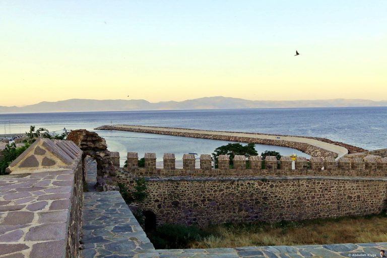
Hisarlik Hill, near Tevfikiye in Çanakkale Province, Türkiye, is the archaeological site generally identified with ancient Troy, also called Ilion. Successive communities occupied the mound from at least the fourth millennium BC until about AD 600, followed by Byzantine-period burials. Its principal sequence comprises nine numbered settlements, Troy I–IX, which represent successive phases rather than one continuous building project. The connection between the ancient city and the Trojan War tradition remains unproven.
The Bronze Age settlements
The earliest occupation, called Troy 0, is tentatively placed around 3600–3500 BC on the basis of limited evidence. Troy I was established around 3000 BC and ended in a fire around 2550 BC. Troy II followed, lasting from about 2550 to 2300 BC. It was destroyed twice, with its final destruction around 2300 BC; the evidence does not establish that this resulted from an attack.
Troy III–V remained occupied from about 2300 to 1750 BC. Some phases appear less prosperous, although the picture is complicated by the loss of early archaeological layers during Heinrich Schliemann’s excavations. Troy V was destroyed by fire around the middle of the eighteenth century BC, before the settlement changed markedly.
Troy VI, established around 1750 BC, became a major Late Bronze Age settlement. The Late Bronze Age was a period when the Hittite Empire and Mycenaean Greek states were major powers in the eastern Mediterranean. Troy VI’s final phase ended around 1300 BC. The cause of the destruction is uncertain: an earthquake has been proposed, as have internal unrest and attack.
Troy VIIa followed, apparently with continuity from the preceding population. It was destroyed around 1180 BC in a major fire, with evidence of an enemy attack. Troy VIIb succeeded it and continued to around 950 BC. Its phases reflect changes in material culture and possible population movement, but do not establish the identity of newcomers. After a fire around 1050 BC, Troy VIIb3 persisted in a reduced form; occupation remained sparse after another fire around 950 BC.
Wilusa and the Trojan War tradition
In the Late Bronze Age, Troy is commonly identified with Wilusa, a place named in Hittite records, although the identification is not certain. Wilusa belonged to the Assuwa Confederation, a coalition of western Anatolian states, around 1400 BC and later aligned politically with the Hittite Empire. Hittite texts name Wilusan kings Kukkunni and Alaksandu, who maintained peaceful relations with the Hittites. Later references point to political turmoil and the removal of King Walmu; Hittite King Tudhaliya IV intended to restore him. The western Anatolian leader Piyamaradu has sometimes been linked to these events, but the texts do not explicitly make him responsible.
Troy VI and Troy VII have both been proposed as possible settings for the Trojan War stories, in part because of their dates and destruction phases. No particular event from the legends has been verified as history, and the evidence does not establish a Greek attack on the city.
Greek Ilion
After centuries of reduced occupation, Greek settlers began rebuilding the site around 700 BC. The city, known as Ilion, developed into a religious and civic center whose standing was closely connected to the Homeric tradition. Parts of the Bronze Age defenses were reused for worship and other purposes.
During the Persian period, the historian Herodotus wrote that King Xerxes sacrificed 1,000 cattle at the sanctuary of Athena Ilias while marching toward Greece. After the Persian defeat in 480–479 BC, Ilion came under the control of Mytilene, a city on Lesbos. Athens later freed the city and enrolled it in the Delian League, an alliance of Greek city-states led by Athens. In 411 BC, the Spartan general Mindaros also made a sacrifice to Athena Ilias.
From about 410 to 399 BC, Ilion was within the sphere of local rulers at Lampsacus, who governed for Pharnabazus, a Persian provincial governor. In 399 BC, the Spartan general Dercylidas expelled their garrison. During renewed Persian control, a statue of the satrap Ariobarzanes was set up in front of Athena Ilias’s temple. Charidemus held the city briefly in 360–359 BC. In 359 BC, the Athenian Menelaos son of Arrabaios expelled him, and Ilion granted Menelaos proxeny, a civic honor for a foreign benefactor. The decree recording this honor is the city’s earliest surviving civic decree.
Hellenistic Ilion
Alexander the Great visited Ilion in 334 BC. He went to Athena Ilias’s temple, sacrificed at tombs associated with Achilles and Patroclus, and granted the city freedom and exemption from taxes. After his death, he was said to have intended a temple to Athena Ilias on a scale that would surpass other temples.
In 311 BC, Antigonus Monophthalmus took control of the Troad and founded Antigoneia Troas by consolidating neighboring communities. Around 311–306 BC, cities of the Troad and the Asian shore of the Dardanelles formed the koinon of Athena Ilias, a confederation of cities that secured a guarantee of autonomy from Antigonus. Each member city sent two representatives to its council, while five officials managed day-to-day affairs, especially finances. The koinon held an annual Panathenaia, a festival for Athena that attracted pilgrims and supported a large regional market. It also financed construction at Ilion, including a theater around 306 BC and an expansion of the sanctuary and temple in the third century BC.
From 302 to 281 BC, Ilion and the Troad belonged to the kingdom of Lysimachus, who helped bring nearby communities into the city. After Lysimachus was defeated by Seleucus I in 281 BC, Ilion came under Seleucid rule. The city issued decrees honoring Seleucus and, after his assassination, his successor Antiochus I. In 278 BC, the Gallic invasion brought a sack of the city. Its defenses then relied on deteriorating Bronze Age citadel fortifications rather than a functioning city wall.
Roman rule
In 85 BC, Roman forces under Fimbria destroyed Ilion after an eleven-day siege during the conflict between Fimbria and Sulla. After defeating Fimbria that year, Sulla granted benefits to the city for its loyalty, helping it rebuild. Ilion began its civic calendar with 85 BC, but continued to face financial strain. Roman tax collectors unlawfully charged taxes on the sacred estates of Athena Ilias, and the city sought restitution from Lucius Julius Caesar. Pirates attacked Ilion in 80 BC. In 77 BC, Lucius Julius Caesar reformed the annual festival to ease its financial burden.
Ilion supported the Roman general Lucullus against Mithridates VI, king of Pontus, in 74 BC. After Mithridates’s defeat, Pompey became the city’s benefactor and patron of Athena Ilias. In 48 BC, Julius Caesar granted further benefits, citing Ilion’s loyalty, its ties to Lucius Julius Caesar, and his family’s claimed descent from the Trojan hero Aeneas.
Augustus visited Ilion in 20 BC and paid for restoration and rebuilding at the sanctuary of Athena Ilias, the council house, and the theater. Around 12–11 BC, the leading citizen Melanippides son of Euthydikos dedicated a statue of Augustus in the theater. Renewed under Roman rule, the city, then also called Ilium, flourished.
Late antiquity and modern investigation
In 267, during the reign of Gallienus, Goths sacked the city. Ilion recovered and prospered in subsequent centuries, but an earthquake around AD 500 devastated its principal monuments and walls. Occupation declined over the following century, and the site was probably abandoned around AD 600. The city had been a Christian bishop’s seat from the fourth century, perhaps continuing until as late as the tenth century.
In 1822, Scottish journalist Charles Maclaren confidently identified Hisarlik as Troy. Earlier travelers had suggested other locations, including Alexandria Troas and a mound near Pınarbaşı. John Brunton cut trenches at Hisarlik in 1855. Frank Calvert excavated there in 1863 and 1865, identified the site with classical Ilion, and persuaded Schliemann to search there for Homeric Troy.
Schliemann began excavating in 1870 and returned in 1871–1873, 1878–1879, 1882, and 1890, with Wilhelm Dörpfeld joining the last two campaigns. Schliemann identified Troy II as Homeric Troy, but its date proved too early to match Mycenaean Greece. His work exposed the succession of settlements, but he also removed or damaged remains he considered unimportant before adequately recording them. He took the objects known as Priam’s Treasure from the Ottoman Empire without authorization. A dispute ended in financial compensation, and Schliemann kept the treasure.
The treasure was subsequently dispersed. Some objects entered the Istanbul Archaeology Museum; much of the remainder went to Berlin’s Royal Museums and was taken by the Soviet Union in 1945, after which it was held in Moscow. Twenty-four gold pieces stolen from the site in the nineteenth century and later displayed at the University of Pennsylvania Museum were returned to Türkiye in 2012.
Dörpfeld continued excavations in 1893–1894, advancing study of Troy VI and VII and using detailed plans and observations of the layers to refine the chronology. Carl Blegen’s team worked at the site from 1932 to 1938 and distinguished at least nine cities and forty-six subdivisions within them. From 1988 to 2005, Manfred Korfmann directed teams from the universities of Tübingen and Cincinnati. Their work revealed the scale of the lower city and supported a reassessment of Troy VI as a major settlement, rather than only an aristocratic citadel. Brian Rose oversaw research on Greek, Roman, and Byzantine remains. Ernst Pernicka directed excavations from 2006 to 2012. A planned 2013 campaign by the University of Wisconsin–Madison was cancelled after its permit was withdrawn. Since 2014, Rüstem Aslan of Çanakkale Onsekiz Mart University has directed work, including a proposed Level 0 earlier than the numbered layers. Since 2016, the University of Amsterdam has studied the history of excavation at the site.
The Turkish government established the 136-square-kilometre Historical National Park at Troy in 1996 to protect historic sites, monuments, and the regional environment. Hisarlik was added to the UNESCO World Heritage List in 1998 under cultural criteria II, III, and VI.
Remains
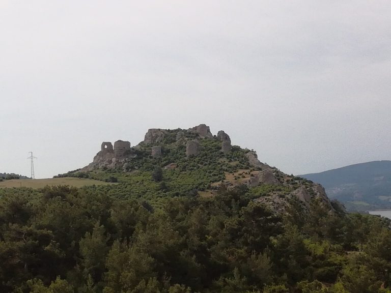
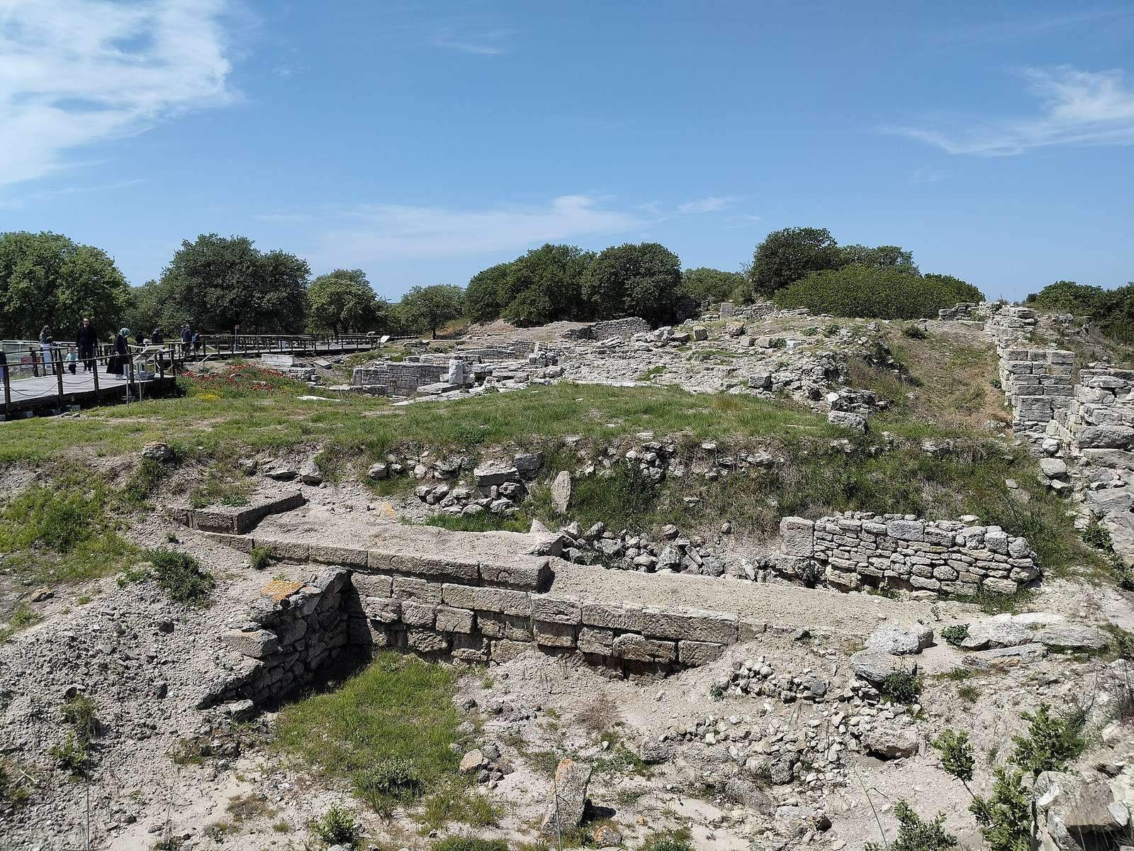
Hisarlik is a tell, a mound formed by successive settlement layers, with the archaeological site extending across the hill and fields to its south. The upper citadel occupies a rocky spur about 300 by 200 metres, with roughly 15 metres of accumulated deposits. The lower town lay mainly on a plateau south and east of the citadel. The hill is about five kilometres from the Dardanelles. When the earliest settlement was founded, the shoreline was closer; sediment carried by the Scamander and Simoeis rivers gradually moved the coast outward.
Bronze Age citadel
Troy I
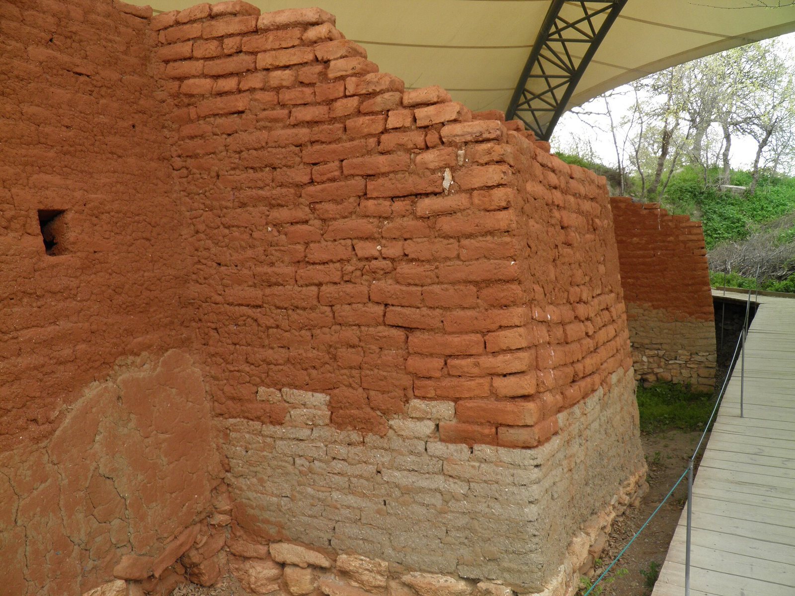
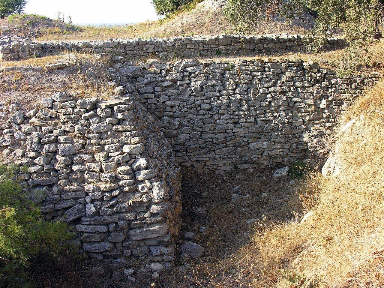
Troy I was a small settlement, with a citadel under one hectare and about 100 metres across. Its stone defensive wall was around 2.5 metres thick and regularly maintained. A gate flanked by four square towers provided access. Closely packed houses had mudbrick walls on stone bases; some followed a megaron plan, meaning a large main hall often preceded by a porch. The houses appear to have been aligned parallel to the southern wall.
Finds from this phase include handmade black or grey pottery, sometimes polished and decorated with white inlay, as well as copper objects. A large carved stone stele, an upright monument, depicts an armed warrior in relief. Evidence also points to spinning and weaving.
Troy II
Troy II was about twice the size of Troy I. Its citadel, roughly 125 metres in diameter, was enlarged and divided into precincts, with a lower settlement beyond. The stone defenses had mudbrick upper sections and underwent three successive building phases. A major southeastern gate had three compartments; a smaller gate to the southwest was approached by a paved stone ramp. Two access ramps survive, one particularly well preserved.
Five long, parallel buildings with megaron plans stood around a central enclosed courtyard. Each was about 40 metres long and covered roughly 400 square metres. The largest, Megaron IIA, measured about 40 by 10 metres. Its porch opened into a broad, columned hall with a central hearth. Assembly, audience, or ritual functions have been proposed for these buildings, but their uses are uncertain.
South of the walls, a timber palisade enclosed about eight hectares. Nearly three metres wide, it had internal supports and columns, with beams secured in cuts made in the bedrock. Houses also extended beyond the citadel. After an early destruction, small houses crowded around the former central megaron, forming narrow streets.
Wheel-made pottery first appears at the site in this phase, alongside red-coated vessels, bronze objects, and deposits of valuables. The assemblages traditionally called Priam’s Treasure may date to Troy II and may represent sixteen separate caches, the largest known as Treasure A. They included thousands of objects made from gold, silver, electrum, bronze, carnelian, and lapis lazuli, probably produced locally. Their original groupings and discovery circumstances are uncertain; one proposal is that the objects brought together finds from different parts of the site.
Troy III–V
Dense residential areas in the citadel characterize Troy III–V. Troy III may have reused the walls of Troy II. In Troy IV, houses of mudbrick were built without stone foundations, and domed ovens appeared. By Troy V, settlement had again extended west of the citadel and included more spacious residences. Its characteristic finds include red-cross bowls and imported Minoan objects. Earthquakes in the eighteenth century BC damaged parts of the settlement.
Troy VI
Troy VI had a terraced citadel enclosed by a substantial limestone wall. Its visible foundations consist of closely fitted stone blocks. The defenses were periodically renewed and widened from an initial thickness of about 1.2 metres to roughly five metres by around 1400 BC. Upper sections of wood and mudbrick may have stood more than nine metres high. The wall sloped outward and used projecting, angled sections; rectangular towers overlooked the plain and sea.
Five gates pierced the citadel wall, including a principal entrance on the south and another on the east. Some opened onto paved streets surfaced with drained cobbles. Large pillars at certain entrances served no structural purpose and may have had religious meaning. A main paved street led from the southern gate toward the center of the acropolis.
Freestanding multistory houses occupied the citadel terraces. Their stone outer walls echoed the defenses, and the houses had no windows at ground level. Some followed a megaron plan; others had halls with pillars or columns, or irregular layouts. The outer terrace is the best preserved, and its houses are associated with the settlement’s elite. A palace may have stood on the highest terrace, where later construction cleared much of the hilltop.
Bronze Age lower town
Troy VI
The lower town extended south and east of the citadel. Reconstructions estimate the occupied area at roughly 20–30 hectares, while estimates for the entire settlement reach about 200,000 square metres. A defensive ditch was cut into bedrock; a wall or timber barrier may have stood behind it, though evidence for that feature is limited. Two more ditches to the south and southwest may have served defense or water management. Erosion and later construction have obscured parts of the area.
Excavated features include houses built with wood and stone, huts, paved surfaces, threshing floors, large storage jars, industrial waste, and murex shells associated with purple-dye production. A paved street west of the citadel led toward one of its gates, and a cemetery was excavated at the lower town’s southern edge. Tunnels and wells brought water from underground springs about 200 metres southwest of the citadel; at least one well also served the citadel.
Locally made wheel-thrown grey and tan pottery occurs alongside imports from Minoan, Mycenaean, Cypriot, and Levantine centers. Local potters also imitated foreign styles. The earliest evidence for horses at the site belongs to Troy VI. The destruction deposit includes collapsed masonry and subsidence in the citadel’s southeast; these features have contributed to debate over the cause of the settlement’s end.
Troy VIIa and VIIb
In Troy VIIa, builders repaired and reused earlier structures, particularly the citadel wall, adding stone towers and mudbrick breastworks. Small houses filled open spaces within the citadel, while new houses spread through the lower town. Many had large storage jars buried in their floors. The lower town may have covered more ground than in Troy VI. The destruction layer contains scorch marks.
Troy VIIb reused earlier buildings, including the Troy VI wall. Finds from its first phase include wheel-made grey pottery, handmade vessels, Mycenaean-style imports, and a bronze seal with convex faces on both sides. It bears Luwian hieroglyphs, a writing system for the ancient Anatolian language, and the names of a woman and a scribe. It is the sole known example of preclassical writing from the site; it may have belonged to a traveling scribe or may predate its archaeological setting.
In Troy VIIb2, upright stone slabs were set into walls and handmade pottery with raised knobs appeared alongside older local traditions. Troy VIIb3 is chiefly represented by finds from the West Sanctuary and terraces on the mound’s southern side. Locally produced amphoras with neck handles point to continued pottery manufacture. The Troy VI walls and a building called the Terrace House were reused for worship and communal feasting. Animal bones, pottery groups, and traces of burned incense support these interpretations. The Terrace House remained unrepaired and appears to have served as a religious center while in ruins.
Greek and Hellenistic sanctuaries
The western sanctuary
Southwest of the citadel, offerings and a building associated with hero worship belong to the renewed Greek settlement. Three temples followed one another there during the seventh and sixth centuries BC; the latest used the Aeolic architectural order. An altar stood about 30 metres to their south. Lion bones from the area have prompted the suggestion that the sanctuary honored Cybele or a related deity.
In the early second century BC, the sanctuary was rearranged with two parallel temples and two altars, possibly dedicated to the Great Gods of Samothrace. Under Roman rule, it was reshaped as one building with a single altar and a platform.
The temple of Athena
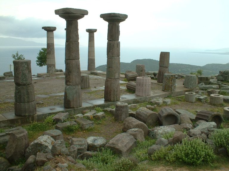
In the late third century BC, a Doric temple to Athena was built on the eastern acropolis over earlier palace remains, after the hilltop had been leveled. The temple stood on a terrace with porticoes, roofed walkways supported by columns, and had sculpted panels in its frieze. The sanctuary also contained a large statue of Zeus and an equestrian statue of Antiochus II.
Civic and Roman buildings
Greek civic structures
Elsewhere in the city, construction included a monumental southern gate, a council house, and a defensive wall more than three kilometres long. The theater dates to around 306 BC. These buildings formed part of a city whose civic life expanded alongside its sanctuaries.
Roman-period city
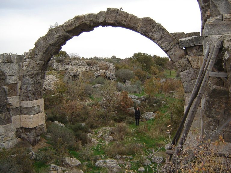
Roman-period Ilium included the restored temple of Athena and its portico, a theater, a council house, and a roofed performance or gathering building called an odeon. The lower city contained a public civic and commercial space, baths, residences, pottery and glass workshops, fishponds, and grazing areas. An aqueduct supplied water, perhaps from a source about 30 kilometres south of the city.
A statue of Augustus was dedicated in the theater around 12–11 BC. A statue of Hadrian was found in the odeon and is now in the Troy Museum.
Late antique church
A church built in the lower city around AD 400 measured about 30 by 18 metres. Its considerable size and mosaic floor suggest that it may have been the settlement’s principal church.