Saint-Blaise: An Ancient Fortified Settlement in France
Site at a Glance
- Popularity
- Medium
- Country
- France
- Primary era
- Classical
- Eras represented
- Iron Age, Classical, Medieval, Early Modern
- Civilizations
- County of Provence, French, Holy Roman Empire, Visigothic
- Site type
- City
On this page24 sections
History
Prehistoric activity and ancient settlement
Saint-Blaise is an ancient fortified settlement in Saint-Mitre-les-Remparts, France. Human activity there reaches back to the fifth millennium BCE, and the settlement later developed among the Celto-Ligurian communities of southeastern Gaul. Salt from nearby lagoons was probably an early reason for occupation. From the seventh century BCE, Etruscan traders maintained a post at the site, where salt was traded and produced. Greek and Etruscan influence accompanied the settlement’s growth, and its high-quality salt at one time competed with that of Marseille. The inhabitants of Lower Provence belonged to the Salyan confederation, a coalition of peoples in ancient Provence.
A proto-urban community took shape from about 650 BCE. The ancient name of the settlement is uncertain. It has been tentatively linked to Mastrabela, named by the late Roman poet Avienus, and to Mastramélè, cited by the sixth-century geographer Stephen of Byzantium. Greek goods brought from Marseille by Phocaeans around 600 BCE may point to the use of the name Mastramellè in the first half of the sixth century BCE. The geographer Artemidorus also referred to the place, while Pliny the Elder used Mastramela for the lagoon.
Urban development and decline
Fire events at Saint-Blaise are placed around 625, 550, and 475 BCE, although the earliest date is uncertain. From about 475 to 200 BCE, parts of the settlement were abandoned. A renewed phase of urban and defensive construction followed between about 200 and 120/80 BCE, known as Saint-Blaise V. After a siege, the settlement was largely destroyed around 120 BCE. It was occupied again briefly and only in part during the middle of the first century BCE, then remained abandoned for at least four centuries.
Ugium and Castelveyre
By the fourth or fifth century CE, a late antique town had developed at the site under the name Ugium. That name remained in use from the fifth to ninth centuries and appears in documents dated 828, 874, 923, and 987. Saracen forces destroyed Ugium in 874. The town was not rebuilt as an urban centre, and its population probably diminished, although occupation continued in parts of the site.
Medieval phases are known as Ugium II, dated from the ninth to fourteenth centuries, and Castelveyre, which developed between the twelfth and fourteenth centuries. After an uncertain period in the eleventh and twelfth centuries, the settlement was called Castellum Vetus, meaning “old castle,” or Castelveyre. The name Saint-Blaise came from the chapel’s patron saint. Churches served the community through successive rebuilding: a second Saint-Pierre followed the ninth-century destruction and burned in the late tenth century, while a third was built in the eleventh. Notre-Dame de Castelveyre, mentioned in 1156, served as the parish church and was dedicated to Saint Blaise in the thirteenth century. A 1231 building contract concerned Castelveyre’s rampart and chapel, and inhabitants gathered around the church.
In 1390, troops led by Raymond de Turenne, a French nobleman and military commander, destroyed Ugium and Castelveyre. The final residents left the old settlement and moved to Saint-Mitre.
Rediscovery and archaeological study
The site was known in the eighteenth century. Shortly before the French Revolution, Father Couture, parish priest of Miramas, described it as an ancient fortified town. Around 1914, geologist Gaston Vasseur interpreted it as a Greek city and collected pottery from its Greek-period occupation. Émile Bourguet proposed test excavations, which A. Bérard carried out without further work at the time; R. de Cabrens explored the site in 1924.
Henri Rolland began excavating on 29 July 1935 and continued until his death in 1970. He cleared the settlement’s interior before work exposed the ramparts in 1946. Further investigations examined the House of Jars and the main gate in 1961–62, and research continued through 1985. Between 1974 and 1978, a stratigraphic excavation in a limited area identified 42 layers of activity, from the Cardial period to Late Antiquity. Later archaeological initiatives inventoried and classified the collections, now held in Martigues, while Jean Chausserie-Laprée led work at the site. Volunteers working with him rediscovered a rock-cut path to the eastern spring in 2010. The archaeological site has been classified as a historic monument since 1943; the chapel received the same status in 1939. The surrounding excavation area was protected in 1967, and the Saint-Blaise lagoons and Castillon forest became a classified protected site in 2020.
Remains
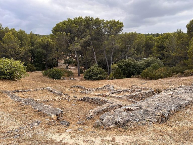
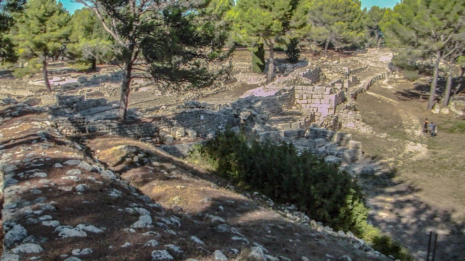
The 5.5-hectare site occupies a rocky spur at the northern end of the Castillon plateau, between the Lavalduc lagoon to the west and the Citis lagoon to the north. Its two plateaus lie about 15 metres apart: the Ville-Basse at roughly 50 metres above sea level and the Ville-Haute at about 65 metres, with the southern part of the upper level known as the Citadel. Cliffs rise 30 to 50 metres above the lagoons. Remains from successive settlements and defensive systems occupy this uneven ground, while Castelveyre extended north from the lower plateau.
Defensive walls and settlement boundaries
Archaic fortifications
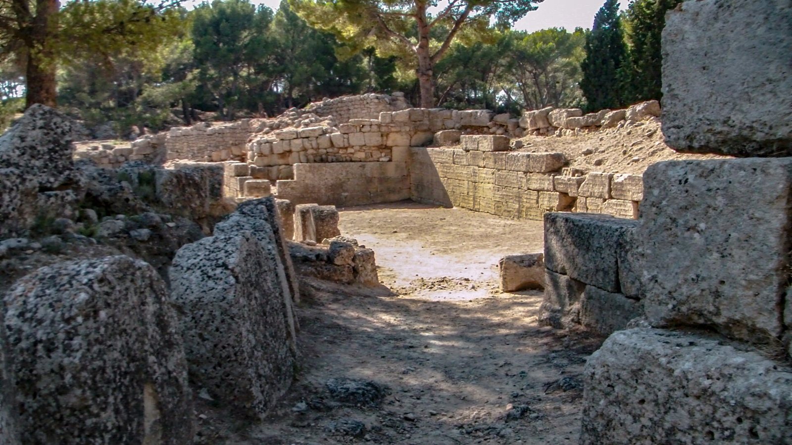
The earliest rampart is generally placed in the second half of the seventh century BCE, but amphorae associated with its foundations point instead to construction in the last quarter of the sixth century. An earlier fortification is possible. The wall was built from blocks and rubble set in black earth. At the western tower, the outer face survives to a height of more than three metres; the stones were roughly squared or selected to present a regular surface. Near the eastern tower of the main gate, large blocks rest within a layer of pebbles, and stepped courses pack the inner face.
The main gate stood in the central, more vulnerable part of the Ville-Basse. Two offset oval towers framed a passage about 20 metres long. Two other curved towers may have belonged to this defensive line, one east of the gate and another at its southwestern end, where upright stone slabs were reused.
Hellenistic and Early Christian defenses
The later Hellenistic circuit largely followed the route and shape of the earlier wall. It extended for more than 400 metres and comprised 11 stretches of wall between major features, three four-sided towers, and three slight projections of the wall. Its southern projecting fortification incorporates at least one earlier tower, while the central gate repeats the earlier arrangement. One carriage entrance and three or four smaller secondary gates pierced the circuit. The wall descends from about 60 metres above sea level in the Ville-Haute to about 46 metres in the Ville-Basse. The projections, associated with drainage channels or spouts, were estimated at about nine metres high; the reconstructed wall height was no more than six metres. Rounded raised sections along the parapet suggest that Greek engineers from Sicily may have designed the fortification.
An Early Christian wall added projecting sections flanked by ten round or four-sided towers. In places, the archaic, Hellenistic, and Early Christian defenses overlap to a height of about ten metres. The thirteenth-century enclosure around the Saint-Blaise chapel now forms the boundary wall of the archaeological site.
Water and access
Fresh water was available in the subsoil. On the eastern slope, a spring below the first cliff could be reached by a path cut into the rock. Two springs lay on the western side. One was at the foot of the thirteenth-century wall; the other, at an elevation of 25 metres, was reached by a steep tunnel descending from a path near the Ville-Haute’s western secondary gate. The tunnel feeds a fountain in the yard of a forester’s house. The higher spring may have supplied installations on the lagoon shore, perhaps salt works or a landing place. Ancient roads approaching from the north crossed the Crau before reaching the settlement.
Archaeological layers and early buildings
Prehistoric and Bronze Age evidence
The earliest archaeological layer lies directly above bedrock. Its finds include small bone and charcoal fragments, abundant pottery, often-retouched flint flakes, raw coral, and arrowheads associated with the Chassean Neolithic tradition. Cardial pottery, decorated with shell impressions, dates to 4700–4500 BCE; Copper Age pottery occurs higher in the layer. Together, these finds indicate activity during the first half of the fifth millennium BCE. Early and Late Bronze Age pottery also occurs, including Italic-style pieces with adze-shaped handles.
The upper part of the layer, which averages about two metres thick, contains prepared floor fragments, imported Etruscan amphorae, dark Etruscan bucchero pottery, and eastern Greek pottery. These materials indicate an early settlement within the substantial fill. The lower portions of two stakes set in the dark earth may belong to that occupation.
Archaic and fifth-century settlement
Layers VII, VI, and V span about 650–475 BCE. Beneath the earliest houses, pebbles from local conglomerate formed a drainage bed and foundation for a spread clay surface. The pebble layer varied in depth, averaging about 10 centimetres and reaching 35 centimetres in the south of the Ville-Basse. Fire traces dated to this period come from three excavated areas in the centre of the lower plateau. A possible hut floor cut into rock in the Ville-Haute may belong to the same phase.
Layer IV represents occupation around the middle of the fifth century BCE. A house with a base for a supporting post provides part of the limited building evidence from this phase. Pottery includes a small quantity of Attic red-figure and black-glazed vessels, a Massaliote amphora, local and regional wares, and handmade pottery associated with the Rhône region in the fifth and fourth centuries BCE. In the central Ville-Basse, a house from the beginning of the fifth century had a divided domestic arrangement with ovens, built hearths, raised storage bins, and a bench made of unfired bricks. These features occupied the space of an earlier house dated 575–500 BCE over a period of nearly a century.
Street plan and domestic areas
Ville-Haute and Ville-Basse streets
Excavations cover about 2,500 square metres in the Ville-Haute and 4,500 square metres in the Ville-Basse. In the upper settlement, an early house cut by the Hellenistic wall appears to have contained a large room and a smaller hearth area bounded by upright stones. The smaller space may have extended into an outside circulation area. A principal east–west route, about 3.6 to 4.2 metres wide, seems to have ended at a house. A parallel street lay 19.2 metres away; another, 2.5 metres wide, ran beside the inner face of the wall. A rock-cut pit 25 metres deep was interpreted as a reminder of a Roman siege, although an effort to locate water there found none.
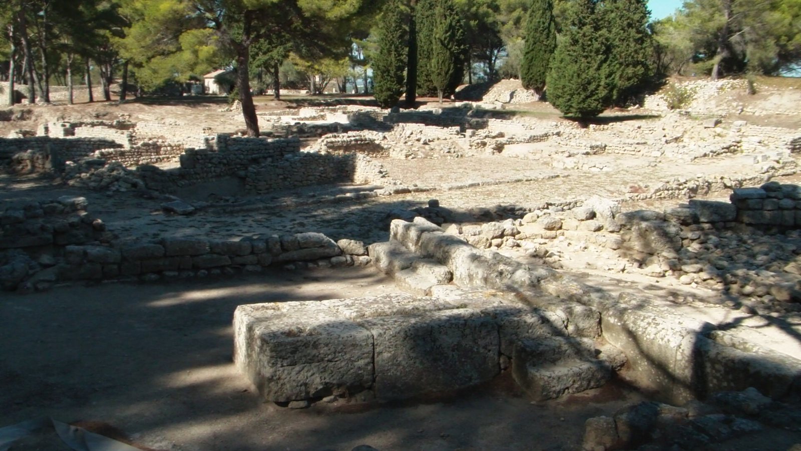
In the Ville-Basse, the principal street through the gate was traced for 80 metres and ran 32 degrees northwest. Its width varied from three metres at its beginning to 2.7 metres beside a sidewalk, 5.25 metres at a junction, and 4.9 metres farther along. Two east–west streets, one 3.55 to four metres wide and the other reported at 2.1 to 3.4 metres, intersected the main route. Together the streets defined a block about 45–48 by 22.45 metres. A sidewalk ran beside the House of Jars. The later settlement followed an orderly, intersecting street plan of the Hippodamian tradition.
House of the Metal Caster
Covering 96 square metres, the House of the Metal Caster stands where the main street meets the first cross street near the gate. A corridor gave access to several rooms. One room contained a raised hearth and iron, lead, and bronze objects and working residues. The building has been interpreted as a private home that may also have included an artisan’s workshop.
House of Jars and neighboring storage spaces
The House of Jars was built into a recess in the Greek fortification. It appears to have contained five rooms arranged in two groups: a large rectangular room with a broad entrance onto the street, followed by four smaller rooms linked by wide openings. Storage vessels, including large jars and wine amphorae, were found with household tableware. The layout may represent a private store kept apart from the owner’s living quarters. Other cellars in the Ville-Basse held amphorae and jars. In a nearby dwelling, a large storage jar was buried in the floor alongside a rotary millstone and a large basin cut into the rock and used as a mortar.
Ash deposits and carved pillars
Ash deposits
Near the eastern secondary gate in the Ville-Haute, excavators found an elongated mound of ash partly beneath the foundations of the Hellenistic wall. It measured about eight metres long and four metres wide and survived to a height of 1.10 metres. Its form has prompted an interpretation as a possible ash altar, perhaps built around a flat stone used for sacrifice, although its unusual layers and position in relation to the wall leave that interpretation uncertain. A second ash deposit, found in the western part of an excavation area in 1981, measured about 1.20 metres high and two metres thick. It contained abundant animal remains, small stones and pebbles, and numerous Archaic pottery fragments.
Pillars for displaying skulls
Three fragments of pillars associated with the display of skulls were found in 1938, 1951, and 1966. Two, dated to 175–140 BCE, had been reused in the western and eastern secondary gates of the Hellenistic defenses. They support the possibility that an earlier indigenous sanctuary had a portico where skulls were attached to pillars. A ritual involving severed heads has also been proposed, though its connection to the community of the mid-fifth century BCE remains an interpretation.
Churches and chapel
Saint-Pierre basilica
The early Christian Saint-Pierre basilica, also called the basilica of Saint-Vincent, stood near the eastern main gate. Later defensive walls intersect its masonry. The single-nave church had a northern portico and a small room used as a sacristy for deacons. A stone barrier separated the nave from the chancel, the area around the altar. The east-facing apse stood three steps above the nave, and its floor carried interlocking patterns and small crosses. A reader’s platform projected into the nave along the church’s central axis. Fragments of polychrome mosaic from the apse of an earlier church, dated to the fifth century CE, were also found at the site.
Saint-Vincent and Notre-Dame de Castelveyre
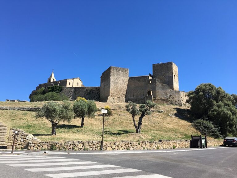
The Romanesque church of Saint-Vincent stood below the present chapel. Dated to the tenth century and rebuilt in the eleventh, it comprised three building phases; low foundations of its northeast-facing apse survive. The twelfth-century Romanesque chapel of Notre-Dame de Castelveyre, later known as Saint-Blaise, has a northeast-facing apse restored in the thirteenth century. Its façade was rebuilt in 1608, and the chapel was altered in the sixteenth century and restored in the nineteenth. After the settlement was abandoned, it served as a small rural priory, with a hermit living in an adjoining building. Archaeologist Henri Rolland is buried at the foot of its choir.
Rock-cut graves and archaeological collections
About 300 graves cut into bedrock remain, mainly south and east of the defenses across the Castillon plateau, among quarries and routes marked by wheel ruts. A few lie near the chapel. The graves are rectangular cavities, often covered by flat stones, and some form small family groups. Many held multiple burials; smaller examples belonged to children. The dead were laid on their backs, with arms at their sides or folded over the chest and heads often supported in a hollow. Their varied forms and objects such as belt buckles place most of the graves in the Visigothic period of the fifth and sixth centuries CE.
The archaeological inventory includes about 15,000 objects, chiefly ceramic vessels.