The Trundle: An Iron Age Hillfort near Chichester
Site at a Glance
- Popularity
- Medium
- Country
- United Kingdom
- Primary era
- Iron Age
- Eras represented
- Stone Age, Bronze Age, Iron Age, Medieval, Modern
- Civilizations
- British, English
- Site type
- Military
- Remains
- Fort
On this page22 sections
History
The Trundle is an Iron Age hillfort on St Roche’s Hill near Chichester in the United Kingdom. Excavations place its construction between about 500 and 100 BC, over an earlier Neolithic causewayed enclosure, an earthwork bounded by ditches interrupted by gaps. The site brings together evidence of prehistoric activity and later use of the hill.
Prehistoric enclosure and hillfort
The Neolithic is the later part of the Stone Age, when farming communities lived in Britain. The enclosure beneath the hillfort is older, but its date remains uncertain. E. Cecil Curwen initially estimated that its earthworks were built around 2000 BC. A radiocarbon reassessment in 2011 suggested they were probably made no earlier than the mid-fourth millennium BC, though the limited number of samples prevents a confident chronology. The study estimated that the inner ditch was cut after a date within 3900-3370 BC, the second after a date within 3650-3520 BC, and the spiral ditch after a date within 3940-3370 BC.
The Iron Age was the period of widespread iron use before Roman rule in Britain. The hillfort’s construction over the earlier enclosure reshaped the summit and partly covered its ditches. The two periods are distinguished not only by their earthworks but also by finds from the ditches, including pottery and tools.
Medieval and post-medieval use
A land grant made in 725 by Nunna, king of Sussex, names a fortified settlement called billingabyrig as a landmark. Curwen proposed that it might refer to the Trundle, but the identification has not been established.
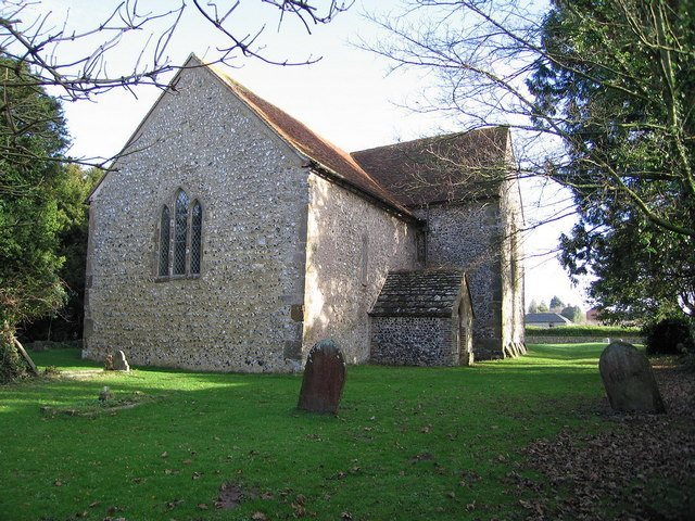
A chapel dedicated to St Roche was probably built near the end of the fourteenth century. A document from 1570 describes it as a former chapel, so it had fallen out of use by then. It may have been abandoned or damaged during the Reformation, a period of religious change when some religious foundations were dissolved or left unused. A windmill was later built on the hill, possibly almost over the chapel’s ruins, and burned down in 1773. A beacon was maintained on the hill from the late sixteenth century until at least the early nineteenth century.
The hill also served as a meeting place. In 1645, William Cawley reported that about 1,000 Clubmen had gathered there. These local militias formed during the English Civil War to resist depredations by both sides. A Masonic lodge, a local organization of Freemasons, met on the hill between 1717 and 1757; whether its members used a building or met outdoors is unknown.
A gibbet, a structure used to display the bodies of executed people, stood at the Trundle. It appears on an 1813 map and had been removed by 1825.
Excavation and protection
In 1925, archaeologist O.G.S. Crawford arranged an aerial photograph of the hillfort. Earthworks visible inside its ramparts led Curwen to excavate in 1928 and again in 1930, establishing that the hillfort covered an earlier Neolithic site. Causewayed enclosures were then little known to archaeologists. Curwen initially interpreted postholes beside the second enclosure ditch as evidence of pit dwellings. After Stuart Piggott argued in 1954 that the postholes were Iron Age, Curwen accepted that interpretation.
Further investigations included a rescue excavation in 1980, geophysical surveys in 1987 and 1989, and a four-trench excavation in 1994. The Royal Commission on the Historical Monuments of England surveyed the hillfort and enclosure in 1995. In 2011, the Gathering Time project reassessed radiocarbon dates from almost 40 British causewayed enclosures, including samples from the Trundle. The site was designated a scheduled monument in 1933, giving it statutory protection.
Remains
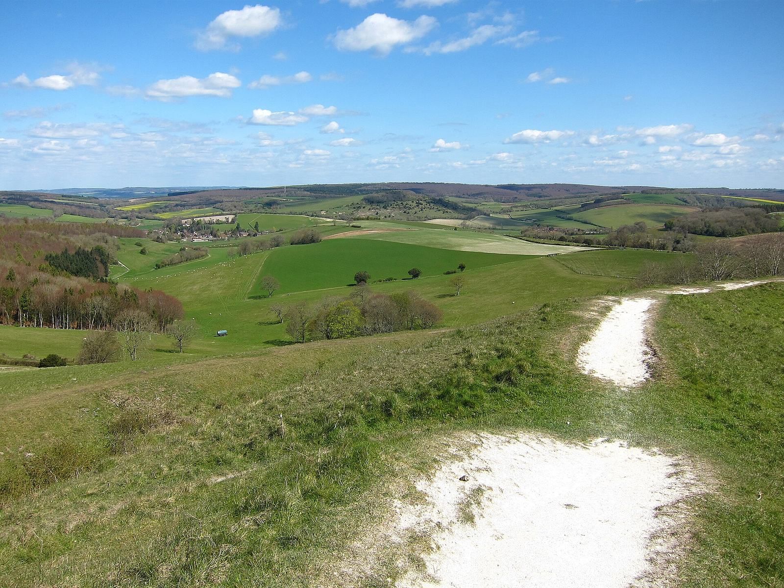
The earthworks occupy the summit of St Roche’s Hill, a 206-metre-high outcrop of Upper Chalk at the western end of a ridge. The hill rises above its neighbours and can be seen from all sides. A surveying marker stands at the summit, probably at the location of a trigonometrical station installed in 1791. The later hillfort partly covers the earlier enclosure, making the full plan of the Neolithic earthworks difficult to trace.
Prehistoric earthworks
Neolithic enclosure
The causewayed enclosure has at least four circular or partly circular ditches. Its innermost ditch surrounds about 0.95 hectares and has a bank on its inner side. A second ditch lies a short distance beyond it. Curwen thought this ditch continued in a spiral for more than one circuit, although later surveys made that interpretation less certain. A further outer ditch may continue beneath the northern hillfort earthworks; cropmarks to the west have also been suggested as part of it. Additional early earthworks may lie buried beneath the hillfort.
Iron Age hillfort
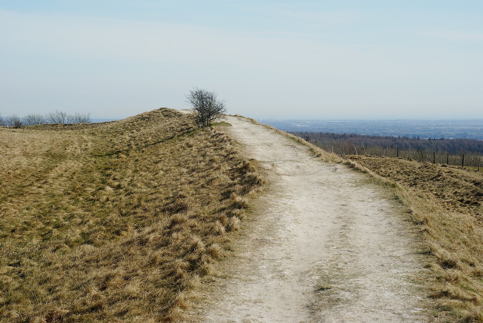
The hillfort forms an irregular, nine-sided enclosure covering about 5.66 hectares. A substantial bank and ditch define its boundary, with a smaller bank outside. The bank consists of nine sections, many of them straight, and is well preserved. Its height and the ditch’s depth vary around the enclosure; at the highest point, the bank rises 5.5 metres above the ditch bottom. Gaps on the east-northeast and west-southwest sides form the entrances.
A linear cropmark beyond the banks has been considered no earlier than the Iron Age, but it has not been excavated. Surveys also recorded 15 depressions inside the ramparts that may be house platforms, along with three possible platforms for Roman buildings.
Entrances and internal pits
Eastern entrance
Excavation at the eastern entrance revealed numerous pits and postholes whose arrangements could not all have been in use at once without obstructing the opening. Curwen proposed that they represented successive entrance designs, possibly including a double gateway. Three deep pits, numbered 11 to 13, were each about 7 to 8 feet deep and 4 feet square, with a ramp leading into them. They appear to have been left unused and filled soon after they were dug. Curwen considered them part of an ambitious defensive scheme begun shortly before the hillfort was abandoned. He suspected a similar arrangement at the western entrance. Squared flint blocks were found in pit 12. Large wooden gates and iron pivot mechanisms have been suggested as possibilities, not confirmed features.
Western entrance
Pit 2 lay in the middle of the western entrance and contained two large postholes. It appears to have been filled soon after it was dug. Another pit in a corresponding position at the eastern entrance led Curwen to consider the pair part of the entrances’ defences. A layer of flint blocks, some squared, lay over pit 2; its date is uncertain, although Curwen proposed an Iron Age date based on the flint’s surface.
Ridge earthworks and burials
Dykes and possible barrow
Two dykes, linear earthworks formed from a bank and ditch, cross ridges approaching the hill from the north. The eastern dyke is associated with a crouched burial found during car-park construction. A crouched burial is one in which the body was placed with its limbs flexed. The burial was considered potentially Bronze Age, as was a feature interpreted as a possible round barrow, a burial mound.
Burial beside the northern rampart
Where the outer Neolithic ditch meets the northern Iron Age rampart, Curwen excavated the crouched burial of a woman estimated to have been about 25 to 30 years old and 1.5 metres tall. She lay beneath a small mound of chalk stones in a grave cut into the upper part of the Neolithic layer. The rampart was built after her burial, which Curwen considered to be no later than the Early Bronze Age.
Grave near the foot of the hill
A shallow grave found near the hill’s foot in 1975 contained a body without its skull and several vertebrae, together with fragments of an iron belt buckle. The grave’s length suggested the person had been buried without a head. An execution nearby sometime between 1000 and 1825 has been proposed, but the burial’s circumstances remain uncertain.
Buildings and later alterations
Chapel and windmill foundations
Two adjacent rectangular building remains measure about 6 by 5 metres and 4.2 by 3.3 metres. The smaller matches the dimensions of a building foundation recorded on the summit in 1839. One structure is thought likely to be the chapel and the other the later windmill, but their individual identification is uncertain.
Wartime installations and ground disturbance
Two radio stations, each with four wooden masts, were built on the hill during the Second World War. By the 1995 survey, one mast remained, along with a concrete foundation between the station locations. Multiple trenches and foxholes had also been dug into the Iron Age banks.
Marl pits
Two marl pits at the summit cut into the prehistoric earthworks. Marl is a lime-rich clay that was extracted from the ground.
Excavated deposits and finds
Ditch layers and artifacts
Excavated ditch sections contained chalk rubble at their base. Curwen interpreted it as natural silting, while later study considered that it might have been deliberately placed. Pottery in a layer above it included small quantities from the Hallstatt and La Tène phases, successive periods of Iron Age material culture. A higher layer rich in early Iron Age pottery was associated with Iron Age occupation. The 1980 excavation identified another layer of chalky lumps at a ditch bottom. Pottery from ditch sections has also been attributed to the Windmill Hill culture, an early Neolithic culture in southern Britain.
Finds included flint flakes, more common in lower levels than in Iron Age layers, and heated stones used to warm water in pots, more frequent in Iron Age deposits. Quern fragments, from hand-operated stones used to grind grain, were larger in Iron Age contexts and smaller in Neolithic ones. Most excavated pits were considered Iron Age. Pits 1, 3 and 5 contained rubbish, including broken pottery in pit 1, which lay beneath a late Iron Age dwelling. Pit 4 was shallower and contained ox and sheep bones; its date is uncertain.
Animal remains and environmental evidence
Animal remains included ox, sheep, pig and a small number of roe deer. Sheep bones were more common in Iron Age than Neolithic layers. A bone from a Neolithic deposit had been shaped into a phallus and cut from the original bone with a flint saw.
Snail remains indicate wetter conditions during the Neolithic than today, and conditions around the Bronze Age burial and hillfort construction that were wetter than today but drier than in the Neolithic. Snail evidence was initially interpreted as showing extensive clearance when the ditch was first dug and renewed clearance during Iron Age activity. A reassessment in 1982 treated Vallonia costata as a woodland species, suggesting Neolithic clearance may have extended little beyond the site. Pottery from the 1980 ditch excavation was concentrated in lower Neolithic layers, with a few Iron Age sherds in upper deposits and some overlap between them.