Sammallahdenmäki: A Bronze Age Burial Ground in Finland
Site at a Glance
- Popularity
- High
- Country
- Finland
- Primary era
- Bronze Age
- Eras represented
- Bronze Age, Iron Age
- Civilizations
- Unclassified
- Site type
- Burial
- Remains
- Necropolis
On this page15 sections
History
Sammallahdenmäki is a prehistoric burial ground near Lappi in Finland, used from the Bronze Age into the Early Iron Age. Its oldest cairns, stone-built burial mounds, date to about 1300-1000 BC. The latest burial, placed in a lower-lying cairn with a stone cist, a burial chamber built from stone slabs, dates to about 170 BC-AD 82. The cemetery preserves a coherent record of changing burial practices across this long period.
Bronze Age burial customs
The cemetery reflects Scandinavian Bronze Age customs that spread through western Finland. The dead were cremated, and their bones were cleaned of soot before burial. A cairn may have been built for one person and later reused for other members of the same kin group; further burials could lead to extensions of the stone mound.
The placement of cairns has been interpreted as a way of marking land associated with kin groups. Burial near the sea may also have reflected beliefs that the sea led to the land of the dead, while a possible connection with sun-worship rituals has been proposed.
Iron Age communities
Settlements southeast of the cemetery are known at Huilu and Tahtmaa. Another settlement south of the burial ground was contemporary with its youngest cairns. Together, these sites provide evidence of communities living in the area as the cemetery remained in use.
Local memory and archaeological study
Local knowledge of the cairns preceded archaeological investigation. A story about Kirkonlaattia (Church Floor) was written down in 1878, and Sammallahdenmäki first appeared in archaeological writing in 1880. In the 1890s, Volter Högman surveyed the area, recording 17 cairns and excavating four in 1891, including Kirkonlaattia and Huilun pitkä raunio (Long Ruin of Huilu). Burnt bone was recovered. Högman called the area Huiluvuori, after Huilu farm and the rocky height behind it, though the name was unfamiliar locally. In 1991, Finland’s place-name authority recommended Sammallahdenmäki or Kirkonlaattia for the cairn area.
Later investigations included photographs of southern cairns in 1911, the recording of local knowledge in 1950, and cairn mapping in 1959. An inventory in 1960 counted 26 burial cairns and found Kirkonlaattia in good condition. A further inventory in 1990 was accompanied by a terrain model and measurements. In 2002, eight cairns were excavated. Burnt bone came from six, and five yielded remains identified as human, probably belonging to adults; the amount was too small for detailed analysis. Excavations at the settlement south of the cemetery followed in 2003-04.
Protection and World Heritage recognition
UNESCO’s World Heritage List recognizes places of outstanding cultural or natural value. Sammallahdenmäki was added in 1999, becoming the first archaeological site from Finland on the list. The inscription recognized the cemetery as exceptional evidence for Scandinavian Bronze Age society and burial customs, and valued its coherence for future research.
The site’s boundaries were set in 1993, and Finland’s Ancient Monuments Act protects its remains from excavation, covering, alteration, damage, or removal. A research plan for development of the area covered 2002-04. A management plan approved in 2015 aims to preserve the site and its natural surroundings. It calls for clearing woody growth near cairns to limit root damage and maintain visibility between them.
Remains
Landscape and layout
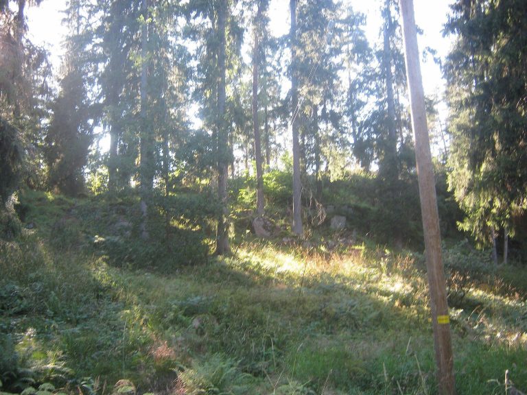
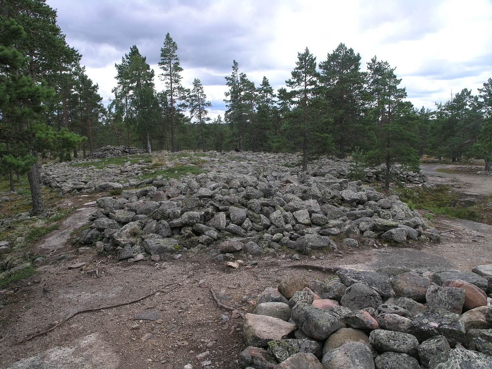
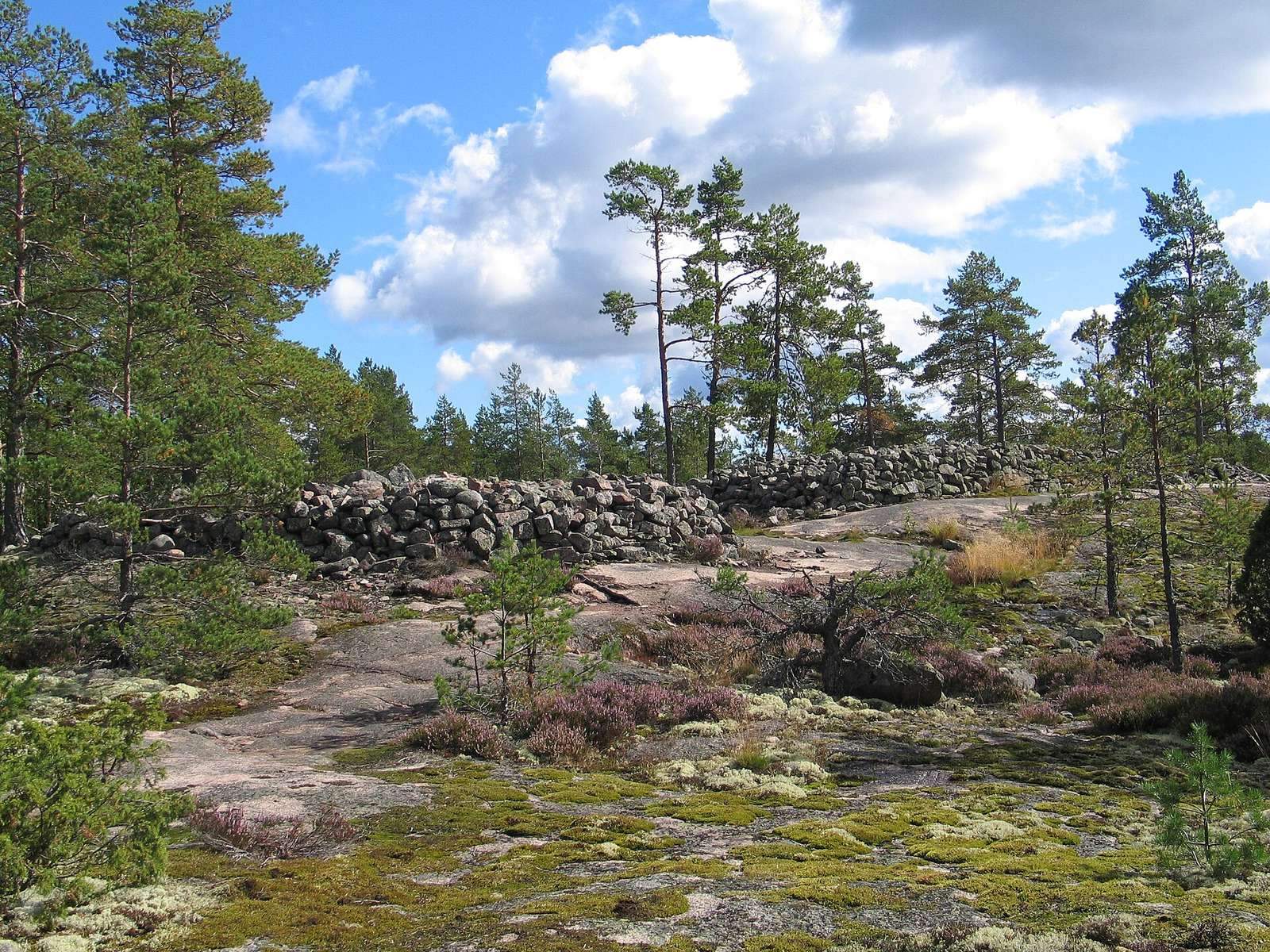
The archaeological area follows a long, rocky ridge north and northeast of Saarnijärvi. Thirty-six stone burial cairns occupy the ridge and the heath between its rocky rises. The oldest stand on rocky ground more than 40 metres high. Granite, probably gathered locally or taken from the bedrock, was used to build cairns of varied form, from small, low circles to larger mounds and low circular rings. Some use dry-stone construction, fitted stones laid without mortar, and several retain stone cists.
The landscape has changed since the cemetery’s early use. A sea inlet once lay where Saarnijärvi is now, and the sea stood higher before land uplift shifted the shoreline westward. The oldest cairns were already on the mainland, with an archipelago to the west; today the cemetery lies about 15 kilometres from the sea. Saarnijärvi reached the foot of the rocks in the early twentieth century, but drainage in the 1950s and 1960s caused it to recede and become largely overgrown. The bedrock is rapakivi, a coarse granite with rounded feldspar crystals. Pine, stunted birch and aspen, heather, bearberry, and reindeer lichen grow on the rocky ground, while wetland plants occur near the lake.
Burial cairns and stone structures
The cairns differ in shape, construction, and preservation. Some are low and round, while others form substantial mounds or rings. Their arrangement across the ridge and heath reflects the varied terrain on which they were built.
Kirkonlaattia (Church Floor)
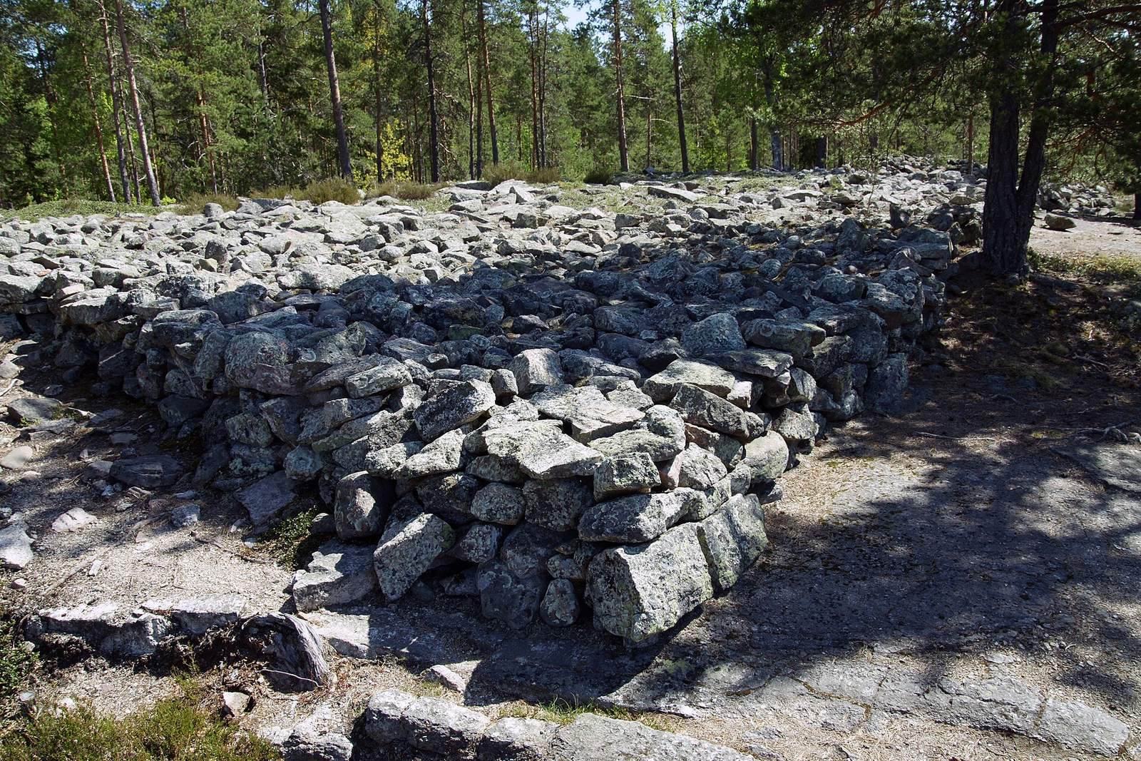
This broad, flat-topped stone construction has an irregular four-sided outline. Its sides measure 19.2, 16.8, 15.0, and 18.8 metres. Its edges rise about half a metre around a thinner layer of stones at the centre. A 3.5-metre slab wall shown on Högman’s 1891 map has been interpreted as a possible cist. The structure’s form is unusual in Finland and exceptional within Scandinavia.
Huilun pitkä raunio (Long Ruin of Huilu)
This elongated, oval cairn resembles a low rampart. It grew through three construction phases, whose inner walls, base-stone arrangements, stone materials, and underlying ground differ. Burials were probably made at different times, with the dead placed among the stones without cremation.
Excavated cairns
Cairns 11, 23, and 31 were among the best-preserved examples examined in 2002. Excavated cairns are generally in the best condition today because they were restored. Cairn 11 contains nested stone rings arranged in an unusual spiral. The rings were made of stones larger than the cairn’s filling stones and were exposed during excavation. Cairn 23 has a wall built from stone slabs, while cairn 31 is a low stone structure beneath which investigators found a double cist. A fragment of a bronze bracelet of a type considered Baltic came from the cist in cairn 31; its closest known parallel is from a cemetery near Pori.
Lower terrace and stone settings
On the lowest rocky terrace, cairns and stone settings are low and largely covered by ground vegetation. Removing moss and undergrowth during investigation revealed three upright stones and two stone cists. Elsewhere, some cairns have been reduced to their lowest stones after stone was taken for building material.
Archaeological features beyond the cairns
Southern settlement
Excavations south of the cemetery in 2003-04 uncovered pottery fragments, burnt animal bone, small quantities of bronze, polished stone objects, and burnt barley and wheat grains from a hearth. Probable marks of house supports suggest that a dwelling may have stood there.
Glacial boulder and local tradition
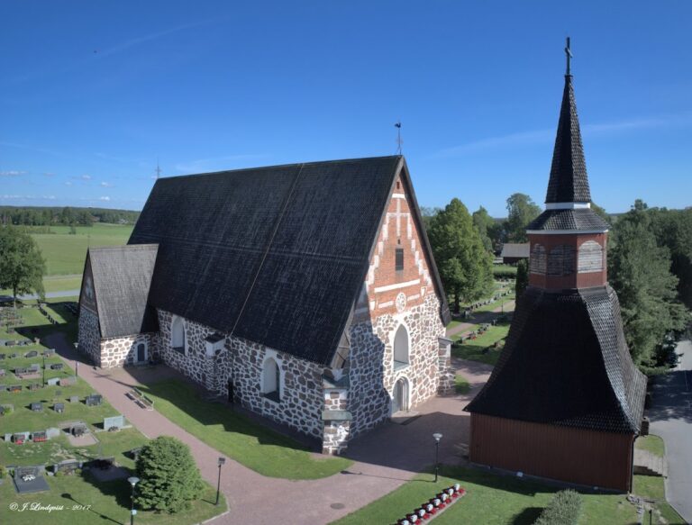
A large boulder carried to the area by glacial ice is associated with a local story about Christians and hiisi, giant-like beings in Finnish folklore, competing to remain there. The Christians raised two pillars, set a bell between them, and rang it to make it seem that their church was finished first. The hiisi abandoned their own construction and left. Another part of the tradition says they threw a stone toward Lapin church, and the boulder is identified locally as that stone.