Castra of Walldürn: A Roman Frontier Fort on the Upper German-Raetian Limes
Site at a Glance
- Popularity
- Low
- Country
- Germany
- Primary era
- Classical
- Eras represented
- Classical
- Civilizations
- Roman
- Site type
- Military
- Remains
- Fort
On this page19 sections
History
The Castra of Walldürn is a Roman military fort in Walldürn, Germany, occupied from about AD 159/160 until the frontier was abandoned around AD 259/260. Also known as the Alteburg fort, it stood on the Forward Limes, part of Rome’s frontier system across the provinces of Upper Germany and Raetia.
Construction and garrison
The fort’s precise construction date is uncertain. Earlier estimates placed it around AD 155, while tree-ring dates from elsewhere along the frontier support building activity around AD 159–161, perhaps coordinated with work on the Raetian frontier after the death of Antoninus Pius. A timber-and-earth fort may have preceded the stone enclosure at Walldürn. A ditch beneath the later stone wall could belong to that earlier installation, but the evidence is inconclusive.
The fort could hold a single military unit. An inscription dated AD 232 refers to explorers whose unit name begins Exploratores Stu and to Britons associated with the dediticii, a Roman term for people who had surrendered to Roman authority. The inscription’s meaning is disputed. Dietwulf Baatz considered the explorers the unit stationed at Walldürn; the Britons’ non-commissioned officers may have commissioned the text without their unit being based at the fort. The complete name of the explorers’ unit does not survive.
The bath, civilian settlement, and frontier withdrawal
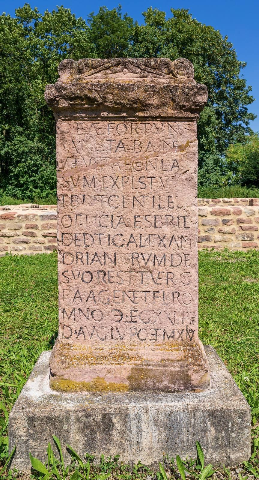
A dedication associated with the bath records its rebuilding and rededication on 13 August 232, after the earlier building had deteriorated. The inscription credits the work to named units, paid for at their own expense, under Titus Flavius Romanus, a centurion of Legio XXII Primigenia. The reading remains contested: Henry Thompson Rowell’s interpretation of two units was preferred by Baatz and Egon Schallmayer, while Hermann Dessau proposed three. Baatz also argued that the inscription had been poorly carved and that plaster may have covered some errors before it was painted. One unit’s honorific, Alexandrian, had been granted by Severus Alexander and was erased after the emperor’s death.
The civilian settlement, or vicus, developed in two phases. Finds place the end of Roman life there in the second third of the third century. The latest coin known from Walldürn is of Gallienus, but its findspot is unrecorded and it does not establish continued occupation. The fort was destroyed by fire as Roman control of the Upper German-Raetian frontier ended around AD 259/260. It is possible that departing troops deliberately burned the fort to keep it from their opponents, but this remains uncertain.
Rediscovery and protection
Eighteenth-century antiquarians noted that remains of the fort and frontier could still be seen above ground. In 1766 Andreas Lamey published a dedication to Mars and Victoria, the Roman god of war and personification of victory. The stone had been found beside the Marsbach, whose name followed the discovery. Small investigations took place in the early nineteenth century. Researchers examined part of the enclosure in 1881 and identified a double ditch the following year.
Wilhelm Conrady led major excavations of the fort and bath in 1896–1897 for the Imperial Limes Commission. Dietwulf Baatz investigated the bath in 1972–1973, after which it was conserved; during the same decade the city acquired the fort area to protect it. In 1982–1983 Egon Schallmayer excavated parts of the civilian settlement threatened by agricultural use. Since 2005, the fort, settlement, bath, and related remains have belonged to the UNESCO World Heritage property of the Upper German-Raetian Limes. They are also protected under Baden-Württemberg’s cultural-heritage law.
Remains
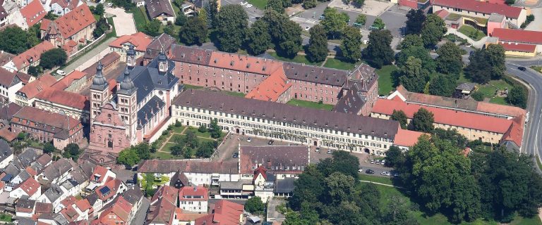
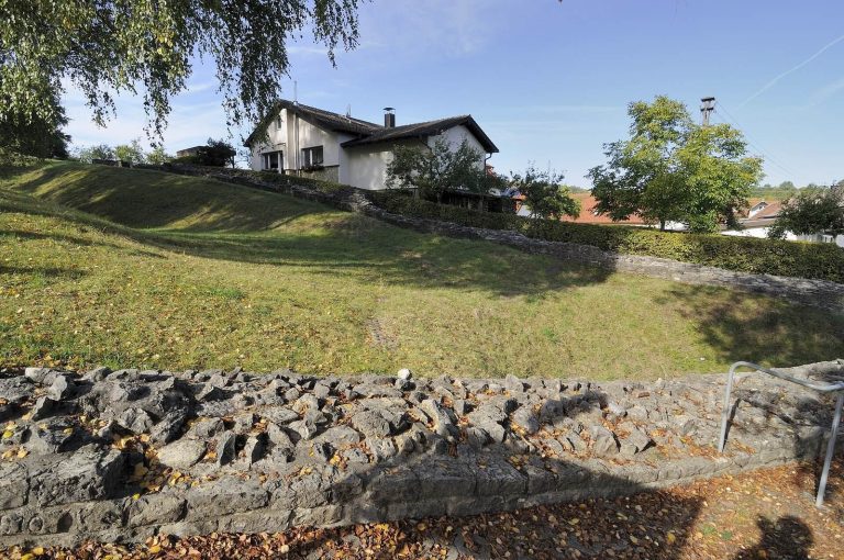
The fort and civilian settlement lie beneath meadow on a low rise southeast of Walldürn, about 398 metres above sea level. The fort was aligned northeast, with its short front facing the Limes bend. The frontier approached from the northwest, turned sharply south about 300 metres east of the fort, and bent southeast farther on. The Marsbach runs northwest below the fort’s rear; its source lies southeast of the site, beyond the Roman frontier.
Fort
Enclosure and defenses
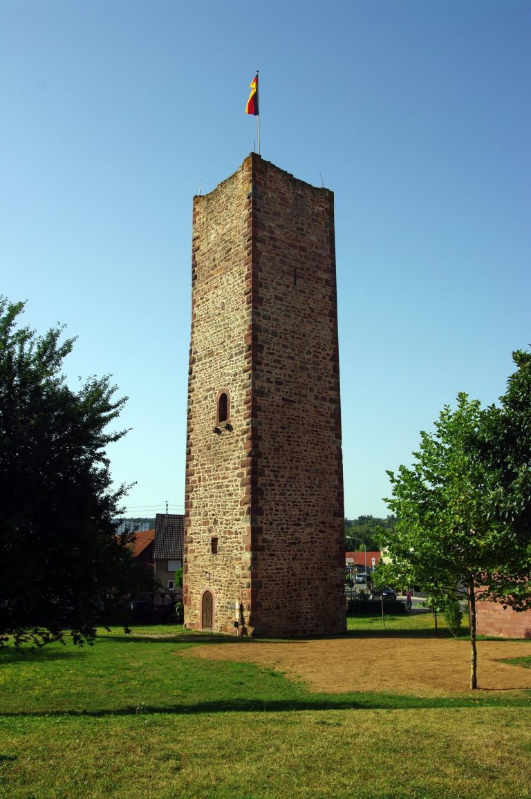
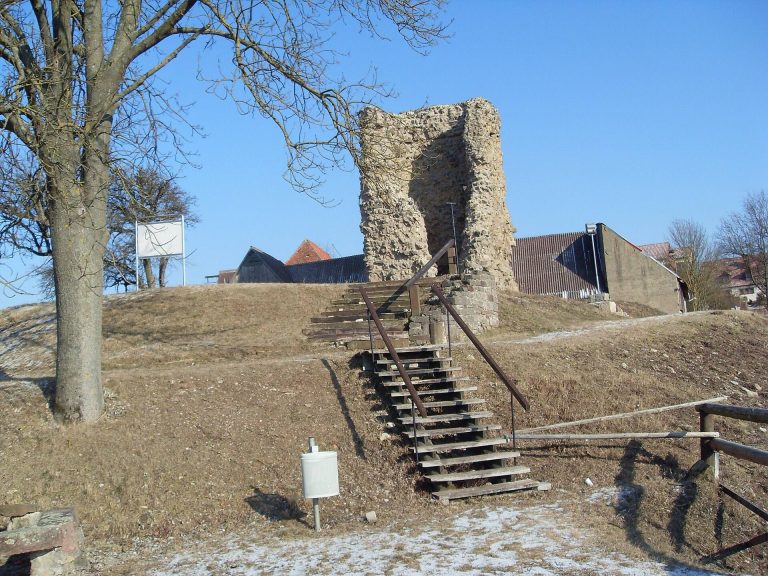
The rectangular enclosure measured 84.3 by 96.5 metres, covering about 0.8 hectares; another estimate gives about 0.7 hectares. Its stone wall had a gate on each side. Each gate was probably flanked by a pair of towers; the identified tower stood beside the southeast entrance and measured 5.50 by 5.10 metres. Its core was built of cast masonry and faced with roughly dressed stone. Large iron nails near the gate probably came from wooden gate leaves, while a threshold slab had a groove for them. Outside the wall, a berm 0.45–0.50 metres wide separated it from a double V-shaped ditch. The ditch was 11.25 metres across and 1.10–1.20 metres deep when excavated.
Buildings within the fort
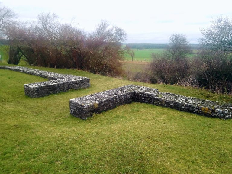
Interior traces include postholes and fire debris with roof tiles, pottery, stones, burnt beams, and reddened clay. Impressions in the clay preserve the pattern of branches woven into timber-framed walls. Corners of mortarless stonework resting on dark soil indicate barracks, and roof-tile fragments suggest that these buildings had fired-tile roofs.
Vicus
Settlement plan
Excavation covered 3,500 square metres between the fort and bath. Survey finds show that the civilian settlement also extended north, south, west, and northwest of the fort. Buildings, probably long and narrow houses, may have lined the road from the northwest gate. Excavated building traces ran north–south. Finds and excavation features include cellars lined with stone or timber, drainage channels, wells, pits, and postholes.
Bath complex
First building phase
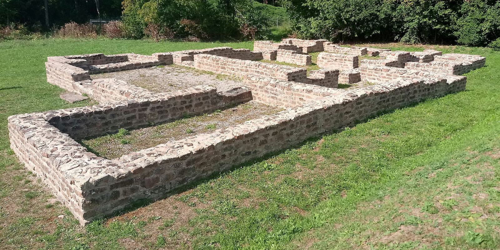
The bath was aligned north–south. Its first arrangement began at the south with a timber entrance porch and a nearly square changing room surrounded by a passage. The stone bathing block contained a rectangular cold room with a small cold-water basin on its west side. A heated warm room lay to the north, with a nearly square sweat room attached to the east wall between the two. Farther north, the hot room had a semicircular projection on its west side containing a hot-water tub, as well as a small basin at the northern end. Two furnace rooms served the building, one north of the basin and another in an external recess on the east.
Bricks stamped for Legio XXII Primigenia came from that legion’s brickworks near Höchst. Repairs took place around AD 185, and the bath remained in use until after AD 200. A coin minted at Rome in 199/200 is the latest evidence associated with this phase. The building probably ended in a fire.
Rebuilt bath
In a later phase, workers removed the earlier bath walls below the floor level then in use. They made the changing room smaller and rebuilt it in timber, while enlarging the stone bathing block. The cold, warm, and hot rooms retained their main sequence. The cold-water basin was reduced, and the former projection and northern basin in the hot room were removed. Two small heated tubs were added to the enlarged pool, and a larger heated room was attached to the east of the warm room. A similarly sized room east of the cold room was interpreted as a sweat room, although it had no heating.
Final heating arrangement
In the final phase, intense heat cracked and broke down sandstone supports in the hypocaust, a system that warmed rooms by circulating hot air beneath their floors. Damage near the hot-room furnace led to the abandonment of that room and adjoining spaces; the former hot room was then used as a furnace for the rest of the bath. The earlier warm room became the hot bath, while its heated eastern addition served as the warm room. Unbroken heating supports remained in place except where the new firing point was made.
Burnt layers, charred wood, fire-marked nails, and melted or broken glass beneath the warm- and hot-room windows indicate that the bath ultimately burned. Its foundations have been partly reconstructed and conserved.
Inscribed remains
A sandstone altar dedicated to Fortuna was recovered during excavation of the bath. The building inscription associated with the rebuilding was found within the complex, about four metres from the threshold to the bathing area.
Objects and environmental evidence
Fort finds
Excavated objects from the fort include bronze and iron pieces, roof-tile fragments, pottery, a limestone projectile for a ballista, and part of a sandstone carving of Epona, a goddess associated with horses and fertility. Pottery includes Terra Sigillata, fine red-gloss Roman tableware often marked with potters’ stamps.
Vicus deposits and pottery
Two deposits of metal objects came from settlement contexts with destruction layers. One contained two tinned-bronze bowls, four other bronze vessels, a crushed but nearly complete bronze cauldron, and fragments of another. The restored cauldron has ten large and eleven small repairs. The second deposit comprised 13 iron tools and implements, found in a pit in the middle of a room in a later settlement layer; the bronze vessels came from rubble belonging to that room’s wall. The contexts indicate two settlement layers, each with a destruction deposit, but do not establish whether the objects were placed before or after the destruction. One group may have been hidden by residents protecting valuables; the bronze vessels in the other may have been gathered by metal scavengers after a building was destroyed. Neither deposit can be securely tied to attacks around 233 or 259/260.
Surface pottery collected from the fort and settlement since the early 2010s is mainly of the second and third centuries. By 2016, identified potters or groups included LAL, of the third quarter of the second century; Cobnertus I or III, dated to AD 160–180; Cerialis III, active around AD 165–200 and occasionally into the third century; Julius II–Julianus I, of the third century; and a type associated with Janu[aris], dated to AD 140–150/160. Many red-gloss fragments had been burned, consistent with evidence for destruction by fire.
Plant remains
Samples from a damp cellar foundation south of Well 3 and its drainage channel, near the Marsbach floodplain, contained thousands of garden orache fruits, almost entirely seeds. The plant was used as a leaf vegetable and could also serve medicinal or dye-making purposes. The concentration suggests that seeds intended for sowing or direct use had been stored or transferred in the cellar. The drainage channel also yielded a small amount of glume-wheat straw, unidentified grain, and hazelnut shells. Amphorae remained in place in a neighboring timber-lined cellar, and their contents were judged very probably to have included wheat.
Wild plant remains form a small part of the identifiable plant evidence. Among them, arable weeds account for 99 percent, chiefly black bindweed followed by white goosefoot. The remains also include summer pheasant’s-eye, a rare poisonous plant associated with limestone-rich soils. Some species point to nutrient-rich cultivated ground, while the small quantity of grassland plants indicates a limited grassland component.