Topoxte: A Postclassic Maya City in Guatemala
Site at a Glance
- Popularity
- Medium
- Country
- Guatemala
- Primary era
- Medieval
- Eras represented
- Iron Age, Classical, Medieval
- Civilizations
- Maya
- Site type
- City
On this page19 sections
History
Preclassic and Classic periods
Topoxte is a Maya archaeological city on islands at the western end of Lake Yaxha in Guatemala. People occupied the site from the Middle Preclassic through the Late Postclassic, though settlement was interrupted around AD 900 and began again around 1100. During the Classic period, Topoxte belonged to the political sphere of Yaxha.
Late Preclassic pottery indicates contact with the Guatemalan highlands. In the Terminal Classic, pottery at Topoxte closely resembled that of Tikal and Uaxactun, two prominent Maya centers in the Petén region. Ixtepeque obsidian came into use from this period onward and became the main source of obsidian for Topoxte and the wider Maya lowlands. A burial dated to AD 750 has been interpreted as evidence of a marriage between Lady Twelve Guacamaya of Topoxte and a prince from Tikal.
Postclassic capital
After an abandonment around AD 900, near the close of the Classic period, Topoxte was reoccupied around 1100. In the Postclassic, it became a capital of the Kowoj, a Maya people and political community of the Petén, and one of the largest Postclassic sites in the region. The city was fortified and probably served as a trading link between the Maya highlands and the Yucatán Peninsula.
Topoxte had close connections with Mayapan, a major Maya city in northern Yucatán. Its ceramics, including incense burners shaped as figures, also reflect those ties. Similarities between Topoxte and sites of the Tulum group have been taken to indicate a shared cultural tradition. Construction intensified on the principal islands as population grew in the Lake Petén Itzá region following the collapse of Chichen Itza. The Kowoj later moved their capital west to Zacpeten, on an island in Lake Salpeten, around the time Topoxte was probably abandoned. A final abandonment around 1450 has been proposed, though the date remains uncertain.
Plain stone monuments erected during the Postclassic may have revived ceremonies marking the end of a katun, a twenty-year period in the Maya calendar. This practice has also been linked to Topoxte’s connections with northern Yucatán.
Later references and archaeological work
In 1618, Spanish missionaries Fuensalida and Orbita were said to have passed Lake Yaxha and described the surrounding region as uninhabited. Indigenous guides may have taken them by a neighboring lake to create that impression. Their reference is the only known colonial-period mention of Lake Yaxha.
Juan Galindo reported the site to the Society of Antiquaries of London in 1831 under the earlier name Islapag, though he may not have visited it. Teobert Maler gave it the name Topoxte in 1904. The name means seed of the Ramón tree, whose nuts were an important part of the ancient Maya diet. Maler cleared central ruins, described Building C, and noted nine pairs of upright stone monuments and altars. Sylvanus Morley recorded sculpted monuments in 1914, including two on Cante Island. In 1933, Cyrus L. Lundell and L. C. Stuart mapped the Main Plaza and established the structure labels still used today.
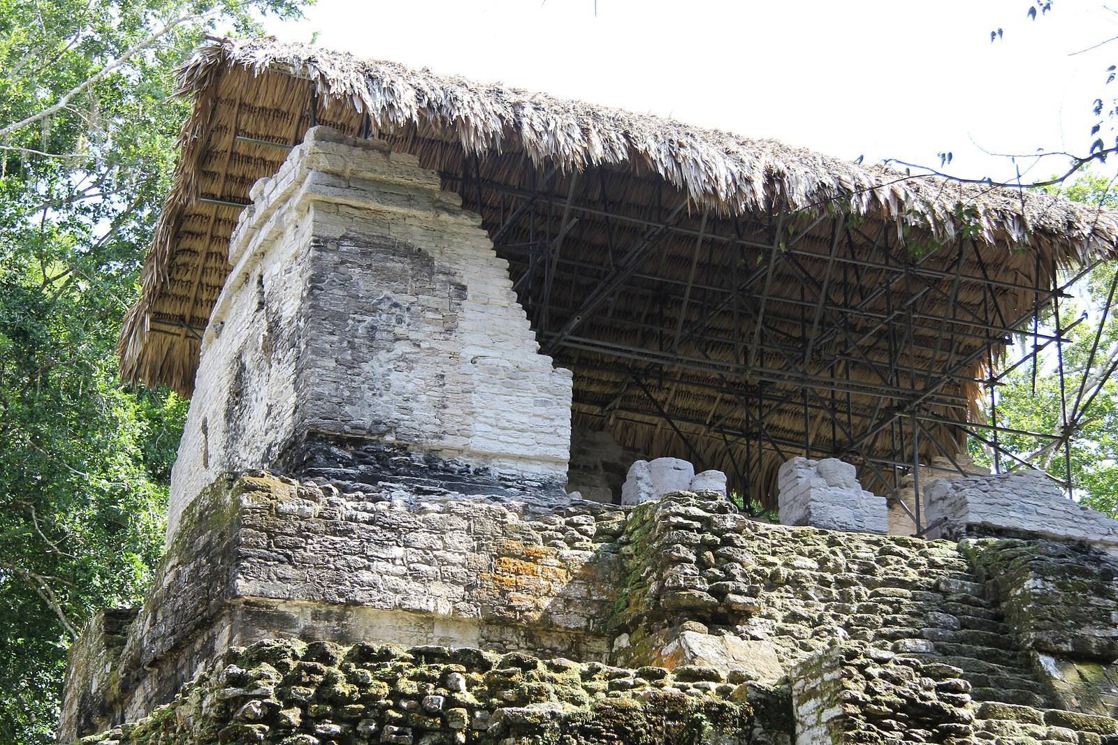
William R. Bullard’s excavations from 1958 to 1960 identified Topoxte’s Postclassic occupation. Don and Prudence Rice worked on Cante Island in 1973–1974. Looting damaged the site during the 1970s and 1980s. Clearing and restoration began in 1989, including protective work on Building C, followed by further archaeological investigations from 1991 to 1993. Topoxte is now part of Yaxha-Nakum-Naranjo National Park. A local tradition describes its ancient inhabitants as unusually short, an interpretation associated with the perceived small size of some buildings.
Remains
Island setting and layout
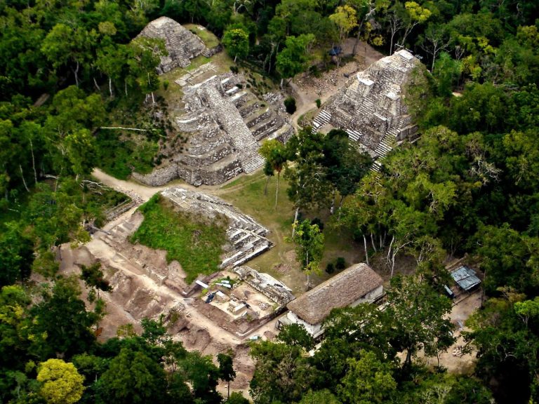
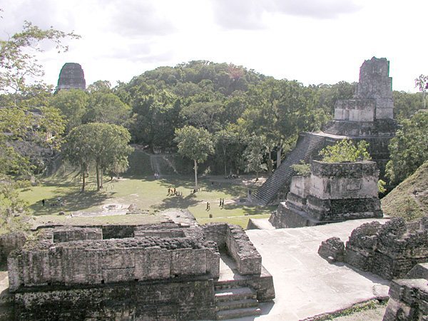
The archaeological city occupies five islands in a group of six at the western end of Lake Yaxha. Its principal remains lie on Topoxte, Cante, and Paxte islands. Changing lake levels can leave the islands surrounded by land; when the water is high, a natural channel connects Lake Yaxha with Lake Sacnab to the east. The smaller lakes Chompoxte, Colorada, and Coloradita lie to the west.
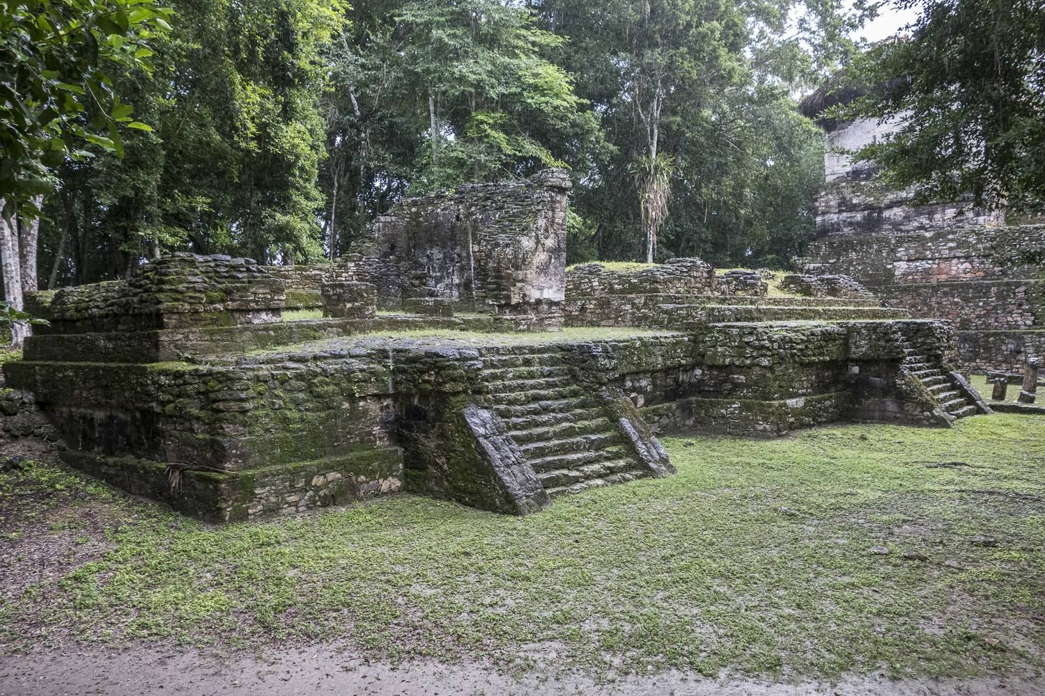
Topoxte Island is formed of limestone and stands about 168 metres above sea level. Its crescent-shaped outline measures roughly 450 metres from north to south and 400 metres from east to west, with a bay on the western side. The ground rises highest in the north and slopes gently south. The island holds the city’s principal ceremonial center, with its largest buildings concentrated in central and northern groups. Residential construction generally followed the terrain, while ceremonial buildings were arranged more deliberately. The stone structures are made of limestone and begin about four metres above the present lake level, suggesting that the Postclassic lake surface was similar to, or perhaps slightly higher than, today’s.
The Main Plaza and its buildings
Main Plaza
The roughly rectangular Main Plaza covers about 1,410 square metres and stands on an artificial platform containing more than nine metres of fill. It is open to the west, toward the lake and sunset. Building G borders it to the north, Building B to the south, and Buildings C, D, and E to the east. Most of the site’s worked stone monuments were placed in the plaza’s southwest corner. Finds in deep deposits in front of Building D and an offering in front of Building E indicate Middle Preclassic activity there. The plaza reached its greatest size in the Postclassic.
Three Postclassic temples bordered the central plaza. Their style, comparable to buildings at Mayapan, features upright walls, columns, and flat stone ceilings. The ceremonial buildings also share features with those at Zacpeten and appear connected with activity at Mayapan.
Building C
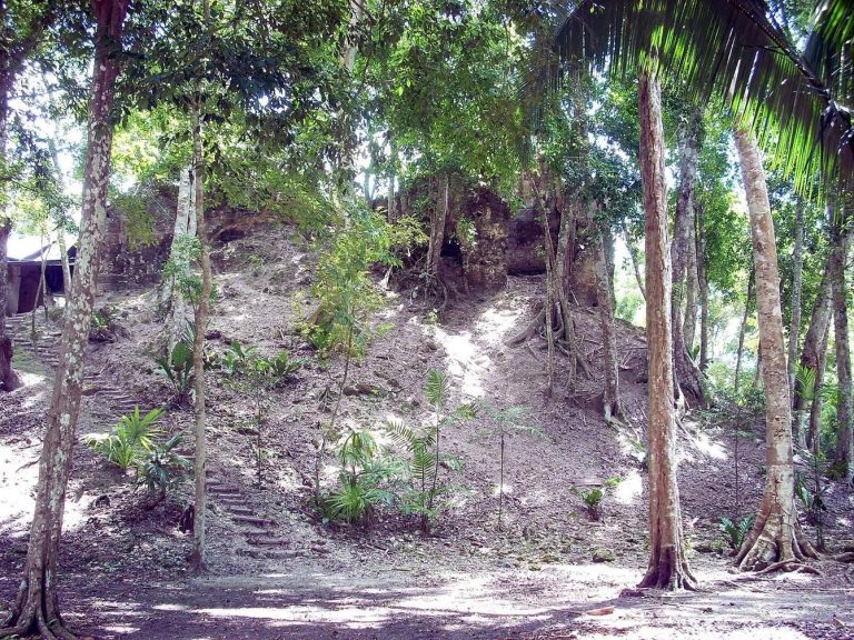
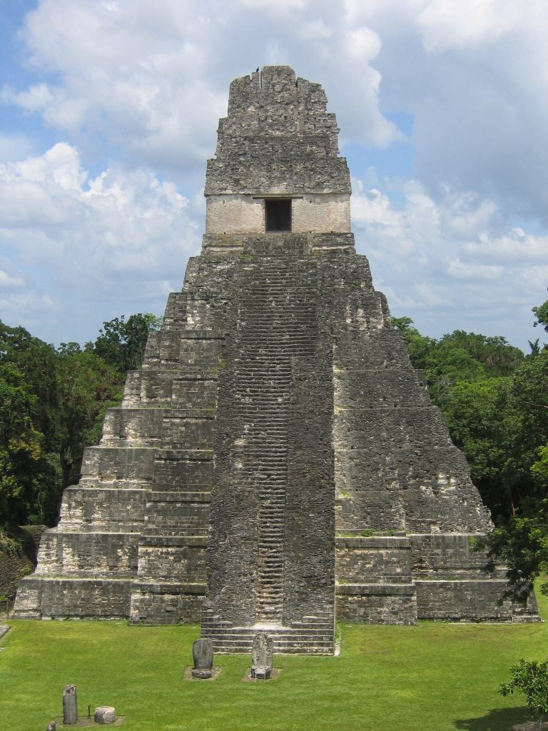
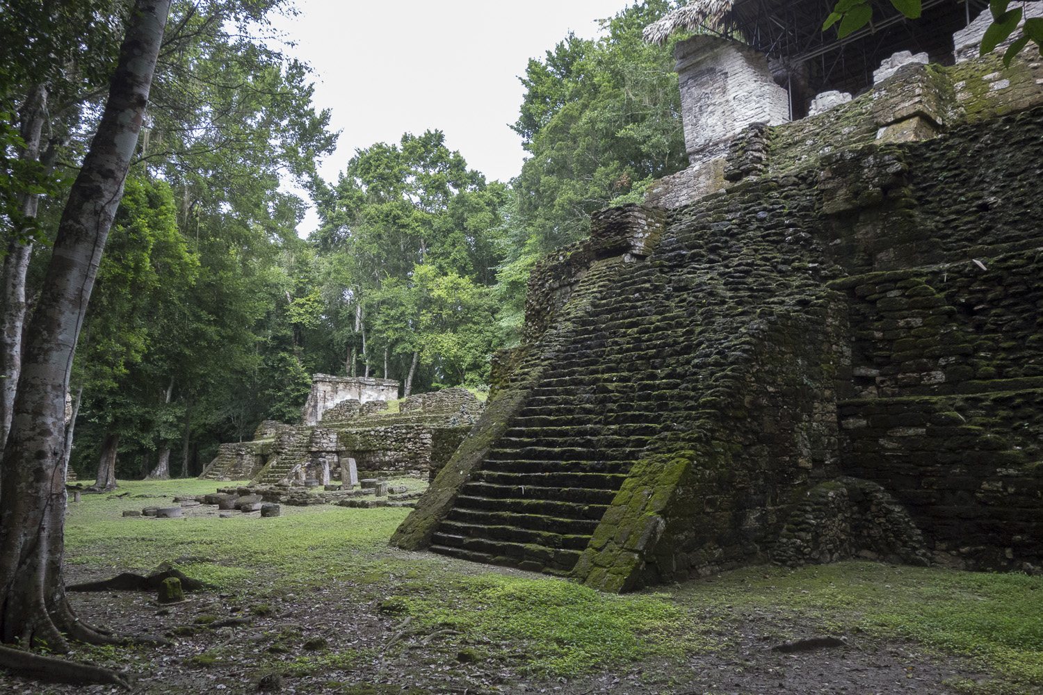
Building C is a stepped pyramid on the plaza’s eastern side. Its three platforms rise 2.45, 2.2, and 2.5 metres. A steep stairway climbs the western face from the plaza at an angle of 49 degrees. A fourth level, reached by another stairway from the upper platform, supported a temple whose walls were originally about 4.8 metres high and 0.8 metres thick.
The temple measured 10.9 by 6.8 metres and contained two rooms divided by a wall and two columns, with a step about ten centimetres high. The columns divided the entrance into three sections, each roughly one metre wide. The stonework was coated with stucco or whitewash. Building C was erected over an earlier structure dating to the end of the Late Preclassic or the beginning of the Early Classic; that earlier building was enlarged in the Postclassic. Two looters’ pits, one at the base and one near the summit, damaged the temple.
A broken stone monument fragment was found on the third tier in front of the temple stairway, together with human bones designated Burial 22. Burial 23 lay in a stone-lined container inserted into the eastern side of the same tier. Burial 18 was near the foot of the lowest tier and main stairway. Burial 21, beneath the summit temple, contained a man aged about 35–50, laid horizontally with an east–west orientation. Finds included a lidded monochrome vessel holding three small pieces of jade, as well as a quartz crystal, a shell bead, and turquoise pieces.
Buildings A and B
Building A is the only large structure assigned to the Late Classic. It comprised a three-tiered stepped platform carrying a small temple, which may have had a raised crest above its roof. During the Postclassic, builders quarried stone from the structure for later buildings, removing its facade. Postclassic Burial 4 was excavated from a terrace near its northwest corner; the burial contained a young woman with a broken copper disk and a piece of flint. Burial 19, dating to the Protoclassic, lay beneath the platform.
Building B is a long, palace-like structure on the south side of the Main Plaza, facing north toward the plaza.
Buildings D and E
Buildings D and E share a platform east of the Main Plaza, immediately north of Building C. D is a rectangular platform with rounded corners. E formed part of a temple complex built in two phases; the earlier phase dates to around 1200. Postclassic Burials 8 and 11 were found at or near its western edge.
Buildings G, J, and K
Building G is a small square structure on the plaza’s north side, facing south. Structure J is a poorly preserved low platform in the plaza’s center, opposite Building C’s stairway. Building K stands on the eastern side of the plaza and once supported two Late Classic stone monuments.
Paxte and Cante islands
Paxte Island
Paxte covers about three hectares, approximately 100 metres west of Topoxte Island. Its 68 identified structures are mostly low rectangular platforms made of unworked limestone, probably the remains of domestic buildings. Two groups of larger structures occupy the island’s highest ground and are aligned north to south; smaller buildings instead follow the terrain. Excavations indicate occupation from the Late Classic into the Postclassic.
Cante Island
Cante covers about 6.5 hectares and lies west of Paxte. Its eastern slope is steep, while the western slope is gentler. The island has 142 mapped structures, mostly medium-sized rectangular platforms arranged to fit the ground. Its main group is organized around a plaza. Occupation appears to have continued from the Late Classic into the Postclassic. Two sculpted stone monuments found there in 1914 date to the Late Classic.
Monuments and burials
Stelae and altars
Nine pairs of stelae, upright stone monuments, and altars were recorded at Topoxte. The plain stelae date to the Postclassic and may once have been coated with stucco and paint. Stela 4 and Altar 4 stand near the area where Burial 24 was excavated.
Burials
By 1995, excavations had uncovered 26 burials at Topoxte. Eighteen were single interments, four contained multiple individuals, and four single burials were accompanied by additional skulls. Two burials lay in rough stone-lined containers, two in caves, and one in a funerary urn. Burials occurred in residential areas, artificial terraces, plazas, and beside major buildings, and date from the Preclassic through the Postclassic.
The finds vary across periods and individuals. Late Classic Burial 2 contained a man with an earthenware bowl and a necklace of four shell or bone beads; Early Classic Burial 3 included two obsidian blades. Postclassic Burial 1, found in a possible residential patio, contained the remains of a young man with tortoiseshell fragments. Burial 12, a Preclassic interment of a woman and a child, included a flint-knife fragment, gray obsidian, and several bone needles. Burial 15, dating to the Late Classic, included an inverted ceramic vessel, a flint projectile point, an obsidian blade, and other objects; the inverted vessel is the only item identified as a certain burial offering.
Burial 49
Burial 49 is associated with Maya priestly hymns in hieroglyphic inscriptions and a scene set in Xibalba, the Maya underworld. The scene was made as a mosaic from seashells, pearls, and stone.