Kedesh: An Ancient Settlement and Administrative Center in Israel
Site at a Glance
- Popularity
- High
- Country
- Israel
- Primary era
- Classical
- Eras represented
- Bronze Age, Classical, Modern
- Civilizations
- Achaemenid, Canaanite, Ottoman, Phoenician, Roman
- Site type
- City
On this page17 sections
History
Kedesh is an ancient settlement and archaeological site in Upper Galilee, northern Israel, near the Lebanese border. Its archaeological record includes an Early Bronze II phase, an archaeological subdivision of the Levantine Early Bronze Age, dated to around 3050/3000–2900 BCE. The site later became an administrative center under successive regional powers. Its identification with the biblical Kedesh Naphtali remains debated.
Bronze Age settlement and biblical traditions
Kedesh began as a Canaanite settlement and later became Israelite. The Book of Joshua describes a Canaanite citadel at Kedesh conquered under Joshua, the biblical leader associated with the Israelites’ entry into Canaan. The account assigns the town to the Tribe of Naphtali and designates it as a Levitical city, a settlement allocated to the Levites for religious service, and a City of Refuge, where someone responsible for an accidental death could seek protection.
The identification of the archaeological site with Kedesh Naphtali is contested. Many place the biblical town in Upper Galilee, while Yohanan Aharoni argued that it lay in Lower Galilee near the Jezreel Valley, at a site now called Khirbet Qadish. Some Egyptian references to a place named Kadesh have also been linked to Kedesh in the Naphtali hills; other scholars connect them instead with Kadesh on the Orontes. Jewish tradition places the burials of Deborah, Barak, Jael, and Heber near the spring below Kedesh. A medieval tradition later associated Deborah and Jael with tombs at the site.
In 733 BCE, Tiglath-Pileser III, king of the Neo-Assyrian Empire, captured Kedesh during the reign of Pekah, king of Israel, and deported its inhabitants to Assyria.
Persian and Hellenistic administration
Around 500 BCE, an administrative compound was built for the Tyrian royal house to manage agricultural produce. Under Achaemenid rule, the Persian dynasty that governed the region before Alexander the Great’s conquests, Kedesh may have become the capital of a Tyrian-administered province of Upper Galilee. The site’s administrative role continued for nearly 350 years under Persian, Ptolemaic, and Seleucid control. The Ptolemies ruled Egypt after Alexander, while the Seleucids governed a large kingdom centered on Syria and neighboring territories.
Kedesh appears in the Zenon Papyri in 259 BCE. These documents are associated with Zenon, a merchant traveling from Ptolemaic Egypt. In the first half of the second century BCE, the Seleucids used the administrative compound to store documents. One building was abandoned around the middle of that century and later returned to use. First Maccabees recounts a battle at Kedesh between Jonathan Apphus, also known as Jonathan Maccabeus, and Seleucid king Demetrius II Nicator. In his conflict with Demetrius, Jonathan captured the town between 145 and 143 BCE.
Phoenician and Roman periods
In the Hellenistic period, the era following Alexander’s conquests and the spread of Greek culture across the eastern Mediterranean, and later under Rome, Kedesh was a Phoenician town subject to Tyre, a major Phoenician city-state. After disturbances in Jerusalem in 66 CE, Jewish forces attacked Kedesh, then part of Roman Syria. During the First Jewish–Roman War, the revolt against Roman rule that began in 66 CE, the Roman general Titus camped at Kedesh before setting out to fight John of Gischala, a Jewish leader in the war.
A Roman temple was built at Kedesh around 117 CE and destroyed by an earthquake in 363. In the fourth century, Eusebius of Caesarea described Kedesh as a former City of Refuge in Naphtali and identified it with Kydissos, a place he located about twenty miles from Tyre and near Paneas.
Qadas in medieval and Ottoman records
By the tenth century CE, the settlement, then called Qadas, belonged to Jund al-Urdunn, an administrative district under the Abbasid Caliphate. In 985, the Arab geographer al-Muqaddasi described Qadas in relation to the nearby Hula Lake and Jabal Amilah district. In the early fourteenth century, the Jewish traveler Ishtori Haparchi identified Kedesh with a place then called Qades.
An Ottoman tax register from 1596 lists Qadas in the subdistrict of Tibnin, within the district of Safad. It records 49 households and nine unmarried men, with an estimated total population of 319, all Muslim. Tax was assessed at 25 percent on wheat, barley, olives, cotton, orchard produce, beehives, and goats, as well as on a grape or olive press. The total assessment was 10,472 akçe, an Ottoman monetary unit.
Qadas in the modern period
In the nineteenth century, Qadas was a stone-built village on a ridge spur. An 1881 description estimated its population at 100 to 300 and noted that residents cultivated figs and olives. Metawali residents, a historical regional term for Shi’a Muslims, went to nearby Nabi Yusha to venerate the name of Joshua. In 1923, boundary arrangements transferred Qadas from French-controlled Lebanon into the British Mandate of Palestine. It was one of seven Shi’a villages in the Mandate known as Metawali. Abundant rain and springs supported farming based on grain, fruit, and olives.
The 1931 census counted 273 residents, one Christian and 272 Muslims, living in 56 houses. In 1945, the population was recorded as 390. The village’s 14,139 dunams of land, with a dunam equal to 1,000 square metres, included 5,709 dunams used for cereals and 156 dunams irrigated or planted as orchards.
Israeli forces captured Qadas on 28 May 1948 during Operation Yiftach. The Arab Liberation Army and the Lebanese army defended the village, while its inhabitants fled amid the fall or depopulation of nearby towns. In June, Kibbutz Manara requested land from the newly depopulated village for winter crops. Yiftach was established on Qadas land northeast of the village site in 1948. Malkiyya, founded in 1949, and Ramot Naftali, established in 1945, also used land belonging to the village.
Archaeological work began with a 1953 trial excavation by Yohanan Aharoni. Surveys followed in 1976–77, and the Roman temple was excavated in 1981, 1983, and 1984. From 1997 to 2012, Sharon Herbert and Andrea Berlin led investigations of the Persian and Hellenistic administrative complex for the University of Michigan, working with the University of Minnesota.
Since 2012, groups of Haredi Jews, members of ultra-Orthodox Jewish communities, have identified remains at Kedesh as the graves of Deborah and Jael. Acts of vandalism followed, including drilling a sarcophagus, painting stones blue, and attempts to break sarcophagi; the antiquities suffered irreversible damage. In 2023, an archaeological project led by Raphael Greenberg was investigating Qadas’s recent history before its destruction, with particular attention to Palestinian remains.
Remains
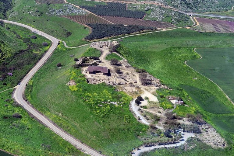
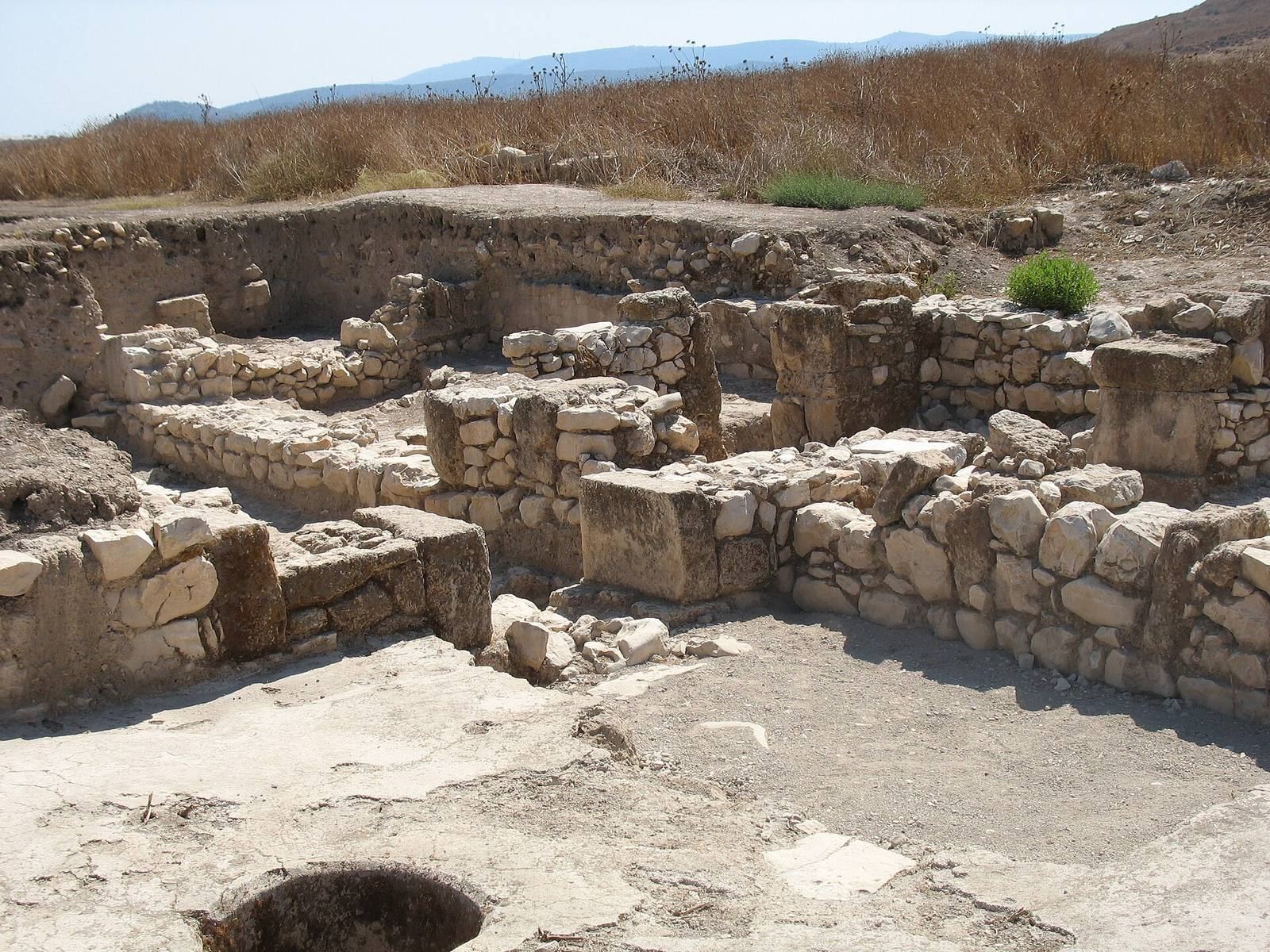
The archaeological site has two principal areas: a settlement mound southwest of North Road and a separate Roman temple area northeast of it. The mound lies about three kilometres northeast of Malkiya and is the largest tell in Upper Galilee. The remains include early settlement defenses, successive administrative buildings, village features, and Roman religious and funerary structures.
The settlement mound
Early settlement and fortifications
During Early Bronze II, the mound covered about 50 hectares and had a complex system of fortifications. Kedesh functioned as a regional center, and pottery from the settlement includes South Levantine Metallic Ware, a classified pottery type from the southern Levant.
Qadas village and spring
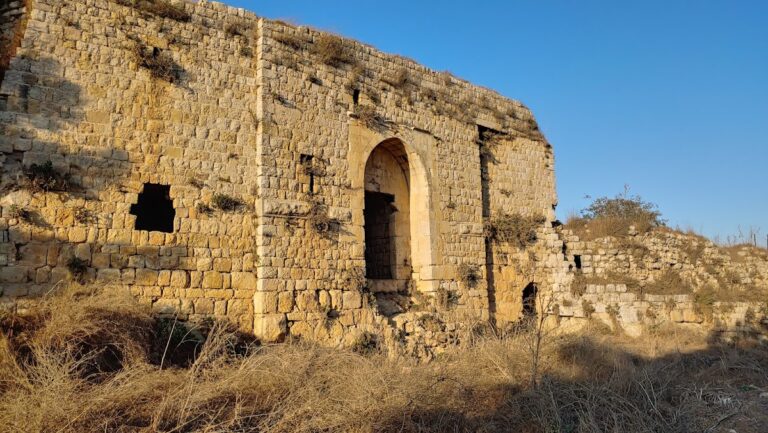
The village occupied a ridge spur. In 1875 it covered about a third of a hill that had once been more fully built over and enclosed by a dressed-stone wall. By the nineteenth century, only a few leveling courses of that wall remained visible. Almost all the village houses contained fragments from older buildings; a column bore a sculpted sun with a radiating crown. Qadas had three springs, a bath below the town, and a mosque in the market whose courtyard contained a palm tree. Ein Kedesh lies at the foot of the mound.
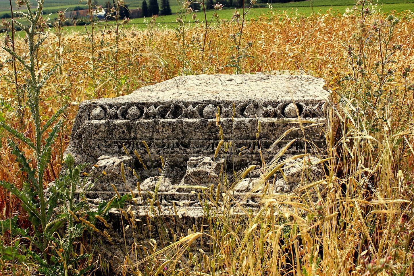
After the village was destroyed, stones from its houses remained scattered across the fenced site, and partly destroyed walls could be seen near the spring. By 1992, apple trees covered the surrounding flat land, while the spring supplied drinking water for cattle. Trenches from the 1948 war lie near the archaeological site, as does a grove of Atlantic pistachio trees.
Administrative complex
Persian and Hellenistic buildings
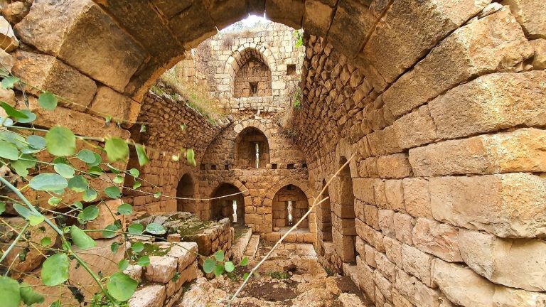
Excavations exposed a Persian building and a later Hellenistic building constructed above it. The latter measured 56 by 40 metres. The compound was monumental and elaborately decorated, with a varied and abundant assemblage of artifacts.
Archive and finds
A clay bulla, a lump of clay used to seal a document or container, preserves the impression of a stamp seal with a Neo-Babylonian-style design. Similar seals were used at Nippur in the late fifth century BCE. Analysis indicates that the clay came from the Kedesh area, consistent with sealing at the site and with the use of papyrus scrolls there.
Small Phoenician amphora-shaped vessels recovered from the Hellenistic archive complex contained cedar oil made from Lebanese cedars and mixed with aromatic resin. Cedar oil was used to preserve papyri. A distinctive coin dedicated to Arsinoe II was found at Kedesh in 2010.
Roman religious and funerary remains
Temple of Baalshamin
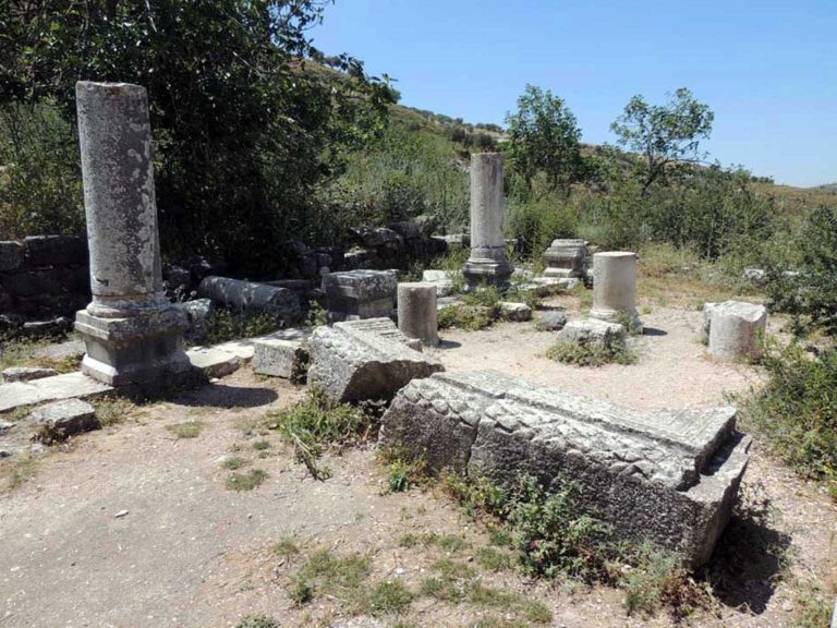
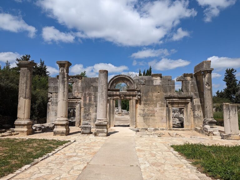
The monumental Roman temple stands northeast of North Road and is among the region’s most elaborate surviving Roman temples. Greek inscriptions identify its dedication to Baalshamin, a major deity in the Syrian-Phoenician world. The entrance appears to have been restricted to priests. Niches beside the openings were cut to channel sacrificial blood toward vessels used for ritual offerings inside, and one doorway is decorated with a figure wearing a toga.
Stone coffins
Large stone coffins, or sarcophagi, are scattered around the site, particularly near the spring. Some are single coffins and others paired, and they have substantial stone lids. Local residents reused some as livestock troughs. The tomb remains date to the first through third centuries CE, many centuries after the era associated with the biblical Judges.
Mausoleum
A ruined ancient mausoleum stands at the northern end of the mound beside Highway 899. A nineteenth-century survey showed it intact. Its stones were probably taken for building houses in Qadas.