Burg Wölpe: A Medieval Castle and Administrative Seat in Germany
Site at a Glance
- Popularity
- Low
- Country
- Germany
- Primary era
- Medieval
- Eras represented
- Medieval, Early Modern
- Civilizations
- Holy Roman Empire
- Site type
- Military
- Remains
- Castle
On this page16 sections
History
Burg Wölpe was a medieval castle at Nienburg, Germany, whose earliest phase is placed around 1115. Its initial form was a motte, a fortified site centered on a raised earth mound. The castle later served as a ducal administrative center for the district of Wölpe.
Origins and the Counts of Wölpe
The castle was first recorded in 1151 under the name Wilipa, when it belonged to the church at Minden. Its beginnings are dated in two different ways: archaeological interpretations place the earliest castle phase around 1115, while pottery associated with the mound’s first construction has been dated to the early 13th century.
In the early 13th century, the Counts of Wölpe moved their fortified residence first to nearby Drakenburg and later to Neustadt am Rübenberge, where they established a new center. In 1302, they sold the County of Wölpe to Duke Otto II for 6,500 silver marks.
Ducal rule and rebuilding
Otto II appointed a Drost, an official who administered territory on a ruler’s behalf, to represent him at the castle. Burg Wölpe then became the seat of the Calenberg administrative district of Wölpe. A feud led to its destruction by fire in 1315.
The castle was destroyed again during the Hildesheim Diocesan Feud, a regional conflict fought from 1519 to 1523 involving the prince-bishopric of Hildesheim and neighboring powers. Duke Erich I subsequently restored it as a palace. He also founded a nearby settlement named Erichshagen, combining his own name with a planned village form whose farmsteads lay along a route and had long strips of farmland behind them. Local speech continued to call the settlement Wölpe.
Administrative use, decline, and investigation
Danish King Christian IV visited the palace in 1624. The following year, forces under Johann Tserclaes, Count of Tilly, a leading general of the Catholic League, captured and damaged it during the Thirty Years’ War, the Central European conflicts fought from 1618 to 1648. After the war, the damaged palace was demolished and converted in 1649 into administrative premises for the district of Wölpe.
A further administrative building was erected near the road in the 19th century. The district was dissolved in 1859 as part of an administrative reform, and its territory was divided between Nienburg and Neustadt am Rübenberge. The Amtshof buildings, the administrative premises, had become dilapidated and were sold for demolition in 1876.
A local-history working group formed in 2009 to investigate the castle remains and develop the site as an archaeological monument. A research plan followed in 2010, and surveys in 2011 used several geophysical and field methods to prepare for excavation. Excavations took place in campaigns from 2012 to 2019 and again in 2021, interrupted by the COVID-19 pandemic.
Remains
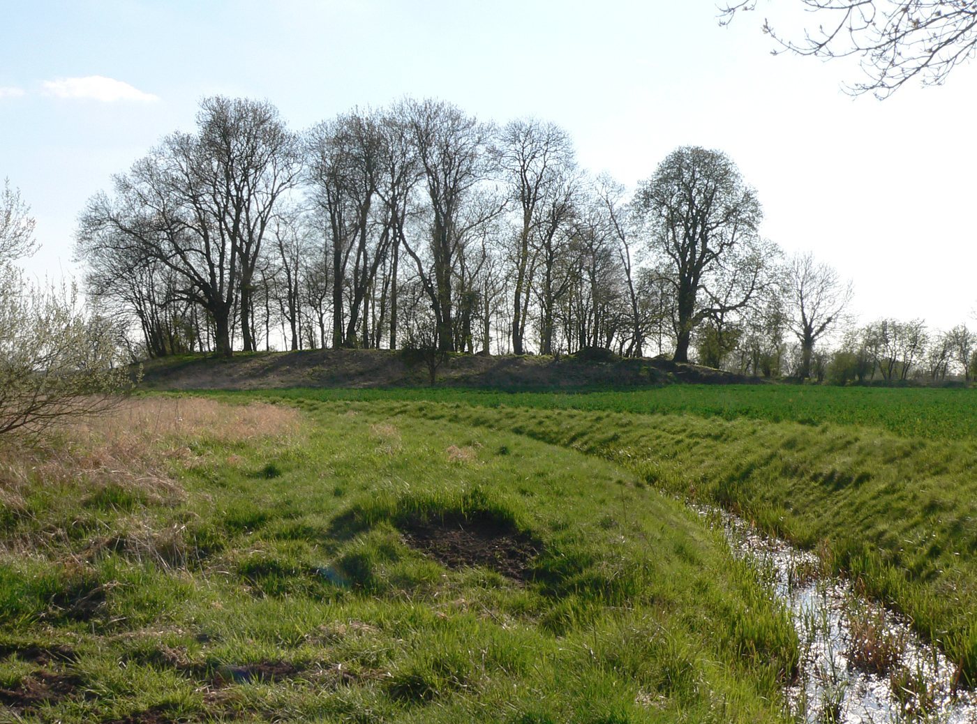
The site lies in low, formerly marshy ground beside the Wölpe, a stream that flows into the Aller. Its layout centers on the raised mound, with a separate outer bailey, or enclosure outside the castle’s central mound. A long causeway crosses the lowland to the mound.
Mound, defenses, and outer bailey
The mound
A natural rise about one metre high lies beneath the mound. The earliest mound was about 20 metres across, and timber arranged in a funnel-like structure helped hold the earth in place. An early stone foundation and a palisade, a defensive barrier of upright posts, stood nearby; the palisade was about five metres beyond the foundation and included a wall-walk, a path along the defense for movement by defenders.
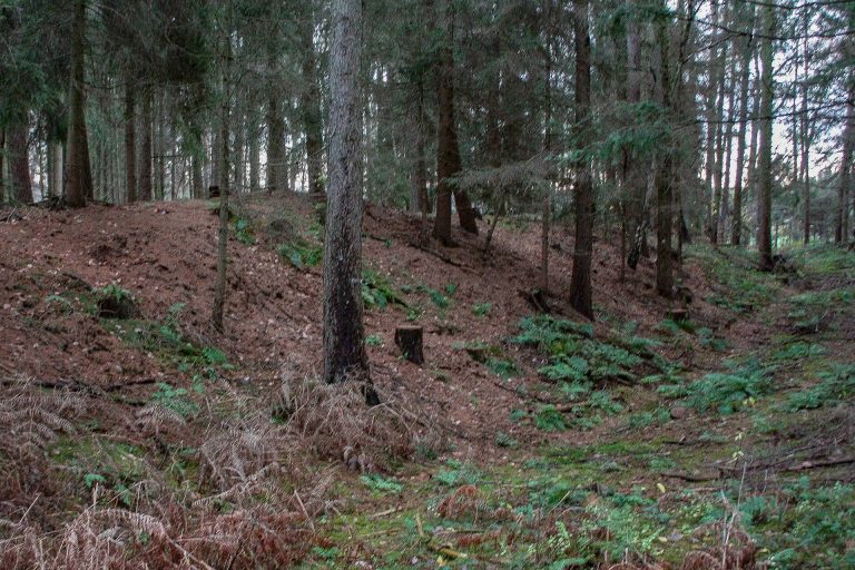
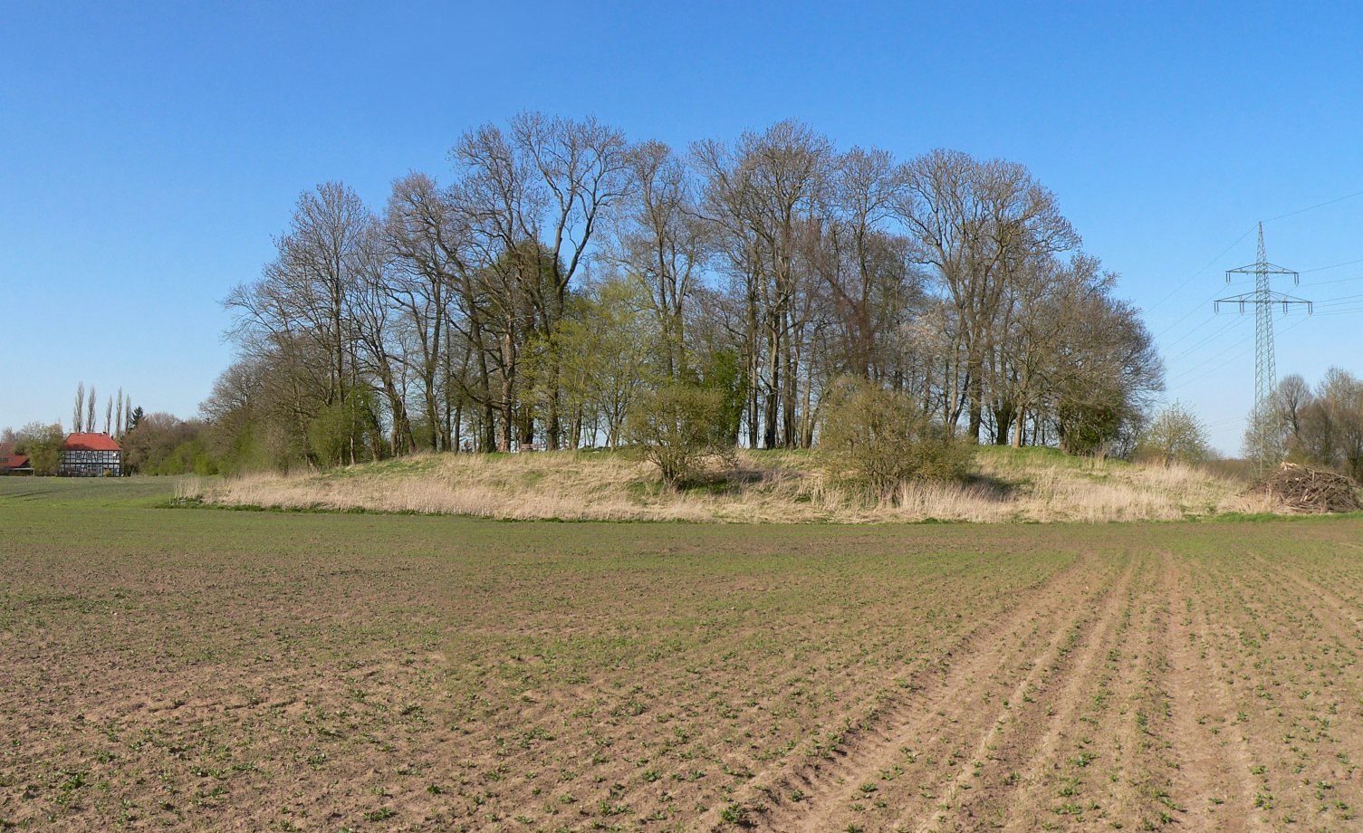
In a later phase after the Middle Ages, additional earth enlarged the mound to roughly 60 metres in diameter. The surviving mound is about 4.5 metres high and measures approximately 60 by 65 metres. Three raised areas on its surface indicate the positions of former buildings. It is tree-covered and includes Nienburg’s oldest chestnut, estimated to be about 300 years old.
Moats and timber structures
A plan from 1778 depicts broad moats around three sides of the castle and palace. At the mound’s foot, excavators found upright posts and horizontally laid timbers in the area of a presumed ditch. The oldest deposits there date to the 13th and 14th centuries, and wooden planks from a walkway lay about one metre below ground. A presumed ditch floor was found in places about two metres below today’s surface; the marshy setting may have reduced the need for a ditch.
In 2013, 44 timber posts and beams were recovered from the lowland. Tree-ring analysis dated most to the 14th through 16th centuries and one to the 11th or 12th century. The timbers may have formed a defensive palisade, stabilized the mound against erosion, or marked the edge of a ditch. A stone feature at the edge of the mound’s plateau may have been part of the castle’s enclosing wall.
Outer bailey and gardens
The outer bailey stood apart from the mound and measured about 80 by 100 metres. Its ground was roughly two metres above the surrounding lowland and had been raised artificially by as much as one metre. Several garden areas are also associated with the site, and their outlines remain visible in aerial photographs. A causeway about 200 metres long crosses the lowland to the mound.
Buildings and structural evidence
The early stone building
Excavators exposed a corner of a stone foundation in 2014. Further work in 2015 revealed a larger building dated to the 12th century, with a narrow, L-shaped entrance framed by dressed sandstone. In 2021, this structure was interpreted as probably a square tower several storeys high. Its walls were 1.4 metres thick, with fieldstone foundations and sandstone above.
The tower’s original entrance was on the first floor. A later ground-floor access, with two doors, led into an entrance hall and to a substantial staircase connecting with the upper floor. A sandstone building also belongs to the earliest phase of construction at the site.
Palace and later buildings
Other building remains include structures from the 16th century and Baroque buildings of the 18th century, built with brick and fieldstone. A 2012 excavation recovered wall fragments and paving that may represent later remains or foundations left during the removal of buildings from 1876 onward. Deposits also included substantial rubble from the 19th-century demolition of castle buildings.
A former district-court building from the 19th century stands near the main road at the mound’s entrance. It later served as a forester’s residence and is now a private home.
Excavated finds and burial
Pottery, fittings, and animal remains
Finds from the mound’s slope include medieval pottery, among it grey earthenware with shaped vessel feet, Pingsdorf ware, a medieval pottery type named for a production center near Cologne, and fragments of globular cooking pots. The pottery spans the 12th century through the modern period. Curved roof tiles laid in alternating concave and convex courses were also found, along with crossbow bolts and stove-tile fragments showing a nobleman or a saint.
Animal remains include wild-boar teeth and the lower jaws of horses and pigs. Bricks recovered in 2018 preserve fingerprints and impressions of small cat paws and a dog’s paw, pressed into the clay before the bricks were fired. Finds from the upper soil mixed medieval objects with later material, including an 1818 Mariengroschen, a small silver coin used in parts of northern Germany, forest-produced glass, and a cannonball. The mixture suggests that some material had been displaced from the castle plateau or nearby areas.
Weapons, coins, and heraldic fragments
A long sandstone fragment found in 2013 formed the frame for a coat of arms once attached to a building. It was associated with the lost arms of Philipp Sigismund of Brunswick-Wolfenbüttel. Other finds from the mound and its slope include a stone cannonball, musket balls, coins including one bearing the portrait of Louis XIV, and a dog skeleton. Animal-bone refuse and further pottery were recovered in later excavation campaigns.
A metal detectorist found a bronze cannon barrel fragment about 50 metres from the mound. It measures 42 centimetres and weighs nearly 15 kilograms; it belonged to a cannon with a 50-millimetre bore. A lion emblem on the fragment resembles the arms of the Schenck zu Schweinsberg family. The cannon may have burst during firing because of wear or a casting defect, possibly during the castle’s siege in the Hildesheim Diocesan Feud, although that connection remains uncertain.
The 2019 burial
Excavation in 2019 partly exposed the ground plan of an early castle building and uncovered a male burial provisionally dated to the Late Middle Ages or Renaissance. The body had been covered with stones, a treatment interpreted as possibly disrespectful. Displaced vertebrae in the neck may indicate that the person had been hanged.