Alésia: A Gallic Oppidum and Gallo-Roman Town in France
Site at a Glance
- Popularity
- Very High
- Country
- France
- Primary era
- Classical
- Eras represented
- Classical, Medieval, Modern
- Civilizations
- Celtic, Duchy of Burgundy, French, Merovingian, Roman
- Site type
- City
On this page21 sections
History
Alésia was the principal settlement of the Mandubii, a Gallic people, on Mont Auxois near Alise-Sainte-Reine, France. The plateau was probably occupied from the fifth century BCE, and the settlement was permanently inhabited by about 80 BCE. It developed into an oppidum, a fortified settlement, and became the setting for Julius Caesar’s siege in 52 BCE.
Trade routes connected the plateau with Massalia, the Greek colony at modern Marseille, while a route between the Channel and the Mediterranean also crossed the hill. These links placed the Mandubii settlement within wider networks of movement and exchange.
The Greek historian Diodorus Siculus described Alésia as a major religious centre and recounted a foundation legend involving Heracles, a Gallic king’s daughter, and their son Galathes. The story is a myth rather than a historical account. The extent of Alésia’s religious importance before Roman rule remains uncertain, although a communal gathering place existed at the location later occupied by the sanctuary of Apollo Moritasgus.
The siege of 52 BCE
In 52 BCE, Caesar’s forces surrounded Vercingetorix and his troops inside the Mandubian settlement. When provisions ran short, Vercingetorix sent noncombatants out of the town, but Caesar’s lines barred their passage. They died between the opposing forces. A Gallic relief army then attacked the Roman positions, while the besieged defenders attempted to break out. Caesar’s troops repelled both efforts, and Vercingetorix surrendered.
The Roman victory ended organized resistance by the independent Gallic peoples under Vercingetorix’s leadership and secured Roman control of the region. The siege later became a central episode in French national history.
Roman rule and later settlement
After the conquest, Alésia continued as a settlement and grew into a Gallo-Roman town, a community shaped by life in Gaul under Roman rule. The Mandubii did not gain the status of an independent city. Instead, Alésia was an administrative pagus, or district, within neighboring civic territories, first in the Roman province of Gallia Lugdunensis and later in Lugdunensis Prima. At its height, the town’s population is estimated at about 4,000. Its metalworking community, including bronze workers and smiths, was associated with the protection of Ucuetis, a Gallic deity linked with metalworking.
Under the emperor Tiberius, who ruled from 14 to 37 CE, a new Gallic rampart was built, chiefly along the plateau’s eastern side, about three-quarters of a century after the siege. The town began to contract around the middle of the third century CE. Its decline has traditionally been connected with Frankish and Alamannic incursions in 269 and 276. Roman forms of occupation had ended by the fifth century, although people continued to live in the area.
Christian devotion to the local martyr Sainte Reine had developed by the fourth century. A Christian basilica was built at the centre of the diminished settlement in the fifth or sixth century. From the seventh century, a church dedicated to Saint-Léger was constructed using stone taken from Roman buildings. Alésia lost its remaining importance by the ninth century, after Sainte Reine’s relics were transferred to the Abbey of Saint-Joseph de Clairval at Flavigny-sur-Ozerain. Roman ruins continued to supply building stone, while some metalworking shops remained active for longer. The area’s reputation for healing water endured into the twentieth century, when prominent people and princely families still used it.
Rediscovery and archaeological study
In the nineteenth century, researchers debated whether Alise-Sainte-Reine was the site of ancient Alésia. An inscription found near the village, bearing the words IN ALISIIA, and a medieval reference to the siege in the region supported that identification. From 1861 to 1865, Eugène Stoffel directed excavations around Mont Auxois under the patronage of Napoleon III. The work uncovered extensive Roman siege defenses and associated finds. The emperor also supported a museum and the marking of defensive lines with stone markers. Aimé Millet’s statue of Vercingetorix was erected on the plateau in 1865 on a pedestal designed by Eugène Viollet-le-Duc. Napoleon III regarded Vercingetorix’s leadership as a symbol of France while also recognizing the formative influence of Roman rule in Gaul.
Excavation of the Gallo-Roman town began in 1904 under the Semur-en-Auxois Society of Historical and Natural Sciences, and the University of Burgundy took over direction in 1958. A Franco-German campaign in the 1990s re-examined earlier discoveries, clarified parts of the archaeological sequence, and recovered further weapons and coins. Aerial photography had also traced siege lines, camps, and subsidiary roads. These investigations reinforced the identification of Alise-Sainte-Reine with the siege, despite alternative proposals such as Chaux-des-Crotenay. Excavation and research continued through university and research-unit programs, including renewed work in the northern area of the Ucuetis monument from 2020. The remains received historic-monument classifications between 1908 and 1953 and were registered in 1992.
Remains
The remains extend across an east–west plateau on Mont Auxois, roughly 400 metres above sea level. The plateau is about two kilometres long and up to 700 metres wide, with an area of approximately 97 hectares. Steep limestone slopes provided natural defenses, particularly on the western side. Fortified entrances stood at the eastern and western ends and in the southwest. Gallic defenses and roads shaped the settlement, while its buildings changed from timber and earth construction to extensive Roman stone building.
Gallic settlement and siege defenses
Rampart and houses
The Gallic settlement was enclosed by a Murus Gallicus, a rampart combining stone, timber, and earth. Fortified axial roads structured its layout. Houses were mainly built with timber frames, walls of woven branches coated in clay or mud, thatched roofs, and earthen floors. Some Roman buildings may have reused the foundations or cellars of earlier Gallic structures.
At En Curiot, excavations revealed a substantial stretch of the rampart and five houses arranged around a small open area. Pottery included Campanian and Gallic wares, alongside Italian wine amphorae, or large transport vessels. Brooches and pieces of iron weapons, including arrowheads, sword scabbards, and shields, date to before the siege. The area was densely occupied when the battle took place.
Roman siege lines
Caesar’s siege defenses comprised an inner line around the besieged settlement, about 15 to 16 kilometres long, and an outer line facing a relief force, about 21 kilometres long. Ditches, earthworks, wooden barriers, towers, camps, and obstacles were adapted to the terrain. The large ditch has been identified only on the oppidum’s western side. Excavated sections of the inner line include three ditches rather than two, possible traces of small iron spikes, and six rows of pits in front of an infantry camp. Towers along this section stood about 14 to 15 metres apart.
The outer line had two parallel ditches. The one nearer the settlement had a V-shaped profile, while the farther ditch was broad with a flat bottom. Five rows of pits lay in front of them, and towers were about 18 metres apart. These excavated intervals differ from the distances Caesar gave in his description of the siege works.
Military camps
Four legionary infantry camps have been identified, two of them excavated; the excavated camps range from about 2.5 to 9.5 hectares. At the camp near Mont de Bussy, square bases for watchtowers measured about 2.5 metres on each side and stood 17 metres apart. Shallow outer ditches were about 3.5 metres wide, and entrances about 12 metres wide had defensive arrangements. Two rows of pointed stakes stood in front of the camp. Caesar’s camp near Mont de Flavigny appears to have included defenses for legionary artillery.
Public buildings and homes in the Roman town
Forum and civic buildings
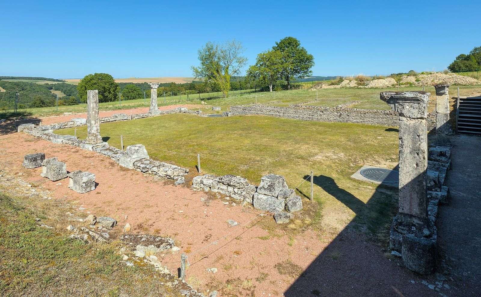
The forum was a public square surrounded by buildings and shops. Its western part formed a nearly square court, with covered colonnades along its southern, western, and northern sides. On the east stood a civic hall with a nearly square plan and three semicircular recesses. The central recess contained the curia, a council chamber. A small Roman temple stood near the western colonnade. At the forum’s northern edge, two streets passed through a setback in the buildings; beyond them stood a long, two-storey block with eight covered colonnades along the street.
Theatre
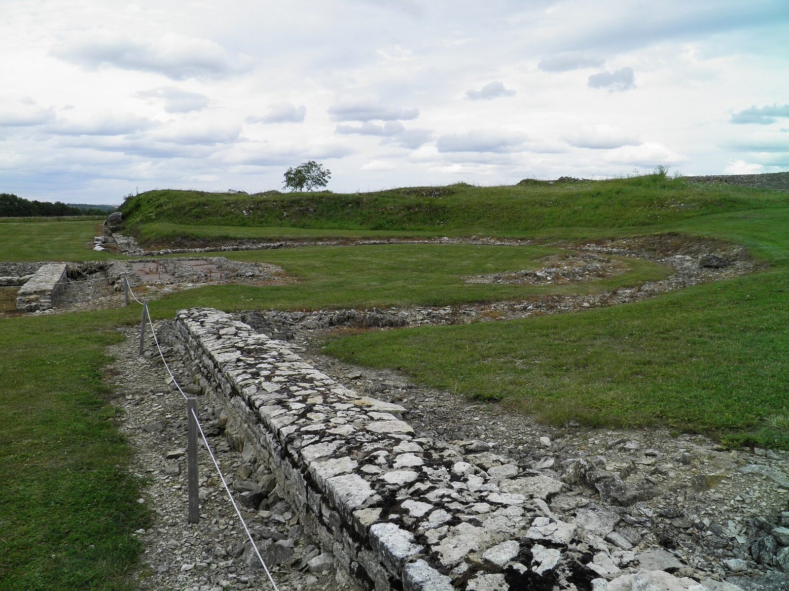
The theatre stood west of the plateau’s centre, with the forum to its east. Built in the late first century CE, it could hold about 5,000 spectators. It measured 81.6 metres from north to south and 24.5 metres from east to west, excluding an adjoining court, and its central axis ran east–west. The seating area extended beyond a semicircle and was enclosed by a curved wall with five entrances. The seats were probably wooden. A small stage platform, 9 by 5.5 metres, projected into the space in front of the seating. Surviving remains include foundations, the enclosure wall, still up to 2.5 metres high, external supports, and foundations for the stage and central performance area. The purpose of proposed galleries facing inward around the adjoining court remains uncertain.
Residential and workshop quarters
Roman streets, some partly paved, linked house blocks, shops, and workshops. Much of the town was built in stone, with timber roof and ceiling beams and either Roman-format roof tiles or flat stone shingles. Residential and workshop areas lay southeast of the forum and farther east. Row houses often had covered colonnades or an atrium, an interior hall or courtyard. Workshops processed copper, bronze, and iron, with smithies and smelting furnaces in lower levels.
In the eastern housing area, some stone cellars retain staircases and rounded-arch niches in their walls, perhaps intended for statues. One house preserves traces of underfloor heating.
Ucuetis monument
The monument associated with Ucuetis occupied the eastern part of the long building block north of the forum. Its section facing the street stood above a crypt, behind which was a large courtyard bordered by a covered colonnade. The complex also included an underground room cut into the rock. A second-century CE dedication names Martialis, son of Dannotalus, and metalworkers who worshipped Ucuetis at Alésia.
Sanctuaries and water installations
Sanctuary of Apollo Moritasgus
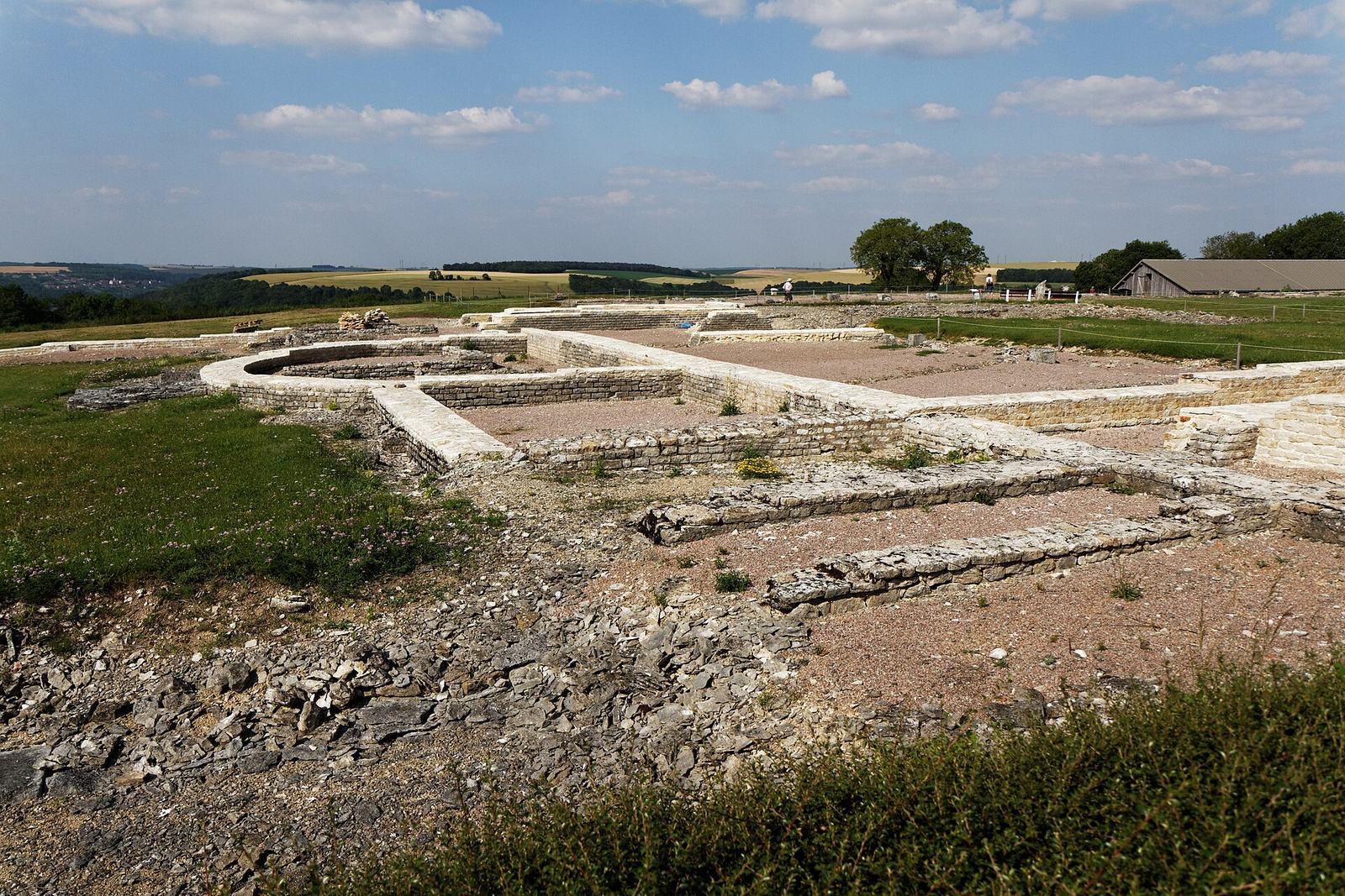
At La Croix-Saint-Charles, east of the plateau and outside its defenses, a large sanctuary stood beside a Roman road from Dijon, within a monumental enclosure. The complex included an octagonal temple dedicated to Apollo Moritasgus, a healing deity, as well as a nearly 40-metre-square temple with a surrounding passage, a smaller rectangular temple, colonnades, and bath buildings. Cold and warm baths, pools, fountains, and channels for water and wastewater formed part of the complex; some channels still carry water.
The sanctuary developed over several centuries. Its Augustan-period phase included the smaller rectangular temple and buildings with two baths south of the larger temple. The great temple and further additions, including a sanctuary to a goddess, date to the third quarter of the first century CE. The octagonal temple was built after 166 CE, and smaller additions followed in the final quarter of the third century. One bath outside the main complex was itself a goddess’s sanctuary. A pre-Roman gathering place at the site, dating to about 100–80 BCE, included a large enclosed ditch containing animal remains and thousands of fragments of Italian wine amphorae.
Small offerings shaped like body parts and surgical instruments were found in connection with the healing cult. The instruments suggest that priests may have performed medical procedures, though they do not prove that this took place.
Other cult buildings
A separate sanctuary of Cybele, a mother goddess worshipped in the Greco-Roman world, was sacked around 370 CE. Another second-century temple had four columns and stood within an enclosed precinct. Its dedication is uncertain; Taranis, a Gallic sky and thunder deity, and Jupiter, the chief Roman god, have both been proposed.
Christian buildings
Basilica associated with Sainte Reine
The Christian basilica associated with Sainte Reine was built at the centre of the reduced settlement in the fifth or sixth century. Its remains lie beneath an earth covering.
Church of Saint-Léger
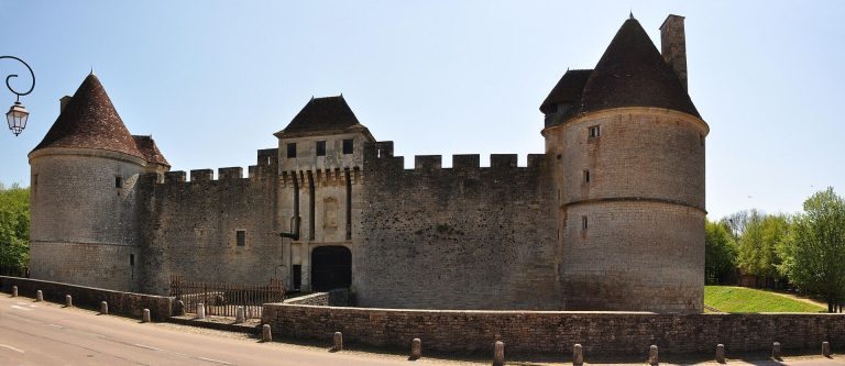
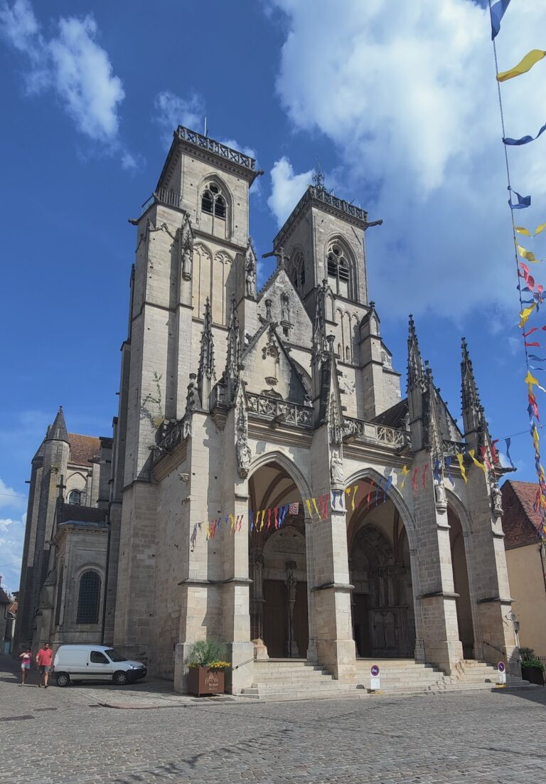
The church of Saint-Léger was originally a small three-aisled basilica built with reused stone from Roman buildings. Its side aisles have disappeared and its arcades were later blocked. A tower was added in the twelfth century.
Excavated finds
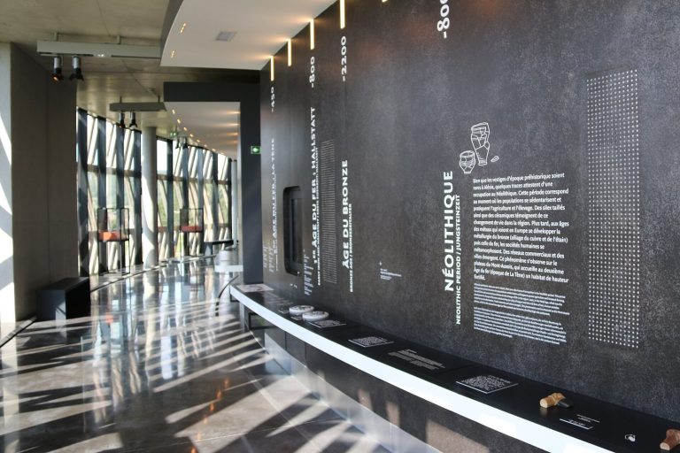
Finds associated with the siege include Roman, Gallic, and Germanic weapons, Roman and Gallic coins, and coins attributed to Vercingetorix. Excavations also recovered Roman caltrops, legionary baggage equipment, and a limestone projectile. Important objects from the excavations are displayed at MuséoParc Alésia and the National Museum of Archaeology.