Rubricaire: A Roman Waystation and Fortified Camp in France
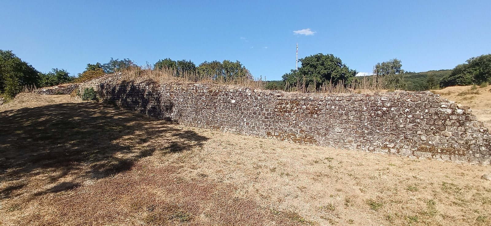
Site at a Glance
- Popularity
- Low
- Country
- France
- Primary era
- Classical
- Eras represented
- Classical
- Civilizations
- Roman
- Site type
- Military
- Remains
- Fort
On this page14 sections
History
Roman waystation
Rubricaire was a Roman waystation and fortified camp at the foot of Mont Rochard in Sainte-Gemmes-le-Robert, France. It stood about 11 km from Jublains and within sight of it. Jublains was the principal settlement of the Aulerci Diablintes, an ancient people of western Gaul. In the early Empire, Rubricaire belonged to the Roman province of Gallia Lugdunensis; in the late Empire, it was within Lyonnaise III.
A garrison at Rubricaire guarded the Roman road and the nearby settlement. The post may have been the most important in Diablintes territory after Jublains. Together, the surrounding landed estates made the area the territory’s largest agglomeration after its Gallo-Roman capital.
Alphonse-Victor Angot proposed that Rubricaire was Robrica, a place marked on the Tabula Peutingeriana, a medieval copy of an ancient Roman route map. He suggested that a copyist had shifted the name by one line. No station on the Angers-to-Le Mans route matched the map’s name and distances, while Rubricaire’s name and fortified remains supported his identification. The Roman station ceased to function toward the end of the third century, as Jublains declined and Roman rule in the region ended.
Rupiacus and the bishops of Le Mans
Within about a century of the station’s decline, the wider area was known as Rupiacus or Rochard. By the end of the sixth century at the latest, it formed a large estate extending from Rubricaire toward the limits of Évron, also called Aurion. The Merovingians and Carolingians, successive Frankish ruling dynasties, occupied the area. It and Jublains were assigned to the Diocese of Le Mans, and Rubricaire later served as a country residence for its bishop. Aurion had a parish by the sixth century at the latest.
The ninth-century Acts of the Bishops of Le Mans gives conflicting accounts of Rupiacus’s origins. One passage says that a man named Alain gave the estate to Hadouin, bishop of Le Mans, together with twelve other estates. Another credits local people with founding it for Saint Thuribe in the second century. A separate tradition tells that Saint Maurus came to Maine at the request of Saint Innocent, bishop of Le Mans, to establish a monastery. Maurus arrived only after Innocent’s death around 559 and instead founded a religious house in Anjou. His followers were said to have consoled themselves by reasoning that Rupiacus, from its name, must be a bleak and rocky place.
In 643, Hadouin founded an abbey in the area with help from the abbot of Diergé. He endowed it with estates at Jeune, Lémaré, Poilé, Baugé, Diergé, Assé, Houélé, Châtres, Commer, Aché, and Froidfont. The Acts of the Bishops of Le Mans also describes Rupiacus as episcopal property, with the bishop exercising authority over Évron and its territory. Évron was founded in the sixth century and its abbey in the seventh; farms belonging to bishops and other landholders spread through the area.
Charlemagne restored Rupiacus to the bishop and chapter of Le Mans in 771, 796, and 802, confirming their possession after a prelate had transferred it away. Bishop Aldric, who held office from 832 to 857, worked to develop the estate, and Louis the Pious confirmed its possession. Around 892, Roger of Maine sacked the episcopal estate. Gontier, bishop of Le Mans, fled to Rochard and worked to restore it, staying at the castle there for several months before returning to Le Mans at Easter. Farming continued at sites established by bishops and their successors through the twelfth century. During this period, the Roman road was diverted away from the low ground at Les Rabries toward Étivau, Villeneuve, and Richebourg.
The episcopal country house at Rubricaire was probably destroyed during the rule of Herbert I, count of Maine. Although settlement in the wider area was dense, no parish center had been established in the eighth or ninth centuries. A bishop probably founded a church dedicated to Saint Gemme in the tenth century. The sequence of the area’s development ran from the Roman station of Rubricaire to the episcopal estate of Rochard and then to the parish of Sainte-Gemme.
Recorded name and archaeological investigation
By about 1770, Antoine Margerie, parish priest of Sainte-Gemme-le-Robert, had written the name Rubricaire in a memorandum about the parish. He recognized the site’s Roman origin, its connection with Jublains, and its strategic position. The spoken variant Rubicaire also appeared in the Napoleonic cadastre, while Margerie used the spelling Rubricaire.
Road construction in 1834 demolished part of the site. A plan prepared in 1859 for proposed excavations still marked traces of walls. The Mayenne Historical and Archaeological Commission acquired the enclosure on 20 September 1887 and transferred it to the department. The baths were uncovered around 1890. In 1903, Angot excavated them with the commission’s support and the landowner’s permission, showing that a feature traditionally called a prison was in fact a bath establishment. The camp and bath complex received French historic-monument protection in 1917. In 1934, archaeologist A. Grenier described Rubricaire and Jublains as having military and fiscal functions, the latter relating to taxation and public revenue.
Remains
Rubricaire’s Roman remains are arranged around an enclosed camp, with the Jublains-to-Le Mans road passing nearby and the bath establishment outside the enclosure. The surviving fabric includes substantial wall masonry, an earth-and-stone perimeter bank, paved road sections, and structures arranged for bathing and heating.
Enclosure and road
Camp enclosure
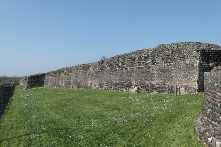
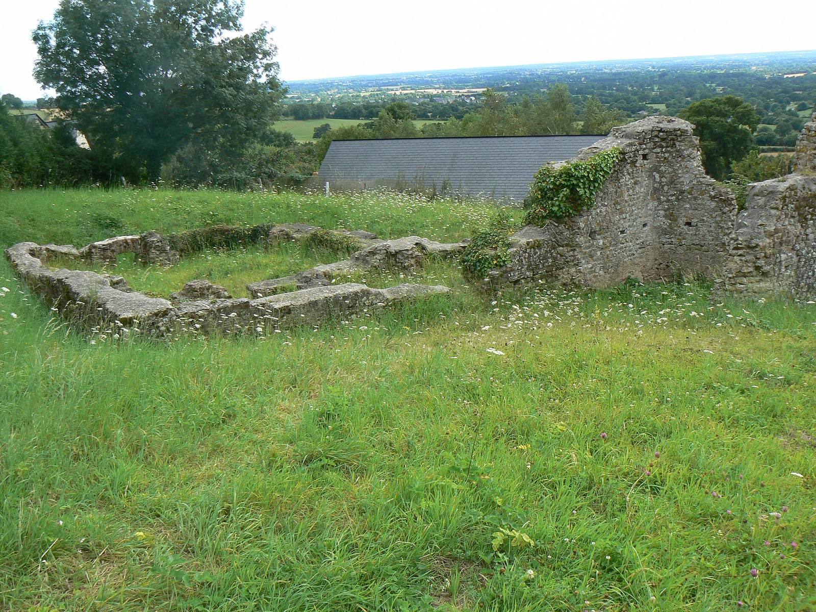
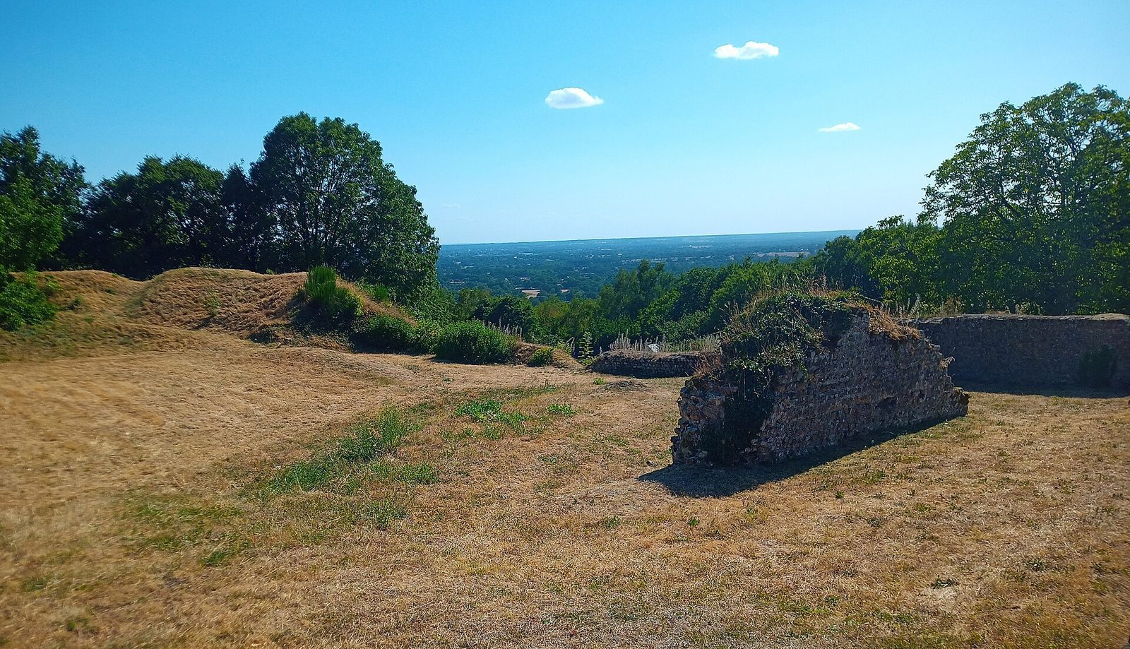
When Margerie described the camp in the eighteenth century, its enclosure and the arrangement of its housing could still be distinguished. By the beginning of the twentieth century, two parallel walls remained on the north side, where the principal dwellings had stood, together with a projecting buttress at the southeastern corner. An earth-and-stone bank marked the rest of the perimeter, enclosing an open central area of about twelve ares.
Roman road
The road from Jublains to Le Mans passed a short distance from the camp. Its course was traced through four surviving or formerly visible sections, scattered granite and sandstone, and broken stretches that could be aligned in a straight route. Two sections had already been destroyed by the time Angot knew the road; two others were lost while witnesses still living in the early twentieth century could recall them. At the Vivoin stream crossing, a raised roadbed remained incompletely levelled. The road was 8 to 9 feet wide, with large blocks set on beaten earth and covered by granite, polished sandstone, and crushed pebbles. Its proposed continuation toward Jublains was thought to follow the causeway at Maisonneuve pond.
Bath complex and water supply
Bath buildings
The baths stood beyond the camp enclosure. Their main rectangular building measured 12.50 by 6.50 m, with its long axis running southwest to northeast. A smaller annex, 4.50 by 2 m, joined it at the western corner and ended in a rounded projection facing southwest. The main building included a service room at ground level, an elevated vestibule above a hypocaust furnace, and a heated sweating room in a projection on its southwest side. A hypocaust was an underfloor heating system that circulated hot air beneath a room. A door on the northwest side led into the vestibule.
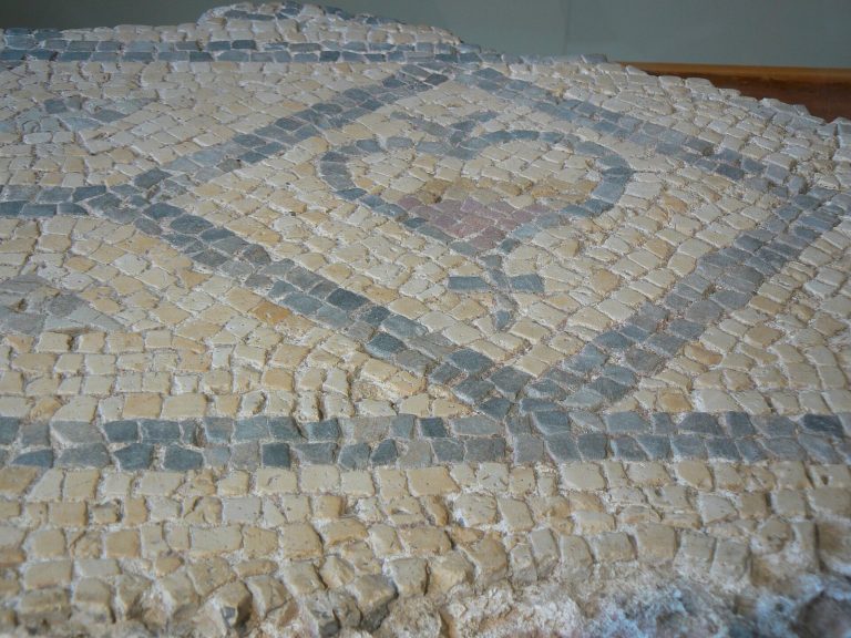
The complex provided cold baths, hot baths, and a heated sweating room. Burial helped preserve parts of its original arrangement, including sections of plaster and conduits for water and heat.
Water supply
Water came from springs at Châtelier, about 200 m away, where it welled up in ten places. It was captured at its source rather than left to run down the natural slope, allowing the supply to serve both the camp and the baths.
Settlement beyond the enclosure
Roman rural and industrial sites
Agricultural and industrial establishments grew near the road, where communication with Rubricaire and access to water were convenient. Their remains included bricks with raised edges and large quantities of imported granite. At Fourneau, foundations of a Roman landed estate lie beneath the walls of the communal school, and the site shows both Roman and Frankish occupation. At Bouverie, ruins still present in 1850 had once been mistaken for a castle or church. They included numerous small bricks of a different manufacture from the Roman examples, with lower ends cut by a knife. Similar bricks at Richefour were found with a fragment of a millstone. Vivoin, beside the Roman road, also shows occupation in both periods.
Frankish farms and residence
La Butte and La Menéteuse, in the Champ du Grès beside the road to Évron, were Frankish farm sites that together covered at least two hectares and yielded abundant granite and brick. Finds at Civardière included poorly fired bricks and a slate marked with concentric circles and a small cross. Foucherie was represented by large slabs and heavily fragmented bricks, while Pezereul was a small settlement. Material associated with the episcopal residence includes burnt wood, scattered bones, iron from javelins and pikes, and coins issued by Herbert I.