Medway Megaliths: Early Neolithic Tombs and Monuments in Kent
Site at a Glance
- Popularity
- Medium
- Country
- United Kingdom
- Primary era
- Stone Age
- Eras represented
- Stone Age, Modern
- Civilizations
- British
- Site type
- Burial
- Remains
- Necropolis
On this page21 sections
History
The Medway Megaliths are a group of Early Neolithic chambered long barrows and related monuments in the lower Medway valley of Kent, United Kingdom. Built during the fourth and third millennia BCE from local sarsen, a hard silicified sandstone, and soil, the group includes elongated burial mounds with stone chambers. The Early Neolithic was the opening phase of farming in Britain. The Medway monuments form the only known prehistoric megalithic group in eastern England and the most south-easterly group in Britain.
Neolithic origins
The monuments belong to a regional tradition of chambered long barrows. Their precise uses remain uncertain. Some chambers held burials of selected groups of people, and the monuments are also widely understood as places where religious rituals may have taken place. Many archaeologists interpret the group as evidence of Neolithisation, the shift from hunting and gathering to farming.
The monuments are divided into western and eastern clusters, roughly 8 to 10 kilometres apart. The western group includes Coldrum, Addington and Chestnuts Long Barrows. Kit’s Coty House, Little Kit’s Coty House and Smythe’s Megalith belong to the eastern group; the Coffin Stone and the White Horse Stones have also been considered possible tomb remains. Their exact chronology and the relationship between their uses are unresolved. Suggested architectural connections range from the Low Countries, Scandinavia and Germany to the Cotswold-Severn tradition. These proposals place the monuments within wider Early Neolithic tomb-building in Europe, but do not establish a precise place of origin.
Later activity in the valley
People continued to use the valley long after the long barrows were built. Later prehistoric activity included rich Bronze Age burials, deposits of gold from the Late Bronze Age and an Iron Age cemetery with elaborate bucket burials. A possible temple from the period of Roman influence in Britain stood on Blue Bell Hill. Near the White Horse Stone, evidence also points to settlement in the Late Bronze Age and Early Iron Age. The medieval Pilgrim’s Way was laid close to the monuments.
Damage, stories and antiquarian interest
In the late thirteenth century, the monuments were deliberately damaged in different ways. Some chambers were toppled, while others remained standing. The reason is uncertain. Archaeologist Paul Ashbee suggested that the destruction might have formed part of a renewed Christian effort to suppress non-Christian beliefs, possibly connected with the Northern Crusade supported by Edward I and Edward III. He also proposed that nearby churches at Tottington, Cosington and Addington might have been involved in the same campaign.
Antiquaries began writing about the group in the late sixteenth century, when some monuments were mistakenly described as stone circles or structures made by Druids. In his 1596 account of Kent, William Lambarde claimed Kit’s Coty House commemorated Catigern, a figure from early British tradition, and believed Horsa was buried nearby. William Camden’s writing helped publicize the monument, and Samuel Pepys visited it in 1669. John Aubrey also described the stones. William Stukeley visited in 1722 and drew plans; that year, Hercules Ayleway recorded a local belief that the stones commemorated two Kentish kings killed in a nearby battle.
Local stories added other explanations. In 1946, folklorist John H. Evans recorded a tale that three witches built Kit’s Coty House and a fourth helped raise its capstone. Stukeley had been told that many stones at Little Kit’s Coty House were pulled down in the late seventeenth century. By the early nineteenth century, the remains were associated with Druids; later, they became linked with the Countless Stones story. In that tale, an Aylesford baker tried to count the stones with loaves of bread. One loaf vanished and the Devil appeared in its place; the baker died as he was about to announce his count. Leslie Grinsell later connected the name with the monument’s pillaging around 1690. In 1976, he noted that people still chalked numbers on the stones as part of the story.
A tale recorded in the early nineteenth century linked the White Horse Stone with the Battle of Aylesford in 455. It claimed that Hengist and Horsa, legendary Anglo-Saxon leaders, carried a white-horse banner before it was found beside or beneath the stone. Ashbee considered the story unlikely to predate the seventeenth century, when the White Horse of Kent motif developed. He suggested that the tale might first have referred to the Lower White Horse Stone and later transferred to the Upper stone after the lower one was destroyed.
Investigation and protection
Some monuments were damaged or destroyed during the nineteenth century, possibly so their stones could be reused for building. Archaeological study also expanded. E. H. W. Dunkin published plans in 1871, and historian George Klint identified the monuments as Neolithic in 1908. In 1924, archaeologist O. G. S. Crawford discussed their locations and possible origins. Robin Holgate reassessed the group in 1982 and called for sample excavations to clarify the monuments’ dates and construction.
Individual investigations began earlier. At Coldrum, John Mitchell Kemble and the Reverend Lambert Larkin excavated in 1856; they found pottery sherds, some of which they thought might be Anglo-Saxon. F. J. Bennett excavated there in 1910, followed by E. W. Filkins in 1922. At Addington, the Reverend Lambert Larkin investigated around 1845 and was said to have found pottery; a claim that he found human bones remains unproven. Thomas Wright explored the site around 1850. Rescue excavations led by Paul Garwood in 2007 and 2010 followed damage caused by rabbit burrowing and road problems. At Chestnuts Long Barrow, John Alexander excavated in 1957 after a nearby house was built and at the request of the Ancient Monuments Inspectorate. Much of the excavated material at Maidstone Museum was destroyed in a fire in the 1980s, preventing radiocarbon dating of the human remains.
Other discoveries prompted revisions to earlier interpretations. Landowner George Fowle uncovered Smythe’s Megalith in 1823 or 1824 while trying to clear stones that obstructed ploughing. In the 1830s, human bones were said to have been found near the Coffin Stone. Edwin Dunkin wrote in 1871 that removing a hedge in 1836 had revealed the stone, two skulls, other bones and charcoal. Excavations led by Garwood in 2008 and 2009 established that the Coffin Stone had been placed in its present position during the post-medieval period, around 1450 to 1600. Garwood nevertheless considered that it might have been set up as a single standing stone in later prehistory.
Protection measures followed nineteenth-century concerns about damage. Kit’s Coty House received protection as an ancient monument in 1885. During an 1886 visit, Augustus Pitt Rivers noted ploughing damage and graffiti, and an iron railing was put around the chamber. Little Kit’s Coty House received legal protection as a scheduled ancient monument in 1887. Coldrum was given to the National Trust, a UK conservation charity, in 1926 as a memorial to local historian Benjamin Harrison.
Modern study and religious use
Archaeological work continued into the twenty-first century. Excavations around the White Horse Stone took place in 1998 and 1999. From 2006 to 2012, Garwood led a project mapping the prehistoric landscape of the Medway valley. In 2007 and 2008, Sian Killick surveyed the tombs and surrounding area, including whether monuments could be seen from one another. Excavations and geophysical surveys at Kit’s Coty House from 2009 to 2012 further examined the relationship between its chamber and mound.
Modern Pagan groups have used the monuments as sacred places since the latter twentieth century. Ceremonies recorded in 2014 included those of Roharn’s Grove, a Druid group, and Heathen groups such as the Odinic Rite and Woden’s Folk. Druidry is a modern Pagan movement drawing on ideas associated with ancient Druids; Heathen groups draw on pre-Christian Germanic and Norse traditions. Pagan interpretations have connected the monuments with ancestry and earth energy. Some Heathen groups have described ancestral bonds in genetic or racial terms, while Druids have emphasized a spiritual relationship with the land. Some Pagans also associate the sites with ley lines, an idea promoted in modern Earth Mysteries writing about spiritual meanings attributed to landscape features.
Remains
The monuments lie along the River Medway where it cuts through the North Downs, a range of chalk hills in southeastern England. The western and eastern clusters occupy opposite sides of the river. Their long barrows generally run east to west, with a stone chamber at the eastern end of an earthen mound and probably a stone frontage beside the entrance. Their chambers reached about 3 metres in height. Builders used large blocks of local sarsen, selecting them from the surrounding area and transporting them to the sites.
The monuments share this broad design but vary in plan and construction. Coldrum has a rectangular layout, Chestnuts had a stone frontage, and Addington and Kit’s Coty had long, narrow mounds. These differences may reflect changes made during use, leaving some monuments as composite structures. Five monuments have been interpreted as facing either the Downs or the river. If the landscape was cleared of woodland, Kit’s Coty, Little Kit’s Coty and Coldrum may have had broad views, while Addington and Chestnuts would have overlooked a smaller part of the surrounding area. Possible lines of sight between monuments have also been proposed for Kit’s Coty, Little Kit’s Coty and the Coffin Stone; Addington and Chestnuts; and the White Horse Stones and Smythe’s Megalith.
Western cluster
Coldrum Long Barrow
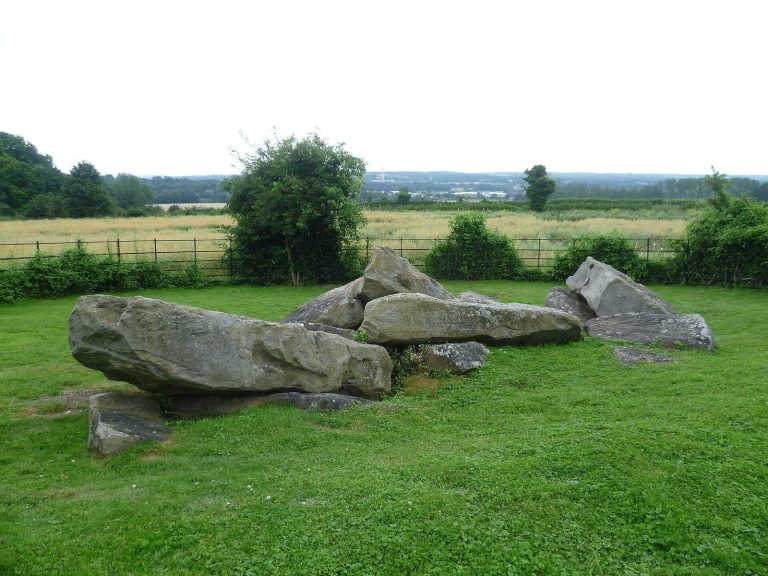
Coldrum Long Barrow, also known as the Coldrum Stones, stands on a small ridge northeast of Trottiscliffe, facing east toward the Medway. It lies about 500 metres from the Pilgrim’s Way. The mound is about 20 metres long, widening from roughly 15 metres at the western end to 19 metres at the eastern end. Its outline forms a truncated wedge. It is the best-preserved monument in the group, although its eastern side is badly damaged, with sarsens broken away and fallen down the ridge. The name comes from the nearby Coldrum Lodge farmhouse, which has since been demolished.
Excavation in 1910 uncovered the bones of 22 people of different sexes and ages in the northwestern part of the monument, along with a pottery sherd and a flint saw. Further bones were excavated in 1922, but most were lost during the Second World War. Beale Post stated that skulls had been found in the terrace near the chamber in 1804 and 1825.
Addington Long Barrow
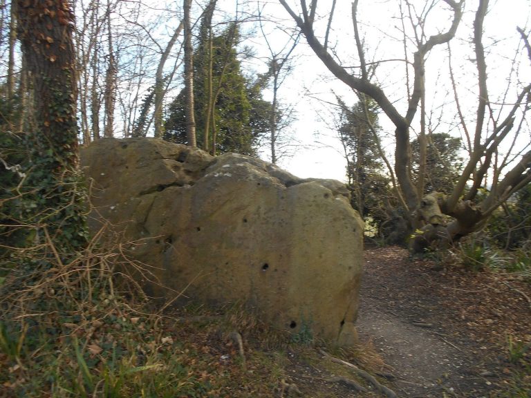
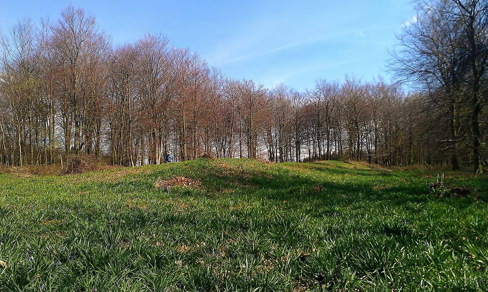
Addington Long Barrow lies about 250 metres north of Addington parish church. A setting of stones around the mound defines a monument approximately 60 metres long, tapering from 14 metres wide at the eastern end to 11 metres at the western end. Its chamber was apparently at the east end and has collapsed. A road now bisects the barrow, whose mound stands about 1 metre high after substantial weathering. Two stones from its edging were removed during road works in 1827 and placed in woodland to the south. Road repairs in 2007 uncovered another sarsen buried on the northern side.
Chestnuts Long Barrow
Chestnuts Long Barrow lies about 100 metres northwest of Addington. Sarsens mark its eastern end, and some stones have been returned to their original positions. The former mound is estimated to have been about 20 metres long and 15 metres wide. Its chamber is estimated at 12 feet long, 7 feet wide and 9 feet high, and was described as unusually large. Human bone, cremated bone, flint artefacts and pottery sherds were placed inside it.
Eastern cluster
Kit’s Coty House
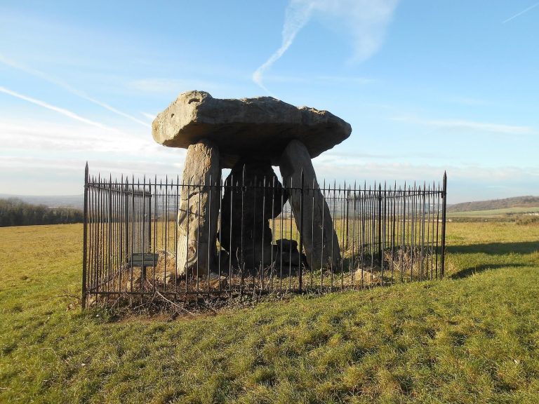
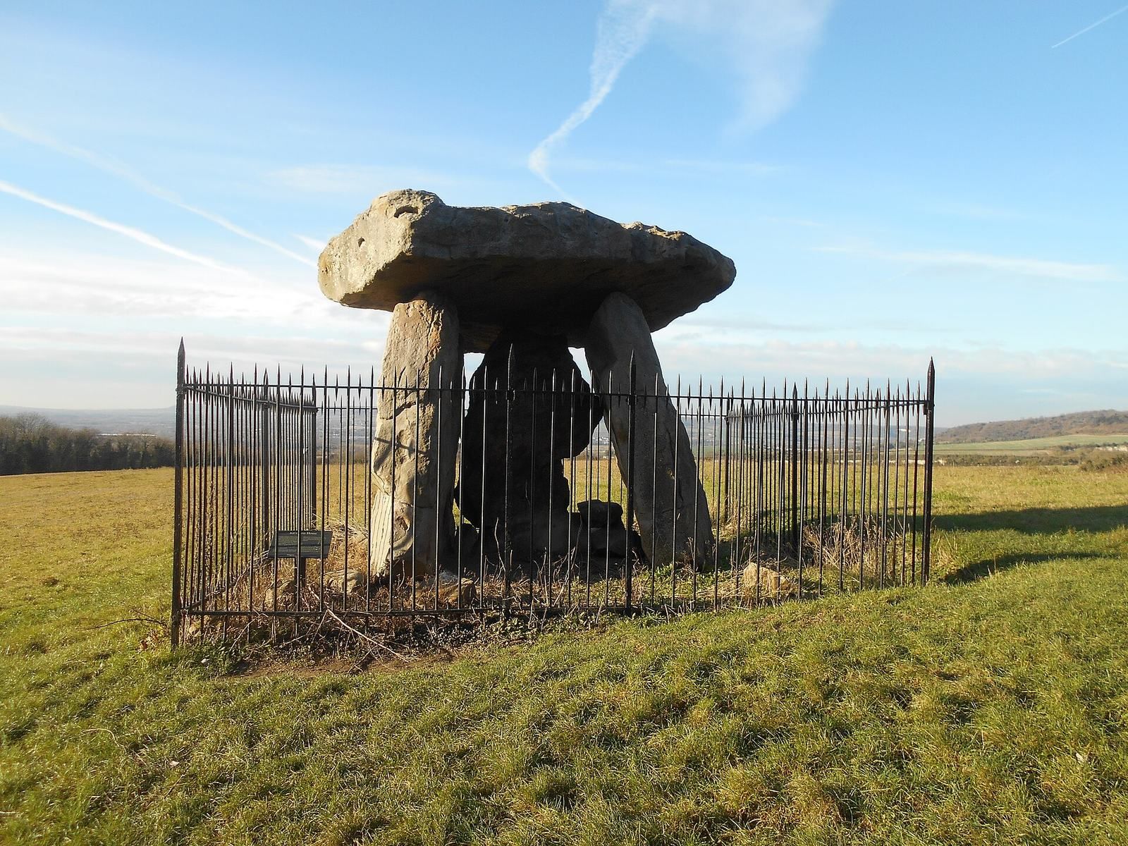
Kit’s Coty House is the surviving chamber of a long barrow whose mound has eroded away. Three large upright stones support a fourth, flat capstone. A measured survey in 1982 identified traces of a mound and a surrounding stone setting about 70 metres long, with an estimated height of about 1 metre. Excavations and geophysical surveys in 2009 to 2012 found that the chamber was offset to the south rather than joined directly to the mound; it may have belonged to an earlier structure. The mound itself had at least two main construction phases.
Little Kit’s Coty House
Little Kit’s Coty House, also called Lower Kit’s Coty House and the Countless Stones, lies about 3 kilometres northeast of Aylesford. Its present arrangement comprises about 21 stones of different sizes, enclosed by iron railings.
The Coffin Stone
The Coffin Stone lies about 400 metres northwest of Little Kit’s Coty House and about 250 metres from the Pilgrim’s Way. This rectangular sarsen measures about 4.40 by 2.80 metres and is at least 50 centimetres thick. Two smaller stones lie nearby, and a farmer placed another sarsen on top of it in 1980. An outline of a mound has been observed in the area, but excavation showed that the main stone reached its current position in the post-medieval period. Garwood proposed that it might instead have been erected as a single stone in later prehistory, a possibility also linked to a large hollow in the adjacent chalk. Human bones and charcoal have been associated with the vicinity, along with Roman pottery sherds.
Smythe’s Megalith
Smythe’s Megalith was a chambered tomb in a field east of the A229. Its rectangular stone chamber contained bones from at least two adults and a pottery sherd. The chamber ran east to west, like the other Medway megaliths, and stood at the eastern end of a long barrow. No visible remains of the monument survive.
The White Horse Stones
The Upper White Horse Stone stands in a narrow strip of woodland east of the A229. It measures 2.90 metres long, 1.65 metres high and 60 centimetres wide. Nine smaller stones extend westward from it for about 10 metres. They may be remains of a tomb, although farmers might instead have moved them from a nearby field. The Lower White Horse Stone, another large upright stone about 300 metres west of the Upper stone, was destroyed in the 1820s. Its site is probably beneath the dual carriageway.
Buried stones near the eastern cluster
Two large buried stones were found near the eastern cluster in 1980. Excavation revealed four additional medium-sized stones in pits cut into the underlying chalk. The group may represent a chambered long barrow.
Other Neolithic features in the valley
Settlement near the White Horse Stone
Excavations near the White Horse Stone revealed an Early Neolithic longhouse, a timber building whose purpose remains uncertain. Three postholes, traces of former timber supports, contained sherds of Plain Bowl pottery, a named Early Neolithic pottery style. Radiocarbon dating placed them between 4110 and 3530 calibrated BCE. Nearby sherds of Clacton-style Grooved Ware and Mortlake-style Peterborough Ware, two other pottery styles, indicate activity from approximately 3750 to 2250 BCE. A smaller circular building to the southeast may be later. Excavators considered domestic or communal use of the longhouse probable, while Ashbee proposed that it may have served as a ritual building. The stone long barrows have also been interpreted as deliberate imitations of timber longhouses.
Evidence from the wider area includes possible roundhouses, four-post structures and pits that may have served for storage. A four-post structure is identified by the plan of its four supports, while its use can remain uncertain. Together, the remains indicate settlement activity around the monuments as well as their funerary and possible ritual use.
Burham causewayed enclosure
At Burham, an oval area of about 5 hectares is enclosed by two closely spaced ditches interrupted by causeways. This type of monument is known as a causewayed enclosure. Excavations in 2009 and 2010 dated its use to approximately 3700 to 3400 BCE. It is the largest known enclosure of its type in Kent and among the largest in Britain.