Lothal: A Harappan Trading and Manufacturing Center
Site at a Glance
- Popularity
- Very High
- Country
- India
- Primary era
- Bronze Age
- Eras represented
- Bronze Age
- Civilizations
- Indus Valley
- Site type
- City
On this page21 sections
History
Lothal is an Indus Valley, or Harappan, settlement in Gujarat, India, whose urban development began in the third millennium BCE. The Bronze Age Indus Valley Civilization extended across parts of present-day Pakistan and northwestern India. Lothal became a major center for trade and manufacturing, connecting communities across the region and beyond.
Early settlement and Harappan expansion
A small riverside settlement preceded the arrival of Harappan communities. Its local economy included copper objects, beads, and semi-precious stones, while potters made red vessels with a smooth surface flecked with mica. Harappan settlers were drawn to the sheltered harbor, the potential for growing cotton and rice, and the area’s bead-making activity. The communities lived alongside one another, and local pottery traditions influenced Harappan production.
A flood around 2350 BCE destroyed the village’s foundations and settlement. Harappan communities subsequently enlarged the town and planned its construction with recurring floods in mind. Lothal’s growth brought together established local practices and the expanding urban life of the Indus civilization.
Trade, flooding, and decline
Lothal’s products included beads, gemstones, and ornaments that reached West Asia and Africa. Its wider trading connections included Egypt, Bahrain, and Sumer, an ancient civilization in southern Mesopotamia. The town received copper, chert, a hard stone used for tools, and semi-precious stones, some of the latter associated with Harappa and Mohenjo-daro. Raw materials were also sent to inland settlements, while exports included beads, gemstones, ivory, and shell goods. A coastal route connecting Lothal with other Indus settlements may have extended to the Makran coast.
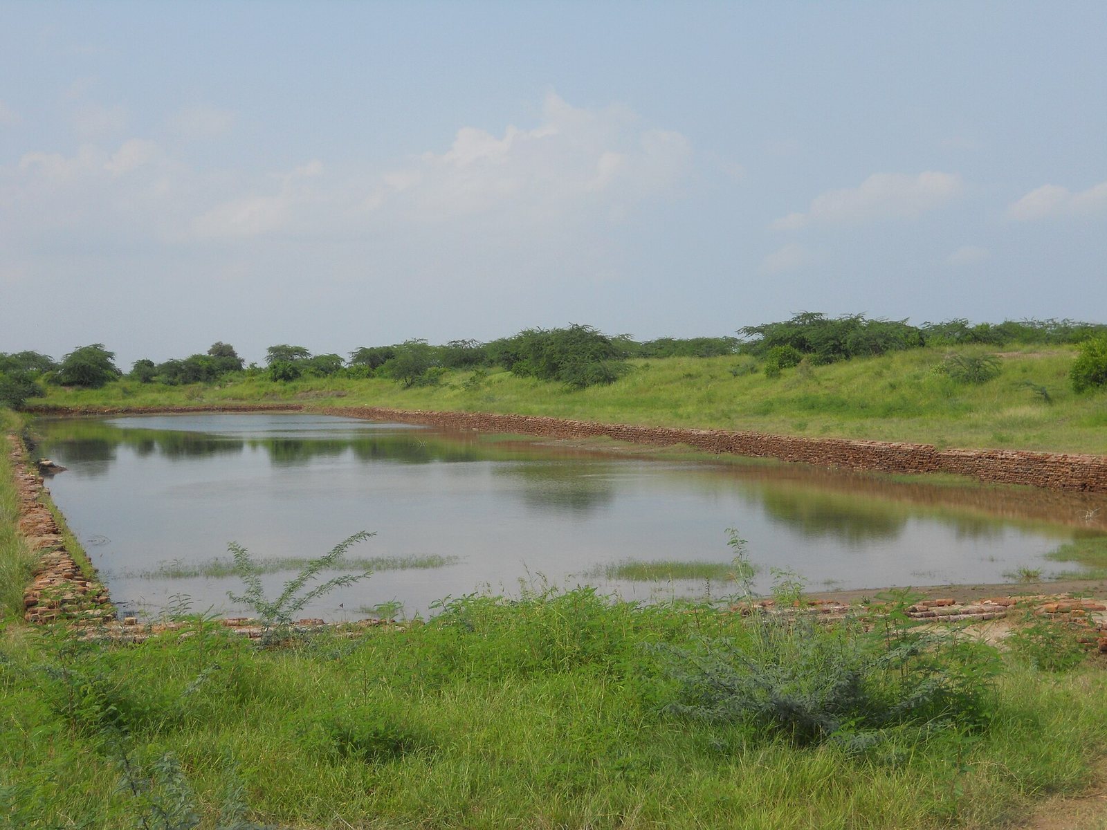
The Archaeological Survey of India (ASI), the government agency responsible for archaeological investigation and monument preservation, identifies Lothal’s basin as an early dock. In this interpretation, it connected the town with an ancient course of the Sabarmati River and a trade route between Sindh and the Kathiawar Peninsula. The identification is debated. Some archaeologists consider the basin mainly an irrigation tank, with goods moved by river craft to larger vessels anchored elsewhere. Marine microfossils, salt, and gypsum found in the basin may indicate that seawater entered it, though flooding has also been proposed as an explanation.
Floods and storms continued to damage the town. A flood around 2050 BCE exposed weaknesses in its defenses, and repairs were inadequate. Around 2000 BCE, a change in the river’s course severed the basin’s connection to the river. Residents dug a shallow channel for small boats, while larger vessels had to remain farther away. Between about 2000 and 1900 BCE, the acropolis, the elevated central part of a settlement, was levelled and occupied by traders and people living in makeshift houses.
Later rebuilding took place as administrative and economic conditions worsened. Flood debris remained beneath rebuilt houses, public drains gave way to soakage jars, and public works received inadequate maintenance. The damaged warehouse was not properly restored. Trade contracted, and independent businesses were increasingly replaced by groups of craftspeople working for common suppliers and financiers.
A major flood around 1900 BCE buried the basin in silt and debris and razed buildings. Recurrent floods and storms, rising soil salinity, and a period of aridity or weaker monsoon rainfall are among the factors associated with Lothal’s decline and abandonment. The disaster also affected parts of Saurashtra, Sindh, and southern Gujarat, and people fled inland.
Later occupation and religious practice
After the city’s destruction, a much smaller population remained. Some people returned and lived in poorly built houses and reed huts, maintaining religious traditions and certain Harappan practices. Cemetery remains are Harappan, and trade revived between about 1700 and 1600 BCE.
Finds at Lothal point to worship of a fire deity, including private and public fire altars and seals bearing a horned figure. Burnt material, pottery, beads, and animal remains may relate to sacrifices associated with the ancient Vedic religious traditions. A sea goddess may also have been worshipped, though this practice appears to have ended by around 2000 BCE. A possible connection has been suggested between this earlier maritime tradition and local villagers’ modern worship of the sea goddess Vanuvati Sikotarimata.
Seventeen burials have been identified, compared with an estimated population of about 15,000. This small number has prompted the suggestion that people also cremated their dead; burials following cremation are known at other Indus sites.
Excavation and later study
The ASI discovered Lothal in 1954 and began excavations on 13 February 1955. Work continued until 19 May 1960, then resumed in 1961, when archaeologists explored areas on the northern, eastern, and western sides of the mound and uncovered channels linking the basin with the river. The excavation followed the 1947 partition of British India, after which major Indus sites including Harappa and Mohenjo-daro lay in Pakistan.
Remote-sensing and topographical studies published in 2004 identified a meandering ancient river, about 30 kilometres long, beside Lothal. Its upper reaches may have provided fresh water to the settlement. The ASI has covered some perimeter walls, the wharf, and early houses with earth for protection. Salt, rain, and sunlight continue to damage the site, while restoration work has been accompanied by cracking and weakened foundations.
Remains
The archaeological site covers about seven hectares on a mound that was once a tidal, saline marsh. The excavated town extends roughly 285 metres from north to south and 228 metres from east to west; remains have also been found about 300 metres south of the mound. Lothal was divided into an upper town and a lower town, with houses arranged on platforms and streets organized around distinct residential and commercial areas.
Town plan and domestic areas
Upper and lower towns
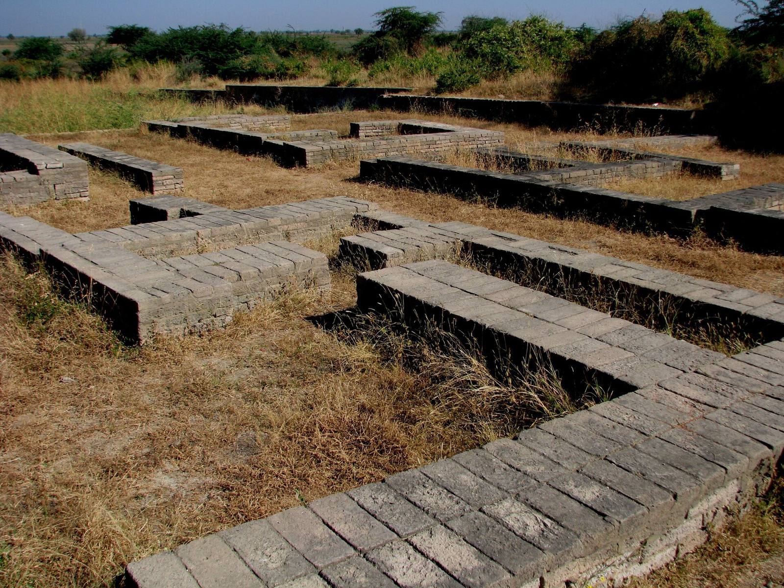
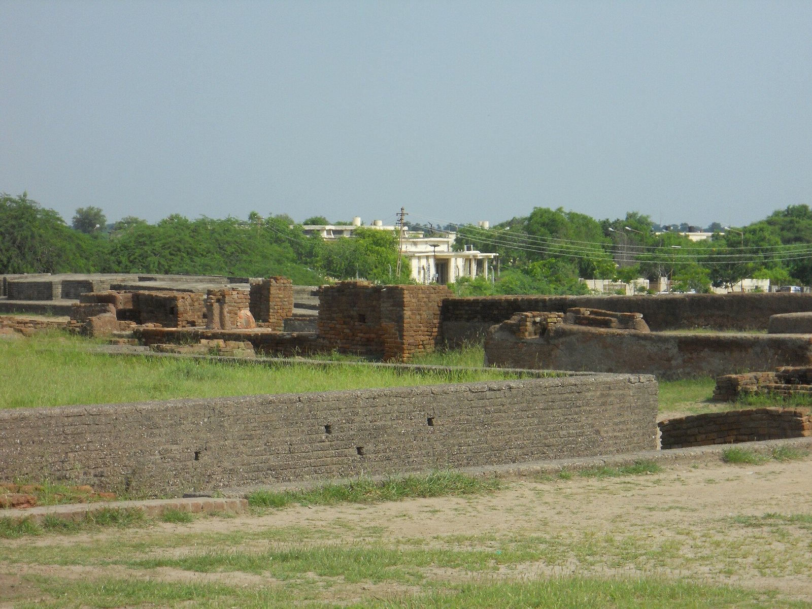
The upper town, or acropolis, occupied a rectangular platform measuring about 127.4 by 60.9 metres. Its mud-brick sides were roughly 12.2 to 24.4 metres thick and stood about 2.1 to 3.6 metres high. Three east–west streets and two lanes crossed it, while two streets ran north–south. Houses elsewhere in the town stood on platforms about one to two metres high, with each block accommodating roughly 20 to 30 houses.
The lower town’s principal commercial street ran north to south and measured about six to eight metres across. Shops, homes, and workshops stood in straight rows along it, with residential areas on both sides of the marketplace. Mud brick formed walls and platforms; fired bricks were used in drains and other features.
Homes, bathing, and water supply
The ruler’s residence in the acropolis covered about 43.92 square metres. It included a bathing platform of 1.8 square metres and an adjoining squat latrine connected to an outside drain that discharged into the basin. Bathing platforms were paved with polished, lime-plastered bricks to limit water seepage. Other acropolis houses had open courtyards, surface and underground drains, and access to a drinking-water well.
Basin and associated structures
Basin and channels
The trapezoidal basin lay east of the town and apart from the main river channel, perhaps to reduce the accumulation of silt. Built of fired brick, it measured about 215 metres north to south and 35 metres east to west. Its surviving northern inlet is about seven metres wide and 0.9 metres deep. A square sluice or spillway, roughly one metre on each side, was built into the southern side and may have held a wooden gate.
The basin’s southern arm had an outlet channel, and a proposed water depth of about 2.1 to 2.4 metres at high tide would have allowed boats to enter. Five stone weights found around the basin may have served as anchors or as counterweights for a water-lifting device. After the river changed course around 2000 BCE, a channel about seven metres wide and two kilometres long was cut to connect the basin with the river’s new course. Five terracotta boat models were also found in the dock area.
Wharf and warehouse
A mud-brick wharf, about 220 metres long, ran along the basin’s western edge. It rested on a packed-mud platform originally about 4.26 metres high, now about 3.35 metres high. A ramp linked the wharf with the warehouse and acropolis. The dock walls survived beneath layers of deposited loam.
The nearby warehouse stood on a mud-brick podium about 3.5 metres high. Its base was laid out in 64 square blocks, each about 3.6 metres on a side, with passages roughly 1.2 metres wide between them. The passages also served as vents, and a ramp led directly toward the basin for loading. Flood damage left 12 blocks for use as temporary storage. Cubical blocks remain visible on the raised platform.
Public building
Across from the warehouse stood a public building measuring about 17.1 by 12.8 metres. Its surviving layout indicates four large rooms and a hall. The hall had a large doorway and a raised floor in its southern corner.
Workshops, drainage, and construction
Craft workshops
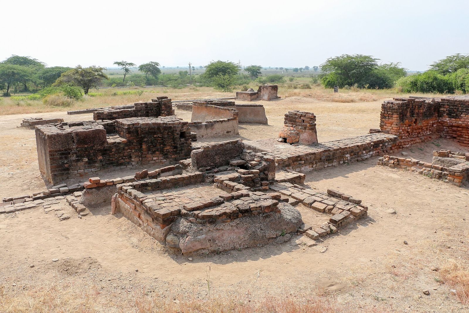
The bead-making factory had a central courtyard, 11 rooms, a store, and a guardhouse. Its circular kiln had two chambers, fuel openings, and four connected flues, beside a dump for cinders. Heat intense enough to vitrify the mud plaster affected its floors and walls. Excavated remains included reed, cow dung, sawdust, and agate. A coppersmith’s workshop contained five furnaces and paved sinks.
Drains and brickwork
Lothal’s drainage system included surface and underground drains, sewers, manholes, cesspools, silt chambers, and inspection chambers for solid waste. Wooden screens fitted into grooves in the side drains trapped debris. The main sewer averaged 20 to 46 centimetres in depth; its stated external measurements were 86 by 68 by 33 centimetres. A radial-brick well measured about 2.4 metres across and 6.7 metres deep. Brickmakers used both short-end and long-side orientations, sometimes alternating them between courses. Most brick dimensions are estimated to have followed a 1:0.5:0.25 ratio, in multiples of 25 millimetres.
Crafts and excavated objects
Metal, shell, and ivory work
Lothal’s metalworkers used copper described as unusually pure and lacking the arsenic common in copper from elsewhere in the Indus Valley. Ingots thought to have come from the Arabian Peninsula were alloyed with tin. Craftspeople made axe-like celts, arrowheads, fishhooks, chisels, bangles, rings, drills, and spearheads, while weapon production remained a relatively minor activity. Lost-wax casting, in which a wax model is replaced by molten metal inside a mold, and multi-part molds were used for bird and animal figures. Curved saws and twisted drills are among the tools associated with the settlement.
Shellworking used high-quality chank shells, marine conches from the Gulf of Kutch and the Kathiawar coast. Products included beads, cosmetic containers, ladles, inlays, and parts for stringed instruments. An ivory workshop was under official supervision. Finds include an ivory seal and sawn pieces intended for boxes, combs, rods, inlays, and ear ornaments.
Beads and ornaments
Bead-makers shaped stones in varied colors and forms. Finds include double-eye agate beads, jasper beads with collars or gold caps, carnelian beads, and very small cylindrical steatite beads. Necklace microbeads of gold were arranged in five strands, with each bead less than 0.25 millimetres in diameter. Cylindrical and spherical gold beads, along with jasper beads, had right-angled edges and have been compared with ornaments worn in women’s hair braids in Gujarat. A large perforated disc from a sacrificial altar has been compared with an ornament worn by Vedic priests. Other objects include faience and steatite ornaments shaped like studs, cogwheels, and hearts, as well as a ring made from thin copper wire twisted into a double spiral.
Seals, measures, pottery, and figures
Excavations yielded 213 seals, nearly all bearing short inscriptions. Engravings show short-horned bulls, mountain goats, tigers, and composite creatures such as an elephant-bull. Stamp seals with copper rings were used to close cargo, while impressions recorded quantities and the marks of rulers or owners. A circular seal from Bahrain depicts a dragon between leaping gazelles.
An ivory measuring scale is 128 millimetres long, 15 millimetres wide, and six millimetres thick. It has 27 visible marks across 46 millimetres, spaced about 1.70 millimetres apart. Ten marks are approximately equal to an angula, a traditional unit of length described in the Arthashastra, an ancient Indian treatise on statecraft and administration. A thick, ring-shaped shell object with slits along its edges has been interpreted as a tool for measuring angles on flat surfaces; it may also have been used to observe stars or for navigation. Craftspeople blunted stone weights before polishing them to improve their durability and accuracy.
Pottery included convex bowls, sometimes fitted with a stud handle, and small jars with flaring rims, forms associated with Lothal’s red ware flecked with mica. Painted vessels show animals in natural settings, including birds carrying fish while perched in a tree above a fox-like animal. Another scene depicts a crow dropping stones into a narrow-necked jar to reach water. The painted animals appear in varied poses, with some birds shown raising a leg or partly opening their wings.
Terracotta finds include game pieces shaped like animals and castles, pyramidal pieces with ivory handles, and human and animal figures. A male bust has slit eyes, a sharply defined nose, and a square-cut beard. The figures distinguish among dogs, bulls, and horses; some wheeled animal forms have movable heads.
Surviving fabric and condition
Visible remains include low walls, platforms, two wells, drains, and paved bathing areas. Near the warehouse, the flood-damaged mud-brick perimeter wall remains visible, along with sections of the burnt-brick north–south sewer in the cesspool area. Silt accumulation has reduced the basin’s depth by about three to four metres. Salt deposits, rain, sunlight, and moss damage the brick and mud-brick structures, while prolonged exposure has caused cracks and weakened foundations.