Khirbet Qeiyafa: An Iron Age Fortified Settlement in Israel
Site at a Glance
- Popularity
- Very High
- Country
- Israel
- Primary era
- Iron Age
- Eras represented
- Iron Age, Classical, Medieval
- Civilizations
- Byzantine, Ptolemaic
- Site type
- Military
- Remains
- Fortified Town
On this page19 sections
History
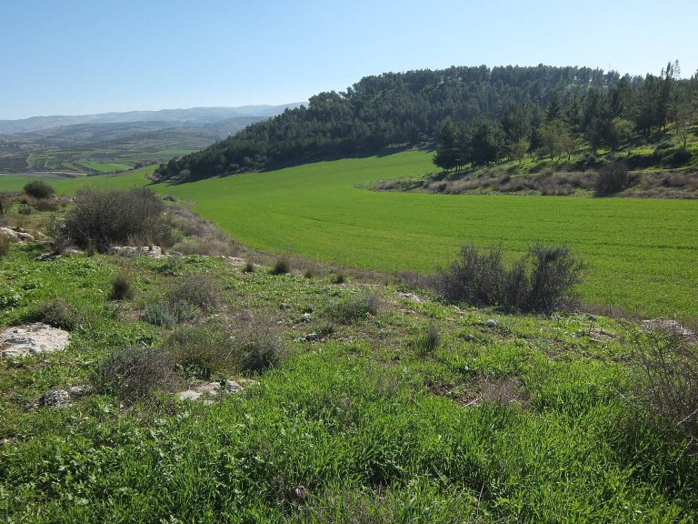
Khirbet Qeiyafa is a fortified Iron Age settlement on a hill in Israel’s Elah Valley, built around the turn of the tenth century BCE during Iron Age IIA, a southern Levantine subdivision of the archaeological Iron Age whose dates vary by chronology. The valley lay on a route between the coastal plain and Judean highlands, at a boundary between Philistia and Judea. The identity of the community that built the settlement remains debated.
Iron Age foundation and abandonment
Radiocarbon dating places charred olive pits from the site at 1020 to 980 BCE. Yosef Garfinkel’s proposed chronology for the fortified settlement is about 1000 to 975 BCE, while Israel Finkelstein and Eli Piasetzky argued for a broader range, from 1050 to 915 BCE. Pottery-based dating has also placed the settlement in either late Iron Age I or Iron Age IIA.
The settlement appears to have endured for roughly 20 to 30 years before it was destroyed and abandoned. Its short occupation makes the remains an important focus of debate about the political organization and cultural affiliations of the southern Levant in the tenth century BCE.
Later occupation
Khirbet Qeiyafa was settled again in the late Persian imperial period or early Hellenistic era, which followed Alexander’s conquests and brought Greek influence to the region. This later settlement was deserted around 260 BCE. Material from the site also spans Roman and Byzantine rule, the early Islamic era, and the Mamluk and Ottoman periods, later periods of Muslim rule.
Surveys and excavation
Victor Guérin noted a village on the hill during his survey in the 1860s. British surveyors recorded stone heaps in 1875, and Conder and Kitchener mentioned the site in 1883. In 1932, Dimitri Baramki described a watchtower of about 35 square metres and associated it with Khirbet Quleidiya, roughly 200 metres to the east. Surveys by Yehuda Dagan in the 1990s led him to propose identifying the site as Adithaim, with occupation from the ninth to sixth centuries BCE; excavations later established an earlier principal settlement.
Saar Ganor identified substantial Iron Age remains in 2005. Excavations directed by Garfinkel of the Hebrew University of Jerusalem and Ganor of the Israel Antiquities Authority began in 2007 and continued through 2013. The excavators first proposed that the site was biblical Azekah. After identifying a second gate, Garfinkel and Ganor proposed Sha’arayim, linking the biblical name with the settlement’s two gates. Gershon Galil instead suggested Neta’im, which he interpreted as an administrative centre associated with royal service and pottery production. Dagan proposed Adithaim and argued that Sha’arayim was more likely at Khirbet esh-Shari’a.
The alternate name Elah Fortress was proposed in 2008, referring to the site’s position on the northern bank of the Elah watercourse. The meaning of Khirbet Qeiyafa is uncertain, though it has been suggested to mean place with a wide view. A plan to establish a national park covering the site and Elah Valley was deposited in 2014 and approved in 2016; its approval also canceled a proposed neighbourhood south of the site.
Political and biblical interpretations
Garfinkel and his colleagues have interpreted Khirbet Qeiyafa as a fortified Judean frontier settlement, probably associated with the reign of David, a king in biblical tradition. They argued that its remains indicate an organized and powerful Judah in the tenth century BCE. Finkelstein and Alexander Fantalkin have proposed a northern Israelite affiliation, while Nadav Na’aman and Ido Koch have interpreted the site as Canaanite or locally Canaanite. The excavators rejected a Philistine identification, but the site’s political and cultural affiliation remains contested.
Interpretations of particular buildings and finds have added to the debate. A large structure uncovered in 2011 was considered a possible governor’s palace; Garfinkel and others suggested that the palatial building might have belonged to David, an attribution that remains disputed. Two pottery inscriptions have figured in discussions of literacy and political organization in tenth-century Judah. Readings of one text range from a continuous legal or moral message, including concern for vulnerable people, to a notice about the accession of Saul or David, kings in biblical tradition. One interpretation favours Saul.
The name on a jar, Ishbaal son of Beda, was cited by the excavators as evidence for an Israelite-Judahite setting and social hierarchy. They suggested that Ishbaal might have owned land whose produce was transported in jars marked with his name. Moshe Garsiel proposed more speculatively that he might have been Yashobeam, a commander associated with David. Garfinkel also identified a miniature temple model with the Temple associated with Solomon in biblical tradition. Other researchers disputed that comparison, and interpretations of the finds as evidence for early Judahite worship remain contested.
Remains
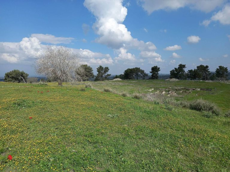
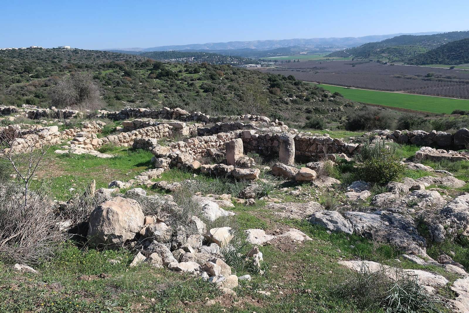
The settlement occupies a hill about 325 metres above sea level on the western side of the Judean Shephelah, the low hill country between the Judean highlands and the coastal plain. It lies on a north-south ridge, with Philistia and Gath to the west and Judea to the east, and overlooks the route toward Hebron and Jerusalem. Tel Azekah is about two kilometres to the west and Tel Socoh about 2.5 kilometres to the southeast. The fortified settlement had an upper and a lower area, enclosed by a city wall about 700 metres long and organized around gates, houses, and open spaces.
Walls, gates, and open spaces
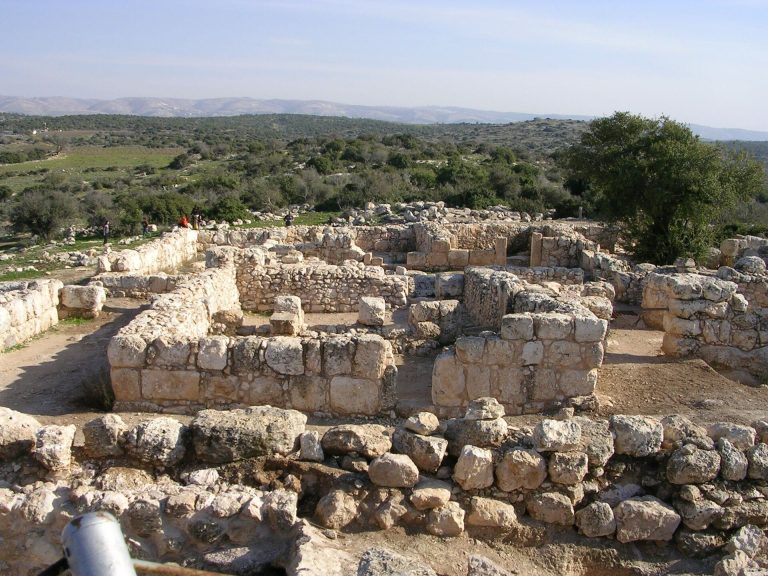
The site’s stone-built layout combines a fortified perimeter with gates and broad spaces within the settlement. Its main defensive construction is a casemate wall, with two parallel wall faces and chambers between them.
City wall and houses
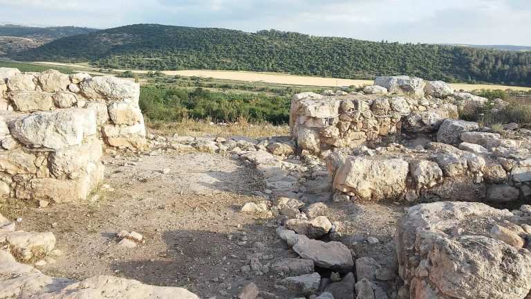
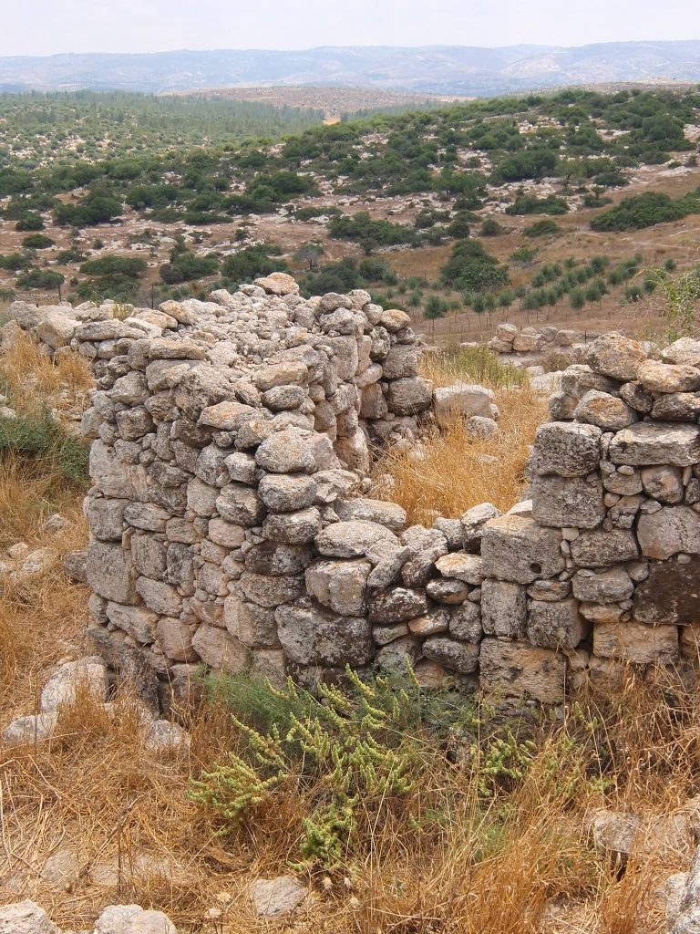
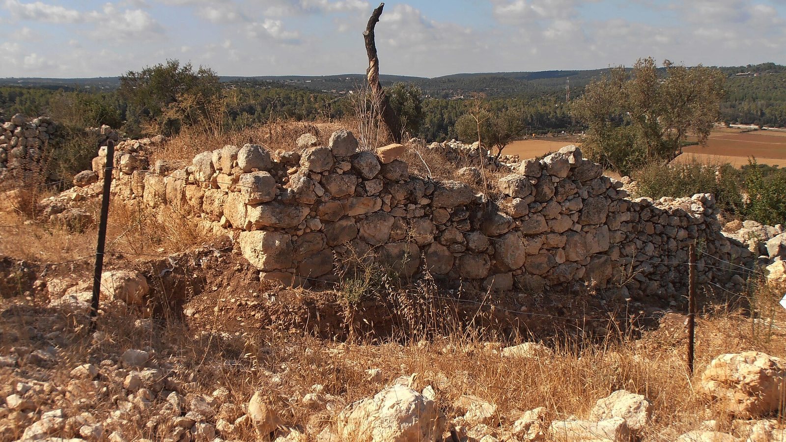
The casemate wall is about 4.5 metres wide. Surviving sections rise about 2 to 4 metres, and the wall may originally have reached roughly 6 metres. Iron Age sections contain very large stones, some weighing 4 to 5 tonnes, with the largest estimates reaching 8 tonnes. In Area B, a lower phase includes stones 1 to 3 metres long, above which a thinner wall about 1.5 metres thick was built. Later Hellenistic masonry made from smaller stones overlies parts of the Iron Age fortification. Iron Age houses were built against the wall and incorporated its chambers into domestic space.
Western gate
The western gate is about 10.5 metres wide, with massive entrance stones and a guard position. A chamber measuring about 3.5 by 2.2 metres lies on each side. A drainage channel was found on the southern side, and other channels were covered. A path from the west-facing entrance descends toward the road leading to the sea. Conservation and reconstruction added courses above the masonry found in excavation and marked the boundary between ancient and reconstructed stonework. The work also exposed the threshold, which had been buried beneath a Hellenistic wall.
Southern gate
Facing the Elah Valley, the southern gate has been interpreted as the settlement’s main entrance. Its design and dimensions are similar to those of the western gate, and it has a monumental stone on either side, each weighing about 10 tonnes. Excavation began in 2009. The area was cleared, excavated, and reconstructed in 2017, while the identification of the feature as a second gate remained disputed.
Plazas and assembly halls
The two gates and broad open spaces form part of a modular town plan. Large plazas follow sequences of five houses on either side of a gate. Excavators identified two large assembly halls in 2010 and interpreted them as spaces intended for ritual activity.
Upper-city buildings
Central enclosure and palatial building
A large rectangular enclosure occupies the centre of the upper city, with spacious rooms on its southern side. At the site’s highest point, a substantial building covers about 1,000 square metres. Its walls are roughly twice as thick as those of an average house, and it has been interpreted as a possible governor’s palace. The palatial structure was decorated with imported alabaster and afforded views toward both gates, Ashdod and the Mediterranean, and the Elah Valley.
Storehouse and Byzantine villa
A pillared storehouse stood alongside the palatial structure and contained hundreds of stamped storage vessels. About 500 jar handles bear one or more fingerprint impressions; other handles have indentations that may have served an administrative purpose, such as managing tax or distribution. During the Byzantine period, a villa was built over the Iron Age palace and cut the older structure in two.
Ritual spaces and objects
Possible shrines
Three large rooms have been interpreted as possible ritual shrines. Portable objects from the site include two miniature temple models, one an elaborate stone piece carved with architectural ornament, and three small box-shaped shrines with different decorative treatments. One of the small shrines has two pillars and a lion decoration. A stone incense altar has three legs and engraved designs on its outer sides. Other finds in this group include cult stands.
Inscriptions and other finds
Ostracon and inscribed jar
A trapezoidal pottery sherd excavated in 2008 measures about 16.5 by 15 centimetres. Its five lines of ink writing run from left to right in Hebrew using an early alphabetic script. The text is fragmentary and has been described as one of the earliest known Hebrew texts.
A ceramic jar found in 2012 in Area C, beside the southern wall, bears the inscription Ishbaal son of Beda on its shoulder. The inscription uses an ancient alphabetic script and is dated to Iron Age IIA. Its initial letters are blurred or damaged. The jar came from a room about 5 by 6 metres, the largest Iron Age room identified at the site. The room had a large entrance, thick stone walls surviving in places to 1.5 metres, a central hearth, and a floor with many finds and installations. It has been interpreted as a possible open courtyard.
Other finds and burials
Excavated objects include cooking pots and jars, tens of thousands of ceramic fragments, an iron knife and sword blade, a spearhead, jewellery fragments, an Egyptian scarab, a fragment of gold, and bowls carved from stone. Animal remains include cattle, sheep, goats, and fish. Coins associated with the later occupation include issues of Alexander the Great, a Macedonian ruler and conqueror, and Ptolemy I, a Macedonian general who founded the Ptolemaic dynasty in Egypt.
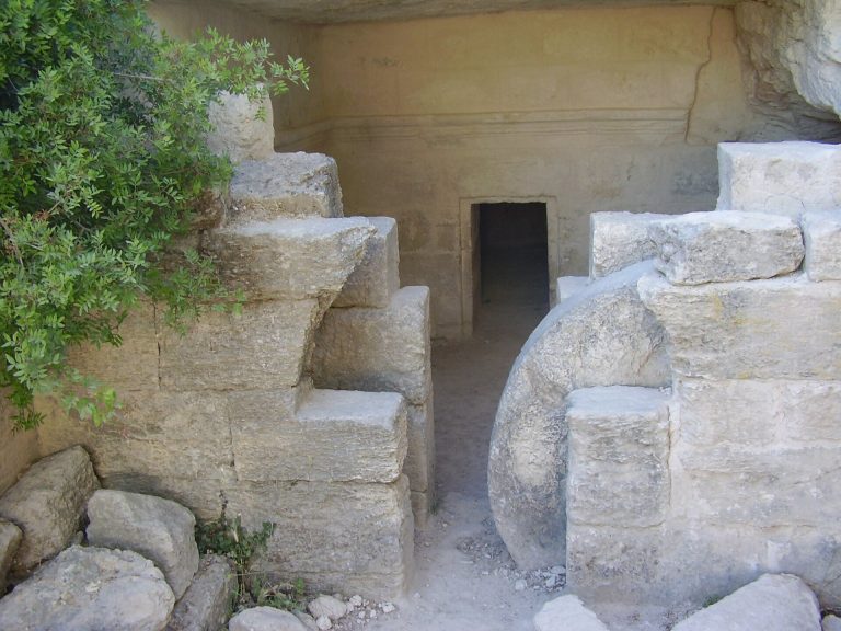
Rock-cut tombs of Iron Age date lie outside the settlement on its southern slope. Surface finds include pottery fragments from the early and middle Bronze Ages, as well as from the Persian, Roman, Byzantine, early Islamic, Mamluk, and Ottoman periods.