Su Nuraxi di Barumini: A Nuragic Settlement and Tower Complex
Site at a Glance
- Popularity
- Very High
- Country
- Italy
- Primary era
- Bronze Age
- Eras represented
- Bronze Age, Iron Age, Classical
- Civilizations
- Carthaginian, Roman
- Site type
- Military
- Remains
- Fort
On this page20 sections
History
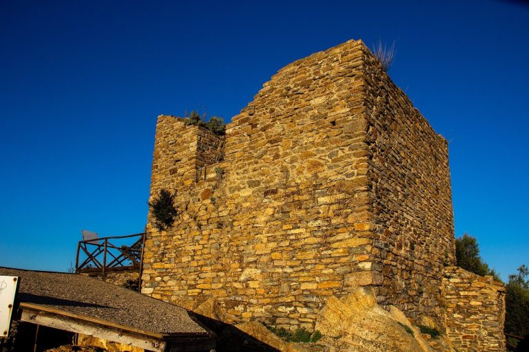
Su Nuraxi di Barumini is a prehistoric settlement centered on a nuraghe, a Sardinian tower complex associated with the Nuragic culture, in Barumini, Italy. Its central tower was built during the Middle Bronze Age, around 1500–1300 BCE, and the settlement was occupied from about the thirteenth to the sixth century BCE. Later occupation continued into the Punic and Roman periods. The site’s successive building phases have helped researchers understand Sardinian prehistory and the development of Nuragic civilization.
Middle and Late Bronze Age
The central tower began as an isolated structure. In the Late Bronze Age, around 1300–1100 BCE, a four-towered defensive enclosure was added, followed by a village. Small wells containing objects offered as votive gifts point to a foundation rite before the settlement was established.
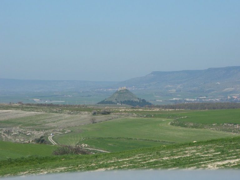
Su Nuraxi probably served as a strategic center along a route linking the Campidano with the island’s interior, near the boundary between the Marmilla and Sarcidano regions. It may also have been the center of a small territory in the foothills, although its precise political role remains uncertain.
Damage and Iron Age renewal
In the late second or early first millennium BCE, the nuraghe suffered serious damage. It was strengthened and modified, its outer defenses were enlarged, and the nearby settlement grew. Around the end of the eighth century BCE, the upper parts of the tower complex and outer defenses were largely destroyed. The site was temporarily deserted before a new community established itself among and around the ruins.
This renewed settlement developed during Sardinia’s Orientalizing period, around 730–600 BCE, when artistic and cultural influences from eastern Mediterranean societies were adopted. An earlier village phase is estimated to have had about 90 residents; the later Iron Age population is estimated at roughly 100, not including possible occupants of the tower ruins. Houses and streets were reorganized, with drainage and modest sanitation facilities.
Punic, Roman and medieval occupation
During the Punic period, associated with the Phoenician-derived culture and political sphere centered on Carthage, and later under Roman influence, the settlement gradually contracted and became poorer. Older buildings were reused, sometimes with rougher new construction incorporated into the ruins. Occupation continued into the third century CE. The central court was progressively used for burials, and a cemetery outside the settlement is also known.
Imported lamps, Attic pottery and fine ceramics indicate a small rural cult active between the fourth and second centuries BCE. It may have been connected with a shrine near Tower C, but that location is uncertain. Some buildings remained in use during the medieval period before the site was finally abandoned.
Excavation and heritage
Giovanni Lilliu first described Su Nuraxi in 1938. Preliminary investigations followed in 1949, and he directed the main excavations from May 1951 to November 1956. The excavations exposed masonry that had been buried beneath collapsed upper structures and helped establish a chronology based on architectural phases and pottery.
Su Nuraxi di Barumini joined the UNESCO World Heritage List in 1997. The listed property covers 2.33 hectares, with a buffer zone of 3.92 hectares.
Remains
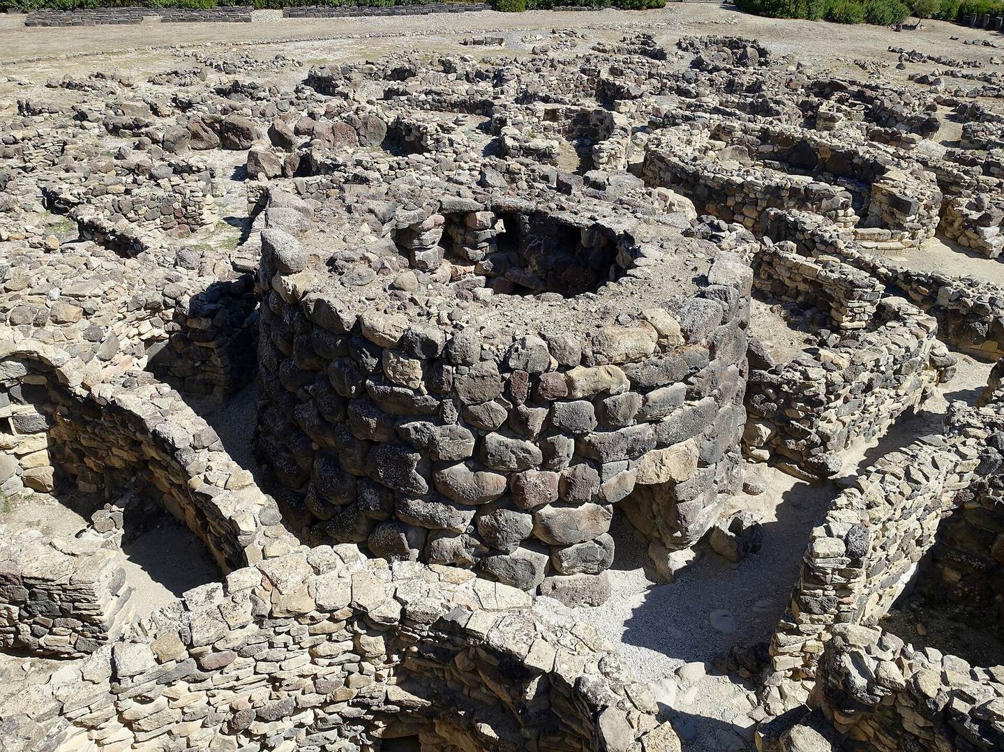
The complex covers about 1,350 square metres on a level area roughly one kilometre west of Barumini, at an elevation of about 230–238 metres. The Tuili plateau lies to the north, while the main tower stands above the Pardu ’e s’eda basin. The tower complex occupies slightly more than a third of the built area, set off-centre to the west and south. The village spreads chiefly to the east, with further groups of buildings to the north and south. Basalt masonry, from large blocks set without mortar to carefully shaped courses, characterizes much of the construction.
The tower fortress
Central tower
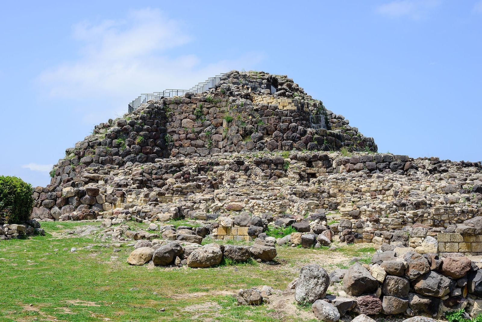
The central tower is built from interlocking polygonal basalt blocks and narrows from about 10 metres in diameter at its base to about 5 metres near its third level. It survives to a height of 14.1 metres; its original height is given as 18.6 metres. A wild olive beam recovered from the lower chamber was radiocarbon dated to 1470 BCE, with an uncertainty of 200 years.
Three chambers were arranged one above another, each with a corbelled vault, made from stone courses that project inward. Only the base of the upper chamber survives. The south-facing entrance has a trapezoidal shape and is 2.07 metres high. A single stone forms its lintel, with a rectangular opening above to relieve the weight. From the entrance, a pointed passage up to 4.14 metres high leads into the circular ground-floor chamber, which measures 4.80 metres across and 7.76 metres high. A guard niche sits to the right of the passage. Two further niches in the chamber measure 1.36 × 1.15 × 3.05 metres and 1.72 × 1.35 × 3.17 metres. Cork found during excavation may have lined them; cork was used to waterproof Nuragic dwellings.
A wild olive trunk remains visible at the rear of the ground-floor chamber. It was used during construction and may later have served another, unknown purpose. A stair passage begins 4.22 metres above the floor on the left wall. Its ten steep steps lead to a landing facing the second chamber; a window lights the landing and is set east of the entrance so as not to weaken the wall. The second chamber is 2.40 metres across and 5.90 metres high. Thirteen further steps lead to the third chamber, 1.20 metres in diameter, of which the wall base remains. A stairway may once have continued from there to a roof terrace.
Four-towered bastion
A rhomboid bastion, a fortified enclosure, surrounds the central tower. Its four projecting towers align with the cardinal directions and are joined by straight curtain walls, the defensive walls connecting towers. The southern and eastern towers guard the tower entrance and the courtyard in front of it. During the Late Bronze Age, an additional ring of masonry, about three metres thick, strengthened the walls and towers. The towers were raised by a storey to heights of as much as 14 metres. They had up to four levels, including chambers above and below an intermediate space resembling a silo.
The inner courtyard is semicircular and covers 56.43 square metres. It contains a well 20 metres deep, cut while the bastion was being built. Later reinforcement blocked the original entrance in the southeast wall. A raised rectangular opening, measuring 1.53 × 0.85 metres, took its place in the northeast wall between Towers C and E. The earlier outward-facing openings for light were also blocked.
The towers had their own passages and chambers. Tower B is reached by a pointed passage measuring 3.70/3.10 × 1.81/1.37 metres; its chamber is 4.70 metres in diameter and 8.40 metres high. Tower C has an angular passage 5.20–5.40 metres long, leading to a chamber 4.90 metres across and 8.40 metres high. Excavation there revealed remains of a wooden walkway on an upper level. A small passage beside Tower C leads to an elliptical chamber measuring 2.60 × 1.80 metres, beneath a small dome 3.84 metres high. It may have been used as an armory.
The northwest Tower D has a partly lost vaulted passage and a chamber four metres across and 7.72 metres high; its original light openings are visible from inside. Between Towers D and E, a doorway 3.65 metres above ground opens into a vaulted chamber 4.23 metres across and 5.20 metres high. The chamber includes a large niche and a small wall cupboard, and access from the courtyard required a movable ladder. Tower E contains a chamber 4.40 metres in diameter and 8.40 metres high, with numerous light openings and a circular well. The well is 2.15 metres deep and 1.11–2.30 metres across. After the chamber’s military use ended, it may have held water or helped keep provisions cool.
Projecting stone supports carried a continuous walkway along the towers and walls, with openings between the supports. The supports were basalt, while the tops of the walls included large white limestone blocks spaced about 40 centimetres apart, alternating with black basalt blocks. Above the lower masonry, the walls were built in courses of squared yellow marl, sandstone, limestone and porous black basalt. Numerous stone projectiles used against attackers were found at the fortress’s foot.
Outer defenses
An outer defensive circuit, or forework, linked towers beyond the four-towered enclosure. Three towers belonged to an earlier phase. Later work added Towers G, H, N, P and Q and incorporated older towers into a polygonal circuit. The defenses were then reorganized into a seven-sided form with two entrances. Towers H and G to the east, and O and P to the west, were positioned to cover the entrances with intersecting fields of fire. A projecting, pincer-shaped entrance enclosed the meeting building. Tower H, in the northeast, survives to about 4.5 metres.
Early sections used basalt blocks laid without mortar. Later alterations enlarged the forework and extended new towers farther beyond the connecting walls. The circuit also included older towers identified as R, M and O. A stone stairway built into the southeast wall between Towers E and C connected the top walkway with the courtyard.
Village layout and houses
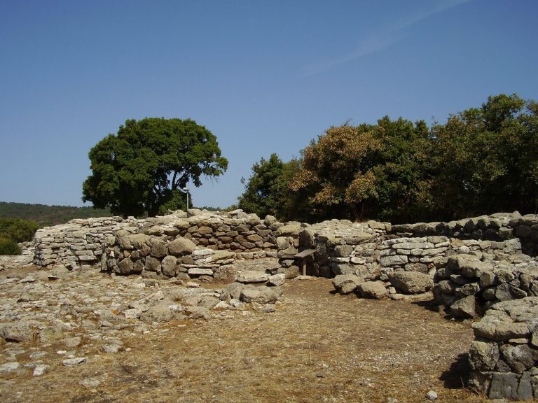
The earliest surviving village buildings date to the thirteenth and twelfth centuries BCE. They include single-room and two-room houses built from large dark basalt blocks. Some circular huts had vestibules, basins and ovens. A later phase added about 70 structures, representing roughly 18 houses and an estimated population of about 90. These houses had adjoining rooms arranged around inner courtyards, with hearths, bench-beds and household fittings. Their thick walls were built dry, without mortar, from large basalt stones.
In the Iron Age, the village expanded to 109 chambers: 71 outside the outer defenses and 38 between those defenses and the nuraghe. The settlement contained about 14 houses, each with 8–12 rooms. Houses stood close together, separated by lanes and arranged around a principal north–south street. Other lanes ran roughly parallel and helped carry rainwater and wastewater away. Modest drainage and sanitation installations appeared in the streets and houses, which were adapted to the existing towers, walls and terrain.
Many Iron Age houses had a paved central courtyard, sometimes with a well. An entrance passage, furnished with seats and small niches, gave access to rooms used for sleeping, living and cooking. Small, carefully built circular rooms are interpreted as ritual spaces. In one house, a room behind an oven with a seat and stone basin may have served for a household purification rite. Some houses included a granary reached from the courtyard; it remained open above while the rest of the house was roofed. Fixed fittings included niches, ovens, hearths and drainage channels. In later construction, walls became thinner and used smaller stones bonded with clay; some spaces had horizontal courses and herringbone patterns.
About 70 early circular huts were generally single-room buildings made from medium-sized basalt blocks without mortar, with conical roofs of timber and branches. Later, housing was divided into individual rooms or units. The village also had workshops, kitchens and areas for processing agricultural produce. A paved square and sewerage system were constructed during the ninth and eighth centuries BCE.
Individual and communal buildings
House 42
House 42 is an elliptical dwelling measuring 15 × 12 metres, with nine rooms, a monumental entrance, a paved passage and a complex central court. Its circular paved courtyard measures 4.17 metres across. In the Hellenistic period, following the conquests of Alexander the Great, the house served five rooms. These included a quadrangular room paved with polygonal slabs, probably used for reception, a small family room with similar paving, a rectangular room opposite the entrance, a tiny polygonal room and a small circular room 1.45 metres in diameter. The circular room has a ring-shaped seat and may have supported domestic or ritual activity. Finds, including Nuragic and late Punic pottery, food remains and stone tools, indicate use from the Orientalizing period through the Hellenistic period, with repeated repairs.
House 20
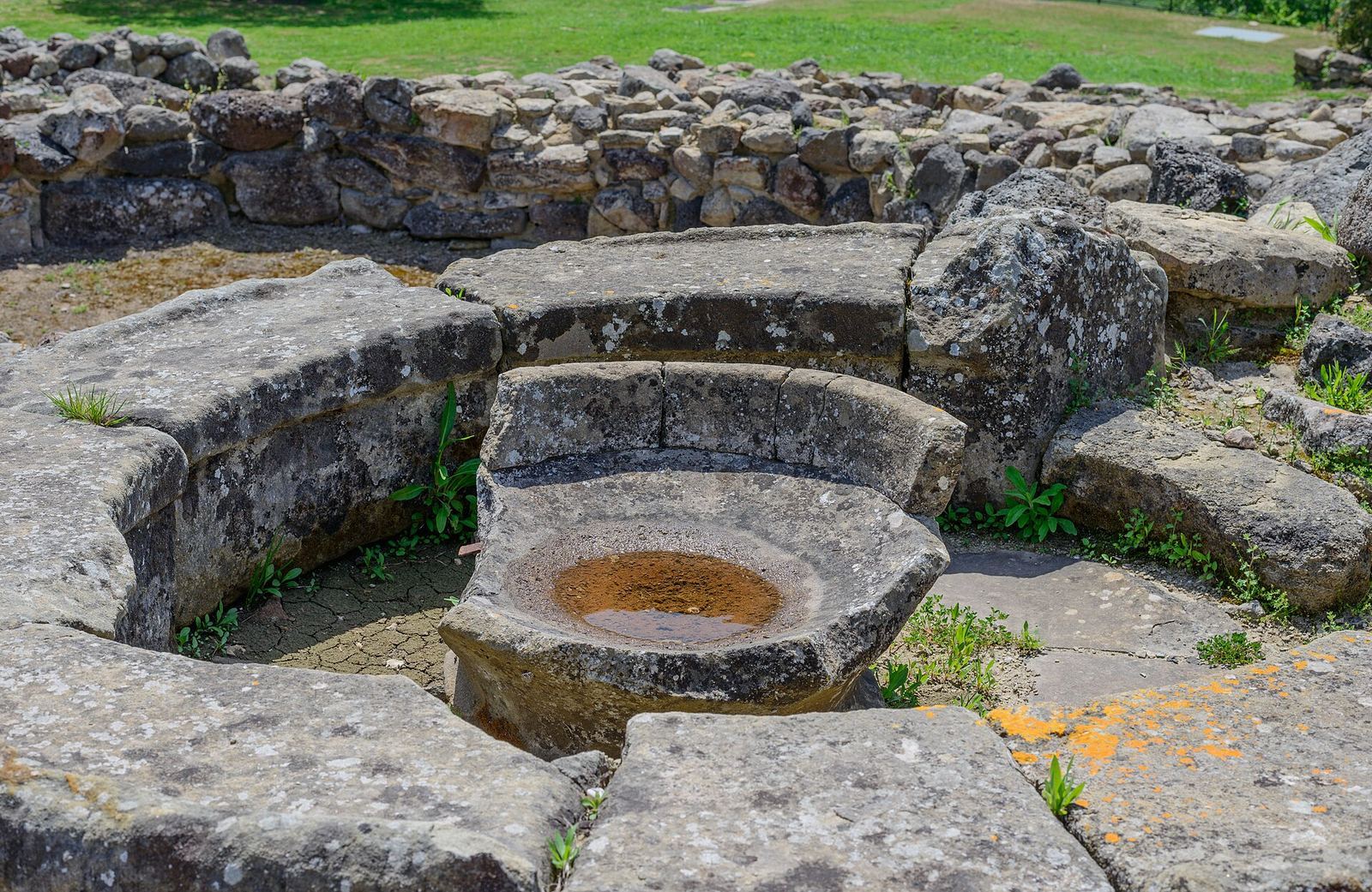
House 20 is a roughly circular, seven-room dwelling measuring 13.60 × 12.60 metres. Its rooms surround a circular courtyard, 3.52 metres across, paved with polygonal slabs. A large original room was later divided during the Hellenistic period. Other rooms include a trapezoidal paved space; a round room with a ring-shaped seat, a trachyte basin made from volcanic rock, and a further basin or bowl; a kitchen with an oven; a triangular room with a niche; a trapezoidal room with two niches; and a small rhomboid room. Finds include late Punic pottery, iron spearheads, Nuragic spindle whorls, weights used in hand-spinning thread, bronze objects and food remains.
House 11
House 11 was altered repeatedly over several centuries and combines Nuragic, Punic and Hellenistic phases. An oval vestibule leads into a circular courtyard 4.53 metres across, with a well at its centre for collecting rainwater.
Building ZZ
Building ZZ is an unusual oval structure with one room, an east-facing entrance and a raised threshold. Five niches line one side of the interior and five shelves the other. The walls survive to 3.25 metres, and the building was probably roofed by a dome. A herringbone frieze on the outside, dating to about 650 BCE, is identified as the earliest known example of this design in Sardinia. The building may have served as a reception hall for the village leader and was associated with nearby Tower H.
Meeting hut
The circular meeting hut is a monumental building 9.70 metres across externally. Inside, a ring-shaped bench could seat about 30 people, and five large niches include one opposite the entrance. Finds include a trapezoidal basin, a sandstone basin, a stone marker shaped like a nuraghe, fragments of Nuragic bronze objects, a bronze sculpture depicting the front of a bovine, arrowheads and metal fragments. The building was altered several times.
Complex 32/36
Complex 32/36 may have been a workshop. It consists of a rounded rectangular room with a vestibule and small niche, joined to a later elliptical room with three niches. A roof collapse in the sixth century BCE killed a person whose skeleton was found inside. Other finds include a small bronze figure of a warrior or leader and a pear-shaped amphora decorated with geometric patterns.
Other Punic-period buildings
Other buildings used during the Punic period include trapezoidal structure 26, quadrangular structure 49 and hut 44, which has a paved floor and a small wall niche. Multi-room house 54 was remodelled during this period and follows the general type represented by Houses 42, 20 and 11.
Ritual objects and other finds
Two conical sacred stones, known as betyls, were broken at the top and reused as building material in later phases. They suggest that a Giants’ Tomb, a Nuragic collective burial monument, may have stood nearby. Excavations also recovered tools, weapons, pottery, ornaments, imported lamps, Attic vessels and fine ceramics.