Shimron: An Ancient City in Northern Israel
Site at a Glance
- Popularity
- Medium
- Country
- Israel
- Primary era
- Bronze Age
- Eras represented
- Bronze Age, Iron Age, Classical, Medieval
- Civilizations
- Achaemenid, Canaanite, Mamluk, Roman
- Site type
- City
On this page23 sections
History
Early settlement and Middle Bronze Age
Shimron was a major ancient city in northern Israel, where the Jezreel Valley meets Lower Galilee. Its earliest known settlement dates to about 3300–3000 BCE, in the Early Bronze Age, an archaeological period in the ancient Levant. By around 1800 BCE, the settlement had grown into a fortified city-state covering as much as 19.5 hectares. Located near the Acre Plain and at the meeting of important routes, it became an inland trade centre linking the ports of Akko and Tel Kabri with Megiddo and Hazor.
Settlement appears to have lapsed during Early Bronze Age III, around 2750–2350 BCE, after only limited evidence for the preceding phase. The wider region experienced severe droughts around 2200–2150 and 2036–2023 BCE. Occupation resumed in Middle Bronze Age I as urban life and long-distance exchange expanded. Shimron’s connections extended north toward the Syrian kingdoms of Yamhad and Qatna, while Egyptian Middle Kingdom influence also reached the city. A place-name that may refer to Shimron appears in the Egyptian Execration Texts, ritual inscriptions intended to symbolically overcome named places or enemies.
Late Bronze Age and Iron Age
During the Late Bronze Age, Shimron occupied less land than it had at its height but retained its position as a royal centre in northern Canaan under Egyptian imperial authority. The Amarna Letters, diplomatic correspondence between the Egyptian court and rulers in the eastern Mediterranean, call the city Šamhuna. They name Kusuna, probably around 1450 BCE, and Šum-Haddu, around 1350 BCE, as its rulers. Letters EA 224, EA 225, and EA 261 describe Šum-Haddu as a vassal of the Egyptian pharaoh. EA 224 also refers to regular deliveries of barley and millet, including supplies for Egyptian storehouses and garrisons, and identifies Kusuna as an earlier ruler.
A letter from Burraburiyash, king of Babylon, recounts a raid on one of his caravans by Šum-Adda and Sutana of Acco. Šum-Adda may have been a different person from Šum-Haddu and is associated with Ḫinnatuna. Biblical narratives also include Shimron among the Canaanite cities whose king allied with the king of Hazor against Joshua, and assign the city to the territory of the tribe of Zebulun.
The city’s political alignments during the Iron Age remain uncertain. Its location allowed for possible Phoenician influence from the west and connections with the northern Kingdom of Israel to the southeast. Shimron may have been destroyed during Assyrian campaigns around 734–732 BCE. A damaged city-name in the annals of Tiglath-Pileser III, king of the Neo-Assyrian Empire, has been read as Samhuna and linked to Shimron. Assyrian deportations in the Jezreel Valley and Lower Galilee were followed by centuries of sparse settlement across the region.
Persian, Hellenistic and Roman periods
Use of the site resumed in the Persian period, when the Achaemenid dynasty ruled the region. Finds point to substantial occupation during the Hellenistic period, the era following Alexander the Great’s conquests, when the Ptolemaic and Seleucid kingdoms held power in turn. A coin from the Ptolemaic period was probably minted at Ashkelon. A hoard from the reign of Seleucid king Antiochus III relates to the change from Ptolemaic to Seleucid rule, and coins of Demetrius II were also found. Later coinage precedes a probable abandonment; whether people continued to live at Shimron after Seleucid authority withdrew in the mid-second century BCE is uncertain.
In 66 CE, during the First Jewish–Roman War, Jewish rebels and Roman troops clashed at Shimron. The Roman decurion, a military officer, Æbutius commanded 100 cavalry and 200 infantry in a night attack. His force withdrew when the terrain made it difficult for the horses to operate effectively.
In the Roman period, the city was known in Greek as Simonias and in Rabbinic Hebrew and Aramaic as Simonia. The Jerusalem Talmud explicitly identifies Simonias with Shimron. The settlement probably lay within the orbit of nearby Sepphoris, and its position near the road connecting Legio and Sepphoris may have helped sustain it.
Byzantine through Mamluk periods
A Byzantine settlement was followed by a much smaller community in the Early Islamic period. A village grew there again under the Mamluk sultanate, which ruled Egypt and parts of the Levant. It may have occupied the site of an earlier settlement from the Crusader period. The medieval Jewish scholar Ishtori Haparchi mentioned Shimron in a work he wrote in 1322.
Modern settlement and archaeological research
A map of Napoleon’s 1799 campaign shows a village called Sammouni at the site. In 1838, Edward Robinson described a small Arab village named Semunieh. German Templers attempted to establish a colony there in 1867 but left because of malaria. By the late nineteenth century, accounts described a small village with three springs and roughly 100 inhabitants; in 1900, Gottlieb Schumacher noted that limited water and the unhealthy location had constrained its growth.
Jewish purchasers acquired the land through the Sursock Purchase. From September 1921, Nahalal’s first settlers lived near the mound while they drained marshes at their intended settlement. In 1936 the Moshavim Movement established an agricultural training station at Shimron; a group trained there later founded Kibbutz Hanita. That year, members of Nahalal’s second generation also formed a commune at the site, which lasted until 1939.
Kibbutz Timorim was established on or beside the mound in 1948. It became a cooperative moshav in 1953 and moved south by 1954 because farmland was scarce. The vacated area later served as a transit camp for immigrants bound for Migdal HaEmek and Ramat Yishai. In 1965, a 28-dunam nature reserve was established to protect the apple-ring acacias growing at Shimron.
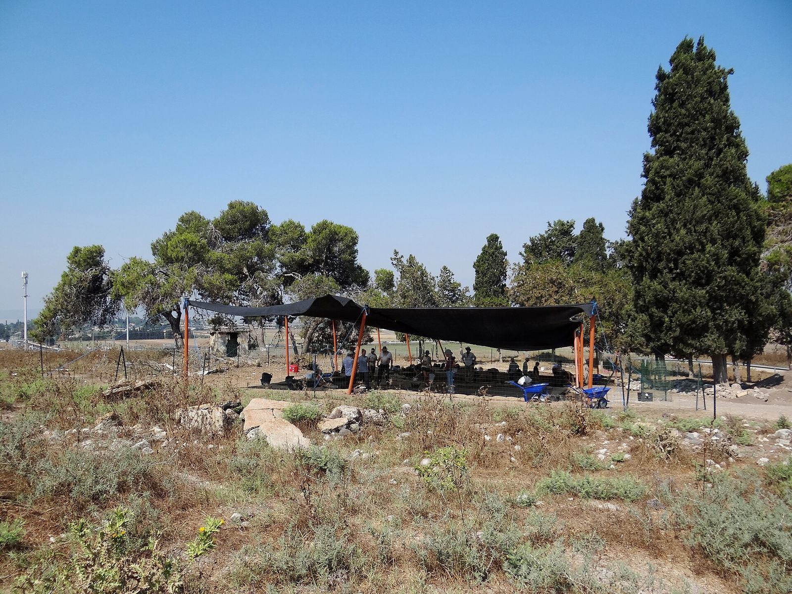
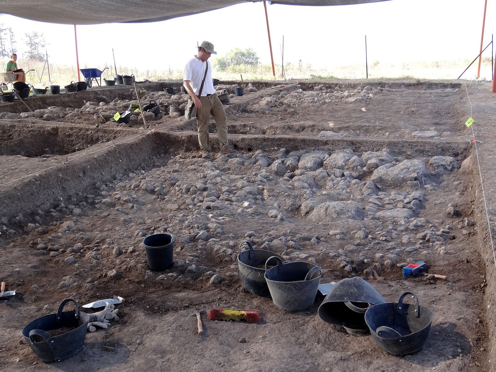
Survey work in 1982 was followed by salvage excavations in 2004, 2008, and 2010, ahead of construction and road work. Research focused on the mound itself from 2016. Geophysical surveys detected later layers above Middle Bronze Age remains, leading to excavations in 2017 and 2019. The first five years of work revealed remains from the Middle Bronze Age, Iron Age, Persian, Hellenistic, Roman, and Mamluk periods.
Remains
Setting and early archaeological evidence
The mound and eastern hill
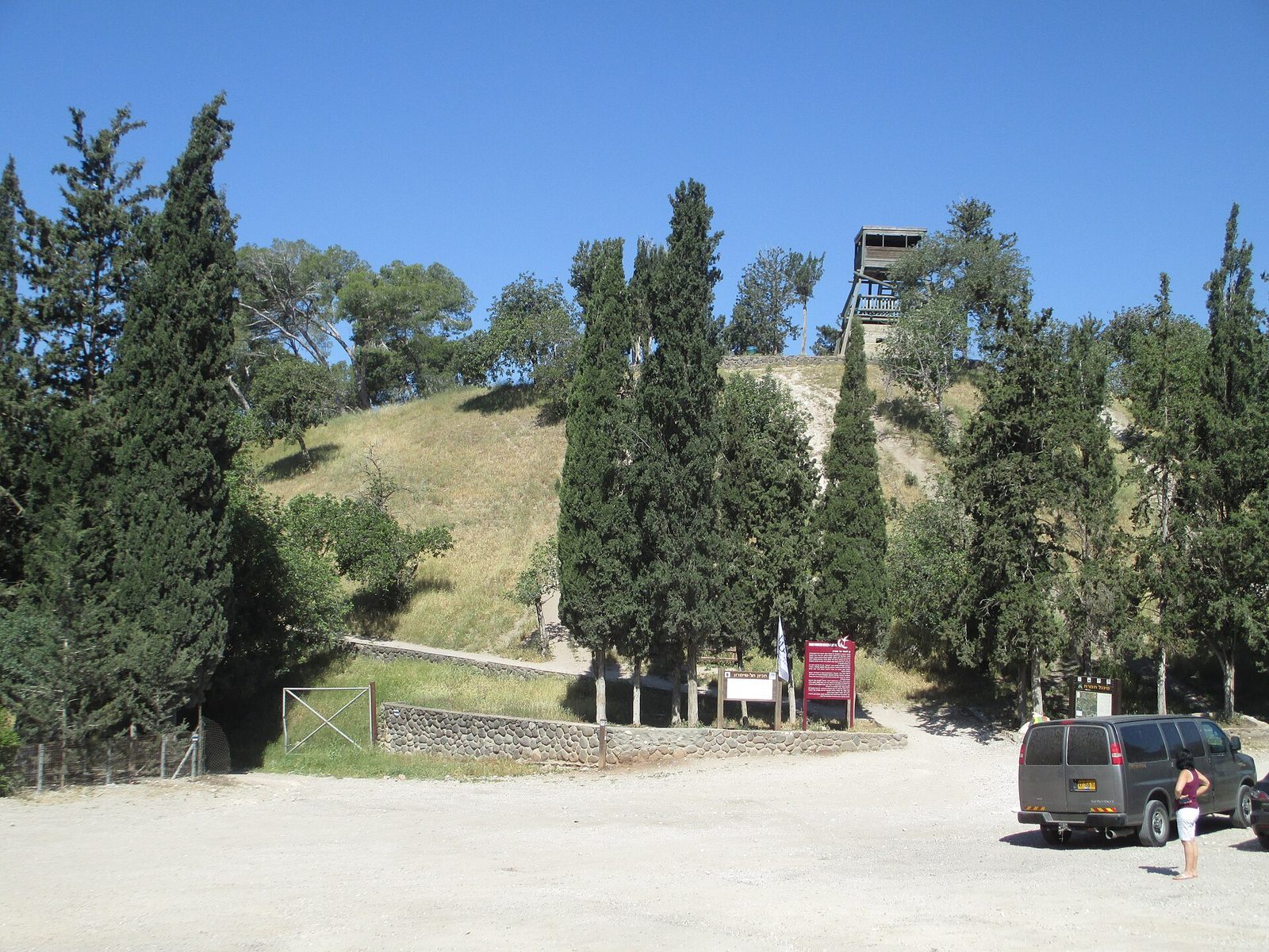
The mound rises about 60 metres above its surroundings. Its northeastern side is steep, while the ground slopes more gently toward the southwest. East of the ancient settlement, a separate rounded hill overlooks the plain and slopes westward toward the town. Traces of a wall near its summit led Victor Guérin to suggest that the hill may once have been fortified.
Prehistoric and early settlement remains
Finds from the surrounding area extend back to the Neolithic period. A 2010 excavation recovered a stone arrowhead from a pre-pottery Neolithic phase, material associated with the Wadi Rabah culture, and sparse remains linked to the Ghassulian culture of the Chalcolithic period. Chalcolithic and Early Bronze Age I material has also been found around the mound. Early Bronze Age remains lie beneath Middle Bronze Age deposits, which makes them difficult to investigate.
Bronze Age buildings and finds
Southwestern domestic quarter
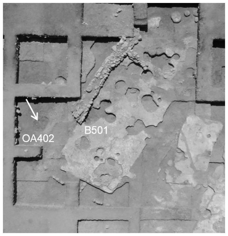
Excavations in the southwest uncovered Middle Bronze Age houses and evidence of household activity and craft production, including metalworking. The domestic remains contrast with the monumental buildings on the eastern acropolis, the elevated centre of the settlement. Pottery from the two areas broadly belongs to the same period, but the forms and quality differ.
Eastern acropolis and passageway
The eastern acropolis contains monumental Middle Bronze Age remains, including a large mudbrick passageway with a vaulted roof made by projecting successive courses inward. Its entrance yielded a seven-cupped Nahariya vessel thought to have been used in ritual. The passageway has been described as the first example of its type found in the southern Levant. Whole and fragmentary Nahariya bowls were also among the finds from the acropolis.
Cylinder seal and cult objects
A Middle Bronze Age cylinder seal found in 2017 is carved from hematite in an Old Syrian Classic style associated with northern Syria. Its imagery shows a sphinx and lion fighting over a human figure and a stag, with vultures, a sun, and a crescent above them. A hare and a bull’s head appear at the sides. The design brings together Egyptian, Mesopotamian, and northern Syrian influences.
In 2024, archaeologists announced the discovery of a monumental structure containing a large cache of Canaanite cult objects about 3,800 years old. The finds add evidence for ritual activity at the ancient settlement.
Iron Age storage pit
An Iron Age storage pit was cut into the earlier Bronze Age fortifications. Its pottery resembles material from Megiddo VI, an archaeological settlement layer at Megiddo. Finds from the pit also include a bronze bracelet and thin sheets of electrum, a gold-silver alloy.
Persian and Hellenistic remains
Building, tombs and coins
A building uncovered in 2004 probably served a public function during the Persian period. Tombs identified in surveys date to the Middle Bronze Age II, Persian, Hellenistic, and Roman periods. A coin probably minted at Ashkelon during Ptolemaic rule was found in 2008. Excavations on the western side of the site uncovered a hoard from Antiochus III’s reign as well as coins of Demetrius II.
Roman remains
Road and stone wall
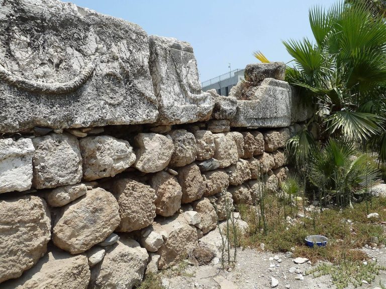
A section of the Roman-period road between Legio and Sepphoris was excavated in 2004. A massive wall built from regularly cut stone blocks also dates to the Roman period.
Houses and ritual bath
Several houses dating from the first to the third centuries CE were excavated near the centre of the site in 2017. Each had an entrance courtyard and rooms divided by stone walls with windows. One of the houses contained a Jewish ritual bath.
Medieval and later features
Settlement areas and boundary inscription
The Byzantine settlement covered 78.3 dunams, or 78,300 square metres. The Early Islamic farmstead occupied 3.9 dunams, while the later Mamluk village covered 12.8 dunams. An inscription reading Shabbat, found near the mound, may have marked the boundary of Shimron or of nearby ancient Mahalul.
Ruins and modern structures
Victor Guérin described a collapsed cut-stone building with two damaged column shafts. Its east–west alignment led him to suggest that it might have been a church. He also noted an enclosure measuring about 35 paces by 25, which he judged to be modern and built from stones of varied sizes, including broken sarcophagus columns.
A lookout tower once stood on the mound above the valley. The tower was dismantled, but its concrete base, built during the British Mandate, remains. The Nahalal cemetery lies at the foot of the mound. The nature reserve protects apple-ring acacias, whose occurrence at Shimron is the northernmost in Israel.