Mitla: A Zapotec Ceremonial and Burial Center in Oaxaca
Site at a Glance
- Popularity
- Very High
- Country
- Mexico
- Primary era
- Medieval
- Eras represented
- Classical, Medieval, Early Modern
- Civilizations
- Mixtec, Spanish, Zapotec
- Site type
- City
On this page17 sections
History
Mitla is a Zapotec archaeological site in Oaxaca, Mexico, established as a sacred burial place. Its ceremonial center began taking shape around 850 CE, and its history connects the religious traditions of the Zapotec and Mixtec peoples of Mesoamerica.
Zapotec origins and the ceremonial center
The name Mitla derives from the Nahuatl word Mictlán, meaning the place of the dead or the underworld. Spanish settlers adapted that name, while the Zapotec name Lyobaa means place of rest. The site may have been inhabited as early as 900 BCE and was occupied during the Classic Period, an archaeological phase in Mesoamerican history dated here to 100–650 CE.
Mitla began as a fortified settlement at the edge of the valley and later became the Zapotecs’ principal religious center. Work to develop it as a ceremonial center started around 850 CE. The oldest group of buildings now identified at the site dates from 450 to 700 CE, spanning the later part of the Classic Period.
Mixtec rule and religious life
Mitla reached its greatest extent and prominence between 750 and 1521. Mixtec rule in the area began around 1000, while many Zapotecs continued to live at the site. Its buildings reflect the traditions of both peoples. As Mixtec influence grew, Mitla became the region’s leading religious center, while Monte Albán remained the main Zapotec political center.
Mitla’s religious importance was closely tied to ideas about death and the afterlife. It was understood as a passage between the living and the dead. Nobles buried there were believed to become cloud people who could intercede for those below, and Zapotec belief placed the lord and lady of the underworld among the buildings of the Church Group.
When Spanish explorers and military expeditions reached the area in the 1520s, Mitla was still occupied and served as a major religious center. Its high priest lived there. The urban center covered about one to two square kilometres, with suburbs around it. Intensive farming across more than 20 square kilometres supplied the population with maize, beans, squash, and chili peppers grown using irrigation and hillside terraces.
Spanish conquest and colonial transformation
A Franciscan missionary and chronicler, Toribio de Benavente Motolinía, interpreted the name as hell in an account from the mid-16th century. Diego García de Palacio, a Spanish naval engineer, described the site in 1576. In 1553, Archbishop Albuquerque of Oaxaca ordered Mitla’s destruction in an effort to weaken its longstanding political and religious importance. Spanish-led forces dismantled and looted its buildings, leaving only a few standing. Clergy later occupied some rooms, displacing Zapotec residents.
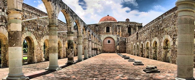
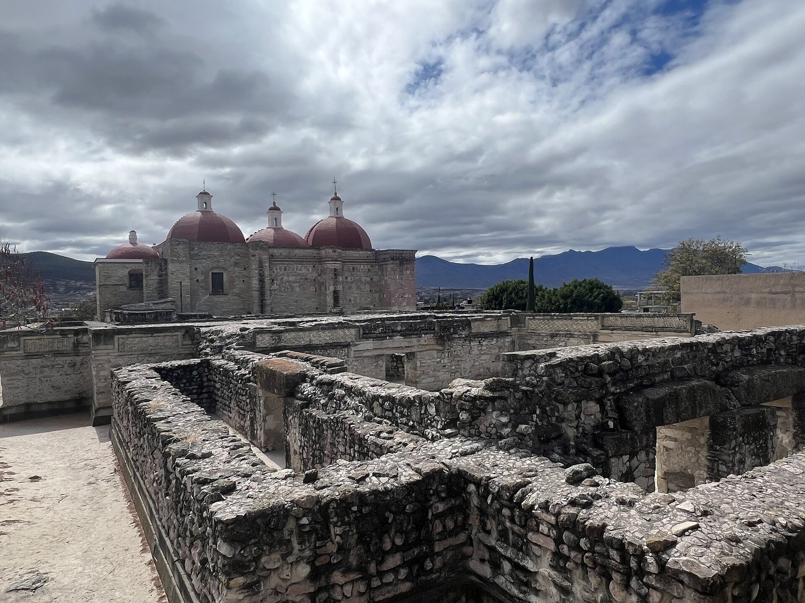
Stone from Mitla was reused in Spanish churches. The Church of San Pablo was built over part of the ruins, while design elements from Mitla were incorporated into the north side of the Cathedral of Oaxaca as an assertion of a new religious order. Across the area, Catholic churches were also built on foundations of destroyed Indigenous temples, sometimes incorporating Zapotec design features.
Excavation, conservation, and heritage
In the early 20th century, the government of President Porfirio Díaz selected Mitla as an emblem of pre-Hispanic Mexico for the centennial celebrations of Mexican independence. Archaeologist Alfonso Caso, who excavated Monte Albán in 1931, also worked at Mitla during the 1920s and 1930s. Excavations continued from the 1980s onward, including extensive work in the North Group; the colonial church was excavated around the beginning of the 21st century.
In 2010, Mexico’s National Institute of Anthropology and History intensified conservation at the ruins to address erosion from wind and rain and persistent graffiti. Investigations in 2022 examined subterranean features. Mitla appears on Mexico’s tentative national heritage list. A UNESCO World Heritage property titled Prehistoric Caves of Yagul and Mitla in the Central Valley of Oaxaca was inscribed in 2010; its listed components include prehistoric caves, Yagul, Caballito Blanco, and the natural landscape. Archaeologist Nelly Robles supported efforts to secure UNESCO recognition for Mitla.
Remains
Setting, layout, and construction
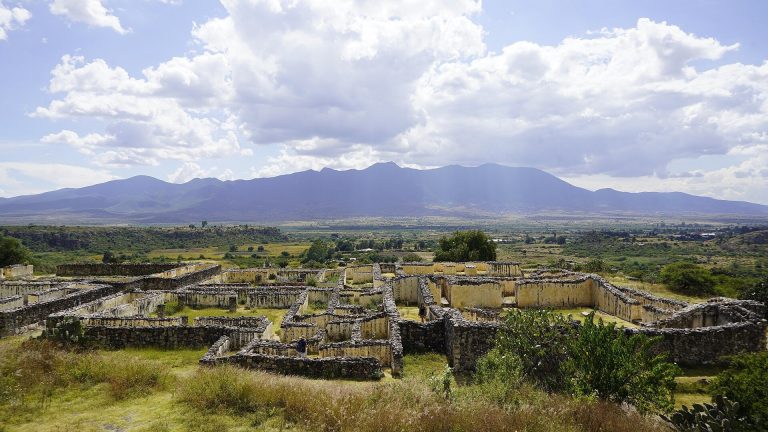
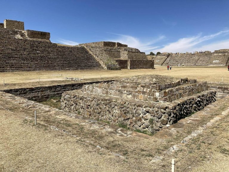
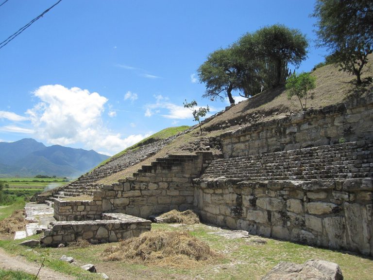
The site lies on the floor of the upper Tlacolula Valley, about 40 kilometres southeast of Oaxaca city and at an elevation of 1,480 metres, with the Sierra Madre del Sur surrounding the valley. Its five groups are the South, Adobe, Arroyo, Columns, and Church groups. Buildings are aligned with the cardinal directions, and a cactus fence encloses much of the area. Walls generally have a core of mud and stone faced with plaster or well-cut trachyte, a type of volcanic rock. Some columns and lintels use stones weighing as much as 18 tonnes. The site’s architectural synthesis reached its height around 1200.
The Columns and Church groups at the northern end are the best-preserved parts of Mitla. Each is arranged around a rectangular courtyard enclosed by one-storey rectangular buildings with long, narrow rooms. Both groups had been fully excavated and restored by the early 1980s.
The northern groups
Church Group
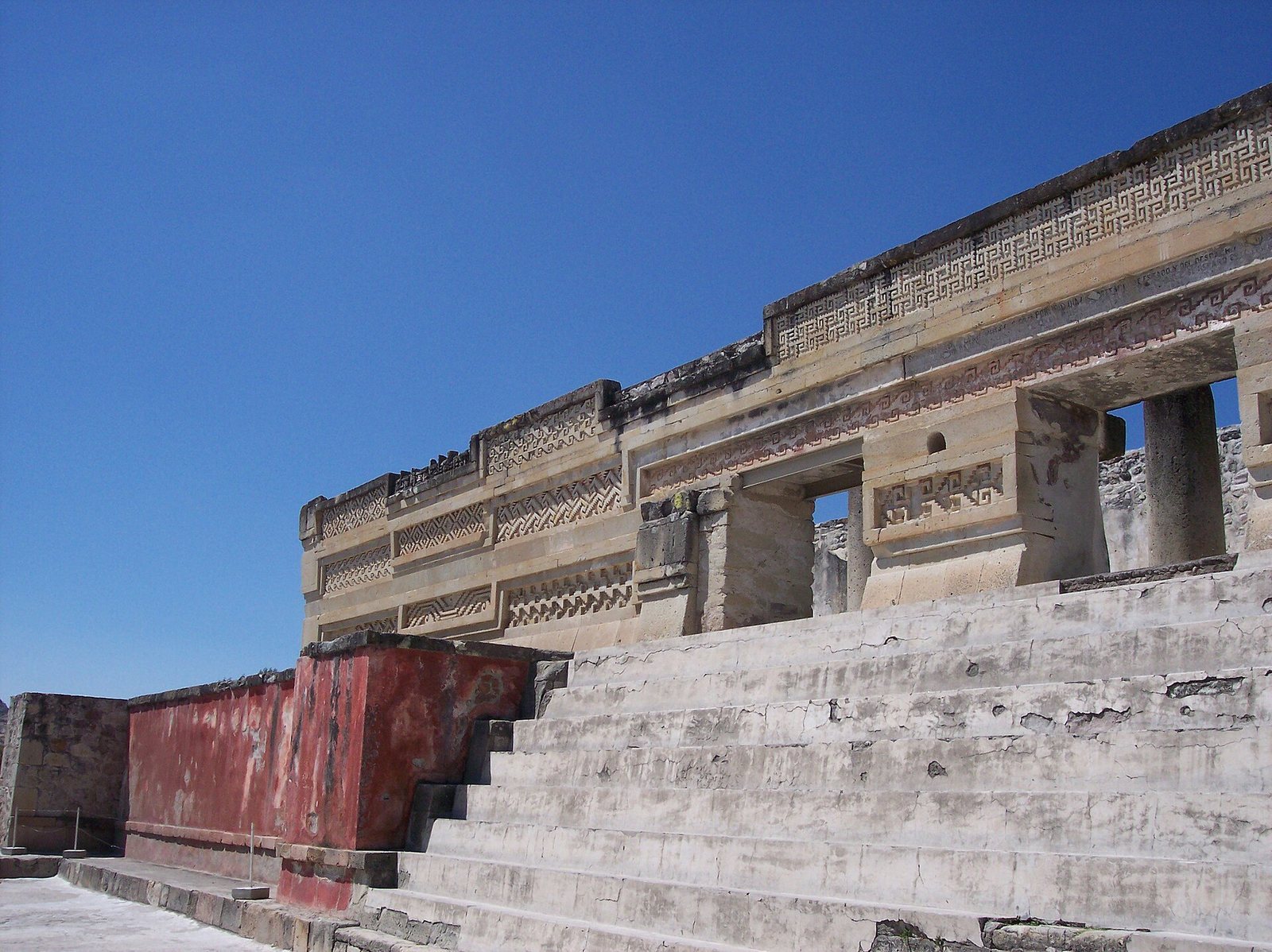
The Church Group, also called the North Group, contains the 16th-century Church of San Pablo, built atop a large pre-Hispanic platform that now serves as its atrium. The group also contains Mitla’s main Zapotec temple, the yohopàe, or house of the vital force, which faces a large courtyard. Two columns frame its entrance and lead into an antechamber whose roof was supported by six columns. Beyond it lie the main room and the Zapotec priests’ living quarters. The temple walls carry mosaic fretwork and murals depicting mythological scenes and figures. The Church of San Pedro is also located in the North Group.
Columns Group
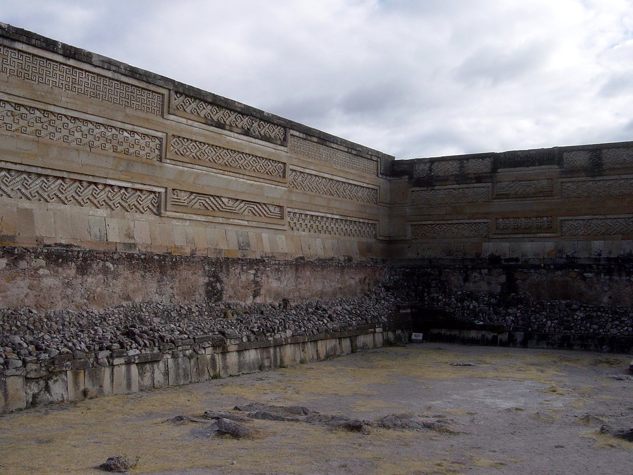
South of the Church Group, the Columns Group has two entrances facing south. Large columns in its entrance room supported the roof, and a small opening in the north wall faces the patio. It is believed to have served as a passage to the afterlife. The group’s principal building, known as the Palace or Grand Hall of Columns, measures 36.6 by 6.4 metres. Six columns of volcanic stone once supported its roof. A small corridor leads to a courtyard with mosaic fretwork and geometric designs. Palm-thatch roofs on wooden beams and columns shelter rooms in the group, protecting their decoration while resembling roofing used in the Mesoamerican period.
South and Adobe groups
South Group
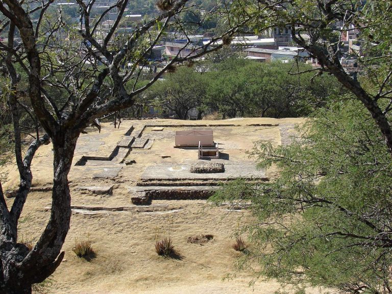
The South Group is classified as both a ceremonial center and a palace. Its central plaza is surrounded by mounds, and its palace buildings have rooms arranged around a square courtyard.
Adobe Group
The Adobe Group is a ceremonial center, with a central plaza surrounded by mounds. The Calvario Chapel is located within this group.
Tombs and mosaic decoration
Burial chambers
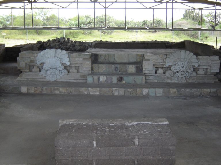
Stone tombs beneath some buildings have cruciform, or cross-shaped, plans and are reached by stairs descending from patios. Their interiors are decorated with mosaics. Elaborate tombs in the north and east buildings of the Columns Group are associated with Zapotec high priests and rulers. In front of the north building’s stairs is a cruciform tomb with an antechamber, large stone ceiling beams, and walls decorated with tablets and stone fretwork. One tomb has an entrance divided by a thick column popularly called the Column of Life. According to a legend, the gap left when a person embraces the column indicates how much life remains.
Mosaic fretwork
Intricate geometric mosaic fretwork appears on walls, friezes, and tombs, especially in the Church and Columns groups. Artisans cut and polished thousands of small stones, then fitted them together without mortar against red-painted stucco. The surrounding stones hold each piece in place by their weight, and some pieces in lintels are set directly into the stone beam. The patterns can cover entire walls, do not repeat exactly within the complex, and are unique in Mesoamerica. Their elaborate effect has been likened to Baroque decoration.
Fortifications and water collection
Mitla also includes fortification walls and a colonial-era rainwater collection tank described as unique of its kind in the valley. The site’s buildings and surviving features bring together its ceremonial, residential, defensive, and colonial phases.