Peralta: A Pre-Hispanic Mesoamerican Archaeological Site in Guanajuato
Site at a Glance
- Rating
- 4.6
- Popularity
- Medium
- Country
- Mexico
- Primary era
- Classical
- Eras represented
- Classical, Medieval
- Civilizations
- Unclassified
- Site type
- City
On this page9 sections
History
Peralta is a pre-Hispanic Mesoamerican archaeological site near San José de Peralta in Abasolo Municipality, Guanajuato, Mexico. The settlement developed during the Bajío tradition, a regional archaeological tradition associated with agricultural societies, distinctive architecture, ceramics, and long-distance exchange. The region was settled around 100 CE, while the settlement’s main period of flourishing is placed between approximately 200 and 700 CE, with its greatest development occurring from about 300 to 700 CE.
Formation and Regional Connections
Peralta grew in a fertile landscape with surface water, agricultural potential, and connections linking central Mexico with the northern and western parts of Mesoamerica. Its communities appear to have been locally autonomous while remaining connected through social and religious networks that probably involved family relationships and regional governments.
The population’s precise ethnic identity remains uncertain. Its inhabitants have been associated with the El Bajío culture, while the use of the broad label Chichimeca remains debated. Chichimeca was a term used by Nahua peoples for several Indigenous groups of northern Mexico and the southwestern United States, rather than for one unified ethnic community. Similarities with other archaeological areas have also prompted suggestions of Nahuatl or Otomi affiliations.
Peralta reached its height during the decline of Teotihuacan, a major Mesoamerican city, and the rise of Tula, a later major center. Trade connected the wider Bajío tradition with foodstuffs, baskets, ornaments, turquoise, shell collars, obsidian, and other luxury goods. Materials from nearby Plazuelas, including turquoise, copper bells, seashells, and jadeite, indicate exchange extending from Guatemala and the Caribbean to New Mexico. Peralta was contemporary with Plazuelas and probably maintained sociocultural relationships with Guachimontones in Jalisco and Chalchihuites in Zacatecas.
Decline and Archaeological Investigation
By about 900 CE, Peralta had declined and collapsed. Its population abandoned the city or returned to a nomadic way of life. The decline has been linked to the overexploitation of the surrounding deciduous rainforest, while archaeological remains also support the interpretation that a natural disaster reduced the population and forced survivors to leave.
The site was identified in 1973 by students from the National School of Anthropology and History. Archaeology students explored it in 1978, salvage archaeologists investigated it in 1981, and further work in 2002 identified several structures. The settlement occupies about 150 hectares and includes a central zone with five peripheral settlements. Restoration has covered less than 10 percent of the site because cultivated land remains among many ruined buildings.
Archaeological investigations have revealed nearly 50 burials. One burial belonged to a woman accompanied by ceramic objects and necklaces made from shell and turquoise, linking funerary practice with materials obtained through regional and long-distance exchange.
Remains
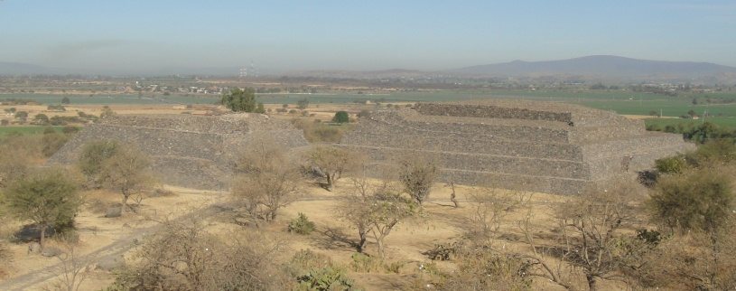
Peralta is organized around a nuclear zone and five peripheral settlements on the slope of Peralta Hill. The central groups include El Divisadero, La Mesita de los Gallos, Conjunto 3 or Celes, and Conjunto 4 or Rancho. Peripheral groups include La Yácata del Chan, La Yácata del Fraile, La Crucita, and Cerrito de Mares. Across the settlement are monumental structures, agricultural terraces, enclosed plazas, circular buildings, and as many as 22 pyramids or other structural remains. The scale of the remains has supported an estimate of more than 15,000 inhabitants.
Patios and Ceremonial Architecture
Peralta’s architecture centers on sunken patios, deliberately lowered courts enclosed by rooms or temples. These spaces occur in several forms, with approximately eight possible variations, and some temple alignments correspond to the equinoxes. Circular structures appear throughout the site and were probably used for ceremonies connected with wind, rain, and fertility deities. A semicircular feature among the walls and other remains is associated with the Danza de los Voladores, a ritual performance in which participants descend from a tall pole while rotating around it.
The Main Structure
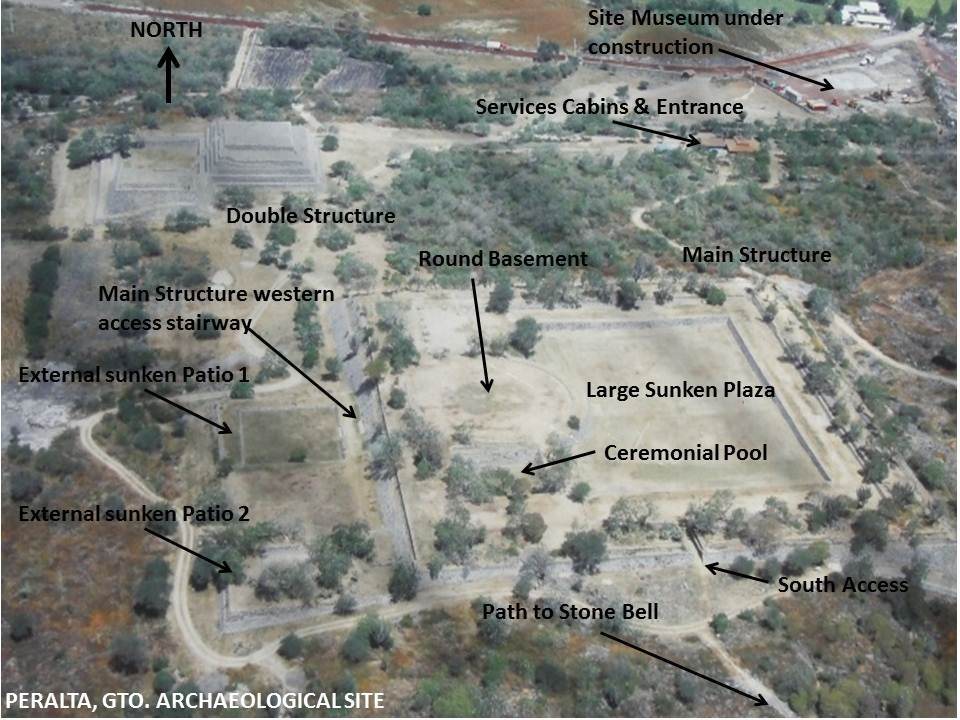
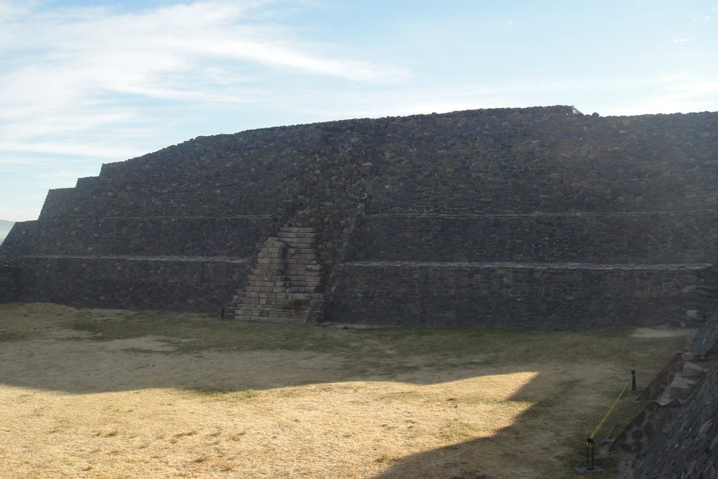
The Main Structure, also called La Mesita or the Governors’ Precinct, is a rectangular stepped complex measuring about 147 meters from east to west and 137 meters from north to south. Its stepped basement accommodated irregular ground, while its outer side walls rise at angles of approximately 45 degrees. Stone and earth form the main construction, with stucco and surface finishes made from clay mixed with plant fibers.
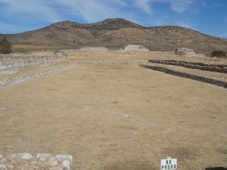
Oriented east to west, the complex has three principal levels. The lower level contains a large sunken plaza, the middle level probably served spectators or ceremonial participants, and the upper level contains further architectural remains. On its western side, the upper level includes a deep ceremonial pool reached by ramps and stairs leading to lower areas, as well as the remains of a circular basement about 42 meters in diameter. Rooms on the eastern side were probably used by governors and high priests.
The principal stairway approaches from the west, facing a platform and two sunken patios, while a secondary entrance lies on the southern side. Human burials with offerings were found in several parts of the complex. The objects included a turquoise collar, shell beads from Pacific coastal regions, two well-preserved wooden pieces, pigments, ceramic vessels, and items carved from obsidian and flint.
Sunken Patios
A large platform west of the Main Structure contains two sunken patios that were probably used for preliminary ceremonies. Sunken Patio 1 lies west of the complex and aligns with its access stairway. It is larger but shallower than Sunken Patio 2, which lies to the south. Other patios, including those in peripheral architectural groups, are bounded by temples on all four sides. Some constructions use black quarry stone.
The Double Temple
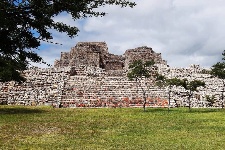
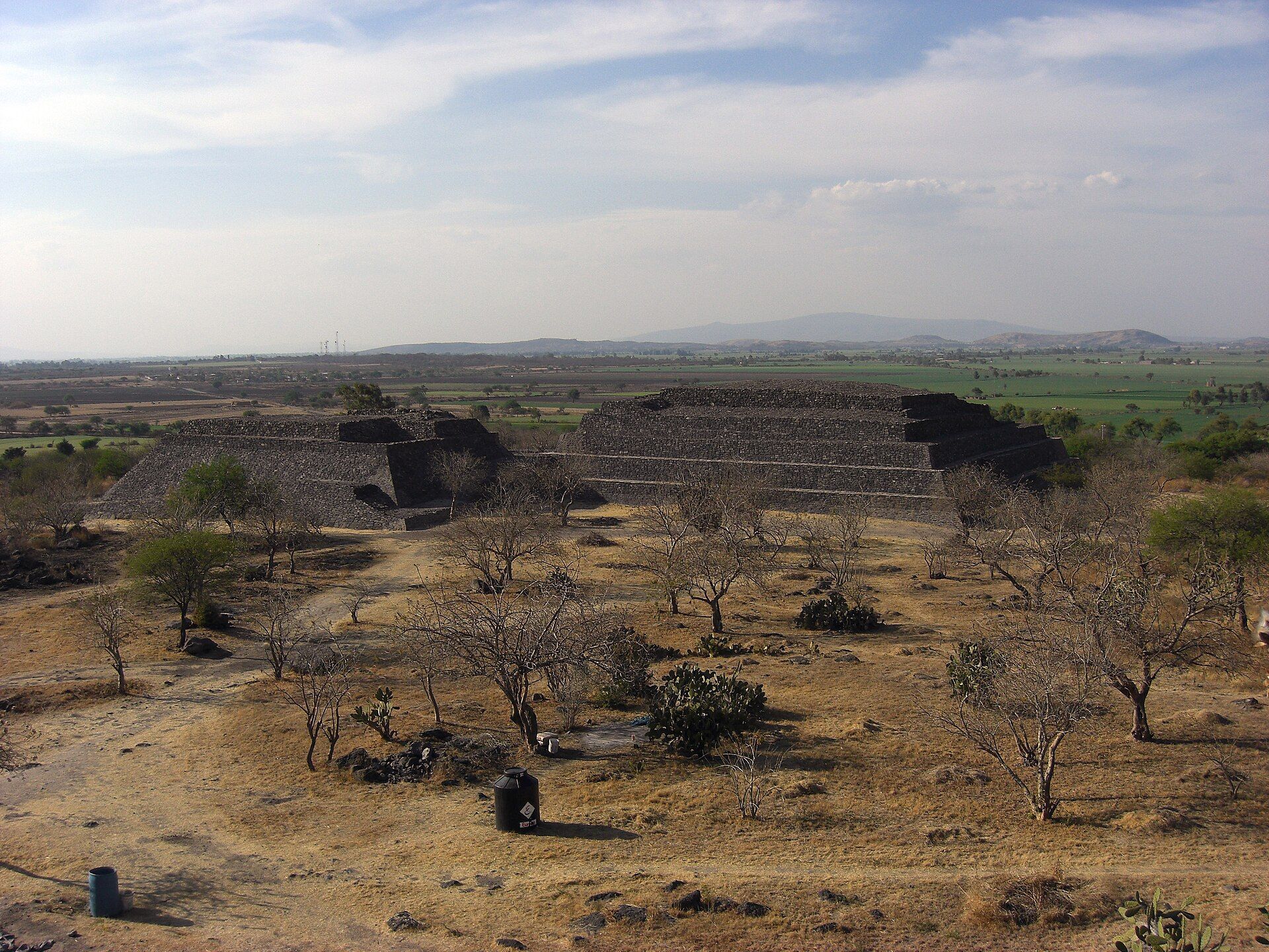
The Double Temple consists of two temples and a plaza on one platform. Construction proceeded in stages, with later buildings placed over earlier ones, possibly under different governors or in response to changing purposes. The successive layers used obsidian, turquoise, tepetate, a compacted mineral-rich earth material, and clay mixed with plant fibers. Additional buildings probably once occupied the tops of the temples for religious or political activities.
A sunken plaza lies before the two temples. Stairways lead from outside the complex into the plaza and from the plaza up to the temples, while a drainage system carried water away and helped prevent flooding.
Peripheral Features and Ceremonial Evidence
A ballgame court has been identified within the settlement, and large agricultural terraces form part of its wider built landscape. The combination of terraces, patios, temples, and plazas reflects an architectural tradition in which ceremonial areas were integrated with agricultural communities.
At the southern end of the site, a mineral-rich basalt boulder served local elders as a bell for calling spiritual gatherings. When struck with a smaller rounded stone, it produces a characteristic sound. The boulder overhangs the side of a hill, forms part of a larger group of stones, and is fractured in at least three places.