Erlitou: An Early Bronze Age Urban Settlement in China
Site at a Glance
- Rating
- 4
- Popularity
- Very Low
- Country
- China
- Primary era
- Bronze Age
- External website
- Open
- Eras represented
- Stone Age, Bronze Age
- Civilizations
- Unclassified
- Site type
- City
On this page18 sections
History
Erlitou is an early Bronze Age archaeological settlement in Yanshi District, Luoyang, Henan, China, and the type site of Erlitou culture, which flourished during the nineteenth or eighteenth through the sixteenth century BCE. Covering about 300 hectares at its greatest known extent, it became the paramount settlement of a polity centered on the Yiluo Basin and extending into the Mount Song region. Its identification with the Xia dynasty remains debated, but the site provides important evidence for the emergence of urban organization, bronze production, social ranking, and long-distance exchange in the Central Plains.
Before Erlitou culture
The area was occupied before the Bronze Age. Yangshao communities, part of a Neolithic tradition in northern China, lived there from approximately 3500 to 2600 BCE. Longshan occupation followed from about 3000 to 2600 BCE. These earlier settlements left houses, pottery, pits, and a jar burial. Yangshao pottery was later incorporated into the rammed-earth walls of the palace and workshop areas, probably because soil used in construction came from earlier deposits.
After a period of abandonment, occupation associated with Erlitou culture began around the nineteenth or eighteenth century BCE. The settlement developed through four archaeological phases, conventionally called Erlitou I through IV. Accelerator mass spectrometry dates place these phases approximately at 1750–1680 BCE, 1680–1610 BCE, 1610–1560 BCE, and 1560–1520 BCE. Other radiocarbon programs produce broader ranges, including about 1900–1500 BCE and 1860–1545 BCE, so the absolute chronology remains under refinement.
Growth of an urban center
During Phase I, occupation was concentrated in the eastern part of the site. From Phase II onward, the settlement expanded across the wider area, with construction and population density increasing through Phases II, III, and IV. At its height, Erlitou was the largest settlement in the region and may have housed between 18,000 and 30,000 people, with an estimated average of roughly 24,000. Its growth may have involved movement from surrounding areas. Chemical analyses indicate that some residents, cattle, sheep, and raw materials came from beyond the immediate region.
Erlitou’s economy combined farming, animal husbandry, craft production, and exchange. Flotation, a method that separates carbonized plant remains from soil using water, recovered tens of thousands of crop remains. More than 90 percent were millet and rice, with smaller quantities of broomcorn millet, soybeans, and later wheat. Rice may have been grown locally, but its unusually high proportion in elite areas may reflect tribute or special provisioning from other regions. Dogs, pigs, cattle, sheep, and goats were kept. Sheep were mainly raised for meat in Phase II and were increasingly used for wool by Phase IV.
The settlement maintained connections over a wide area. Two of 22 analyzed individuals had rice-based diets associated with the Neolithic Jiangnan region and may have migrated from there. Some white pottery probably came from Nanwa in Dengfeng, while impressed hard pottery may have originated in the Jiangsu-Zhejiang region. Marine shells, jade, turquoise, and other materials also reached Erlitou through long-distance exchange, tribute, or elite redistribution.
Political identity and later decline
Many Chinese archaeologists identify Erlitou as a capital of the Xia, a traditionally recorded early dynasty whose historical status remains uncertain because contemporary written records do not securely document it. Other interpretations associate the site with Bo, an early Shang capital. Xu Xusheng initially considered it the Shang capital of Western Bo because its scale and artifacts resembled those of the early Shang. The available evidence does not conclusively establish a connection between Erlitou and the Xia dynasty.
Xu Xusheng led a survey in 1959 to locate archaeological remains that might relate to early historical accounts of the Xia. On 16 May, his team identified remains and artifacts near Erlitou village, giving the site its present name. Archaeological excavation by the Institute of Archaeology began in autumn that year. The first major phase continued from 1959 to 1978, with an interruption from 1965 to 1971. About 20 campaigns exposed the foundations of major buildings, other rammed-earth structures, and burials. The results were published in 1999.
Rescue excavations from 1980 through the end of the twentieth century examined bronze-casting and bone-working areas, smaller buildings, graves, and ritual features. From 1999 onward, excavations directed by Xu Hong increasingly treated Erlitou as an urban system. They revealed drainage installations, a planned road network, walls around the palatial area, and enclosures around workshops. A five-volume report on the 1999–2006 excavations appeared in 2014.
The palatial area and central institutions were eventually superseded as fortified Erligang settlements developed nearby. Erligang represents an early phase of Shang-related urban and bronze production. Yanshi Shang City, about 6 kilometres northeast, became a major regional center. By the later Erligang period, bronze production and other elite industries at Erlitou had ended, and the settlement had contracted to about 30 hectares around the former palatial area. Erlitou was finally abandoned during the late part of Phase IV and later became an ordinary village.
Environmental changes affected the settlement’s history. Before the Erlitou period, the Yi and Luo rivers flowed on opposite sides of the site. A major flood around 4000 years ago altered their courses, deposited fertile soil, and created a more open area south of the settlement. During the Han and Wei periods, another flood shifted the Luo back northward, producing the modern river arrangement. Later river movement destroyed parts of the northern settlement. The Erlitou period was generally warmer and wetter than the present climate of Luoyang, although pollen indicates increasing aridity from the end of Phase I until conditions improved in Phase IV.
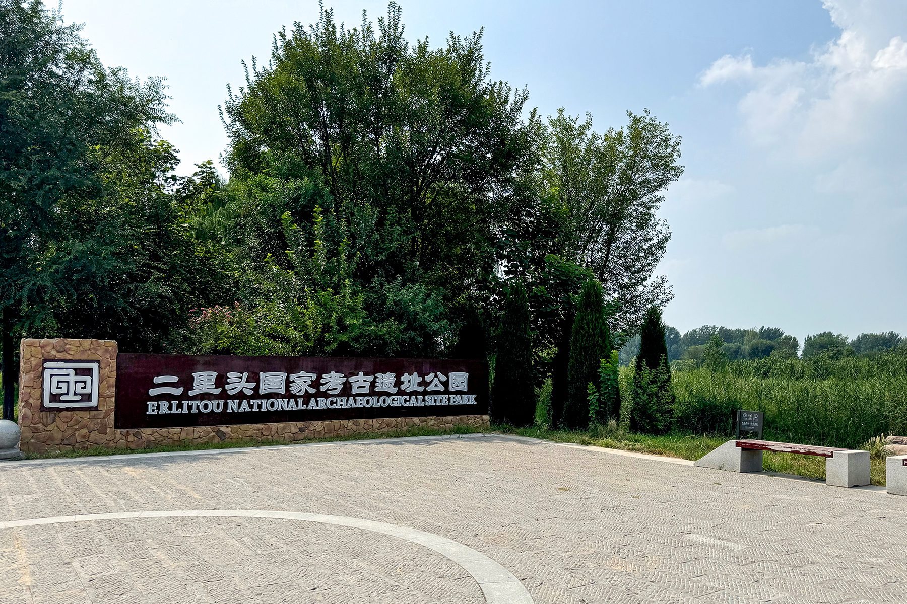
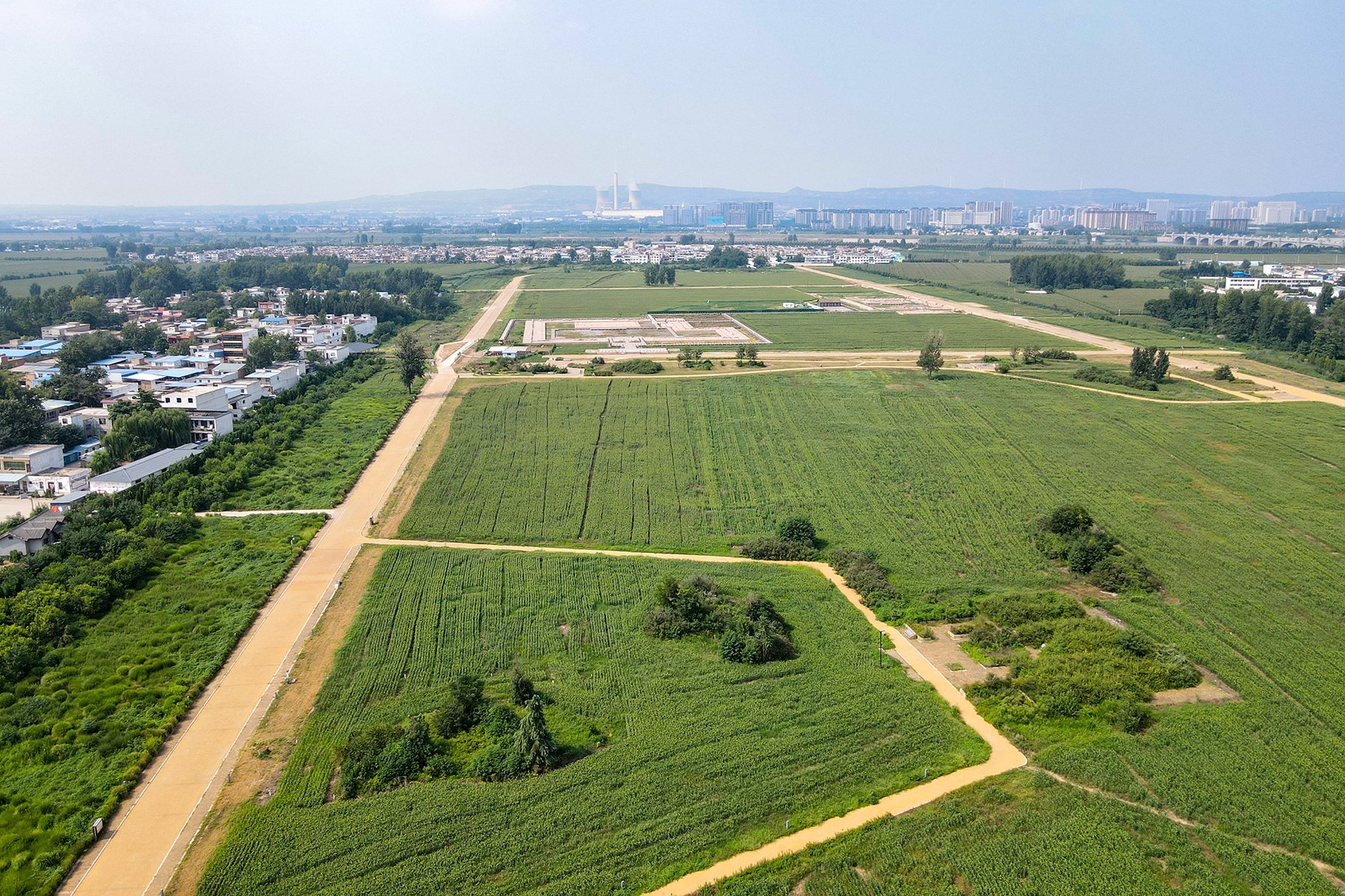
Erlitou was declared a national priority protected cultural heritage site on 13 January 1988. A general conservation plan followed in 2006, provincial legislation established the protected area in 2009, and a national archaeological park was created in 2022. Modern agriculture has removed some upper deposits, while three villages partly overlie the ancient settlement. The Erlitou Site Museum of the Xia Capital opened nearby in October 2019, although its use of the term “Xia Capital” reflects an interpretation that remains contested.
Remains
Settlement plan and palatial area
The settlement extended about 2,400 metres from east to west and 1,900 metres from north to south. Its known area is approximately 300 hectares, while the original settlement may have covered about 400 hectares before the northern portion was damaged by changes in the Luo River. During its peak, an elevated eastern zone contained the palatial area, elite residences, ritual remains, and enclosed workshops. A lower western zone was occupied mainly by small houses, including semi-subterranean structures whose preservation is poorer.
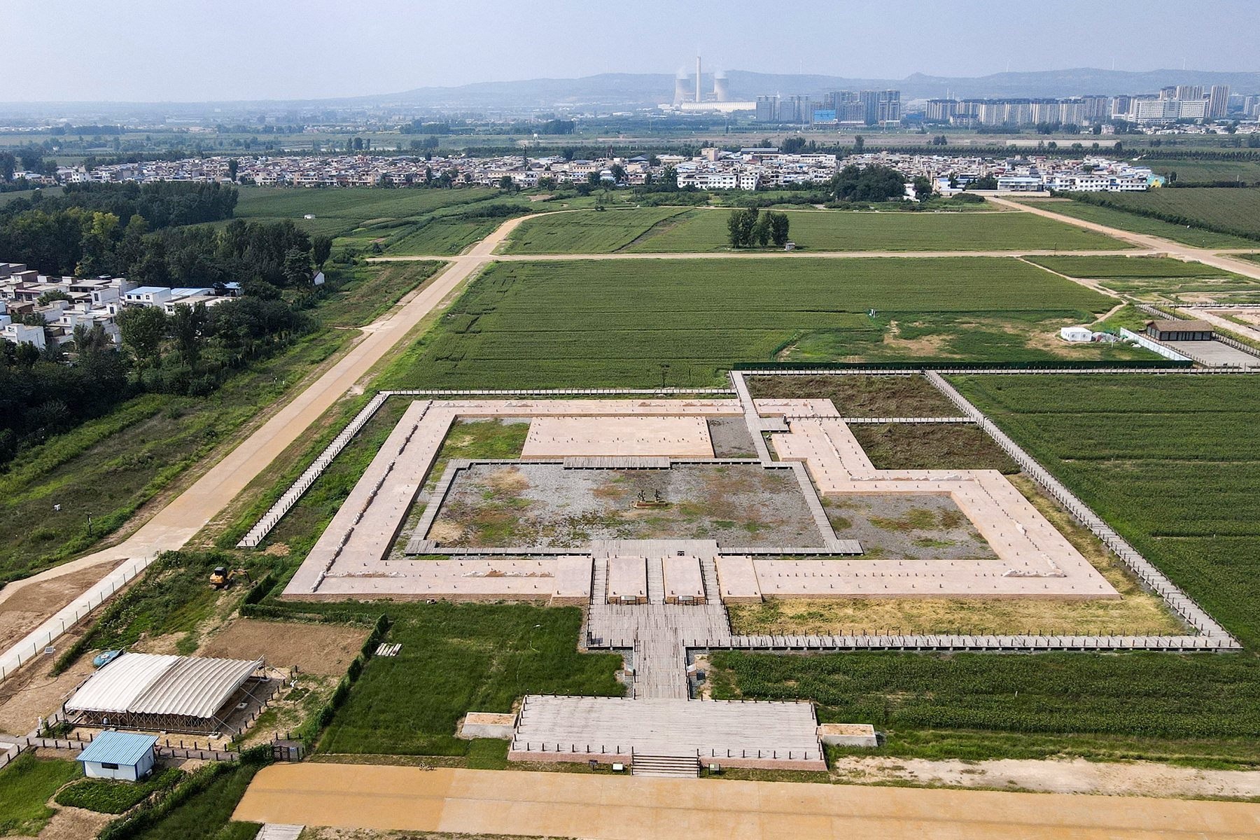
The palatial complex covered more than 100,000 square metres and eventually formed an enclosed rectangular area of at least 12 hectares. Rammed-earth walls, made by compressing layers of damp earth within temporary forms, surrounded the complex and were about 2 metres thick. Four roads about 20 metres wide formed a grid around it during Phase II, dividing the city into nine sectors with the palatial area at the center. Later roads around the enclosure were generally 10 to 20 metres wide. This planned network is regarded as the earliest known urban road system in China.
Foundations 3 and 5
Large rammed-earth buildings occupied the northeastern part of the palatial area during Phase II. Foundations 3 and 5 were multi-courtyard structures covering several thousand square metres. Foundation 3 measured more than 50 by 150 metres and contained three courtyards. Both buildings had associated large burials and wells, but excavation remains incomplete. They were later abandoned, after which a wall was constructed inside the surrounding roads and the palatial area was transformed into an enclosed palace city.
Foundation 1
Foundation 1 was built during the early part of Phase III. It is an irregular, L-shaped rammed-earth platform surrounded by covered corridors and arranged around a courtyard. The western side measures about 99 metres, the northern side about 90 metres, and the eastern side consists of sections about 48, 21, and 48 metres long. Several hundred square metres of pebble paving were found between Foundations 1 and 2, possibly explaining the unusual shape of the platform.
The principal building stood along the northern side of the courtyard. Postholes indicate a timber-framed structure eight bays wide and three bays deep, with mud walls. Its roof has been tentatively reconstructed as a double-eaved hip roof. The southern covered corridor contained a gate with two passageways, while the eastern corridor included a small room. Foundation 7 crossed the southern palace-city wall and aligned with the main hall and southern gate of Foundation 1, suggesting that it may have formed the most important entrance. Foundation 8, built into the western wall, may have been a gate or side building, while Foundation 9 lay southwest of the main entrance.
Foundations 2, 4, and 6
Foundation 4 was constructed south of the abandoned Foundation 3 during the early part of Phase III. It is a single rammed-earth platform about 36 metres east to west and 13 metres north to south, and it remains under excavation.
Foundation 2 was built over Foundation 3 during the later part of Phase III. It used the eastern palace-city wall as one boundary and measured about 73 metres north to south and 58 metres east to west. Its quadrangular enclosure had covered corridors along the western, southern, and eastern sides, together with a southern entrance. Drainage channels beneath the eastern wall led outside the complex. The northern hall was divided into three rooms by a narrow wall.
Foundation 6 was built north of Foundation 2 during the late part of Phase IV. It measured approximately 57 to 58 metres east to west and 43 to 47 metres north to south, and resembled Foundation 2. Foundations 4, 2, and 6 shared a north-south axis. The two main architectural groups, one centered on Foundation 1 and the other on Foundation 2, were abandoned during the late part of Phase IV.
Roads, houses, and ritual features
Parallel wagon tracks were found on the road south of the palatial complex. They are about 1 metre apart and date to roughly 3700 years ago, making them among the earliest known wagon tracks in China. The evidence does not establish whether the vehicle was pulled by people or animals.
A large pit north of Foundation 6 was first dug for earth during Phase I. By Phase II it covered about 2,200 square metres and was 4 to 7 metres deep. It may later have served as a ritual place before being filled during the late part of Phase IV. Small and medium-sized rammed-earth foundations around the palatial area probably belonged to middle- and lower-ranking elites. A lightly excavated area north of the palace is associated with ritual activity.
Commoners’ houses were concentrated in the lower western settlement. Many were semi-subterranean structures about 3 to 5 square metres in area, accompanied by small surface buildings. Medium-sized buildings, generally north of the palace, ranged from tens to hundreds of square metres and were usually single-roomed. Some may have served as residences, meeting places, or locations for ritual offerings. Commoners’ buildings were intermixed with graves, courtyards, and roads, while the palatial and workshop zones were enclosed within their own walls.
Workshops and production areas
Bronze workshop
The walled workshop zone south of the palatial complex contained bronze-casting and turquoise-working installations. Its enclosure began in Phase II and was abandoned in Phase IV. The bronze workshop covered about 1.5 to 2 hectares near the ancient Yiluo River. Casting areas, ceramic molds, copper slag, preheating areas, houses, and kilns occupied the zone.
The workshop produced the earliest known bronze vessels in China made with ceramic piece molds. A piece mold is assembled from several ceramic sections around an object before molten metal is poured inside. Surviving molds indicate vessels more than 30 centimetres in diameter and include animal-face designs. Erlitou bronze objects were cast as single pieces rather than assembled from separately cast sections. Flat objects used two-part molds, while complex vessels required several ceramic pieces. Crucibles, slag, lead sheets, charcoal, and discarded outer molds were found among the casting debris.
Turquoise workshop
The turquoise workshop occupied more than 1,000 square metres northeast of the enclosed workshop zone. Pit H290 contained thousands of raw turquoise pieces, blanks, and defective products, showing the stages of production and identifying the area as a specialized workshop. Turquoise was fashioned into beads, tubes, and inlays. Three turquoise-inlaid bronze plaques were found in the 1980s, and a dragon-shaped object discovered in a palace-area tomb in 2002 was formed from more than 2,000 turquoise pieces set into decayed organic material.
Other craft areas
More than ten pottery kilns dating from Phases II through IV have been identified. Bone-working areas south of Foundation 4 and in the northern ritual zone produced objects from bone, antler, tooth, and shell, especially arrowheads and hairpins. More than 250 copper and bronze objects include ritual and drinking vessels, bells, weapons, tools, and turquoise-inlaid plaques. Bronze forms include jue cups, ding vessels, he vessels, weapons, knives, chisels, awls, saws, spindle whorls, and fishhooks.
Stone tools include axes, adzes, sickles, knives, pestles, mortars, shovels, spears, and other implements. More than 100 jade objects, concentrated mainly in higher-ranking graves, include axes, ceremonial weapons, tablets, shovels, blades, and multi-perforated knives. Nearly 100 lacquer objects include vessels, boxes, cases, spoons, drums, and coffins. Textile remains survive chiefly as traces attached to bronze and jade objects, including coarse fibers probably made from hemp and finer plain-weave fabrics.
Burials and social organization
More than 500 burials have been found, including over 400 from the Erlitou period. Graves were divided into five ranks according to size and grave goods. Higher-ranking burials contained bronze ritual vessels, jade, and white pottery, while lower-ranking graves generally held everyday pottery. Burials occurred in clusters or rows near residential areas and were sometimes placed beside or beneath houses, courtyards, and roads.
Large and medium-sized tombs
The largest known tomb lies slightly northeast of the central hall of Foundation 2. It is a rectangular vertical-shaft grave measuring about 5.20 to 5.35 metres east to west, 4.25 metres north to south, and 6.10 metres deep. A secondary ledge and compacted fill formed part of its construction, while an ancient robbers’ shaft reached the chamber and removed its contents.
Medium-sized shaft graves contained bronze jue cups, weapons, jade tablets and axes, pottery, lacquerware, turquoise, mica, shell, and other objects. One grave held two large jade zhang blades. Another included a bronze jue, a bronze dagger-axe, a stone chime, jade weapons and ornaments, turquoise ornaments, bone beads, and marine shells.
Small graves
Small graves were the most numerous. Some were barely large enough for one body and usually contained between one and 20 objects, mainly pottery. Several individuals show evidence of bound hands or feet, and some graves contained incomplete skeletons or burial arrangements with disordered remains.
Objects and environmental evidence
The pottery assemblage includes cooking vessels such as jars, tripods, steamers, and later li and yan forms; serving vessels such as dou and stemmed dishes; wine vessels including gu and jue; pouring vessels such as gui and he; and storage vessels including basins, zun, and jars. Most pottery is grey because it was fired in a reducing atmosphere. Smaller quantities are black, white, impressed hard, or brown. Vessels were made from local clay using coiling, wheel-forming, and molding, with basket, checkerboard, and cord impressions, carved lines, cloud and thunder patterns, and animal designs.
More than 600 oracle bones from the Erlitou through Erligang periods were recovered, mainly made from cattle shoulder blades, with smaller numbers from pigs, sheep, and deer. Animal remains include fish, freshwater shellfish, birds, sika deer, elk, rabbits, pigs, tigers, and rhinoceroses. Charcoal is dominated by oak, while pollen indicates woodland, forest-steppe, bamboo, willow, hackberry, spruce, and mixed coniferous-broadleaf vegetation. Wells from Phases II through IV reached about 9 metres in the earlier phases and about 7 metres in Phase IV, reflecting changing environmental conditions and water access.
Together, the surviving roads, drainage systems, elite compounds, workshops, houses, wells, ritual areas, and graves show a planned settlement with specialized production and marked social differences. Its bronze, jade, turquoise, lacquer, shell, pottery, and textile remains also reveal a society connected to regions beyond the Yiluo Basin.