Givati Parking Lot Excavation: Jerusalem’s Multiperiod Archaeological Site
Site at a Glance
- Rating
- 4.2
- Popularity
- Low
- Country
- Israel
- Primary era
- Classical
- External website
- Open
- Eras represented
- Iron Age, Classical, Medieval
- Civilizations
- Byzantine, Israelite, Roman, Seleucid
- Site type
- City
On this page16 sections
History
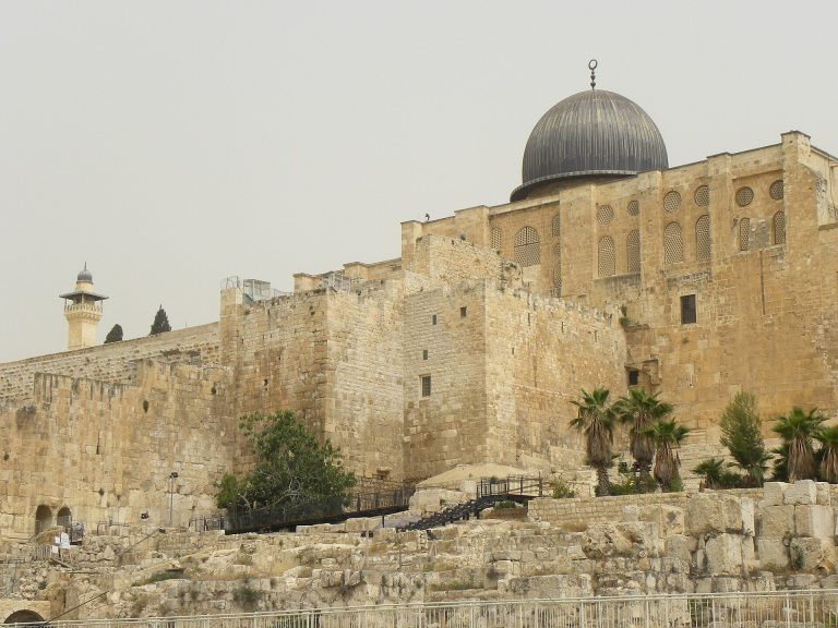
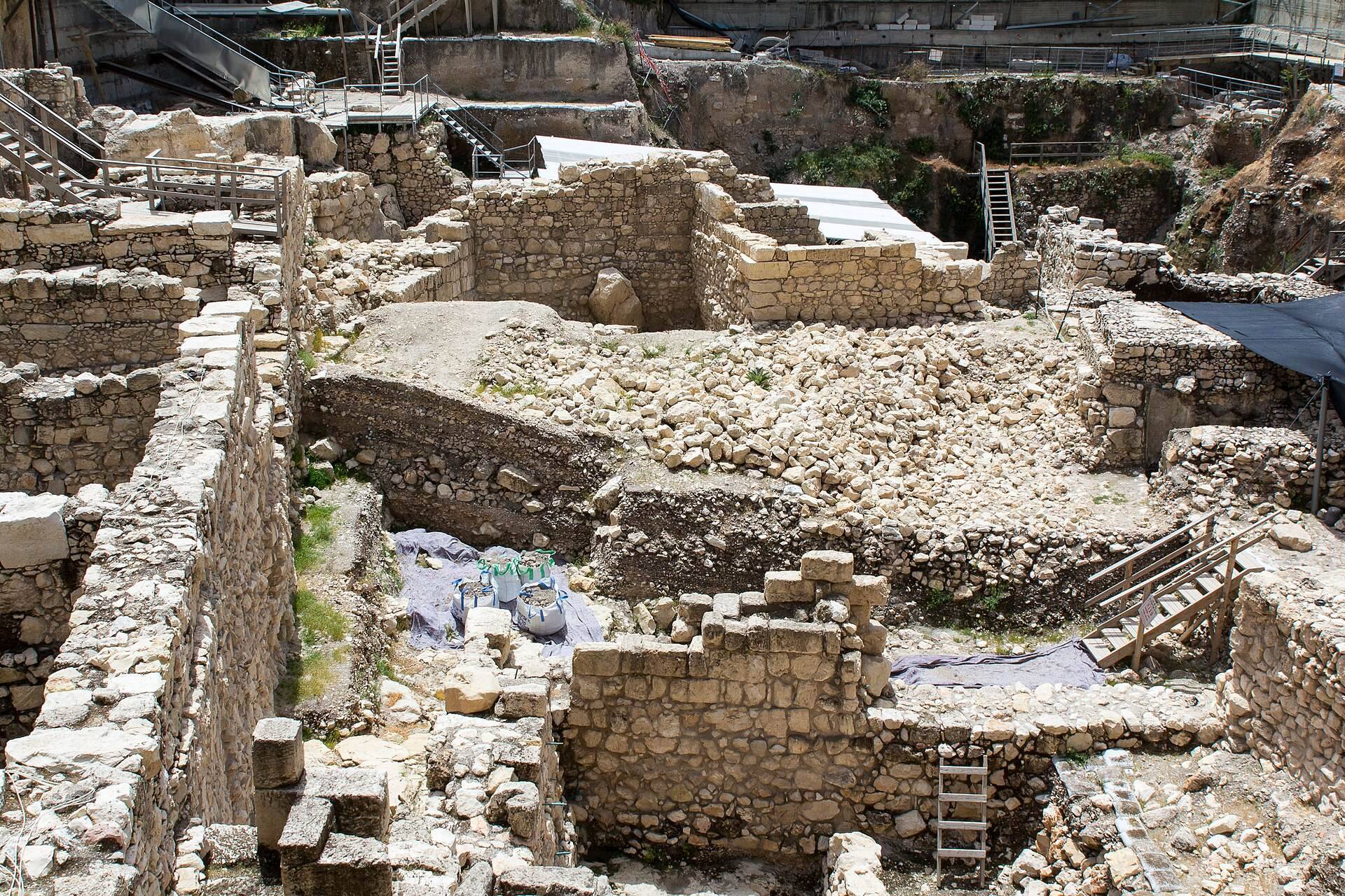
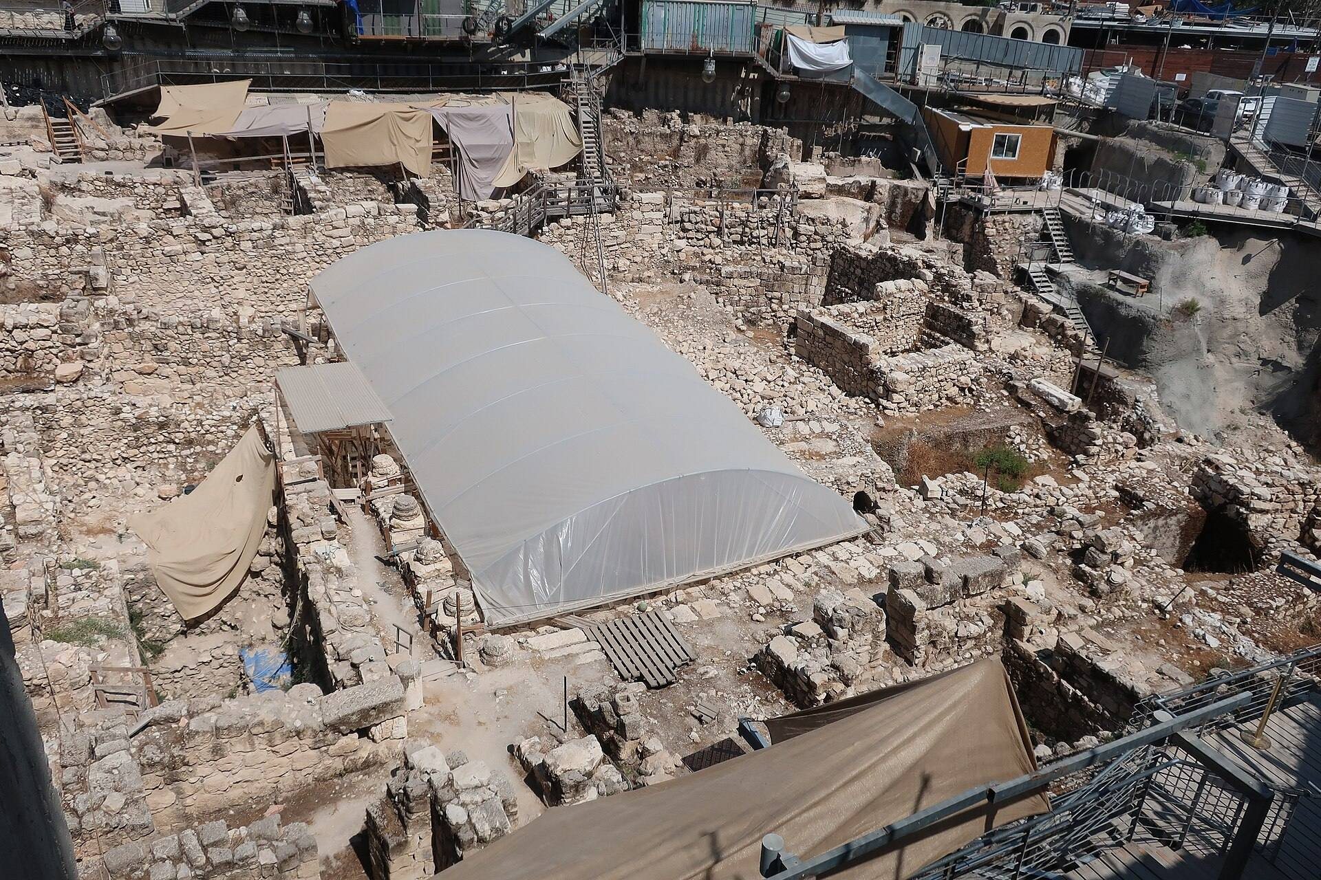
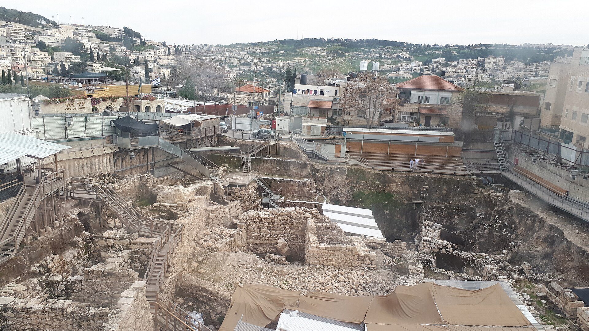
Givati Parking Lot dig is an archaeological excavation in Jerusalem, Israel, in the Wadi Hilweh neighborhood of Silwan beside the City of David archaeological site. The excavation occupies a slope descending toward the Tyropoeon Valley and has revealed successive phases from the Iron Age through the Early Islamic period. Its discoveries illuminate the changing northern and western edges of the ancient City of David, as well as the gradual filling and urban development of the valley.
Early Jerusalem and the First Temple period
The earliest substantial remains belong to the Iron Age, the period of the kingdoms of Israel and Judah that included the First Temple period. They are associated with the era of the kings of Judah and include a large, richly furnished building that may have served as a royal administrative chamber. Its destruction belongs to the Babylonian destruction of Jerusalem in 586 BCE, when the First Temple was destroyed and the city suffered extensive damage.
A deep moat was also formed in approximately the ninth century BCE as part of the northern defenses of the City of David. It ceased to function during that century and was finally filled during the Hasmonean period, when a Jewish dynasty ruled parts of Judea in the second and first centuries BCE. The moat has helped clarify how the northern side of the early city may have been protected before the Temple Mount became part of Jerusalem’s urban area. Newly exposed rock-cut channels associated with it were provisionally interpreted in 2023 as part of an unclear royal industry.
The excavation has produced several finds connected with this period, including Iron Age seals and seal impressions. A seal impression published in 2019 bears the words “belonging to Nathan-Melech, servant of the king.” It dates to the second half of the seventh century BCE and has been tentatively connected with Nathan-Melech, a royal official mentioned in 2 Kings 23:11 during the reign of Josiah. A recent report also describes sycamore beams believed to have formed the roof of an inner courtyard in a building burned during the destruction of 586 BCE.
Hellenistic and Second Temple Jerusalem
During the Hellenistic period, which followed the conquests of Alexander the Great and preceded Roman dominance in the eastern Mediterranean, the area acquired new fortifications and buildings. The Israel Antiquities Authority has interpreted some of the defensive remains as the Seleucid fortress known as the Acra. The Seleucids were the Hellenistic dynasty that ruled much of the Near East after the division of Alexander’s empire.
This identification remains disputed. The architectural archaeologist Leen Ritmeyer has argued that the fortifications formed part of the defensive walls of the Lower City, the lower urban sector described by Josephus, while the Acra proper stood separately on higher ground overlooking the Temple. The question reflects the uncertainty surrounding ancient descriptions of the fortress and the Greek term acra, which can also mean a fortress more generally.
During the later Second Temple period, which ended with the Roman destruction of the Temple in 70 CE, the area contained substantial buildings and urban infrastructure. A large structure in the southern part of the excavation was destroyed during the Great Revolt, the Jewish uprising against Roman rule from 66 to 73 CE. It has been tentatively associated with one of the palaces of Adiabene, an ancient kingdom in northern Mesopotamia. The proposed connection with Queen Helena of Adiabene remains an interpretation rather than a confirmed identification.
Roman expansion and Byzantine transformation
After the destruction of the Second Temple, Jerusalem was refounded as Aelia Capitolina, the Roman colonia established at the city. During the second century CE, the Roman city expanded southward into the City of David and the excavation area. A large estate was built there in the third century, showing that the district had become part of the developed Roman city.
Byzantine Jerusalem, governed within the eastern Roman Empire, later underwent further construction. An earthquake on 19 May 363 brought down Byzantine buildings, including upper-storey walls that collapsed eastward onto lower levels. Some parts of the area were subsequently used for agriculture before rebuilding took place during the later Byzantine period. A substantial residence associated with a wealthy Byzantine administrator was eventually established there.
The residence was destroyed in 614, when Jerusalem was conquered by the Sasanian Empire, the pre-Islamic Persian Empire that ruled much of the Near East in late antiquity. A hoard of gold coins found in the building appears to have arrived in an urgently organized shipment. Its proposed ownership by the building’s administrator remains hypothetical.
Early Islamic Jerusalem and modern excavation
Early Islamic remains indicate that Jerusalem extended beyond the traditionally known line of its walls. Markets and a substantial drainage system show that the area formed part of the city and possessed organized urban infrastructure. The latest ancient occupation belongs to this period, after which the buried remains were covered by accumulated earth and construction debris.
The area was expropriated by the Jerusalem Municipality in the 1970s for an urban-renewal project and a visitor parking lot. It was used for many years as parking for people visiting the Western Wall. The name “Givati Parking Lot” derives from a terrorist attack on 15 October 1986 against soldiers of the Givati Brigade after their swearing-in ceremony at the Western Wall.
Excavations had already taken place nearby. Robert Macalister and Duncan worked east of the present area in 1923–1925, John Winter Crowfoot and Fitzgerald excavated to the south in 1927, and Kathleen Kenyon investigated the northeastern edge, known as Area M, between 1961 and 1967. Work in the present area began under Eli Shukron in 2005, continued under Doron Ben-Ami and Yana Tchekhanovets, and became a major parking-lot excavation in 2007. The work is directed by Yuval Gadot of Tel Aviv University and Yiftah Shalev of the Israel Antiquities Authority.
The excavation was required as a rescue operation before planned construction. From the 1990s, the El’ad Association planned development in the City of David area and later managed the project and site, while the Israel Antiquities Authority carried out the archaeological work. The plans provided for discoveries to be incorporated into the proposed building. Residents of Silwan and Peace Now petitioned against the construction, and a petition seeking to halt the excavation was rejected. Disputes over the removal or dismantling of some remains, including a Muslim and possibly Jewish cemetery, have connected the site with wider arguments about archaeology, preservation, and political control in East Jerusalem.
Remains
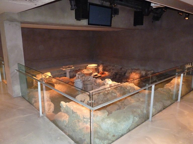
The excavation covers approximately 3,500 square metres on the former slope toward the Tyropoeon Valley. Accumulated earth and construction debris cover much of the area and have preserved buried structures, including walls that collapsed suddenly during the earthquake of 363. Test drilling found bedrock about 15 metres below the western part of the site and about 9 metres below the eastern entrance. These depths show that the former slope extended westward more gently than the nearly level modern surface. Progressive filling of the Tyropoeon Valley allowed construction to spread between the City of David and the Upper City by the third century CE.
Iron Age defenses and royal buildings
Royal administrative building
In the southern and southeastern parts of the site, Iron Age remains include dense domestic construction and an unusually large building that continues beyond the excavated area. It contained Jerusalem ivory objects, dozens of wine jars flavored with vanilla, seals bearing personal names, and a luxurious second-storey floor. That floor burned and collapsed into the basement, while radiocarbon analysis places the destruction in 586 BCE. The building’s scale, furnishings, and imported or exotic goods have led excavators to interpret it as a royal administrative chamber in a wealthy city.
The building also preserves evidence of its final destruction. Sycamore beams described in a 2026 report are believed to have formed the roof of an inner courtyard before the structure was burned. A Persian-period pottery fragment shaped as a human face, Iron Age seals, and seal impressions form part of the wider collection of finds from the excavation.
Northern moat
A deep rock-cut moat occupies the northern part of the early defensive system. It was formed in approximately the ninth century BCE, ceased to function during that century, and was filled during the Hasmonean period. Rock-cut channels exposed in 2023 were provisionally associated with the moat and interpreted as part of a possible royal industrial activity whose precise nature remains unclear.
Hellenistic and Second Temple remains
Hellenistic fortifications
The Hellenistic remains include imported Greek vessels and stonework in a Hellenistic style. The fortifications attributed by some archaeologists to the Seleucid Acra include a defensive wall, a tower approximately 4 by 20 metres, and a glacis, a sloping defensive embankment outside a fortification. Bronze arrowheads, lead sling-stones, and ballista stones, which were projectiles fired by large mechanical weapons, were found with the defenses. Some ballista stones bear a trident stamp associated with the reign of Antiochus IV Epiphanes. Coins from the reigns of Antiochus IV through Antiochus VII Sidetes and numerous stamped Rhodian amphora handles add to the evidence for the Hellenistic occupation.
The identification of these remains as the Acra is uncertain. Their north-to-south orientation and their position about 200 metres from the Hellenistic Temple Mount, at a substantially lower elevation, have been used to argue that they belonged to the fortified Lower City rather than to a higher citadel overlooking the Temple.
Second Temple buildings
A large and richly built structure in the southern part of the excavation survives only in a limited exposed area. Its construction included large undressed stones and high-quality plaster, with fragments of fresco in several colors. Its tentative association with one of the palaces of Adiabene is based on historical interpretation rather than a confirmed identification. The building was destroyed during the Great Revolt.
A separate late Second Temple-period building to the north contained ritual immersion pools, or mikva’ot. The central section of Jerusalem’s late Second Temple drainage channel was also found. It ran beneath a principal paved and stepped street that crossed the city from near the Western Wall toward the Pool of Siloam in the City of David.
Roman and Byzantine remains
Roman estate
The Roman estate occupied the eastern and central parts of the excavation and covered approximately 1,000 square metres. It included a courtyard and garden, water installations, and probably a large colonnaded court identified through surviving continuous bases for columns, known as stylobates. Columns, capitals, mosaics, and other architectural elements follow Roman forms of the third century.
Fragments of wall paintings, a statue of a boxer, and a pearl earring were found in the estate. Approximately 80 roof tiles carry stamps of the Tenth Legion Fretensis, connecting the building with the Roman military environment of Jerusalem. A small onyx cameo, about 1 centimetre long and 0.7 millimetres wide, depicts Cupid in blue against a dark-brown ground. The winged figure rests a hand on an overturned torch, a symbol of death, and the round cameo was probably set into jewelry, possibly as a mourning ornament.
Byzantine residence and coin hoard
A seventh-century Byzantine building in the northern part of the site was probably the residence of a wealthy official. Its principal portion extends beneath the road descending from the Western Wall and may continue beyond the excavated area. The building used carefully cut, closely fitted stones together with many reused blocks from the Second Temple period.
A room at its western end contained 264 gold coins arranged in groups, probably within cloth or another perishable container. The coins are uniform issues probably minted in Constantinople and carry the portrait of Emperor Heraclius, who ruled the Byzantine Empire from 610 to 641. They were minted between 610 and 613, show little or no wear, and appear to have arrived together in an urgently organized shipment. The building was destroyed in 614.
Streets and drainage
The western edge of the excavation contains a Byzantine street approximately 6 metres wide, exposed for about 30 metres. It formed part of a paved route running north to south down the slopes of the City of David. Early Islamic remains include well-built primary and secondary drainage channels. Their construction reflects organized urban infrastructure and identifies the area as part of a market district within the City of David.