Mateo Salado: A Ychsma Administrative and Ceremonial Center in Lima, Peru
Site at a Glance
- Rating
- 4.4
- Popularity
- Medium
- Country
- Peru
- Primary era
- Medieval
- External website
- Open
- Eras represented
- Medieval, Early Modern
- Civilizations
- Inca
- Site type
- Religious
- Remains
- Sanctuary
On this page19 sections
History
Mateo Salado is a Ychsma administrative and ceremonial-religious center in Lima, Peru, built mainly during the Late Intermediate Period, probably beginning around AD 1100. The Ychsma were a pre-Inca culture of the central Peruvian coast known for monumental architecture made from compacted earth and large adobe blocks. Construction and expansion continued during the period of Regional Cultures, approximately from AD 1200 to 1430. Some archaeologists, including Luis Guillermo Lumbreras, have linked the site’s beginnings to the earlier Wari cultural tradition.
Ychsma and Inca occupation
Mateo Salado appears to have been politically and economically important in the lower Rímac Valley. The Ychsma community was probably politically autonomous and took part in regional exchange networks. Building and maintaining the complex required the organization of substantial labor forces, reflecting its administrative and ceremonial importance.
The Ychsma occupied the site until the arrival of the Incas. Inca control of the region is generally placed between approximately AD 1450 and 1532, following the conquest of the area around 1470. The Incas respected and altered the complex, incorporated it into the Qhapaq Ñan, the interconnected road system of the Inca Empire, and probably used some of its buildings as cemeteries. Mateo Salado may also have become the residence of the local curaca, a community authority who governed the valley on behalf of the Inca. Its principal plaza may have hosted religious festivals and helped organize labor.
Colonial transformation and changing names
European arrival in the 1530s was followed by abandonment and extensive damage. Colonial and later republican looters disturbed the complex, while agricultural use, brickmaking, and informal occupation altered its fabric. Colonial farmers remained in the area until the early nineteenth century. From the second half of the nineteenth century, brickmakers, farmers, and precarious occupants used parts of the archaeological site.
The name Mateo Salado derives from the Hispanic form of Matheus Salade, a French hermit who reportedly lived among the pyramids during the 1560s. He was presumably Lutheran and had come to Peru while concealing his faith. After criticizing the privileges and splendor of Catholic priests, he was accused of heresy and burned at the stake on November 15, 1573. His execution took place at the first auto de fe held in Lima, a public ceremony connected with the announcement and enforcement of inquisitorial sentences, and he is regarded as the first victim of the Spanish Inquisition in Peru. He was also identified as one of the early looters of the pyramids.
The complex’s original name is uncertain. In the sixteenth century, Indigenous people from Maranga, Huadca, Lima, Pacán, and Amancaes were concentrated in Santa María Magdalena de Chacalea, about one kilometer south of the site. Twentieth-century researchers applied altered forms of that settlement’s name, including Chayacala, Chayacalca, and Chayacalta, to the archaeological complex, but this identification is considered arbitrary. In the eighteenth century, the pyramids were called Huacas de Ríos, after the Ríos estate or Chacra de Ríos. Later names included Cinco Cerritos, referring to the appearance of the five pyramids, and Ascona, after a nearby former estate.
Early descriptions and archaeological research
The earliest known written description dates from 1638, when Antonio de la Calancha presented the site as an Inca residence and a temple of fishermen and related the story of Matheus Salade. A document from 1774 called the complex Huacas Chacra Ríos. Thomas J. Hutchinson visited and described the pyramids in 1873.
Julio C. Tello visited Mateo Salado in 1935, 1936, and 1941, producing its first plans and scientific studies. He also opposed the brickmaking companies that demolished portions of the pyramids to reuse earth from their walls. Pedro Villar Córdova, Hermann Buse de la Guerra, Santiago Agurto, and Rogger Ravines later conducted further investigations. The most complete early record of the five pyramids was prepared by Duccio Bonavia, Ramiro Matos, and Félix Caycho in 1962 and 1963.
Urban damage and recovery
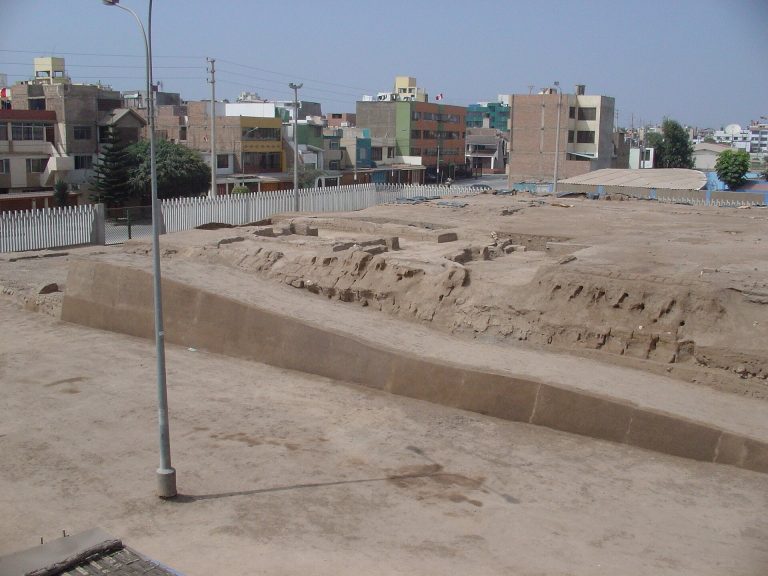
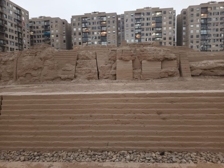
The complex suffered major destruction during the republican period. Brickmaking companies removed parts of the pyramids from the second half of the nineteenth century into the first half of the twentieth. In 1940, the AVEP Urbanization Company demolished part of the monument. A settlement was established in 1963 at the intersection of present-day Tingo María and Mariano Cornejo avenues, and construction of Plaza de la Bandera destroyed part of the former perimeter wall in 1979. Unplanned urban growth eventually divided Mateo Salado into three separated sectors.
In Pyramid B, Bonavia, Matos, and Caycho found a relief showing two seabirds joined at the beak. The relief was reburied for protection, but the wall carrying it was later destroyed. A recreation based on Félix Caycho’s drawing became the complex’s logo.
Maritza Pérez directed excavation and conservation work in Sector B of Pyramid B in 2000. From July 2007, the Ministry of Culture continued archaeological research, conservation, and recovery. Work concentrated on Pyramid A from 2007 to 2008, Pyramid B from 2008 to 2010, and Pyramid E from late 2012 through 2013, recovering approximately 35 percent of the complex’s total area. The program removed areas occupied by automobile mechanics in 2010 and built a perimeter enclosure to reduce the risk of further invasions. Conservation followed principles of authenticity and minimal intervention, stabilizing the remains and clarifying their layout without extensive reconstruction.
Excavation revealed evidence of colonial and republican looting, brickmaking, and nineteenth-century Chinese migrants who worked agriculturally on estates in Lima. Mateo Salado was declared Cultural Heritage of the Nation in 2001, and its three sectors were defined as an intangible archaeological zone. The complex is state property and is publicly administered through the Mateo Salado project. Its long-term recovery and community-management program has been presented as a model for archaeological heritage recovery in Peru.
Remains
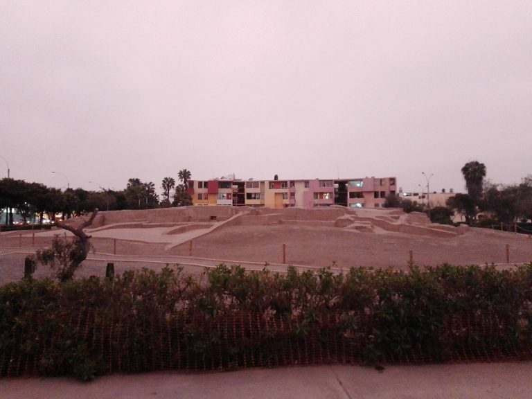
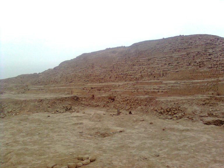
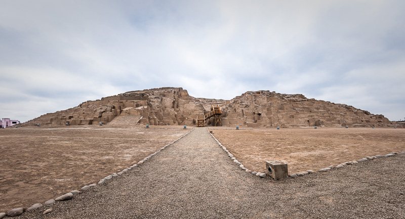
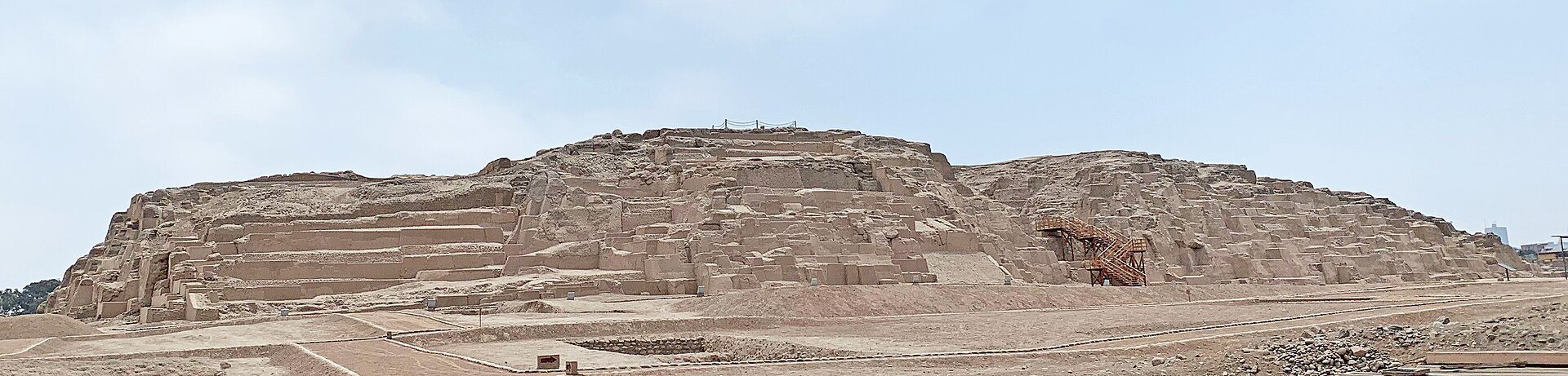
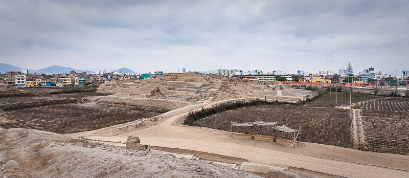
Mateo Salado covers approximately 16.4 hectares and consists of five stepped, truncated pyramidal mounds known as A, B, C, D, and E. The structures were built mainly with large rammed-earth walls and adobe blocks in the Ychsma building tradition. Modern urbanization separates the complex into three sectors. Sector A contains Pyramids A, B, C, and E, Sector B contains part of the wall that formerly enclosed three pyramids, and Sector C contains Pyramid D. The letter designations were formalized in the 2001 heritage delimitation.
Principal pyramids
Pyramid A
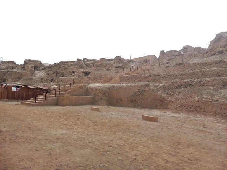
Pyramid A, also called the Main Temple, is the largest mound, measuring approximately 18 meters high and 164 meters long. It was probably the principal temple. A large ramp or stairway on its northern front connected it with the extensive main plaza, while broad courts occupied the summit. Stairways on two sides led from these courts to lateral platforms. The name Main Temple was assigned by Pedro Villar Córdova, and the summit was affected by early looting. Conservation work later stabilized and clarified parts of the pyramid without extensive reconstruction.
Pyramid B
Pyramid B, known as the Pyramid of the Birds, is the second-largest mound and contains extensive rooms and plazas. It may have served as a residence or palace for the ruling elite, or as a temple associated with local Ychsma fishermen. Bird imagery appeared in reliefs, paintings, and graffiti on its walls, while bird designs were also found on gourds and spindles during work from 2008 to 2010. The best-known relief showed two seabirds joined at the beak. Although the original wall no longer survives, its design is preserved in a recreation based on Félix Caycho’s drawing.
Pyramid C
Pyramid C has a quadrangular plan and is approximately 9 meters high. It measures about 85 meters from north to south and about 73 meters across. Large rooms rise in stepped succession from north to south, forming a distinct sequence within the mound.
Pyramid D
Pyramid D is the first pyramid outside the walls that enclosed the principal group. It is approximately 8 meters high and oriented toward the sea. The mound forms part of Sector C, separated from the other pyramids by modern urban development.
Pyramid E
Pyramid E, also called the Minor Funerary Pyramid, is the second extramural pyramid and the smallest of the five. It measures approximately 50 meters long, 40 meters wide, and 6 meters high. Like Pyramid D, it faces toward the sea. It may first have served as a Ychsma temple and was later reused as a cemetery during the Ychsma-Inca period. Excavation identified a food-storage area that may have been built during the Inca occupation, followed by the building’s use for burials.
Plazas, roads, and enclosure walls
Plazas and ceremonial features
Plazas in front of the monuments functioned as forecourts or approach areas. One contained an ushnu, a raised ceremonial platform used for ritual acts, public ceremonies, and displays of political authority. At Mateo Salado, it may also have served as a seat or throne for the local curaca. Archaeological work identified the Podium Plaza in 2008, a ceremonial well in 2009, and the Yellow Ceremonial Stairway in 2012.
Roads and walls
The complex may once have been connected to the Maranga archaeological complex by a narrow walled road. A nearby walled road associated with the Inca period formed part of the coastal branch of the Qhapaq Ñan. A large wall on the eastern side protected Mateo Salado. The site formerly had a larger perimeter wall, part of which was destroyed during construction of Plaza de la Bandera in 1979.
Burials and recovered objects
Pyramid E cemetery
Excavation in Pyramid E identified 53 Ychsma burials from the Inca period, of which nine were intact. Some of the intact funerary bundles remained well preserved. Associated finds included vessels, tools for textile production, agricultural implements, and a large funerary bundle with a false textile head. The pyramid also contained the burial of a Chinese migrant dating from the late nineteenth century, linking the mound to the agricultural and migrant history of republican Lima.
Other archaeological finds
Excavations recovered textiles, ceramic utensils, a camelid-shaped carving made from spondylus, a large marine shell valued in ancient Andean societies, and a decorated wooden piece with incised designs. Another wooden carving represents a seated figure holding a cup, with a bird perched on its head. These objects, together with the architectural remains, illuminate the ceremonial, administrative, and funerary uses of the complex.
Conservation and presentation
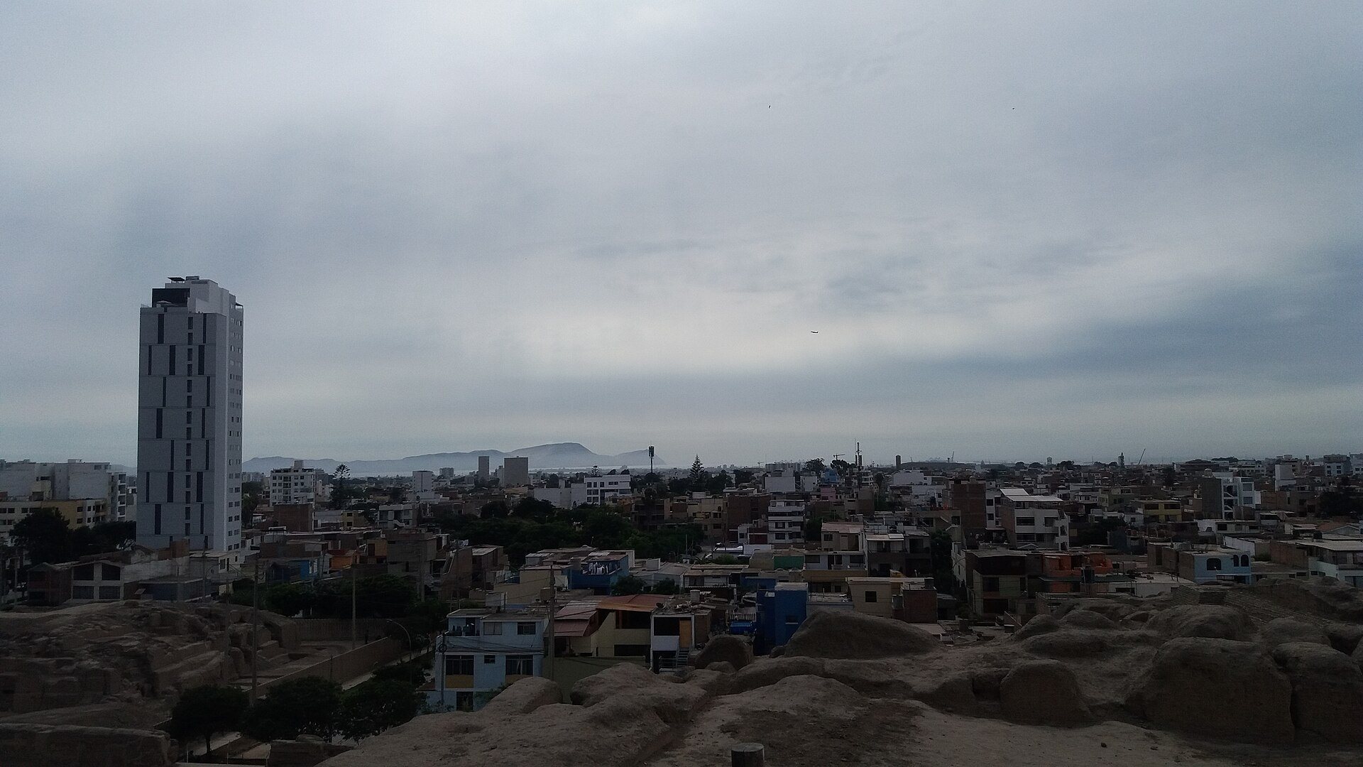
Conservation and visitor-management works stabilized and presented portions of Pyramids A, B, and E while retaining the surviving fabric. Paths were filled or redirected through open areas to protect underlying structures, and steep slopes were modified to permit movement without damaging the archaeological remains. A twenty-three-story residential building, 56 meters high, was constructed opposite Pyramid E in 2013. Its construction endangered the pyramid and workers, and the completed building created a negative visual impact, including in views from Pyramid A.