Tayasal: A Maya Archaeological Site on Lake Petén Itzá
Site at a Glance
- Rating
- 4.4
- Popularity
- Very Low
- Country
- Guatemala
- Primary era
- Classical
- Eras represented
- Classical, Medieval
- Civilizations
- Maya
- Site type
- City
On this page13 sections
History
Tayasal is a Maya archaeological site on a peninsula in Lake Petén Itzá, Guatemala, occupied from the Middle Preclassic period, around 1000 to 350 BC, through the Late Postclassic period and the Spanish conquest era, approximately AD 1200 to 1539. Its strongest early development came during the Late Preclassic period, around 400 BC to AD 250, when Maya communities built monumental architecture, triadic pyramids, and ceremonial complexes across the region.
Preclassic and Postclassic Tayasal
During the Late Preclassic, Tayasal participated in wider Maya architectural and political developments. A triadic pyramid consisted of a dominant central building flanked by two smaller structures on a shared platform. Tayasal also included an E-Group, a ceremonial arrangement formed by a western structure and an eastern platform carrying three buildings. These features show that the peninsula was an active center within broader Maya traditions before the florescence of many Classic-period cities.
Occupation continued through the Classic and Postclassic periods. Most Postclassic activity was concentrated along the southern shore of the peninsula, which lies within the core of the Itza territory around Lake Petén Itzá. The Itza were a Maya-speaking political group that controlled this region during the Postclassic period. Early colonial accounts describe the peninsula as a place where the Itza frequently conducted rituals.
The name Tayasal derives from a corruption of Tah Itza, meaning “Place of the Itza.” That name originally referred to the heartland of Itza territory. It was later applied incorrectly to the archaeological site and now also refers to the peninsula containing Tayasal and the village of San Miguel.
Spanish conquest and colonial communities
A musketball excavated at Tayasal provides evidence of contact with the Spanish. Spanish forces defeated the Itza ruler Kan Ek’ at Nojpetén in 1697. Kan Ek’ was an Itza royal title used by the ruler who led the polity at the time of the conquest. The defeat was followed by a Spanish reorganization of local populations into mission communities around Lake Petén Itzá.
Missions were established on the peninsula at San Miguel in 1702 and at San Bernabé in 1703. By 1734, seventeen mission settlements stood around the lake, including San Bernabé, San Miguel, San Andrés, and San Jerónimo. Many mission inhabitants were local Maya rather than migrants from distant communities. Historical and archaeological evidence connects Maya groups identified as Kowoj and Mopan with San Bernabé, while colonial material remains reflect cultural changes under Spanish rule. San Bernabé’s population declined sharply during the eighteenth century because of high infant mortality.
Archaeology and protection
Guthe excavated at Tayasal in 1921 and 1922, followed by Morley’s work in 1937 and 1938 and further investigations during the 1950s and 1960s. The University of Pennsylvania excavated the site in 1971 and 1977 and mapped 339 structures. The Proyecto Maya Colonial carried out a month-long investigation in 1996. Since 2009, the Proyecto Arqueológico Tayasal has emphasized the period of Spanish contact and the early colonial era, while also remapping the site to correct errors in the 1971 plan.
Tayasal became a national monument in 1931 and remains protected as a national monument. In 1994, the Instituto de Antropología e Historia defined the boundaries of the protected area.
Remains
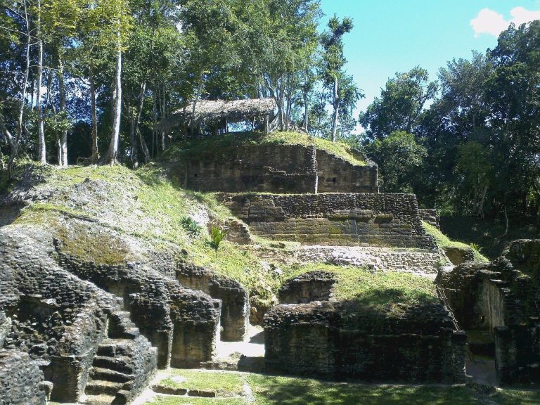
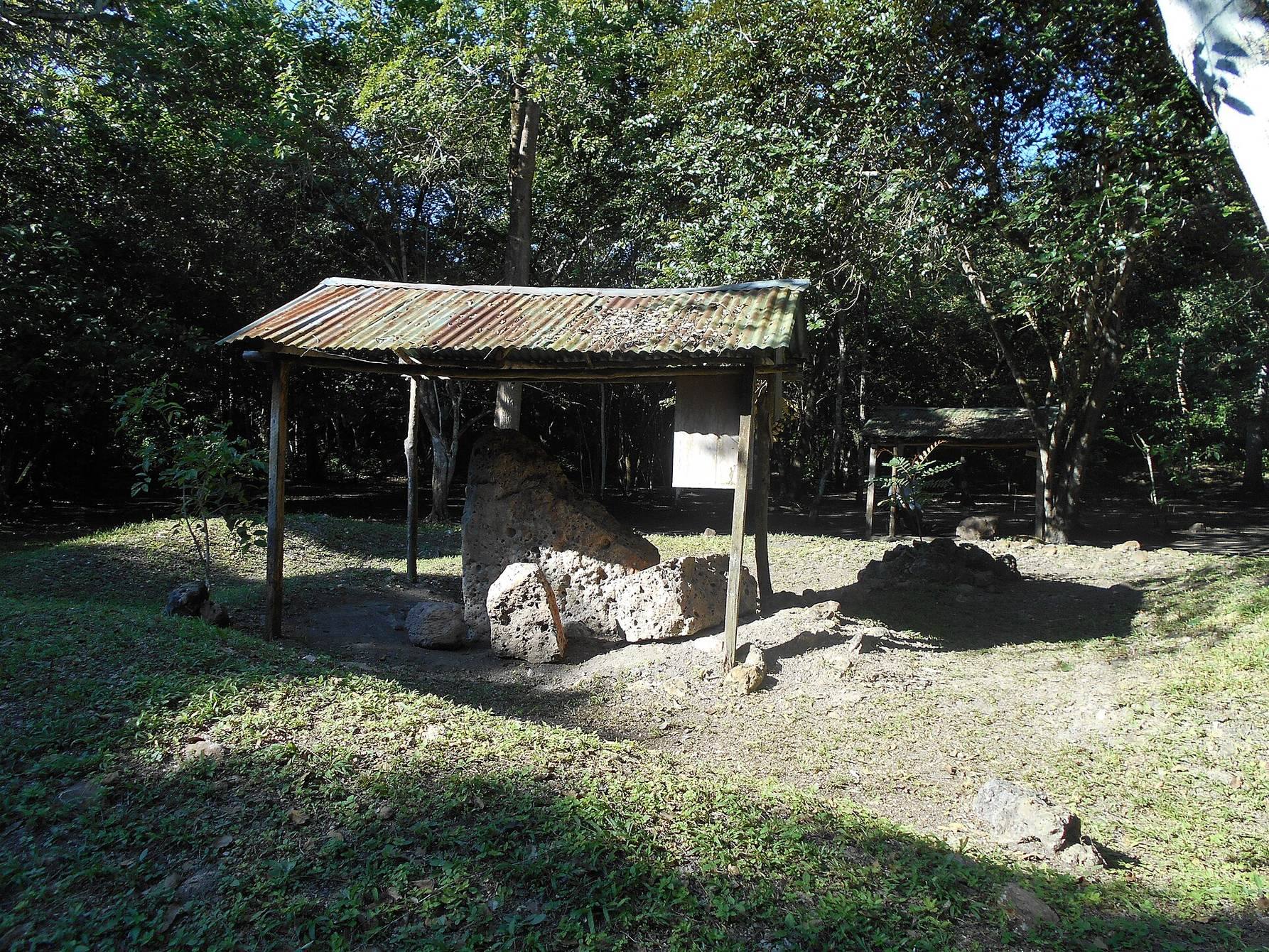
Tayasal covers approximately 2.75 square kilometres on a peninsula in Lake Petén Itzá, a short distance north of Flores. Water separates the peninsula from Flores by about 270 metres. The protected area is bounded by the lakeshore to the north and west and by the modern village of San Miguel to the south and east. San Miguel probably covers part of the Postclassic settlement. Within the site are large open plazas, palaces, pyramid-temples, an acropolis, defensive walls, residential buildings, and a cenote, a natural sinkhole or water-filled depression associated with limestone terrain. Excavations recovered as many as fifty burials and twelve caches, while stelae, upright stone monuments that could carry carved imagery or inscriptions, stood in the main plaza.
Late Preclassic ceremonial architecture
Mirador del rey Kan Ek’
Mirador del rey Kan Ek’, or “King Kan Ek’s Lookout,” comprises Structures T65 to T67 on the higher part of the peninsula. Built during the Late Preclassic period, it is a triadic pyramid formed by a massive pyramidal platform, a single access stairway, a principal structure, and two smaller buildings flanking it. The arrangement places the three structures on one elevated architectural complex.
Cerro Moo
Cerro Moo, made up of Structures T256 to T258, is another Late Preclassic triadic pyramid on the peninsula’s higher ground. Its central building and two flanking structures follow the triadic arrangement used in other major Maya ceremonial centers of the period.
Group 23
Group 23 lies southwest of the acropolis and appears to have been constructed during the Late Preclassic as an E-Group. Its axis runs 9 degrees south of the east-west line, leading investigators to interpret it as a ceremonial complex rather than an astronomical observatory. A western radial structure faces a long eastern basal platform supporting three buildings. Later construction, including a group of Late Postclassic structures, covered the radial structure.
San Bernabé area
The San Bernabé area occupies the northwestern part of the peninsula and contains several Late Preclassic structures. Two platforms in this area preserve evidence of construction, later use, and activity extending into the colonial period.
Structure T29
Structure T29 is a Late Preclassic platform measuring 23 by 23 metres and standing 0.5 metres high. It was reused during the Postclassic and continued in use during the colonial period. Excavations around the platform recovered a Spanish silver coin, probably a real, tin-glazed maiolica pottery, and a lead bullet. The platform probably supported a colonial-period residence.
Structures T30 and T30a
Structure T30 is an elongated circular platform in the northwestern part of the site. It measures 23 metres from east to west and 18.7 metres from north to south, and stands 1 metre high. Dating to the Preclassic period, it served as the basal platform for four structures designated T30a through T30d.
Structure T30a is a circular platform 5.17 metres in diameter and 22 centimetres high. Its wall consists of three courses of soft limestone blocks, and its fill contains soil mixed with small stones. Potsherds from the fill belong to the Late Preclassic Chicanel phase, an archaeological phase associated especially with the Petén region. Ritual deposits from the Late and Terminal Classic periods show that the platform continued to be used after its construction, while material in its eastern fill dates to the Terminal Classic period.
Burials and excavated objects
One burial at Tayasal dates to the Terminal Classic period, around the eighth century AD. Three excavated vases accompanied the individual. Their imagery is characteristic of Maya artefacts from the surrounding Petén region and is thought to express concerns associated with elite status, comparable to those represented on carved stelae at neighboring sites.