Monte Negro, Tilantongo: A Mixtec Civic-Religious Center in Oaxaca
Site at a Glance
- Rating
- 4.5
- Popularity
- Very Low
- Country
- Mexico
- Primary era
- Classical
- Eras represented
- Classical
- Civilizations
- Mixtec
- Site type
- City
On this page13 sections
History
Monte Negro, Tilantongo, is a Mixtec archaeological city and civic-religious center on Cerro Negro near Santiago Tilantongo in Oaxaca, Mexico. Built during the Early Ramos Phase, part of the Mesoamerican period before the rise of the major Classic-period states, it dates to about 300 to 100 BC. The settlement was occupied for little more than a century before it was abandoned, although it continued to hold symbolic importance for Mixtec communities.
Origins in the Mixteca Alta
Monte Negro emerged during a period when permanent urban centers were developing in Oaxaca. It was broadly contemporary with the early growth of Monte Albán, the major Zapotec urban center in the Central Valleys. Some radiocarbon evidence has been interpreted as possibly placing Monte Negro earlier, but the principal archaeological dating assigns its construction and occupation to the Early Ramos Phase.
The city followed two earlier settlements in the Tilantongo area. A settlement near Diuxi covered about 49.52 hectares during the early Cruz Phase, approximately 1500 to 850 BC. Another settlement at La Providencia covered about 91.57 hectares and existed between roughly 850 and 300 BC. Local populations appear to have moved successively toward higher ground before establishing the urban center on Cerro Negro.
The origin of Monte Negro is understood as local rather than as the result of a Monte Albán military colony or an Aymara settlement. Its foundation seems to have accompanied pressures generated by the consolidation and expansion of Monte Albán, together with the wider development of urban centers in the Oaxaca highlands. Interaction among Mixtec and Central Valley populations brought exchanges in ceramics, architectural ideas, and shared forms of religious expression, with additional influences connected to the Gulf of Mexico region.
Urban development and abandonment
Monte Negro formed part of a wider period of urban growth in the Mixteca Alta, alongside Yucuita, Cerro Jazmín, and Huamelulpan. These developments took place amid population movements, military activity connected with the Central Valleys, the expansion of the Monte Albán state, and efforts to find alternative routes toward the Pacific coast.
The reason for the settlement’s final relocation remains uncertain. Survey indicates population growth between the Cruz and Ramos phases, but also a change in settlement form. Communities became more concentrated around the urban center as lower settlements were abandoned. A defensive purpose has been proposed, although clearly defensive architectural elements have not been identified. Agricultural pressure is also questioned because the lower valleys offered better farmland than the rocky mountain slopes.
After its abandonment, Monte Negro remained a symbolic place for Mixtec communities from the Postclassic period to the present. Its meaning has been considered in relation to Mixtec origin traditions, traditions concerning water, and the historical kingdom of Tilantongo. The site is therefore connected not only with an early urban phase but also with later understandings of Mixtec history and identity.
Rediscovery and archaeological work
The Oaxacan historian Manuel Martínez Gracida learned of Monte Negro in modern times in 1892 and wrote about it in 1910. An earlier reference may occur in a 1674 geographical description by Francisco de Burgoa, although identifying that reference with Monte Negro remains interpretive.
Systematic excavation began in 1937 during the seventh season of the Monte Albán explorations and continued through 1940. Alfonso Caso, whose work helped establish institutional archaeology in Mexico, directed most of the investigation, while Jorge R. Acosta directed the final season. The archaeologists recorded structures and stratigraphy, searched for tombs, and compared the settlement with early Monte Albán. Their work also influenced interpretations of early Zapotec-Mixtec interaction and the development of Mexican archaeology.
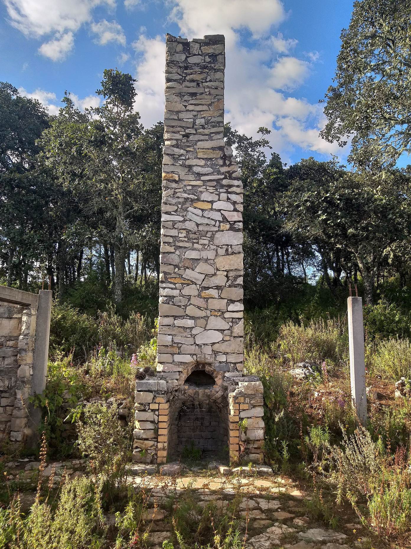
Because the summit stands about 2,600 meters above sea level, roughly 500 meters above Tilantongo and far from a permanent water source, a field camp was built between 1936 and 1937. The architect Armando Nicolau designed the camp. Excavations involved residents of Tilantongo as well as members of the Monte Albán research team.
Later regional investigations expanded knowledge of the settlement. Byland and Pohl published a larger map in 1994, while the 1999 Central Mixteca Alta Settlement Pattern Project defined an area of about 78 hectares. Between 2000 and 2004, Alexander Geurds and students from Leiden University worked with residents of Cerro Negro and the Oaxaca regional center of Mexico’s National Institute of Anthropology and History to map the site, assess its conservation, and develop interpretations of the ceremonial center’s symbolism. Scattered piles of excavation debris have sometimes been mistaken for ancient architectural mounds.
Remains
Mountain settlement and architectural groups
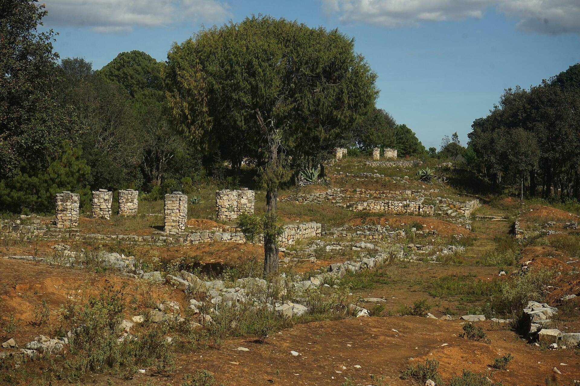
Monte Negro occupies the summit of Cerro Negro and extended across approximately 78 hectares. The excavated monumental area represents only part of the settlement. Two principal architectural groups were identified, one arranged along a north-south axis and the larger one along an east-west axis beside a causeway. Earlier interpretations described an inverted L-shaped plan with two separate nuclei, while later mapping identified additional elements that suggest continuity between them and adaptation to the mountain’s contours.
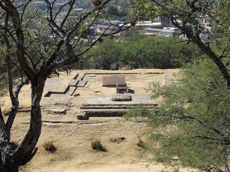
At least four enclosed plazas formed the center, each associated with residential units and buildings that controlled movement between spaces. A causeway was bounded by structures, and one excavated group followed streets more than 100 meters long. These streets ran east-west and north-south. The largest identified plaza measured about 20 by 20 meters and was enclosed by a temple and other buildings.
Temples and plazas
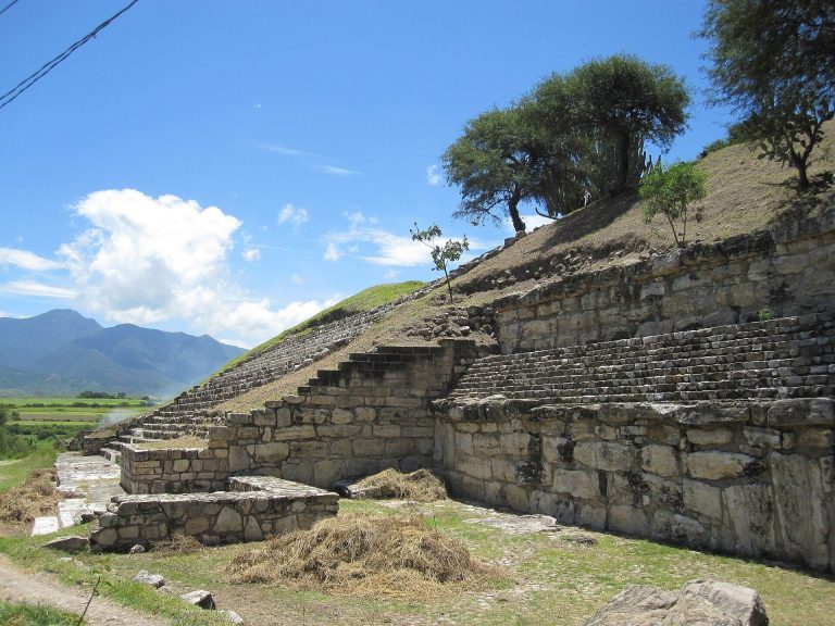
Temples varied in size and internal arrangement, but they stood on stone platforms equipped with stairways and column supports. Residential units near temples and plazas included more elaborate examples interpreted as elite housing. Their identification rests partly on their proximity to ceremonial spaces and on the greater quantity of carved stone associated with them.
Stone columns and construction
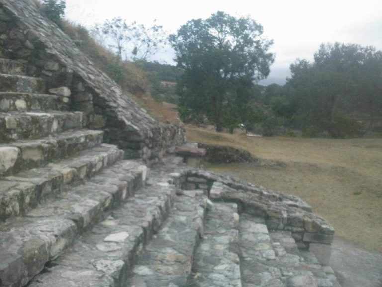
The buildings generally consisted of a single structural body with vertical walls that rarely exceeded about 2 meters in height. Their upper sections used adobe or wattle-and-daub, some of which survives. Most structures were quadrangular and arranged around large patios. Floors were made from stone paving, stucco, or compacted earth, while stone stairways led to adobe structures built on raised platforms. The stairways lacked side parapets.
Round stone columns are among Monte Negro’s distinctive architectural features. Builders formed them from stacked stone drums or irregularly cut stones, bonded and leveled with mud before covering them with smaller stones. The columns reached about 3 meters high and occurred in both residences and temples. Column bases were also associated with platforms whose foundations used limestone blocks and rubble.
Drainage and mountain terraces
Some residential patios had paved floors with a central opening. One such opening contained a simple clay tube, leading Jorge R. Acosta to interpret these patios as possible impluvium arrangements, courtyards that collected or directed rainwater through a central opening. Sloping drains beneath several buildings curved around the architectural center, and four additional clay tubes found in rubble provide evidence for a wider drainage network.
Agricultural terraces extended down the mountainside toward the valley floor, about 500 meters below the site. The terrace system, known as lama-bordo, used stone retaining walls to hold soil and water on sloping ground. Rebuilding the walls over time created deep redeposited soils suitable for cultivation. Maize was the principal crop, although frost at the settlement’s elevation shortened the growing season.
Burials and excavated materials
Tombs and interments
Excavation uncovered six tombs and 20 burials. Most were primary interments, and their locations followed no consistent pattern. Some pits were covered with slabs resting on the edges of the excavation or with irregularly placed stones, possibly representing an intermediate form between simple pits and formal tombs.
The tombs were rectangular chambers with walls, floors, and flat roofs but no doors or entrances. Other burial structures used adobe blocks with stone or wooden roof beams, while some people were placed in simple pits. The range of burial forms reflects different construction practices within the settlement.
Human remains and offerings
Human remains include examples of oblique annular cranial deformation, the deliberate reshaping of the head during infancy, as well as a smaller number of skulls with straight tabular deformation. One adult had dental mutilation, including a pyrite inlay in the upper canines and additional inlays and filing along the cutting edge of the upper right central incisor. The remains also provide evidence of decapitation among men and trepanation, a surgical opening made in the skull.
Some elite burials contained ceramic offerings together with shell and jade ear ornaments. Other recovered materials included stone sculpture, obsidian knives, carved and modeled bone, and turtle shell. These finds help connect burial practices with the social distinctions expressed in the settlement’s ceremonial and residential areas.
Ceramics and regional connections
Excavated ceramics include ochre, brown, gray, red, and black-on-red painted wares. The vessels include jars, bowls, spoons, and tortilla griddles. Some gray vessels with red and black painting were probably imported from elsewhere in Oaxaca, while similarities in clay composition link other ceramics with Monte Albán. Creamware bowls and jars from the Postclassic period, recognizable by their yellow to yellow-orange color, were also found across the terraces.
Monte Negro does not follow a standardized Mixtec urban plan. Its enclosed plazas, residential compounds, ceremonial buildings, drainage works, terraces, and controlled movement instead represent a local experiment in organizing an urban center and its administration on a mountainous site. The surviving remains preserve both the settlement’s distinctive design and its connections with the wider cultural changes of the Oaxaca highlands.