Archaeological Site of Nicopolis: Roman Victory City and Early Christian Capital




Site at a Glance
- Rating
- 4.4
- Popularity
- Low
- Country
- Greece
- Primary era
- Classical
- External website
- Open
- Eras represented
- Classical, Medieval
- Civilizations
- Byzantine, Roman
- Site type
- City
On this page22 sections
History
The Archaeological Site of Nicopolis in Greece, near Preveza, preserves the Roman city founded by Gaius Julius Caesar Octavian after his victory over Mark Antony and Cleopatra VII of Egypt at Actium in 31 BC. The city commemorated that victory, controlled western Greece alongside Patras, and developed into a major urban and commercial center. Its public monuments, sacred precincts, and later churches preserve the city’s development from the Augustan period through Late Antiquity.
Foundation and the Actian Games
Octavian created Nicopolis by bringing together earlier settlements, including Kassope, Ambracia, and Leukas. Some inhabitants were forcibly relocated to the new city. Roman descriptions call Nicopolis a Roman colony, a free city, and an Augustan colony, while its exact legal status remains debated. Its position as a free city is explicitly attested.
Octavian dedicated Nicopolis to Apollo Actius and revived the Actian Games, earlier contests associated with the Acarnanians. The games were held every four years and combined religious observance with athletic, artistic, and equestrian competitions. The first New Actian Games probably took place in September 27 BC. They continued, perhaps with an interruption during the reign of Caligula, until the third century AD, when the spread of Christianity brought the ancient athletic festivals to an end.
The competitions included running, wrestling, boxing, pankration, the pentathlon, horse races, poetry, rhetoric, tragedy, comedy, music, recitation, and pantomime. Competitors were divided into boys aged 13 to 16, beardless youths aged 17 to 20, and men aged 21 and above. Spartans under Euricles, a Spartan leader associated with Octavian, initially administered the games. Later, responsibility passed to the Nicopolitans through the Sacred Actian Council.
The area for the contests was chosen near the hill where Octavian had established his headquarters before the battle. This decision presented the victory as divinely sanctioned and transformed the battlefield landscape into a sacred precinct. Apollo was worshipped at Nicopolis as Leucadius and Agyieus. Inscriptions also record the worship of Poseidon and Ares, while other cults included those of Zeus, Dionysus, Hermes, Hephaestus, Asclepius, Hecate, Pan, Heracles, Attis, Artemis, Isis, Cybele, and the imperial cult of Octavian.
Roman expansion and urban prosperity
Nicopolis expanded rapidly between the Ionian Sea and the Ambracian Gulf. Its two associated harbours, Komaros and Vathy, supported its commercial role. The city acquired a theatre, stadium, gymnasium, odeon, aqueduct, fortifications, baths, and other civic monuments. Buildings were repeatedly altered during the Roman period. The Great Theatre belonged to the Augustan building program and received extensive renovation under Hadrian, probably between AD 100 and 150. The stadium was enlarged, probably in the late first or early second century AD, and partly converted from an athletic venue into a place for gladiatorial combats and animal fights.
Nicopolis became the capital of Epirus Vetus, the late Roman province of Old Epirus created during Diocletian’s administrative reforms. It also became the seat of the provincial governor and the archbishop of the province. This ecclesiastical status helps explain the construction of several large basilicas and the continued importance of the city after its civic and religious life had begun to change.
Late Antiquity and contraction of the city
The spread of Christianity altered Nicopolis’s public and religious life. The sanctuary monuments of the Proasteion, a suburban precinct containing the Actian monuments, were eventually abandoned after the athletic contests ended. Christian churches became important centers of religious, social, and political life, and six Early Christian basilicas have been identified. Basilica B is regarded as the cathedral and metropolitan church because of its size and luxurious construction, while Basilica D served as a cemetery church outside the later fortifications.
The Herulian incursion in the mid-third century exposed weaknesses in the Augustan defenses. The Vandals captured Nicopolis in AD 474, and forces of the Ostrogothic king Totila plundered the city in AD 551. After the Vandal capture, the defended area was reduced to the northeastern sector of the earlier city. This enclosure covered about 274 stremmata, or 27.4 hectares, roughly one-fifth of the area enclosed by the Roman walls, leaving the Forum and other major Roman public buildings outside the new defenses.
The date of the Early Christian fortifications remains uncertain. An older interpretation connected them with the sixth-century emperor Justinian, while current research places their construction broadly in the second half of the fifth century, perhaps under Zeno or Anastasius. The available evidence does not securely identify which ruler was responsible. Nicopolis gradually declined and was superseded by Preveza during the Middle Ages. After the ancient city was abandoned, architectural elements were reused at Arta and elsewhere during the Despotate of Epirus, the Venetian and Ottoman periods, and later times.
Antiquarian study and archaeological work
Antiquarian study began with the visits of Ciriaco de’ Pizzicolli in 1435 and 1436. William Martin Leake visited in 1809 and identified several places mentioned by Strabo, including the headquarters of Augustus, the gymnasium, and the harbour at Vathy. Thomas Smart Hughes visited in 1813, and Thomas Leverton Donaldson visited in 1820 and prepared the first topographical plan of the city and plans of important monuments.
Systematic archaeological work began in 1913 under Alexander Philadelpheus. Finds kept in the mosque of Preveza were destroyed when the building was bombed during the Second World War. Research resumed from 1925 under Georgios Miltiades and Anastasios Orlandos. John Papadimitriou began a major research program in 1940, but the war interrupted it.
The Archaeological Service has continued excavation, restoration, and conservation through the regional Ephorates. The Scientific Committee of Nicopolis was established in 1987 to protect and promote the antiquities and develop the site as an archaeological park. A wider archaeological-park program divided the area into eight monument zones, including the Proasteion with its Stadium, Gymnasium, and Great Theatre. Conservation of the Great Theatre began in the early 1950s, followed by emergency structural work in the 1970s and 1980s. Test trenches in 1990 and stabilization work in the early 2000s clarified and supported parts of the theatre.
From the 2000s onward, excavation, stabilization, restoration, architectural and topographical recording, and geophysical survey were undertaken in two major phases. Work exposed parts of the lower auditorium, orchestra, stage, western side entrance, retaining wall, curtain mechanism, and western staircase, while inscriptions, sculptures, coins, and architectural members were recovered and conserved. The archaeological site is protected under national and international legislation and covers approximately 13,500 stremmata. Its remains preserve successive phases of Nicopolis without substantial disturbance of the archaeological layers by later settlements.
Remains
Nicopolis occupies the neck of the Preveza peninsula between the Ambracian Gulf and the Ionian Sea. The Roman city followed a rectangular grid of north-south and east-west streets, while the Proasteion formed a sacred and public landscape around the Sacred Grove. The principal surviving monuments include the Great Theatre, Stadium, Actium Monument, Gymnasium, baths, necropolises, Early Christian fortifications, basilicas, roads, drainage systems, and aqueduct installations.
Urban grid and Proasteion
The cardo maximus ran north to south and the decumanus maximus east to west. Parallel streets defined urban blocks that probably measured about 56 by 165 metres, although practical deviations occurred. The main east-west street was paved with large rectangular limestone slabs and incorporated channels in its pavements. It measured about 14.80 metres wide and extended for approximately 1,500 metres between the western gate and the eastern side of the fortifications. Its western continuation led toward the Ionian harbour at Komaros, while the eastern route approached the road to Vathy, although its final connection with a gate remains uncertain.
A section of the main north-south street, also about 14.80 metres wide, was found north of the Odeon. It had a sewer and a brick inspection shaft. Smaller streets beside the Houses of Manius Antoninus and Georgios the Advocate were about 7.40 metres wide and connected to large sewers. Within the Proasteion, the Sacred Grove contained the Actium Victory Monument, the Stadium, and the Great Theatre.
Great Theatre
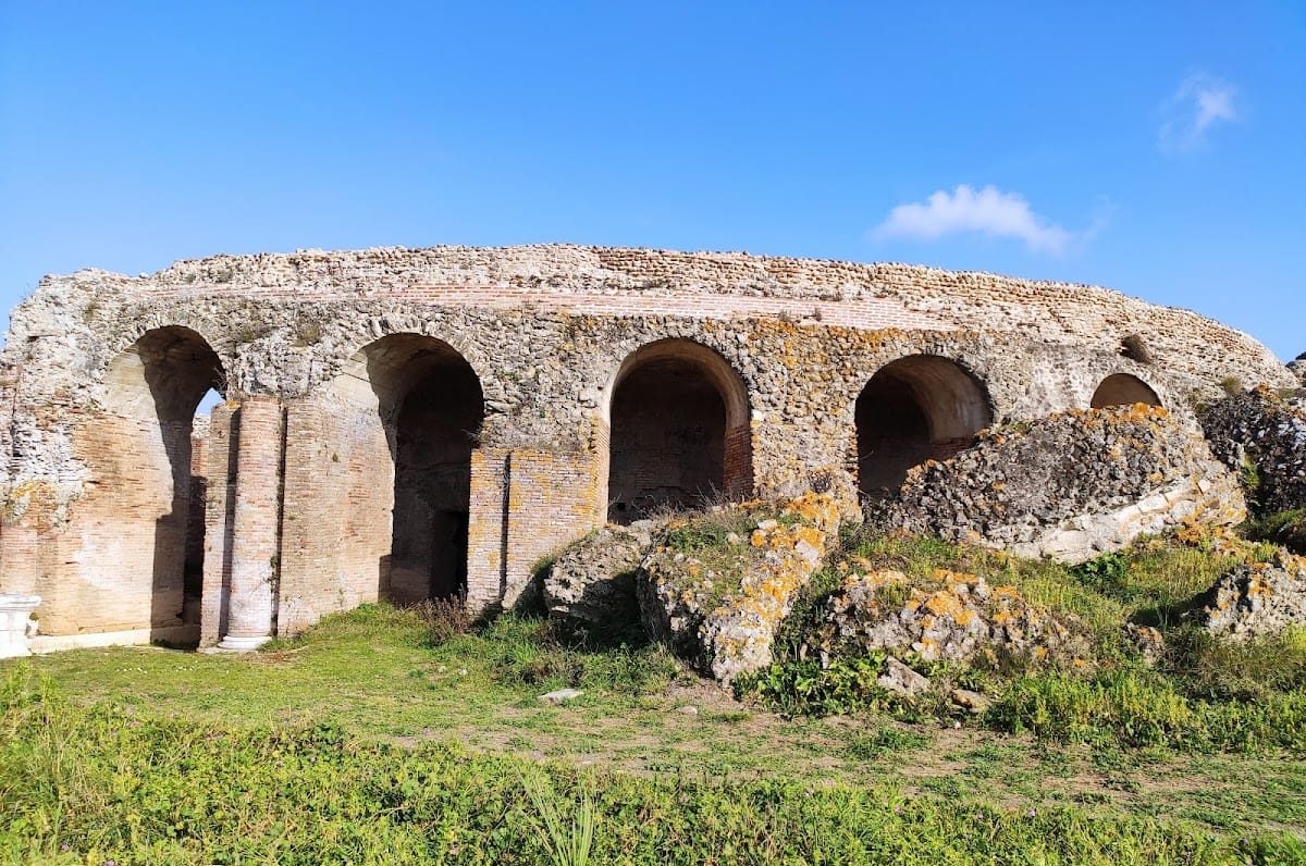
The Great Theatre stands on the southern slopes of the Sacred Hill of Apollo, northeast of the Stadium. Its orientation differs from the city streets because it was adapted to the natural slope. The Roman-type building has a semicircular outer retaining wall, stage retaining walls, vaulted entrances, an upper and lower auditorium, a raised stage, orchestra, side entrances, and stone seating. Its first construction phase dates to the late first century BC or early first century AD and included the outer wall, retaining walls, side entrances, and parts of the auditorium and stage building.
The lower auditorium rests on the natural slope, while the upper section stands on stone-built supports. Buttresses reinforce the semicircular outer wall, and projecting pairs of stones preserve the supports for wooden poles that carried an awning over the spectators. Three vaulted audience entrances led through corridors to the original passage separating the upper and lower seating. Staircases served the two lateral entrances, while a portico at the top of the auditorium was bounded by a continuous brick wall with three symmetrically placed doors.
The walls beside the stage were built from large blocks reused from earlier buildings, many of which retain sockets or other traces of their earlier use. Two sloping vaulted corridors led to the orchestra. A tribunal for officials stood above the western side entrance, and traces of a corresponding structure survive at the eastern side. The upper seating rested on concrete supports, although much of it was removed in the past. A few seats remain, some bearing inscriptions that identify their holders, while numerous lower seats survive on the natural ground.
The semicircular orchestra measures about 22 metres across and retains a polychrome pavement of large limestone and marble slabs. The later stage building measures approximately 44 by 6 metres and survives in places to about 9 metres above the present ground. Constructed entirely in Roman brickwork, it replaced the original stage building while retaining its alignment and incorporating some earlier walls and foundations.
The straight stage facade was about 37 metres long and had three arched ground-floor entrances. The central royal doorway stood in a niche, flanked by two shorter side doors. A two-storey projecting colonnade with a straight entablature decorated the facade. Behind it, a narrow space about 2.70 metres wide formed the post-stage area and was roofed at least at first-floor level by seven transverse vaults. The raised performance platform measured about 4.5 metres wide. Its front had alternating semicircular and rectangular niches faced with polychrome marble, with the curtain mechanism running behind them.
Stadium
The Stadium lies south of the Actium Monument between the Theatre and Gymnasium, on the lower slopes of the Sacred Hill of Apollo. It is oriented east-west and has an elliptical plan with earthen embankments, fragments of seating foundations, entrances, and retaining walls. Its unusual two-curved-end form is a stadium-amphitheatre, a transitional design between a Greek stadium and a Roman amphitheatre.
The first phase had a horseshoe plan and a concealed entrance on the axis of the curved end. It was built for the athletic contests of the Actian Games and was probably complete by September 27 BC, when the first New Actian Games were held. The building measured about 218 metres long and 58 metres wide, while its track was approximately 200 metres long and 23.50 to 24 metres wide.
A second curved end was later added on the western side, with three entrances to the track. Three more entrances were built on the northern, southern, and eastern sides, and a podium 2.60 to 2.80 metres high was constructed around the arena. These changes probably belong to the late first or early second century AD and correspond to the stadium’s later use for gladiatorial combats and animal fights. The northern side used the natural slope, while fills retained by walls formed the eastern curved end and southern side.
Actium Monument
The Actium Monument occupies two artificial terraces on the slopes of the Sacred Hill of Apollo, at the location of Augustus’s headquarters during the battle. The lower terrace had two parallel retaining walls. The upper terrace was formed by a monumental retaining wall and cross-walls, whose surviving anchor-shaped cuttings held the bronze rams of captured ships belonging to Antony and Cleopatra. About 36 rams are estimated to have been installed.
A dedicatory inscription, originally about 54 metres long and found in fragments south of the retaining wall, recorded the dedication of Augustus’s headquarters to Mars and Neptune and referred to its decoration with naval spoils. The upper terrace contained a triple-shaped portico with Doric and Corinthian colonnades. Its walls carried frescoes with linear and plant motifs, while Corinthian-type roof tiles and terracotta architectural members included relief decoration such as wolf and dolphin waterspouts.
The open center held a richly decorated elongated altar, of which the foundations survive. Two square bases stood symmetrically to its north. One may have supported a bronze group representing the donkey Nicon and its driver Eutychus, whose meeting with Augustus was interpreted as a favourable omen before the battle. About thirty fragments of small perforated pots found around the courtyard suggest an organized garden. The garden and altar were probably dedicated to Apollo. A rectangular room, probably an imperial-cult building known as an Aedes Augustalium, was added to the northern wing during the first century AD after Augustus’s death.
Gymnasium and northern baths
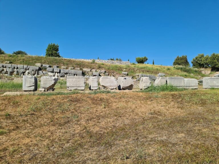
The Gymnasium lies southwest of the Stadium and is identified with the gymnasium of the Proasteion mentioned by Strabo. Its surviving walls are mainly built in Roman brickwork. The complex probably included an open exercise area surrounded by a colonnade, rooms, a training court, and baths. Semicircular remains at the western end of the field probably belonged to the bathing rooms. A funerary monument in the Gymnasium area had a rectangular podium measuring 11.10 by 11.94 metres and two brick-built chambers. Excavations in 1940 recovered fragments of marble statues and moulded architectural members, which are now lost.
The northern baths, known locally as Bentednia, lie about 570 metres south of the Stadium, west of the funerary road from the North Necropolis toward the Proasteion. Their rooms radiate around a large semicircular platform and include vaulted corridors, rectangular halls, and spaces with numerous apses. A branch from the city aqueduct supplied the complex. Its exact date is uncertain, but similarities in plan and construction technique with buildings at Hadrian’s Villa suggest a Hadrianic date.
Necropolises and mausolea
Several cemeteries surrounded Nicopolis. Their use extended from the first century AD into the early fourth century, while grander second-century mausolea reflect the prosperity of the city under Trajan and Hadrian. Monumental tombs near the Stadium probably belonged to prominent local figures associated with the organization and administration of the Actian Games.
Mausolea near the Stadium
Two mausolea were excavated a few metres from the eastern curved end of the Stadium. The northern tomb was temple-shaped and stood on a stone-faced concrete podium. Steps on its western side led to a probable Ionic entrance hall, and stone sarcophagi probably surrounded the burial chamber. It dates to the second half of the second century AD. The second mausoleum, about one metre to the south, was a rectangular brick structure. Its northern wall had buttresses between which were three brick-built cist graves. Four undecorated stone sarcophagi and another brick cist grave survived inside.
Five fragments of a marble sarcophagus decorated with high-relief scenes of the Labours of Heracles were found between the two tombs. The sarcophagus contained at least three disturbed burials, the earliest dating to the second half of the second century AD.
North Necropolis
The North Necropolis lay outside the Northwest Gate on both sides of a funerary road leading toward the Stadium and Actium Monument. Its southern part contained enclosures with as many as fourteen graves, including brick-built cists, tile-covered graves, infant burials in large storage amphorae, and cremation burials in clay or stone urns.
The northern area contained above-ground mausolea arranged along the road, either as separate buildings or in groups linked by passageways. Their vaulted burial chambers had pitched roofs and floors of limestone slabs, bricks, marble inlay, or mosaics. Some interiors were faced with marble. The cemetery included decorated marble sarcophagi made locally or in Attica, imported Assos-type stone sarcophagi, and simpler limestone examples.
Western Necropolis
The Western Necropolis extended beyond the monumental Western Gate along the continuation of the main east-west street toward Komaros. More than 160 graves were investigated near the wall, including cist graves, limestone sarcophagi, and receptacles for cremation urns. Some graves were built one above another, while large family cists held as many as thirteen individuals.
Three robbed chamber mausolea survive near the Western Gate. They are approximately square or rectangular and preserve fragments of marble sarcophagi decorated with flowers, erotes, garlands, and satyrs. Two large parallel rooms about 300 metres from the Ionian Sea may have been associated with commercial activity because of their coastal position.
Southwestern and southeastern cemeteries
The Southwest Necropolis began at the Southwest Gate and followed a paved funerary road 5.40 metres wide, with pavements on both sides. Excavation about 100 metres from the gate exposed part of the road, three mausolea, and 23 graves. Poor grave goods and repeated reuse suggest burials of lower-status people, while the mausolea may have belonged to wealthy citizens or freed persons seeking social status.
The Southeast Necropolis extended from the Southeast Gate along the road to Vathy. Mausoleum 6, dated to the first century AD, had a high quadrangular podium and cylindrical upper structure, a vaulted corridor, and a three-sided vaulted chamber faced with reticulate masonry and red mortar. Mausoleum 12 was a large chamber tomb dating approximately to the middle of the second century AD. Its roughly square vaulted room had a western entrance and large arched recesses for sarcophagi, framed by smaller niches.
A funerary enclosure south of the western semicircular gate tower contained two chamber mausolea. One had a white mosaic floor and sarcophagi around its perimeter; the other had a rectangular-tile floor and preserved an Assos-type sarcophagus. Three further chamber mausolea and about sixty graves were found south of the eastern tower and wall.
Early Christian fortifications
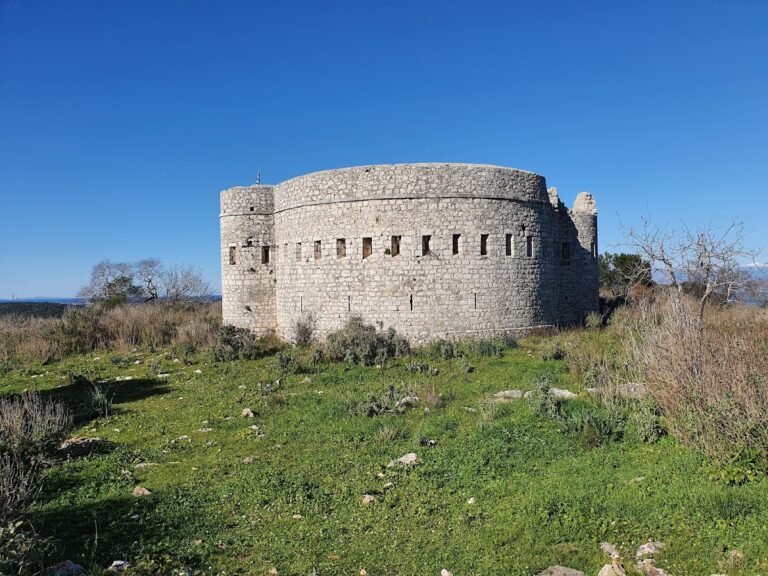
The Early Christian fortifications have a trapezoidal plan and a perimeter of approximately 2,072 metres. Their walls survive in places to 12 metres high. They incorporated and heightened sections of the Roman defenses while adapting to the earlier urban grid. The southern wall had twelve towers at intervals of about 33 metres, including rectangular, horseshoe-shaped, and polygonal forms, as well as circular and polygonal corner towers.
The western wall had sixteen towers, including eleven rectangular towers, circular corner towers, horseshoe-shaped towers beside the Western Gate, and another circular tower beside a smaller gate. Tower intervals ranged from 26 to 40 metres. The walls had stone foundations of two or three courses, monolithic lintels above entrances, and one or two relieving arches with masonry tympana. The western wall preserves a wall-walk and better-preserved stairways.
The cores were made from mortar, rubble, stone and marble fragments from Roman monuments, pieces of statues, and bricks taken from the Augustan wall. These reused elements reflect the abandonment of important Roman public buildings by the Early Christian period. The western and southern walls belong to separate building phases. The western wall was built more carefully and includes areas of brick decoration, while the largely unexplored northern and eastern sections reused the Roman wall. A large triangular bastion in the eastern section probably had an associated ditch connected with the Mazoma lagoon.
Early Christian basilicas
Basilica A
Basilica A, also called the Basilica of Dometius, lies in the southern part of the Early Christian city near the junction of the main east-west street and a north-south street leading to the southern gate known as the Beautiful Gate. Dedicated to Saint Demetrius, it was a three-aisled, timber-roofed church with a projecting three-part cross-arm, atrium, entrance hall, and ancillary buildings.
A monumental porch led into a paved atrium surrounded by three porticoes with mosaic floors. The entrance hall contained a mosaic of plants and animals arranged within 88 interlocking circles. A southern apsidal annex probably served as a room for liturgical offerings. The central nave was wider and slightly raised, while the side aisles had polychrome marble inlay. The church had a gabled roof over the nave and sanctuary and lower lean-to roofs over the aisles. Its sculptural decoration included double-sided screens with a Christogram and lambs on either side of a cross. Construction began around the middle of the sixth century under Bishop Dometius, and completion of the mosaic pavement under his namesake successor dates to approximately AD 550 to 575.
Basilica B
Basilica B, the Basilica of Alcison, stands in the northwestern Early Christian city about 50 metres east of the western wall. Its ecclesiastical complex covers approximately 5,900 square metres and includes the church, a partly excavated baptistery, and ancillary buildings. The five-aisled, timber-roofed basilica had a three-part cross-arm that did not project beyond the side walls. Its size and construction indicate that it probably served as the cathedral and metropolitan church, although its dedication is unknown.
A Roman north-south street ran west of the basilica beneath a covered portico with two monumental triple-arched entrances, and a large drainage conduit ran below it. The atrium had mosaic pavements with large interlaced wheels, a rectangular tank, and marble basins. The entrance hall had a geometric mosaic and a central royal doorway with a marble frame. Four colonnades, each of twelve monolithic columns, divided the church into five unequal aisles.
The sanctuary contained a marble canopy, altar, stepped episcopal throne, priestly seats, and rear passage. Annexes had marble inlay or mosaic floors and included a partly preserved baptistery. A reused cylindrical altar dedicated to Asclepius served as the wellhead of one well, with its inscription still visible. An inscription identifies Bishop Alcison as the founder of the southwestern annexes. The basilica was built in the middle or second half of the fifth century and underwent additions under Alcison in the late fifth or early sixth century, interventions under Bishop Dometius in the middle of the sixth century, and further work in the late sixth or early seventh century.
Basilica D
Basilica D stands on the low hill of Karaouli overlooking the Ambracian Gulf, outside the Early Christian walls and near the Roman Southeast Gate. It was discovered during excavations for a telecommunications antenna in the early 1950s. Its location and internal burials identify it as a cemetery basilica. The three-aisled, timber-roofed church had a projecting three-part cross-arm, entrance hall, atrium, and annexes. A probable portico extended beyond the northwest corner of the atrium and provided access from the road.
The entrance hall retains part of a geometric mosaic with a wreath of multicoloured flowers and fruit. The main church had Ionic columns, a central nave with cut-marble inlay, and side aisles with irregular marble or stone paving. The sanctuary preserved the altar base, priestly seats, and stepped base for the bishop’s throne. A finely made marble sarcophagus from a Constantinopolitan workshop and a cist grave containing at least six individuals were found beside the sanctuary. The privileged burial may have been that of a martyr, while the adjacent grave is interpreted as a burial placed near a saint or martyr. Two further cist graves contained eighteen individuals, supporting the interpretation of some annexes as burial spaces for clergy and prominent citizens. The basilica dates to the first half of the sixth century, based mainly on its sculpture and mosaic pavements.
Aqueduct and archaeological finds
The aqueduct supplied water to the Gymnasium and baths through a branch from its main conduit. Surviving elements along its route from the Louros sources to the city include conduits, bridges, tunnels, and associated water-management structures. Together with the streets, sewers, public buildings, and fortifications, the water system preserves the infrastructure of the Roman city.
Excavation and conservation have recovered inscriptions, sculpture fragments, coins, architectural members, sarcophagi, funerary stelae, mosaics, and architectural decoration. A marble funerary stele from the Eastern Necropolis names two deceased women whose family names indicate Roman citizenship. A glass funerary vessel from the first century AD was found in its original position. These objects, along with the urban fabric and surviving monuments, trace the physical development of Nicopolis from its Augustan foundation through the Early Christian period.