Castell de Ponts: A Medieval Castle in Spain
Site at a Glance
- Rating
- 4.2
- Popularity
- Very Low
- Country
- Spain
- Primary era
- Medieval
- External website
- Open
- Eras represented
- Iron Age, Classical, Medieval
- Civilizations
- Iberian, Roman
- Site type
- Military
- Remains
- Castle
On this page15 sections
History
Castell de Ponts is a castle in Spain, above the town of Ponts, whose medieval history is first documented in 1024. It stands on the hill of Saint Peter, overlooking the confluence of the Llobregós and Segre rivers, and became one of the most extensive and notable castles in the Noguera comarca. Its upper area also preserves evidence of an Iberian settlement and a Roman fortified installation, while later medieval and early-modern phases made it an important centre of territorial authority.
Early settlement and Roman fortification
Excavations carried out in 2000 challenged the traditional view that the oldest part of the castle was a tenth-century or Andalusi-period tower. The upper part of the hill instead contained an Iberian settlement dating from approximately the third century BC. In the Roman period, this settlement was modified and enlarged through construction of a castellum, a fortified military installation smaller than a major legionary fortress, in the third century AD. A monumental lintel near the church of Saint Peter is associated with this Roman military presence.
The traditional chronology had assigned most of the complex to an eleventh-century rebuilding and the lower enclosure to the sixteenth and seventeenth centuries. Archaeological work placed the defensive wall of the lower enclosure earlier, between the eleventh and twelfth centuries. During the early-modern period, the castle was occupied only marginally before its eventual destruction.
The castle in the county of Urgell
In 1024, a judgment was pronounced in the castle church of Saint Peter. It ordered Durand, abbot of Santa Cecília de Elins, to return to Bishop Ermengol and Santa Maria de la Seu d’Urgell the church of Cortiuda and the tithes and first fruits of Castelló, which the monastery had improperly retained. Counts Ermengol II of Urgell and Berenguer Ramon I of Barcelona attended, along with Berenguer Ramon’s mother, Countess Ermessenda.
The presence of both counts indicates that Castell de Ponts was probably held under the overlordship of the counts of Barcelona and infeudated to the count of Urgell. An infeudated castle was controlled by a subordinate lord in return for obligations to a higher-ranking lord. This arrangement probably arose during Ermengol II’s minority, when his guardian, Count Ramon Borrell of Barcelona, intervened in the affairs of Urgell.
In 1057, Ermessenda sold her rights and properties in several counties, including Urgell, to her grandson Ramon Berenguer I of Barcelona. A later oath of fidelity between them, concerning the counties, castles, and rights involved, also included Castell de Ponts. Between 1053 and 1071, Countess Sança of Urgell swore fidelity to Ramon Berenguer I and Almodis for a group of castles held from them, including Ponts.
Ermengol VII of Urgell left Castell de Ponts to his son Ermengol VIII in his 1167 testament. Before 1185, Ermengol VIII donated his rights over the castle and town to his wife, Elvira de Subirats. The fortress then became closely involved in the disputes that followed Ermengol VIII’s death without a male heir. In 1228, Jaume I, also known as James I of Aragon, recovered the castle for Aurembiaix. In 1258, rivalry between the Montcada family and the Cabrera counts of Urgell led to the plundering and burning of the castle and town by Montcada forces.
Royal intervention and later lordship
In October 1268, Jaume I invaded the county of Urgell and ordered Roger Bernat III, count of Foix, to surrender the castles he held in fief. The viscount of Cardona and the count of Foix responded by making themselves strong at Castell de Ponts. Pere el Gran, or Peter III of Aragon, besieged the castle in 1279 during his conflicts with rebellious nobles. The following year he entrusted it to the knight Guillem Moliner, but jurisdiction returned to Berenguer de Puigverd, lord of Ponts, in 1282.
The castle remained involved in later political and military struggles, including the war against Joan II. In 1427, Ramon de Casaldàliga was lord of the castle and town. After the revolt of the count of Pallars, the Crown confiscated Castell de Ponts in 1491 and incorporated it into its own possessions. The action followed the marriage of Hug Roger of Pallars to Caterina Albert, whose father, Felip Albert, was lord of Ponts, Maldà, and Maldanell.
The Albert family recovered the castle at the beginning of the sixteenth century and undertook repairs. In 1572, however, it sold the property to Bernat de Codina, treasurer of the Principality of Catalonia. The Codina family remained lords of Ponts until 1648.
Destruction and archaeological interpretation
Castell de Ponts was badly damaged after the War of the Spanish Succession, an early-eighteenth-century conflict over the Spanish monarchy. Its final destruction came in 1839, during the Carlist Wars, nineteenth-century civil wars fought largely over succession and the political order in Spain. Troops sent by the Count of Spain blew up the castle.
The surviving remains are protected as a cultural asset of national interest in the category of historic monument. The excavations of 2000 reshaped the interpretation of the site by identifying an Iberian settlement, a later Roman military installation, and medieval defensive work within the complex. Together, these phases place the castle in a history extending from the pre-Roman communities of the Iberian Peninsula through Roman military occupation and medieval lordship to its destruction in the nineteenth century.
Remains
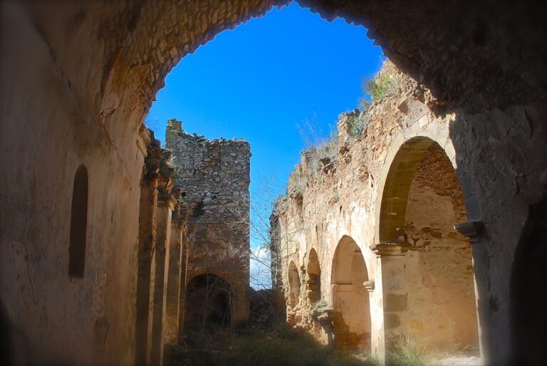
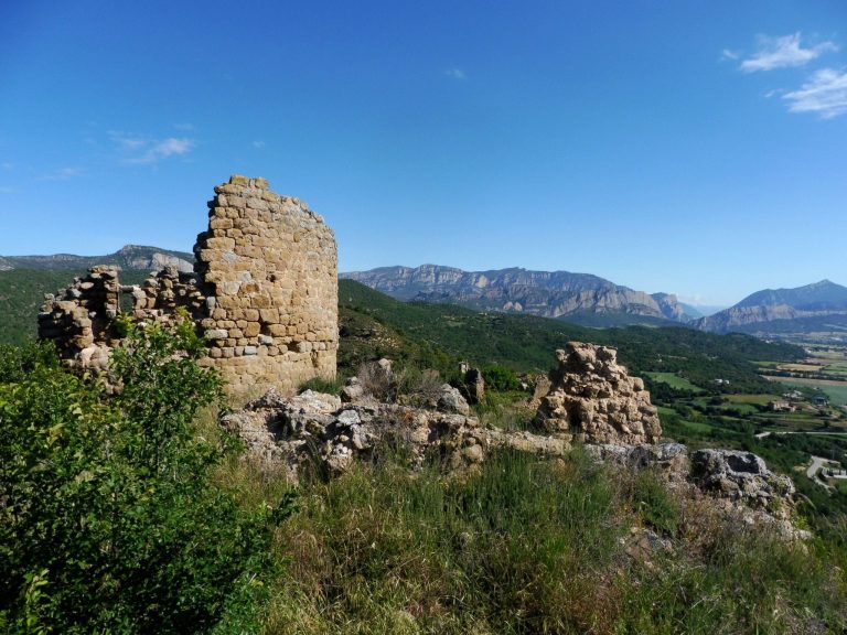
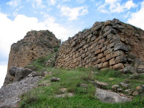
The castle occupies the summit of the hill of Saint Peter, approximately 528 metres above sea level, on the eastern side of Ponts. A cliff naturally protects the southern and western sides. The surviving complex is organized around a circular main tower, an upper enclosure with associated buildings, and a substantially larger lower enclosure. Many principal elements remain distinguishable across the hilltop.
Upper fortification
Main tower
The main tower stands at the highest point of the fortification and was built in two stages. Its central body has an internal diameter of 2.2 metres and walls 2.7 metres thick. Large, fairly square ashlar blocks, approximately 40 by 30 centimetres, are arranged in courses and bonded with thick mortar composed mainly of lime. A later external casing surrounds the original structure. It is especially visible on the southeast side, where its thickness varies from 1 to 1.7 metres according to the ground around it. The tower survives between 2 and 6 metres high.
The casing is built from elongated rectangular stones, approximately 30 by 15 centimetres, laid in courses with a finer mortar containing more lime. Large sections of circular wall lie at the tower’s foot and probably resulted from its destruction during the Carlist Wars.
Upper enclosure walls
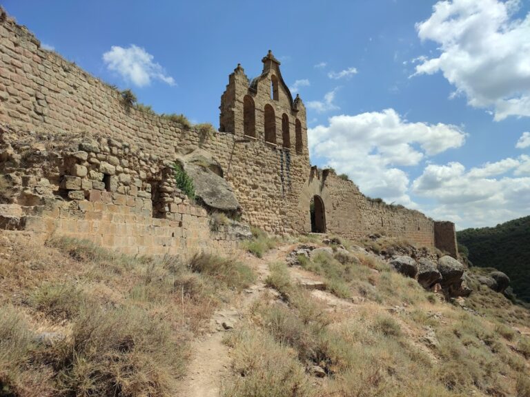
The upper enclosure has a broadly rectangular plan, with sides measuring approximately 30 metres. Its southern and western sides follow the cliff and meet at an almost right angle. The more accessible eastern and northern sides form a broadly semicircular line. The perimeter wall is generally 1.2 metres thick and uses medium-sized, elongated ashlar blocks, approximately 15 by 30 centimetres, laid in courses in a manner similar to the outer casing of the main tower.
A badly damaged quadrangular turret survives at the northern end of the western wall. At the centre of the northeast wall, a projecting body extends for 7.6 metres and projects between 45 and 90 centimetres beyond the curtain wall. Its corners are built with larger and more carefully worked ashlar blocks.
Buildings inside the upper enclosure
A nave attached to the tower runs from east to west and is covered by a pointed vault. It is 3.6 metres wide and was probably about 8.5 metres long. At its end stands a similarly oriented wall approximately 15 metres long and 80 centimetres thick, with a doorway opening through it.
Farther east, close to the projecting body of the enclosure wall, is a structure approximately 5.6 metres long and perhaps 6.5 metres wide. Its walls are 1.2 metres thick and are built from large blocks measuring about 30 by 40 centimetres. Additional wall remains exposed by unauthorised excavations have a relationship to the other structures that remains uncertain.
Lower enclosure and associated features
Lower defensive wall
The lower enclosure is much larger than the upper one and has a broadly rectangular plan. Its eastern and western sides measure approximately 100 metres, while its northern and southern sides measure about 80 metres. Six slightly battered quadrangular turrets are attached to the wall. Each is approximately 4 metres square. The wall is about 1.2 metres thick, and some sections retain a later sloping talus, a reinforcing base added against the masonry.
Rock-cut press base
Within the lower enclosure is a large cylindrical press basin or mill base cut into the rock. A spout at its base forms part of the surviving feature and indicates the practical use of this installation within the enclosure.
Roman and ecclesiastical remains
Monumental lintel
Near the church of Saint Peter is a monumental lintel from an entrance associated with a Roman military installation. Its carved molding combines a rounded torus and a concave scotia, framed by narrow flat bands. Vegetal wreaths decorate the molding, while a military emblem occupies the centre. The piece connects the visible medieval castle landscape with the Roman fortified installation identified in the upper part of the hill.