Cerro do Castelo de Alferce: A Fortified Settlement in Portugal
Site at a Glance
- Rating
- 4.3
- Popularity
- Very Low
- Country
- Portugal
- Primary era
- Medieval
- External website
- Open
- Eras represented
- Classical, Medieval
- Civilizations
- Umayyad, Visigothic
- Site type
- Military
- Remains
- Fortified Town
On this page14 sections
History
The Archaeological Site of Cerro do Castelo de Alferce is a former fortified settlement in Alferce, Portugal, occupied from the Bronze Age through the Islamic period. Set on an isolated hill in the Serra de Monchique, it developed through prehistoric, Late Antique, Visigothic, and Islamic phases and controlled routes between the mountains, the coast, and Silves.
Prehistoric occupation
The earliest substantial settlement dates from the end of the Bronze Age, from the end of the second millennium BC to the first quarter of the first century AD. Its fortifications suggest a community with political and ceremonial importance. Earlier occupation during the Chalcolithic, the Copper Age between the Neolithic and Bronze Age, is also possible.
Archaeological work has identified evidence of Middle Bronze Age activity on the western summit platform. Pottery recovered in 2023 from beneath the foundations of the central fortress belonged to the Southwest Bronze Age and dated from the end of the third to the middle of the second millennium BC. These discoveries show that the later fortifications were built over a landscape used by earlier communities.
Late Antiquity and the Islamic transformation
A later settlement or fortification was established during the fifth century, within a period of regional population growth that had begun in the late fourth century. This phase belonged to Late Antiquity, the transition between the Roman world and the early Middle Ages, and continued under the Visigothic kingdom, the Germanic-ruled polity that governed much of Iberia after Roman imperial authority declined.
The site may also have been occupied during the Roman period. Joaquim Botto described a possible Luso-Roman layer, referring to interaction between Roman culture and local populations in the western Iberian region corresponding broadly to Portugal. Roman evidence around Alferce remains limited to scattered pottery fragments.
From the eighth century onward, the settlement was adapted as an Islamic hisn, a fortified settlement or defensive enclosure. The intermediate line of walls was probably built during the ninth century. The central fortress belongs to the second half of the tenth century, during the period of the Umayyads, the Islamic dynasty whose western branch ruled Al-Andalus from Cordoba.
The central stronghold probably supported the Castle of Silves and formed part of a wider group of Islamic fortifications established in the Algarve during the tenth and eleventh centuries. Its position enabled surveillance of the Odelouca and Monchique waterways, which formerly served as transport routes between the mountains and the coast, as well as of an important route towards Silves. The fortress was built over earlier defensive structures and was made conspicuous by its lime coating, which may have expressed Umayyad military authority.
Munt Shakir and abandonment
Cerro do Castelo de Alferce may correspond to Munt Shakir, a mountain described in medieval Islamic documents as strongly defended and close to the ocean. The mountain was occupied by Muladi and Berber rebels during two episodes in the ninth century. Muladis were converts to Islam and their descendants, while Berbers were North African peoples who played an important part in the history of the medieval western Islamic world. The identification of Munt Shakir with Alferce remains uncertain.
The fortress was abandoned during the tenth or eleventh century. Afterward, local inhabitants gradually removed stone from the structures. Seismic activity, agriculture, vandalism, and clandestine excavations caused further damage, particularly during the twentieth century. Construction of an access road to a rural building also led to the demolition of part of the central fortress’s northern wall.
Rediscovery and archaeological investigation
The site was known at least by the eighteenth century, when Luís Cardoso included it in the Diccionario Geographico, published between 1747 and 1751. In 1899, Joaquim Botto recorded prehistoric objects offered to the Museum of Faro by the prior of Alferce, Cabrita Neves. Botto described three superimposed occupation layers, with a Neolithic layer about five metres below the surface, Luso-Roman remains above it, and Islamic buildings over those deposits.
Test excavations began in 2002 within a research programme on warfare, rural settlement, and fortified habitation between the tenth and thirteenth centuries. A French and Belgian archaeological team continued the work in 2004. Those excavations established that the central fortress was pentagonal rather than square, as older maps had shown, and identified three corner towers.
Further surveys and excavations clarified the layout of the enclosures. A 2012 survey of the western summit platform recovered substantial Middle Bronze Age pottery. In 2014, vegetation clearance revealed more of the fortifications, including an eastern section of the second wall that may have continued towards the northeastern corner of the first enclosure and connected with a tower. A break and depression in the ground may mark an entrance.
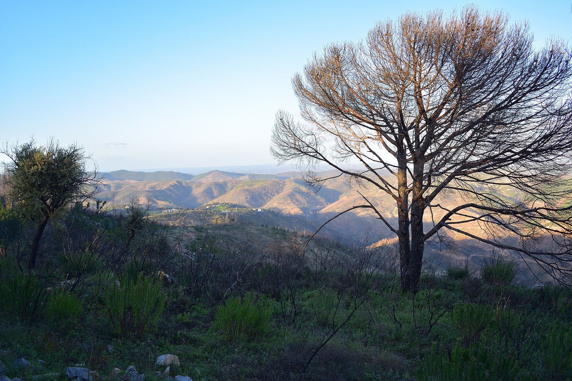
Investigations in 2017 confirmed three previously known towers, identified three more, and proposed a possible seventh. They also recorded the destruction of part of a wall, possibly during the Umayyad period, and recovered numerous pottery fragments. A forest fire in the summer of 2018 destroyed much of the uncontrolled vegetation around the site, allowing research on the northern side of the hill and revealing an entrance area and previously unrecorded wall sections. The enclosed area was then estimated at about 9.1 hectares.
Non-intrusive geophysical surveys on 9 September 2019 located buried structures and examined their depths in the site’s two principal areas. The surveys investigated possible prehistoric remains, the Islamic fortress, and the second wall line. They identified another tower and confirmed that the second enclosure was pentagonal rather than square.
A multi-year research programme submitted in 2020 examined the occupations from recent prehistory to the Islamic Middle Ages, together with the communities that used the surrounding territory. Excavations in 2020 and 2021 investigated the first enclosure, its possible entrance, the cistern, and the area between the first two walls. Work resumed in 2023 and 2024, including investigations within the central fortress and the older fortified enclosures.
The site was classified as a Site of Public Interest in 2013. By January 2020, it lay entirely within several privately owned rural properties, with a modern residential building at the southern edge of the area inside the outer wall. Regular vegetation clearance by the landowners, the Alferce parish, and the municipality has supported continuing archaeological work.
Remains
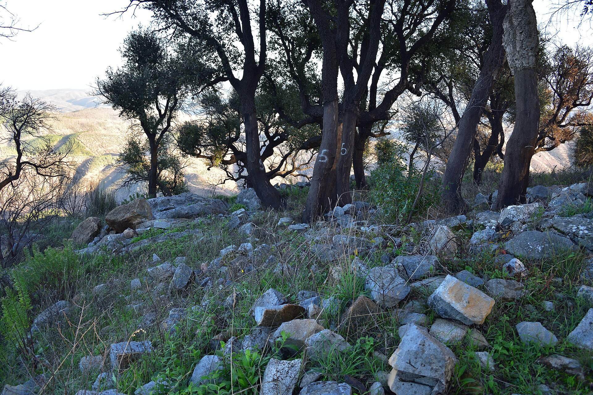
Cerro do Castelo occupies the summit of Cerro do Castelo, an isolated hill reaching 488 metres in the eastern part of Picota in the Serra de Monchique. The hill overlooks the Picota, the coastal strip, the routes between Silves and Monchique, and the basin of the Ribeira de Odelouca. Three wall lines of different sizes follow the summit and its slopes, forming an outer enclosure, an intermediate enclosure, and a central fortified redoubt.
Defensive enclosures
Outer enclosure
The outer wall followed the terrain around the hill and enclosed an elongated area oriented from north to south, covering approximately 2.1 hectares. A modern residential building stands just inside its southern limit. The wall was built from syenite blocks, a coarse-grained igneous stone similar to granite, bonded with fine-grained clay. Much of the surviving fabric consists of wall sections and collapsed or damaged areas.
Intermediate enclosure
The intermediate wall formed a pentagonal enclosure with a different orientation from the central fortress. Its fifth side faced west, while the corresponding side of the central fortress faced east. The reason for this difference is unknown, although military requirements or adaptation to the terrain have been proposed. A residential area identified through pottery lay immediately west and north of the central fortress, while another possible residential area occupied the western side near the summit.
The inner faces of the western and eastern walls include herringbone masonry, a pattern in which stones form repeated diagonal arrangements resembling fish bones. An eastern section of the wall continued towards the northeastern corner of the first enclosure and may have joined a tower. A break and depression may indicate an entrance to the enclosure.
Central fortress
The highest part of the hill held a central fortified redoubt, identified as a qasr or alcácer, a strongly fortified enclosure that could serve as a principal defensive or administrative stronghold. It stood approximately three to four metres from the intermediate wall and had an approximately pentagonal plan. At least six towers were attached to its walls, including towers at the northern, eastern, southwestern, and northeastern extremities, another on the northwestern side near the entrance, and a sixth on the southern side. A seventh tower may have stood at the southeastern end.
The central fortress was built to a higher standard than the intermediate wall. Its syenite blocks were bonded with fine-grained clay, and traces of lime plaster about five centimetres thick remained on the walls. Some sections had buttresses, possibly added to prevent collapse when the walls were already severely ruined, perhaps after earthquake damage. Excavation in 2023 uncovered a house, wall buttresses, and pottery beneath the fortress foundations, linking the Islamic structure with earlier occupation of the hill.
Water supply and storage
Cistern
A cistern stood a few metres from the inner face of the southern section of the intermediate wall. It was probably rectangular, approximately four metres long, 2.2 metres wide, and 1.5 metres high, with a depth of about 2.6 metres. Its walls included possible incised designs, while its floor was made from stone slabs and reached by several steps covered with mortar.
The nearest stream lay about 300 metres away at the bottom of the valley, making a protected water store necessary. The cistern probably had an arched covering with a vaulted roof made from ceramic tiles. Fragments found inside during the 2020 excavation probably belonged to that roof. The structure survives as one of the principal physical features of the fortified settlement.
Storage silos
Several silos were found outside the fortifications near the circuit of the oldest walls. They were probably used to store grain and other foodstuffs before being filled with stones and pottery fragments. Their contents included a complete jug base and fragments of small vessels dating from the ninth or tenth centuries. The first silos identified across the site were uncovered during the 2023 excavations.
Archaeological finds and surface features
Rock engravings appear on a granite outcrop near one of the northeastern corners of the oldest wall. They include cup marks, small rounded hollows carved into the rock, and a foot-shaped figure known as a podomorph. The figure points east. Its date remains uncertain because similar engravings occur in both later prehistory and the medieval Islamic period. Interpretations linking the direction to Cordoba, the river, escape, or sunrise remain speculative.
Twelve stone artefacts found near the summit include three polishers, two polished axes, two reciprocating hand-mill stones, two percussion tools, two adzes, and a blade. Ceramic finds include a semicircular gaming stone with graffiti, vessel fragments with nipple-shaped decoration, possible plate fragments, decorated half-round roof-tile pieces, a perforated object that may have formed part of a cheese strainer, an Islamic lamp handle, and the tip of another chain-like object. A vessel rim was considered typical of tenth-century Umayyad manufacture.
Half-round roof-tile fragments north of the second wall may indicate buildings outside the fortifications. Coarse handmade pottery from that area and the northern side of the hill probably predates the Islamic period and suggests that prehistoric occupation extended beyond the western platform. A refuse area beside one of the walls contained charcoal and abundant animal remains, including fish bones, clam shells, and bones of pig, cattle, deer, and rabbit.
Late nineteenth-century finds included a probable adze, a small handmade and polished ceramic vessel, large fragments of poorly fired pottery with rudimentary handles, and a worn loom weight. Some pottery was preserved at the Museum of Faro. The surviving remains are mainly sections of the walls, tower bases, and the cistern, with losses caused by stone robbing, seismic activity, agriculture, vandalism, clandestine excavation, and the collapse or removal of wall sections.