Dindigul Fort: A Strategic Hill Fort in Tamil Nadu
Site at a Glance
- Rating
- 4.4
- Popularity
- Medium
- Country
- India
- Primary era
- Early Modern
- Eras represented
- Early Modern
- Civilizations
- British
- Site type
- Military
- Remains
- Fort
On this page11 sections
History
Dindigul Fort is a hill fort in India, built by the Madurai Nayak dynasty on a strategic rock hill in 1605. The Madurai Nayaks were a ruling dynasty that governed the Madurai region after emerging from the political order of Vijayanagara. Muthu Krishnappa Nayakar, who became ruler in 1602, built the hill fort and another fort at the foot of the hill. Dindigul had become a northern gateway to the Madurai Nayak kingdom in 1559, giving the site an important military position.
Early and Nayak Rule
Before the rise of the Madurai Nayaks, the region had successively been associated with Chola, Pallava, Pandya, Madurai Sultanate, and Vijayanagara rule. After Muthu Krishnappa Nayakar, Muthuveerappa Nayak and Thirumalai Nayak ruled the Madurai kingdom. Dindigul gained renewed prominence during the rule of Thirumalai Nayak and later under Rani Mangammal.
The fort’s name is connected with Tamil words referring to a ground-attached ledge or pillow and to rock, an apparent reference to the form of the hill. The settlement was also known as Dindeecharam and as Padmagiri in a work by the poet Palupatai Sokkanathar. The Saiva poet Appar is said to have mentioned the town in the Tevaram.
Mysore and British Control
In 1742, the Mysore army under Venkata Raya conquered Dindigul and the fort. Dindigul then became the capital of an administrative region containing eighteen palayams, or small territories made up of several villages and generally governed by local military chiefs. In 1755, Hyder Ali was sent to Dindigul to deal with resistance from these territories. Hyder Ali was Mysore’s military leader and later became its de facto ruler. He appointed Purshana Mirsaheb governor of Dindigul in 1777, and the fort was strengthened during this period.
British forces invaded Dindigul in 1783 under Captain Long, but an agreement in 1784 returned the town and fort to Mysore. In 1788, Hyder Ali’s son Tipu Sultan became ruler of Mysore and took control of Dindigul. James Stewart captured the fort for the British in 1790 during the Second Anglo-Mysore War, a conflict between Mysore and the British East India Company. Under the settlement of 1792, Tipu Sultan ceded Dindigul and the fort to the Company.
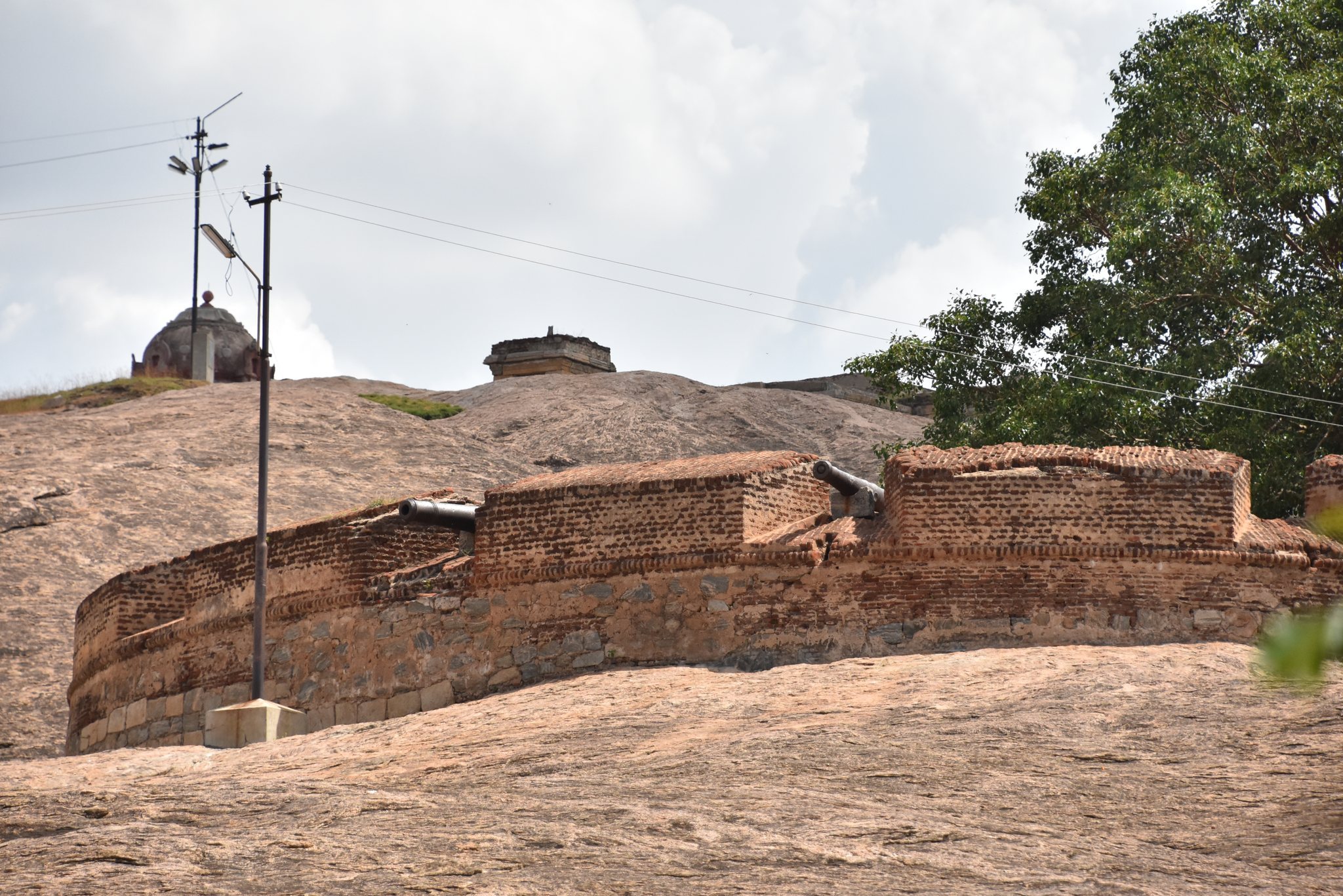
The British added cannons and built sentinel rooms at the corners in 1798. Their forces used Dindigul as a military station until 1859, when the military headquarters moved to Madurai and Dindigul was attached to Madurai as an administrative subdivision. British rule continued until Indian independence in 1947.
Conflict, Conservation, and Interpretation
Dindigul Fort played a role in the Polygar Wars, the late-eighteenth- and early-nineteenth-century conflicts between local military chiefs and expanding British authority in southern India. Gopal Nayak, the Polygar of Virupachi and commander of the Dindigul division, helped Queen Velu Nachiyar of Sivaganga and the Maruthu Pandiyar brothers remain at the fort with permission from Hyder Ali. The conflicts also involved forces associated with Tipu Sultan and support from the French.
The Archaeological Survey of India, the national institution responsible for protecting designated monuments in India, maintains the fort as a protected monument. In 2005, the surrounding area was fenced and several deteriorated structures were refurbished. Earlier neglect and unauthorized use by nearby residents had contributed to the deterioration of parts of the site, which is described as undergoing renovation.
Remains
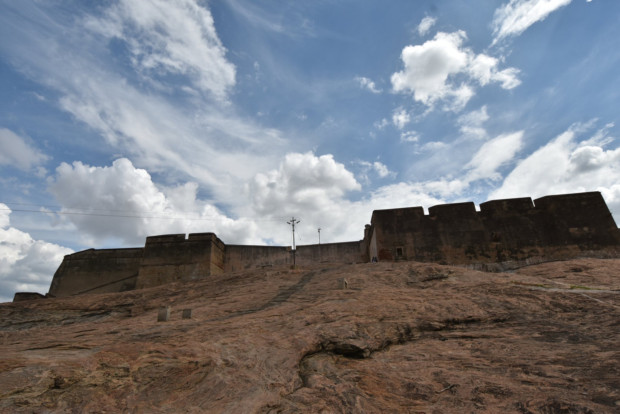
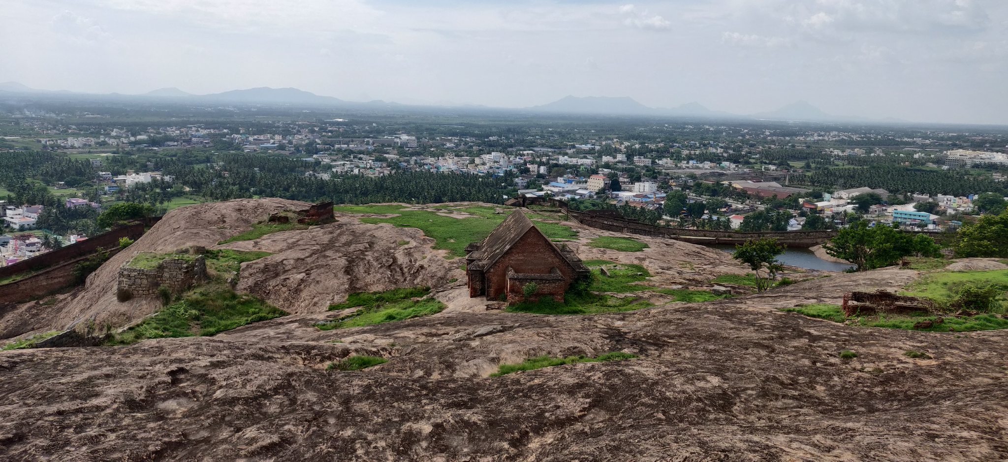
Dindigul Fort occupies a large rock hill rising about 900 feet, or 270 metres, with a circumference of approximately 2.75 kilometres. Its stated area is about 600 dunams. Granite and other stone form most of the construction, while brick appears in parts of the fort. Double walls enclose the hilltop and were designed to withstand heavy artillery. The summit overlooks Dindigul to the east, while villages and farmland extend on the other sides.
Entrances and Defensive Works
The approach to the fort includes approximately 800 steps. At the end of the staircase, a first gate opens into an inner courtyard, and a second gate leads from the courtyard into the interior. The walls contain cannon positions and spy holes, while additional defensive features include tunnels and trenches.
Artillery Positions
Cannons and gunfire artillery were incorporated into the fort during the seventeenth century. Cannons were placed at vantage points around the hill and along the walls, and at least one British cannon remains within the fort. Some cannons are described as having balls sealed inside them.
Interior Buildings and Water Systems
Forty-eight rooms served different purposes within the walls. They included accommodation or cells for war prisoners and slaves, a spacious kitchen, a horse stable, and a meeting hall for army commanders. Some of these rooms were built partly of brick. Ruins, arsenal depots, animal stables, and damaged halls with carved stone columns also survive.
Arms and Ammunition Storehouse
The arms and ammunition storehouse incorporated several protective measures. Its rooms had double walls, roof ventilation holes, and a sloping ceiling intended to prevent rainwater from seeping inside. A thin brick wall could also help soldiers escape during an emergency.
Rainwater Reservoirs
Reservoirs collected rainwater by using the steep gradients of the rock. These water systems supplied the fort’s occupants and formed part of the practical infrastructure of the hilltop stronghold.
Summit Temple
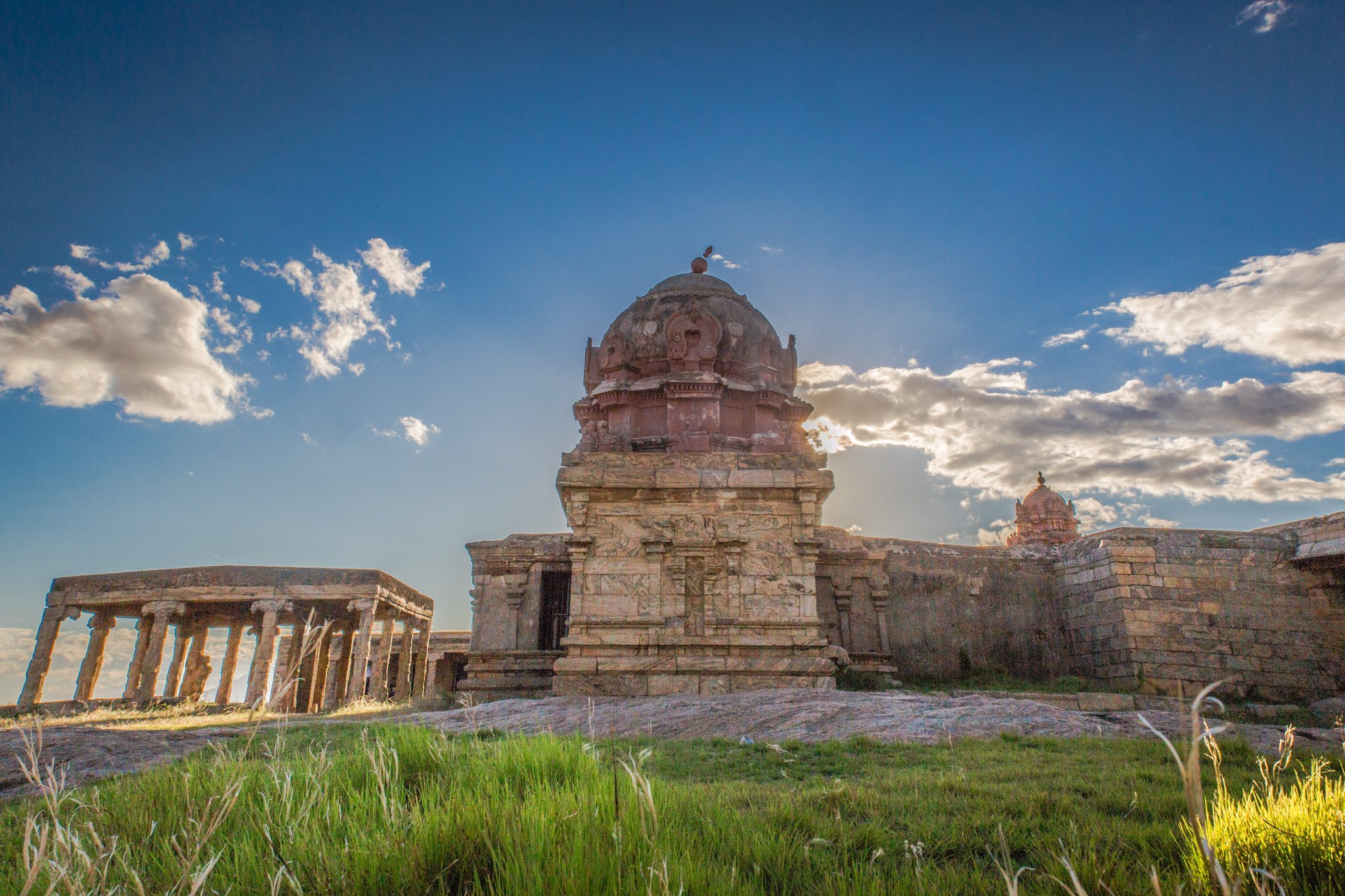
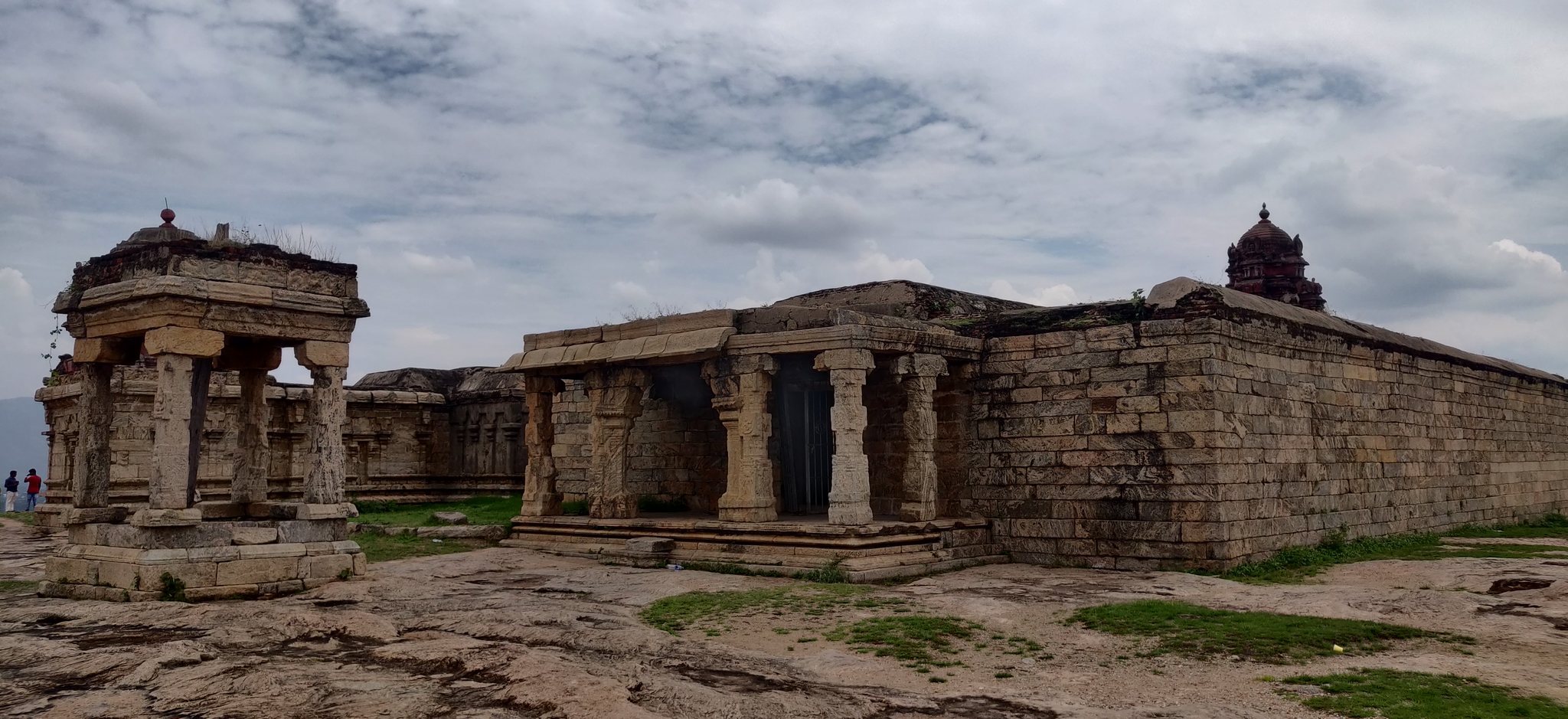
An abandoned temple complex stands at the summit and is identified as the Abirami Amman Kalaheswarar Temple. The complex contains sculptures and carvings cut into the rock, along with other religious buildings and architectural details made from carved stone. Its remains form a religious group within the otherwise strongly fortified hilltop site.