Castro of Monte Mozinho: An Iron Age and Roman Hillfort in Portugal
Site at a Glance
- Rating
- 4.6
- Popularity
- Low
- Country
- Portugal
- Primary era
- Classical
- External website
- Open
- Eras represented
- Iron Age, Classical
- Civilizations
- Roman
- Site type
- Military
- Remains
- Fortified Town
On this page16 sections
History
Castro of Monte Mozinho is a fortified hilltop settlement in Portugal, founded in the 1st century BCE by the Callaici within the Iron Age Castro culture. It occupies the summit of Monte Mozinho near Penafiel, and later developed marked Roman characteristics after the region came under Roman power. Covering about 20 hectares, the settlement preserves evidence of changing population levels, religious practice, burial customs, and Romanization, although its original Roman name and any securely established role as a regional central place remain unknown.
Callaician foundation and Roman expansion
The Callaici, also called the Gallaeci, were an ancient population of the northwestern Iberian Peninsula whose cultural area included northern Portugal. Their communities commonly occupied fortified hills and used circular stone buildings. Monte Mozinho was established in the southern part of their territory during the 1st century BCE. Few remains from its pre-Roman phase have been identified, but the settlement formed part of a wider landscape of contemporary fortified communities, including the large sites of Briteiros and Sanfins.
Roman control was established in the region after the Cantabrian Wars, fought between 29 and 19 BCE during the reign of Augustus, the first Roman emperor. The foundation of Bracara Augusta and Lucus Augusti helped extend Roman institutions and customs among local communities. At Monte Mozinho, a more substantial reorganization took place during the Flavian and Antonine period, the Roman imperial era from the late 1st through the 2nd century CE. This phase included the construction of the oval acropolis and the first temples, marking a stronger Roman influence on the earlier settlement.
Changing occupation
Occupation became less dense during the 2nd century, then increased again during the final decades of the 3rd century. Cemeteries indicate that people continued to use the settlement and its surrounding area from the 1st through the 4th century, despite these changes in population density. A small community also occupied the site during the Middle Ages. The settlement therefore remained part of the local landscape long after its main Roman phases.
Monte Mozinho stood between the present-day parishes of Oldrões and Galegos in the municipality of Penafiel, about 7 kilometres north of the confluence of the Douro and Tâmega rivers. Its position on a summit nearly 400 metres above sea level overlooked the Ribeira da Camba. The settlement was surrounded by smaller contemporary communities. Its size and position may have given it a central role, but the available archaeological evidence does not establish that function securely.
Excavation and protection
Archaeological excavation began in 1930 under Abílio Miranda. Work continued in 1943 under Elísio Ferreira de Sousa and in 1947 under Fernando Russel Cortez, before a further series of campaigns led by Carlos A. Ferreira de Almeida from 1974 to 1979. Teresa Soeiro began additional excavations in 1982, and investigations continued regularly until 2006. The settlement area received protection in 1948 as an Imóvel de Interesse Público, a Portuguese designation for a property of public interest, and it is also identified as a National Monument of Portugal. An interpretation centre was inaugurated in 2004, with an interpretive centre associated with the archaeological site by 2008.
Remains
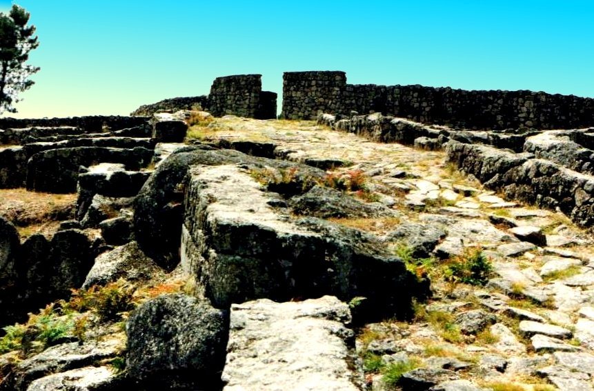
The fortified settlement covers about 20 hectares on a hilltop now covered by pine woodland. Its slopes are comparatively gentle, offering limited natural support for defence. Three rings of dry-built walls enclosed the site. At the gateways, the walls reached up to 3.5 metres in thickness, with stone-filled sections faced externally with granite slabs. Within these defences, granite-paved streets divided the settlement into neighbourhood blocks and connected the principal areas.
Defences and settlement layout
Oval acropolis
The innermost wall formed an oval enclosure at the summit during the Flavian-period reorganization. Measuring about 35 by 20 metres, this space was kept free of buildings and probably served social or religious purposes. A broad paved road began at the acropolis entrance and ran northeast towards the gate in the outer part of the settlement, probably forming the principal traffic axis.
Streets and houses
Stone buildings were arranged in blocks defined by walls and streets. They had both circular and rectangular plans. The main structures were generally oriented north to south, while associated lateral buildings followed an orthogonal arrangement. Earlier, pre-Flavian buildings were mainly circular and often had distinctive pincer-shaped vestibules. Later structures were predominantly rectangular, although some circular buildings without these vestibules also belong to the later phase.
Religious and commemorative structures
Probable Roman temple
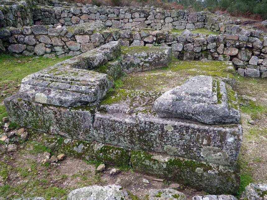
East of the meeting point between the acropolis entrance and the central road stood a probable Roman temple, likely dedicated to Jupiter, the principal Roman deity associated with the sky, thunder, and the Roman state. The building appears to have contained a rectangular cella, the enclosed inner chamber of a Roman temple, together with a podium along its long side. Additional rectangular structures stood in front of it.
Monument at the main entrance
Outside the second wall ring, north of the main road, are the remains of a Roman monument that flanked the settlement’s principal entrance. Its position placed it alongside the approach to the fortified community and formed part of the architectural setting of the main gateway.
Possible tower-shaped mausoleum
A heavily ruined possible funerary monument stood within the third wall, close to the upper courtyard. Its foundation survives comparatively well and contains a rectangular cavity framed by stones. The structure has been interpreted as a tower-shaped mausoleum that may have carried columns and sculptures.
Burial areas
Cremation and inhumation cemeteries
Several cemeteries lay north of the inhabited area, outside the walls. Cremation burials date from the 1st to the 3rd centuries, while inhumation burials, meaning burials of unburned bodies, date from the 4th century. These burial areas provide evidence for continued use of the settlement’s surrounding landscape through successive Roman periods.
Burial boxes near the outer wall
Another necropolis near the outer wall contained two small burial boxes built of stone. Slate covered the boxes, which were fitted with shelves for ceramic vessels. Their construction and internal fittings add to the evidence for varied burial practices around Monte Mozinho.
Excavated objects
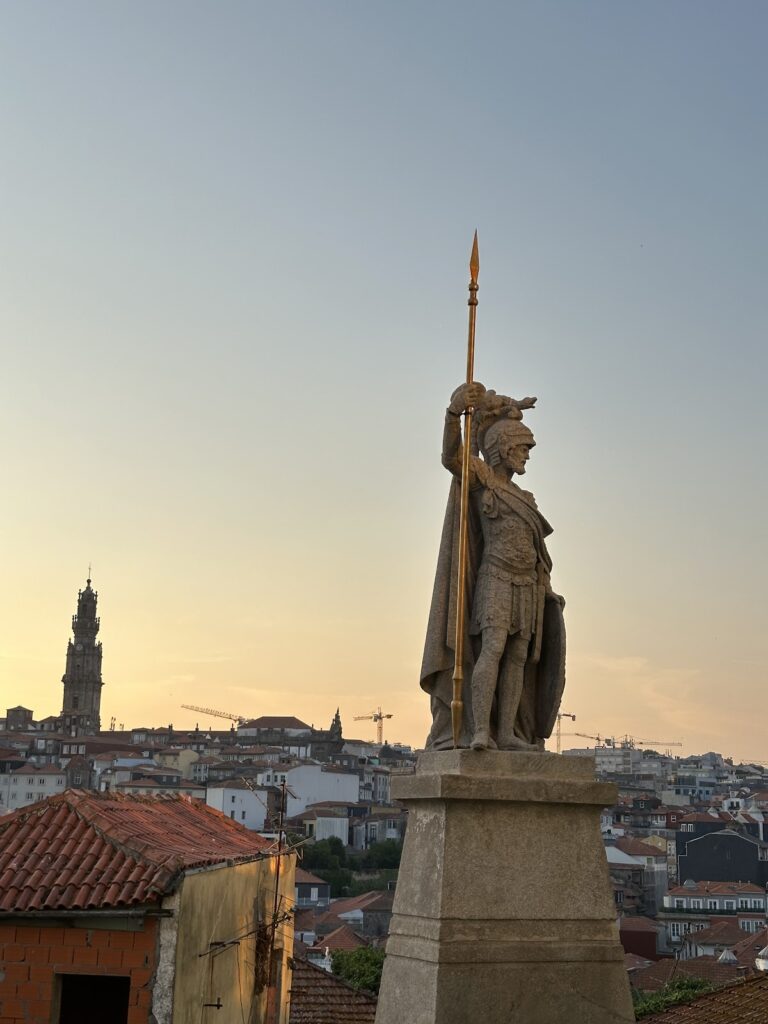
Excavations have produced pre-Roman and Roman pottery, glass, roof tiles, millstones, coins, and metal objects associated with adornment, defence, and agriculture. The finds also include silver and bronze jewellery, Transmontane brooches, granite statues, and fragments of altars. Some altars were dedicated to Jupiter, while fragments of warrior statues, including granite statuary, reflect the settlement’s local and Roman cultural traditions.
The coin series extends from the reign of Gaius Julius Caesar to that of Constantine. These objects, together with the buildings, roads, temples, monuments, and cemeteries, are distributed among the Municipal Museum of Penafiel, the Museum of Ethnography and History of Porto, and the Museum of Anthropology of the University of Porto.