Konguta Vassal Castle: A Medieval Tiesenhausen Stronghold in Estonia
Site at a Glance
- Rating
- 4.2
- Popularity
- Very Low
- Country
- Estonia
- Primary era
- Medieval
- Eras represented
- Medieval, Modern
- Civilizations
- Russian
- Site type
- Domestic
- Remains
- Manor House
On this page18 sections
History
Konguta Vassal Castle is a medieval stone fortress in Konguta, Estonia, associated with the Tiesenhausen family and the Diocese of Tartu. Its foundation is uncertain, although Baltic German historians traditionally dated it to around 1260. The castle probably developed from a smaller fortified residence into a regional stronghold and estate centre, serving the Tiesenhausens’ possessions in western Ugandi.
The Tiesenhausen fief
In 1223, while Bishop Hermann I of Tartu could not proceed from Otepää to Tartu, he distributed estates in Ugandi among important members of his entourage. His brother-in-law Engelbert von Tiesenhausen received Puhja parish, which belonged to the Tiesenhausen family by 1224. The fief covered most of the later parish, including the estate districts of Konguta, Kavilda, Teilma, Teedla, Uderna, and Hellenurme.
The family may initially have occupied a fortified outpost connected with the bishop’s castle at Otepää. As their holdings expanded, they established fortified residences, and Konguta became the centre of their possessions in the area. The castle, together with the strongholds at Rõngu, Rannu, and Kavilda, formed part of the western defensive system of the Diocese of Tartu. This frontier faced Livonian Order territory towards Lake Võrtsjärv, while an important route from Pskov through Kirumpää and Otepää to Tartu passed nearby.
The early fortress may have begun as a small wooden residence that was gradually enlarged and enclosed by defensive walls. Larger regional stone fortifications were certainly being built or strengthened by the fourteenth century. Historical forms of the name included Kongota, Gross-Kongota, Konghetal, Congtall, Kongtha, and Kongedahl.
Family divisions and the medieval castle
Konguta first appears in written records on 13 April 1417. On that date, Johannes and Engelbrecht von Tiesenhausen sold half of the castle, the manor in front of it, the village of Lembyvere, and half of another village to their cousin Engelbrecht von Tiesenhausen of Ergli for 900 Riga marks. The transaction divided the castle between the Berzaune and Ergli branches of the family.
On 8 April 1449, Bishop Bartholomäus Sawijerwe granted Dietrich von Tiesenhausen part of his father Engelbrecht’s inheritance, including Konguta Castle and the villages of Soova and Ängu. The associated holdings extended through Puhja, Rõngu, and Otepää parishes and included fishing and processing rights on Lake Peipus. Dietrich probably received half of Konguta, while the Berzaune branch retained the other half. He also acquired Kavilda.
Dietrich’s sons divided their inheritance in 1486. Heinrich received most of Konguta Castle, while his brothers retained a shared lodging building. Their agreement refers to a fortified tower, a heated residential building, a former dining hall, a chapel, and another residence with a mantel chimney, a large open chimney projecting over a fireplace. In 1494, three Tiesenhausen brothers divided the castle again. One received the tower and probably a gallery leading to the residence with the mantel chimney, while the chapel and the kitchen beside the gate remained communal. The gates were secured with locks and keys.
A manor stood beside the castle around 1500. That year Hans Tiesenhausen bought his brother Jürgen’s share of the castle and estates for 5,500 old Riga marks. The complex accommodated three separate Tiesenhausen household units, probably in different residential wings. Imperial privileges issued by Charles V in 1528 separately named Peter, Bhrun, and Dettloff von Tiesenhausen of Konguta, with Dettloff’s son Bertram also mentioned. The record reflects the presence of several family branches at the castle.
The sixteenth-century divisions
Around 1550, Bruno Tiesenhausen, his brother Detloff, and their paternal uncle Fromhold divided the castles and estates of the parish. Bruno received Konguta, Fromhold retained Kavilda and Uderna, and Dettloff received several villages in the southern part of the parish. On 27 December 1557, Johann Tiesenhausen of Nouss transferred two farms in Musterma village to Bruno.
Destruction during the Livonian War
The Livonian War, fought from 1558 to 1583 over control of Livonia by Muscovite Russia, the Livonian Confederation, Sweden, Poland-Lithuania, and other powers, brought the destruction of Konguta. Russian forces entered the Diocese of Tartu in January 1558. After Tartu surrendered to troops led by Pjotr Shuisky on 18 July, Russian forces occupied Konguta, Rõngu, and Rannu and stationed troops in the castles. The surrounding settlements and villages were burned during the campaign.
On 12 October 1558, Gotthard Kettler, the coadjutor of the Livonian master, recaptured Konguta and the other two castles. The fortifications were then burned and demolished to prevent Russian reuse or restoration. Bruno Tiesenhausen was identified as the owner, and two of his sons were captured by Russian forces near Rõngu.
After the Livonian Confederation dissolved, the former diocesan territories came under Muscovite control, but Konguta Castle was not rebuilt. A settlement seems to have been restored for a time, while the castle remained unusable. A 1564 truce listed Konguta among the important castles and points in the region. A settlement in front of the castle was later burned by the Russians, probably before the territory passed to Poland-Lithuania.
The 1582 Jam Zapolski Truce transferred the former Diocese of Tartu to the Polish-Lithuanian Commonwealth. Konguta was then described as a small stone noble castle formerly belonging to a Tiesenhausen and destroyed down to its foundations. Peasants cultivated part of the land, while two estate mills operated on the Soova River. Bruno Tiesenhausen’s son Dietrich sought to recover the Konguta lands, but his appeal failed. Stephen Báthory converted the Konguta and Kavilda estates into crown demesnes, or estates held by the monarch.
Swedish rule and the later manor
In 1588, the estates were granted or returned, along with properties in Puhja and Rannu and the former Vaabina castle-estate, to Heinrich von Tiesenhausen of Berzaune. Heinrich renewed his request for confirmation of Konguta in 1590, but apparently never obtained it, and he died in 1600. Because this Tiesenhausen branch had supported Poland, its members fled when the Swedes arrived and lost their estates.
On 16 February 1626, King Gustavus II Adolphus granted the Konguta-Kavilda estates, together with Teedla and Taydelma, to Lars Eriksson Sparre. Sparre leased Konguta and Kavilda in 1628. A Swedish survey in 1627 found the manor site empty except for one peasant guarding an orchard. The 1638 survey referred to the old Konguta manor but no longer mentioned the castle. In 1655, the estates belonged to Lars Claesson Flemming, who pawned Konguta to Dietrich Rigemann von Löwenstern for 4,000 thalers.
During the late seventeenth-century reduction of estates, Konguta passed to the state and remained a crown manor for nearly a century. In 1789, the pastor and antiquarian August Wilhelm Hupel described substantial castle ruins, broad moats that were partly filled or overgrown, and a former village that had disappeared. He also recorded a tradition that a monastery had once stood there. The manor had a watermill and a windmill.
In 1791, Catherine II granted most of Konguta Manor to Sara von Greigh, widow of the deceased general and admiral Samuel von Greigh, and their children. The manor changed owners repeatedly during the nineteenth century and was divided into Gross-Konguta and Klein-Konguta. Eduard Philipp Körber described the site in 1830 as a roughly rectangular, rampart-like enclosure with discernible moats. A single-storey thatched log manor house stood there, while much of the remaining castle fabric was probably dismantled during the approximately forty years of von Greigh ownership.
Rediscovery within the manor complex
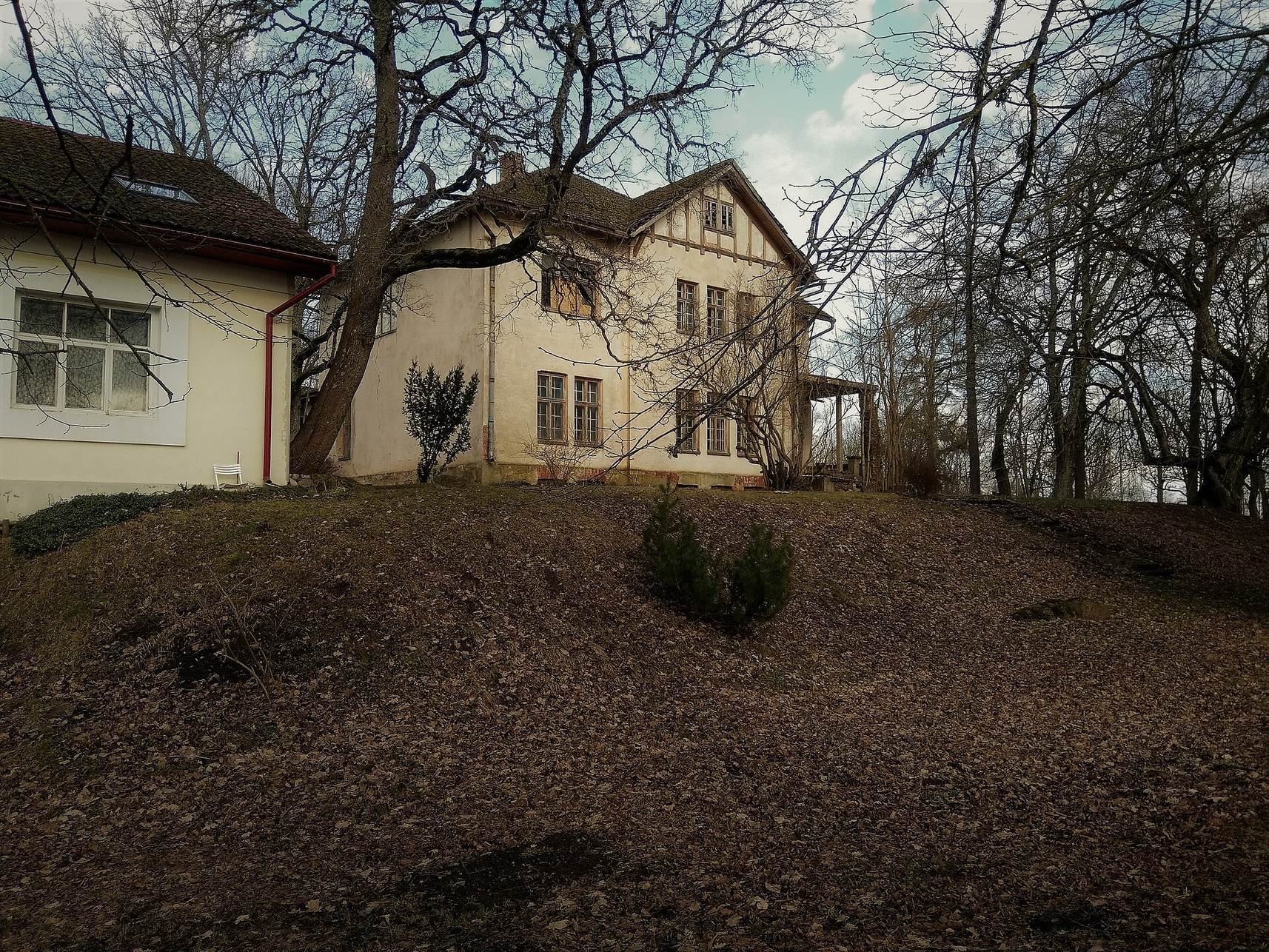
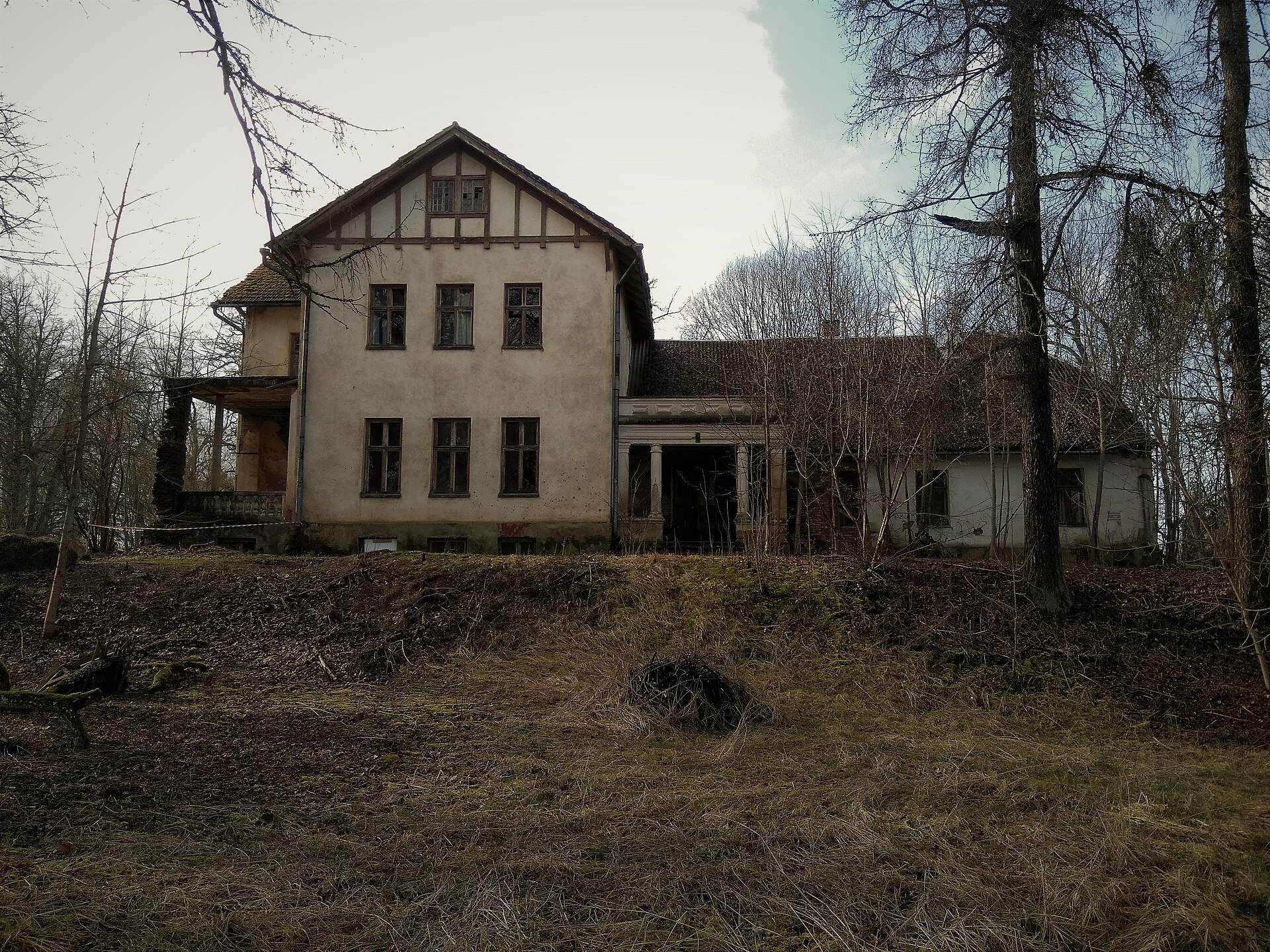
Otto von Ungern-Sternberg acquired the manor in 1908 and enlarged its centre. A new two-storey Heimat-style main building was completed around 1910 by incorporating the older one-storey manor house. Medieval castle foundations were uncovered during construction and partly reused. The manor was confiscated after the Estonian War of Independence.
A 1922 survey recorded a surviving vaulted cellar attributed to the castle period. Drilling in 1958 revealed nearly one metre of rubble in the centre of the castle mound and a cultural layer about 3.5 metres thick. A brick vault remnant and a burned layer were found beside the northern wall of the manor buildings. Around 1970, masonry remains were encountered during a sewage-trench excavation in the courtyard, although they were not documented. In 1973, the historical specialist Uno Hermann prepared a 24-page survey of the castle site for the Estonian restoration authorities.
Remains
Fortified enclosure and water defences
Castle platform
Konguta was probably an irregular camp-castle, a fortified enclosure whose buildings stood within a defensive perimeter rather than following a regular plan. It occupied the northwestern edge of a low hill at an elevation of 80.5 metres above sea level. The stone plan was rectangular and oriented east-west, while the moat system followed lines close to the cardinal directions.
The castle platform measured approximately 54 by 67 metres, covering about 3,618 square metres. Much of it was probably raised artificially with earth. In the central area, the cultural layer reached nearly three metres in depth. The rampart remains clearly rise more than two metres above the surrounding ground over most of their length.
Moats and approaches
A small notch valley cut into the hill probably helped form the northern side of the moat and may also have contributed to the other sides. Springs exposed by the dug channels supplied water to the moats. The northern moat remains clearly visible, while its southern course can still be traced by its width. The eastern and western sections were probably filled in.
The access bridge has not been located, although a possible crossing has been proposed near the centre of the northern moat, where an earthen causeway survives. The castle may have extended westward beyond the present mound, where the ground descends. Several ponds lie in that direction, and a stream from the moat flows through them towards the northwest and the Rõikoja area.
Buildings within the castle
Tower and residential buildings
The complex included a fortified tower and several residential buildings constructed of brick and fieldstone. One residence had a large ceremonial hall on its upper floor. A gallery probably connected the tower with the residence opposite it. The 1486 inheritance agreement describes a tower with a heated residential building, a living floor, and an upper former dining hall. The building may have been heated by a stone hypocaust, an underfloor system that circulated warm air beneath the floor.
Chapel, kitchen, and service buildings
The castle also contained a chapel and a residence with a large mantel chimney. A kitchen beside the gate was shared by the family branches, and the gate passage or gatehouse probably included this communal service area. A well probably stood where the later manor courtyard well was located. Other economic buildings were built against or near the defensive wall, although their exact arrangement remains uncertain.
Settlement and mills
A medieval settlement probably stood about 50 metres east of the castle, where large strong walls have been uncovered. A watermill may have operated near the castle under its protection, depending on the discharge of the springs. The later manor had both a windmill and a watermill, with the latter farther away on the Kavilda, or Soova, River.
Manor buildings and surviving fabric
Manor house and courtyard
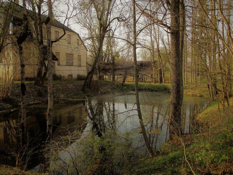
The early twentieth-century manor complex occupies and partly incorporates the castle site. The newer two-storey manor house stands at the southeastern corner of the mound, while the older wooden manor house extends northwards towards the northeastern corner. Other buildings form an almost continuous ring around the site and enclose a courtyard. Castle foundations were reused in the early twentieth-century main house.
Economic buildings and cellars
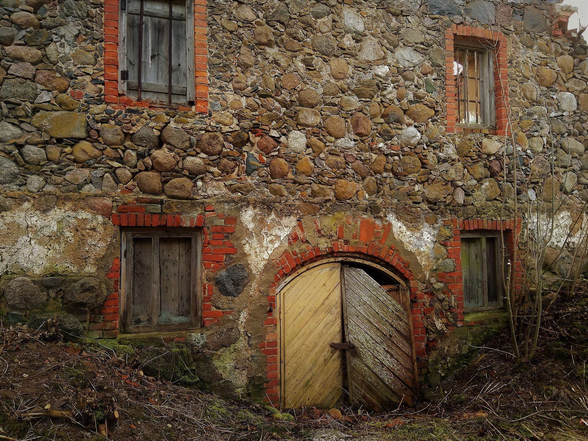
A storehouse-cellar at the northwestern corner has fieldstone and brick walls. Older economic buildings line the southern edge of the site, continue westward across the rampart, and include a passage gate. Their cellars have been converted into dwellings. A brick vault remnant and a burned layer beside the northern wall of the manor buildings provide further evidence of the earlier fortress.
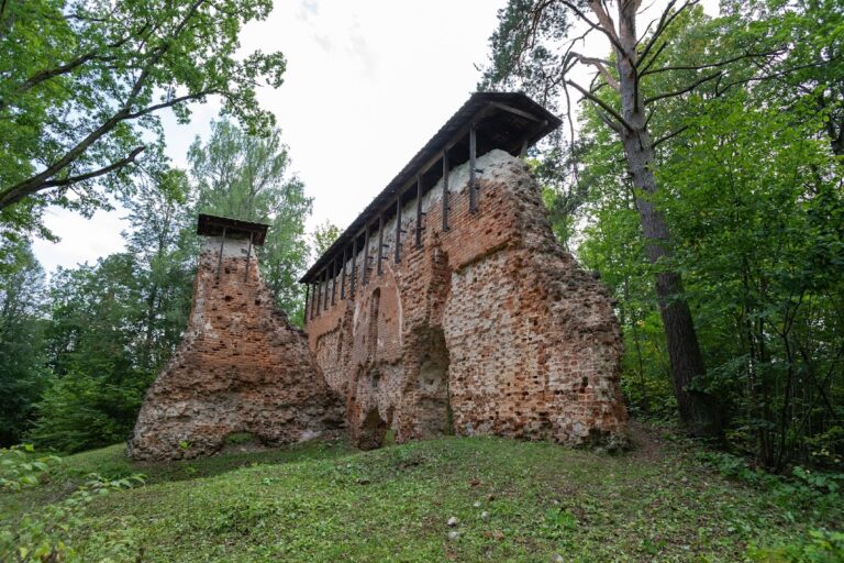
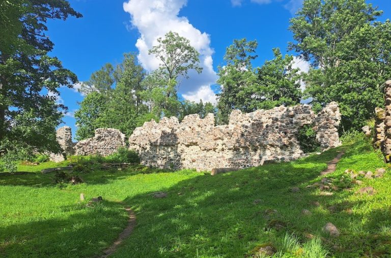
The later manor park occupies the southern and eastern sides of the mound, while part of the western slope is supported by a concrete retaining wall. By 2019, the castle’s surviving fabric was concentrated in buried remains and in masonry preserved within the cellars and foundations of the later manor buildings.