Ķoderu hillfort: A Late Iron Age Liv Settlement in Latvia
Site at a Glance
- Rating
- 4.4
- Popularity
- Very Low
- Country
- Latvia
- Primary era
- Iron Age
- External website
- Open
- Eras represented
- Iron Age
- Civilizations
- Unclassified
- Site type
- Military
- Remains
- Fortified Town
On this page8 sections
History
Ķoderu hillfort is a Liv hillfort in Latvia, occupied from the ninth to the twelfth century during the Late Iron Age, when elevated fortified settlements were common in the eastern Baltic. The settlement consisted of a defended enclosure with wooden buildings and occupied an important position beside a route leading toward the Latgalians, Tālava, the Krivichs, Novgorod, and the Russian lands.
Liv settlement and regional connections
The hillfort stood in a region inhabited by Livs, a Finnic-speaking people whose communities occupied parts of present-day Latvia, including areas around the Gauja and the lower Daugava and its tributaries. Baltic tribes who arrived later lived nearby. The Little Jugla River and the steep slopes of the hill strengthened the settlement’s natural defenses, while its position along a route supported movement and trade through the surrounding region.
Conquest and later traditions
A late nineteenth-century document by Augusts Bīlenšteins linked the hillfort with the Suntaži castle mentioned in 1318. Around 1592, Riga burgomaster and chronicler Francis Nīenšteds described the Ķoderu settlement and preserved a tradition that leaders named Nupa and Kaipa had fought German crusaders. The hillfort was eventually conquered and burned, after which the few survivors fled permanently to the Gauja Livs.
In the early twentieth century, the historians K. Lēvis of Menārs and H. Lākmanis proposed that Ķoderu hillfort might instead have been the Remīne castle mentioned in thirteenth-century sources. This identification remains hypothetical. The hillfort takes its modern name from the nearby Ķoderu houses, while its traditional name, Great Man’s Bed, refers to its side profile, with raised areas at both ends resembling a large bed.
Later historical memory and investigation
During the Middle Ages, the Ķoderu tavern stood about half a kilometre toward Jugla village beside the road. Along with Vāverkrogs, it was regarded as notorious because road bandits operated along a dangerous stretch of the Kangari road beyond it. Before the Second World War, the writer and painter Jānis Jaunsudrabiņš spent summers with his wife at the nearby Dēliņi farmstead, drawing creative inspiration from a landscape associated with legends and traditional stories.
Historians surveyed the hillfort in 1998, and archaeological excavations took place in 2015 under the direction of Elīna Guščika, with students from the University of Latvia’s Faculty of History and Philosophy taking part. On 19 December 1998, the site received state protection as an archaeological monument of local significance under protection number 1873.
Remains
Setting and physical form
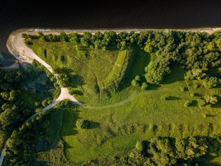
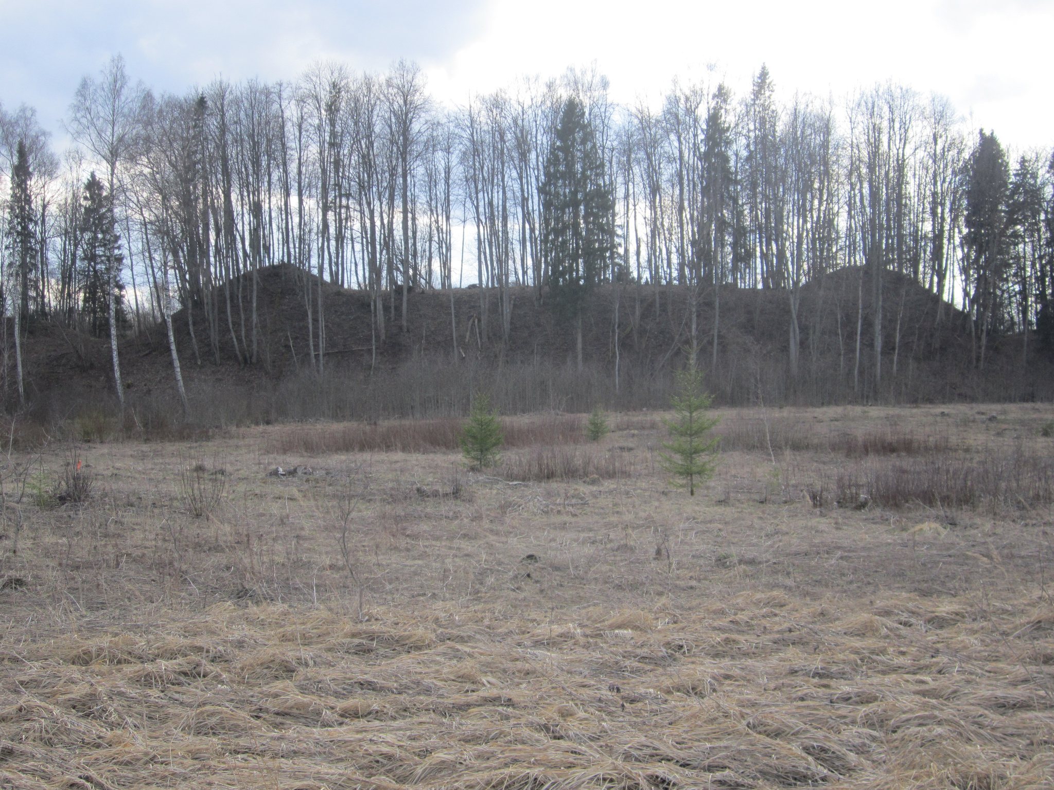
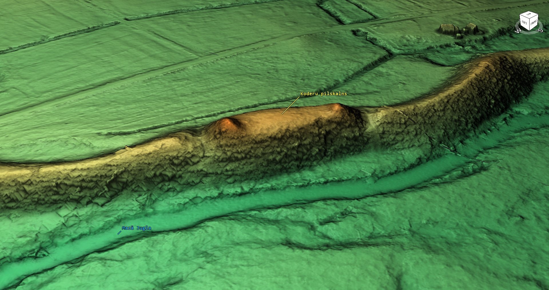
Ķoderu hillfort occupies an esker-like hill among the initial hills of the Lielie Kangari ridge, at the boundary between the Madliena depression of the Central Latvian lowland and the Ropaži Plain. An esker is a long, narrow ridge of sand and gravel formed by meltwater beneath or within a glacier. The Lielie Kangari ridge extends from Vāverkrogs to Uceni near Suntaži and formed as the last ancient ice sheet melted approximately 10,000 to 12,000 years ago. The hillfort is 65 metres long and 25 metres wide. It rises about 15 metres on the road side and 30 metres on the river side, while its summit plateau covers roughly 1,625 square metres.
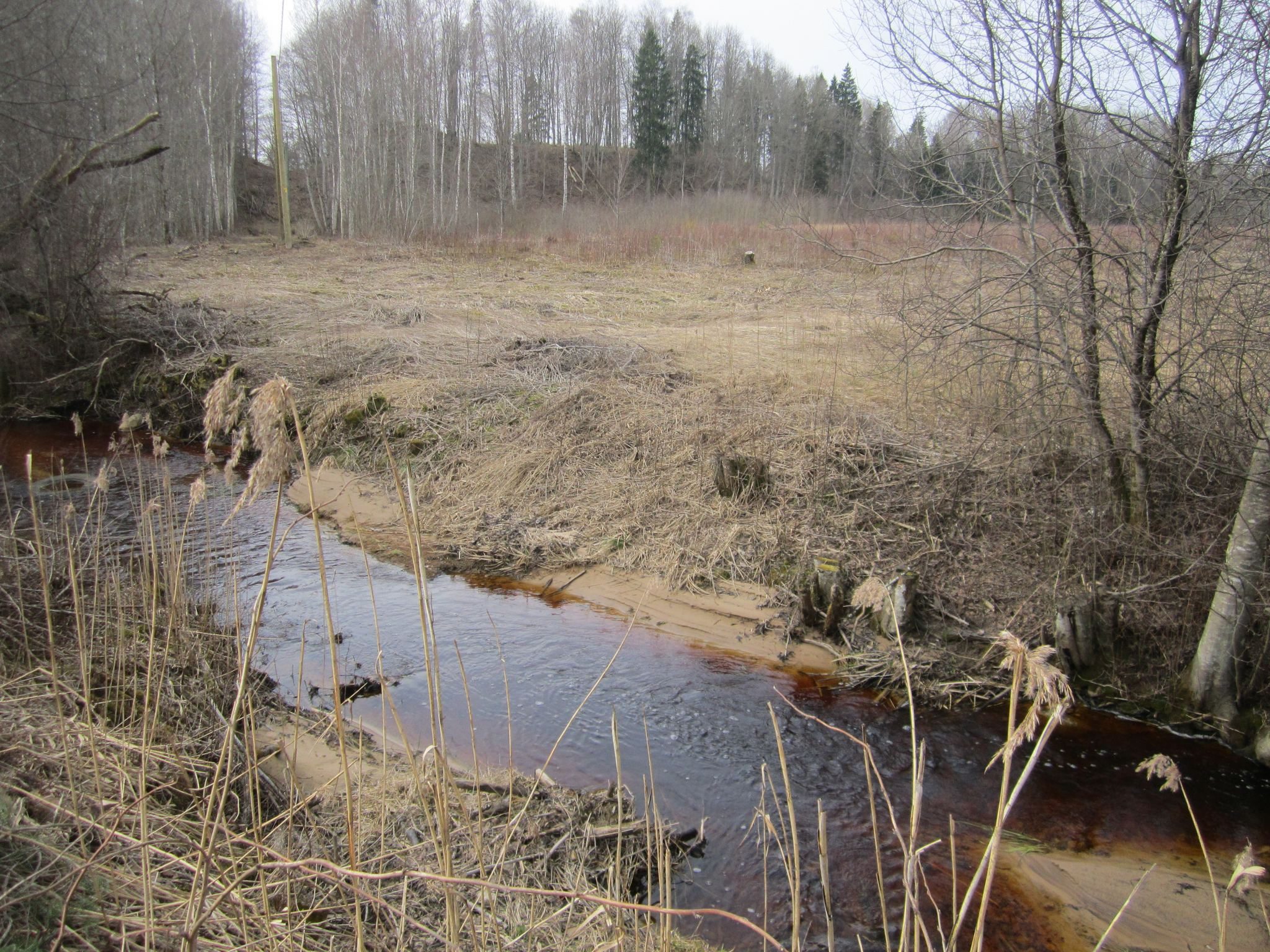
The Little Jugla runs along the southern foot of the hill, and the small Dēliņurga stream flows beside it as a right-bank tributary of the Little Jugla. The hillfort forms part of a chain of smaller esker hills, with river valleys interrupting the ridge as it continues eastward toward the Jugla area. Some of the neighbouring hills have been partly or completely quarried away.
Earthworks and fortified settlement
The ridge was cut through in two places to form defensive ditches, with two high earth ramparts between them. Additional ramparts at the two ends of the hillfort rise 3 to 4 metres and may have supported lookout towers. Their elevated positions offered a broad view over the surrounding area. The raised ends and the hill’s overall profile create the form behind the traditional name Great Man’s Bed.
A wall several metres high, made from sharpened logs, enclosed the settlement. Wooden buildings stood behind it. The northern cultural layer extends beyond the main ditch onto the rampart, where it formed a larger, slightly enclosed forecourt. This outer area was used for movement and trade connected with the fortified settlement.
Archaeological deposits and finds
A cultural layer, the accumulated soil and occupation debris left by human activity, is approximately one metre thick across the summit plateau and slopes. It is black in colour and contains burnt stones, animal bones, and fragments of handmade and wheel-made ceramic vessels dated to the ninth through twelfth centuries. These remains belong to the period when the fortified Liv settlement was occupied. The site is regarded as an unusual archaeological monument in Ogres Municipality because of its distinctive shape and profile.