Pravý Hradec: An Early Medieval Hillfort in Czechia
Site at a Glance
- Rating
- 3.7
- Popularity
- Very Low
- Country
- Czechia
- Primary era
- Medieval
- Eras represented
- Medieval
- Civilizations
- Duchy of Bohemia
- Site type
- Military
- Remains
- Fort
On this page7 sections
History
Pravý Hradec is an early medieval hillfort in Czechia, on the southwestern edge of Klecany, whose construction dates to the turn of the ninth and tenth centuries. Its precise function remains uncertain, although its position offered direct visibility toward Prague Castle and may have been connected with a ford across the Vltava. The hillfort developed on a spur that had already been occupied during the Early Bronze Age by people of the Únětice culture, a Central European archaeological culture known for settlements and metalwork.
Early Medieval Development
Pravý Hradec stood near Levý Hradec, an early medieval hillfort associated with the beginnings of Christianity in Bohemia. Levý Hradec had stronger natural protection, a larger level area for settlement, and more plentiful building material. These advantages help explain why Pravý Hradec has not been interpreted simply as a replacement for its better-protected neighbour. Emanuel Šimek instead proposed that its position had a strategic relationship with a crossing of the Vltava.
The hillfort’s occupation continued into the tenth century and later. Excavations in 2000 uncovered a Slavic cemetery dating to the tenth century, with graves belonging to members of the higher social stratum. The cemetery supports an early date for the hillfort’s existence. Naďa Profantová also proposed that a wooden or stone church may have stood here around the turn of the tenth and eleventh centuries, although archaeological confirmation of the building has not been obtained.
Archaeological Investigation and Protection
The site was known by the nineteenth century, when J. L. Píč described the location called Na Valech but found no clear traces of a hillfort. Vladimír Martinec led the first archaeological investigation in 1965. It clarified the form of the fortifications, uncovered an Únětice-culture settlement pit and remains of several structures, and initially placed the hillfort’s existence in the twelfth century. The later discovery of the tenth-century cemetery provided evidence for an earlier phase. Pravý Hradec has been protected as a cultural monument of the Czech Republic since 1958.
Remains
Layout and Setting
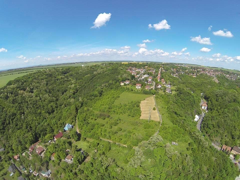
Pravý Hradec is a single-part hillfort measuring approximately 300 by 200 metres and covering 5.8 hectares. It occupies a spur extending from the Zdiby Plateau. Steep slopes descend toward ravines on the southeast and northeast, while the southwestern side falls toward the Vltava with a height difference of about 40 metres. The neck of the spur is about 100 metres wide. Stone quarrying and urban development have damaged the northern part of the site.
Fortifications
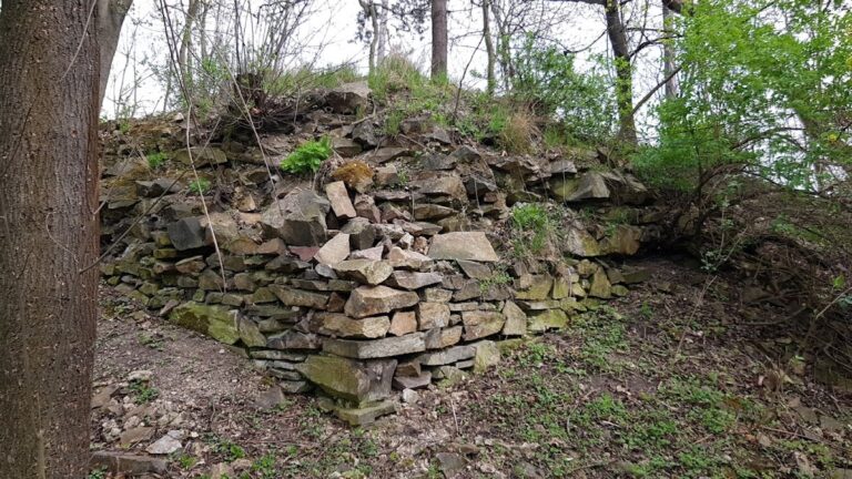
Only an indistinct bank survives from the perimeter rampart. A ditch formerly stood in front of it on the approach side, while the rampart across the neck of the spur was more substantial than the remaining perimeter defenses. On the northwestern side, the rampart was about 4.5 metres wide and used timber chambers made partly from conifer wood. Its outer face was strengthened by a dry-laid wall of marlstone and slate, while the inner side consisted of timber logwork about 15 centimetres thick. The original thickness of the stone facing is uncertain.
The southeastern fortification had a front stone facing measured at 1.5 metres thick. Behind it was a 3-metre-wide wall of black clay containing oak-beam remains, followed by an 8-metre-wide layer of grey clay. This construction ended in a destruction layer almost 2 metres wide, formed of smaller stones. A protected approach to water may also have been incorporated into the northern defenses.
Burial and Settlement Evidence
The tenth-century Slavic cemetery contained burials associated with members of the higher social stratum. Archaeological work also exposed an Únětice-culture settlement pit and the remains of several structures, linking the hillfort’s medieval occupation with much earlier use of the spur.
Geomagnetic surveying, a non-invasive method that detects buried features through variations in the ground’s magnetic properties, indicated that the hillfort may have been divided into several areas. That internal arrangement remains unconfirmed, as does the proposed church from around the turn of the tenth and eleventh centuries.