Talsi Castle: A Livonian Order Road-Block Fortress in Latvia
Site at a Glance
- Rating
- 4.8
- Popularity
- Low
- Country
- Latvia
- Primary era
- Medieval
- External website
- Open
- Eras represented
- Medieval, Modern
- Civilizations
- Livonian Order
- Site type
- Military
- Remains
- Castle
On this page9 sections
History
Talsi Castle was a stone fortress of the Livonian Order in Talsi, Latvia, built during the medieval period as part of the order’s control of Courland. It first served as a subsidiary castle of the Kandava bailiwick, an administrative territory governed by an order bailiff, and became an administrative centre for the Talsi parish district after 1447.
Early Settlement and Livonian Rule
Talsi was one of the principal settlement areas of the Livonians’ Vanema district. Curonian settlement also expanded into the area, where roads from Riga through Tukums and Kandava divided toward Ventspils and Dundaga. In 1231, Talsi village appeared in an agreement between local Curonians and Alna Balduin, the representative of Pope Gregory IX. The agreement required the population to accept priests and baptism, pay taxes to bishops and prelates, join campaigns against pagans, and provide hostages.
Under the land-division agreement of 4 April 1253, Talsi passed from the Bishop of Courland to the Livonian Order and became part of Vredecuronia, or Peace Courland. The order received two-thirds of Courland, while the bishop received one-third. Around 1260, the order probably occupied an earlier wooden fortress called Old Talsi on Klosterkalns, about 500 metres southeast of the later stone castle.
The construction date of the stone castle is uncertain. A settlement between the earlier fortress and the later castle was mentioned in 1361, and inhabitants probably moved to the new castle settlement after the stone fortress was completed. The order’s castle is securely mentioned by 1434. Talsi first appeared in the Livonian castle list in 1411, was called a town in 1422, and was described as a fortified place in 1434 and 1437.
Conflict and Administrative Development
Talsi was the site of a treaty concluded on 12 May 1282 between the Livonian Order and the abbot of Daugavgriva monastery over disputed territories in Courland. In 1290, Lithuanian forces attacked the castle and its settlement. The settlement was destroyed and the surrounding area was plundered, but the castle was not captured.
The order granted fiefs in the Talsi area in 1292 and 1318, and the district was progressively divided into fiefs. In 1447, the Talsi castle district was separated from Kandava and placed under the authority of the Kuldiga castle district, its commander, and his judicial bailiff. A Talsi parish district was recorded from 1462, while German merchants and craftsmen were living in the town by 1498.
A stone church was built near the castle in 1553. Two years later, the fortress was described as a Courland road castle that was not especially strong and functioned more like a granary than a permanent residence. This reflects its role as a road-block castle, a fortress placed on an important route to control movement and offer travellers shelter or protection.
From the Livonian Order to Destruction
In 1561, during the Livonian War, the former order territories became the Duchy of Courland and Semigallia. Talsi Castle passed to Duke Gotthard Kettler, the last master of the Livonian Order and the first duke of the new state. Talsi and Sabile were again administered with the Kandava district under a local captain. A Lutheran church was built in Talsi in 1567, and a stone-walled church was mentioned again in 1609.
Swedish troops passed through Talsi during the Polish-Swedish War in 1656, and Polish forces camped there in 1658. Swedish troops probably destroyed the castle in 1659 to prevent its recapture by Poland. It was not rebuilt and lost its military function.
The ruins were then quarried for building stone. Their demolition intensified after a fire in 1733 destroyed almost the entire predominantly wooden town. During the Great Northern War, Talsi was under Swedish control in 1701, was taken by Russian forces in 1705, and returned to Swedish control in 1706. The war continued until 1710. Prussian troops belonging to Napoleon’s army entered Talsi in 1812.
Later Changes and Archaeological Investigation
A measured draft plan of the castle was prepared in 1844. Around the middle of the nineteenth century, Baron von Heiking built a town villa on the former castle site, with a dendrological park and streets arranged around the former moat. A windmill was built west of the villa in 1857 and operated until 1915. It burned down in 1922, but the hill retained the name Dzirnavkalns, meaning Mill Hill.
Adolf Karnup’s excavations on the Old Talsi fortress hill in 1936-1938 indicated that the wooden fortress remained in use during the thirteenth and fourteenth centuries, probably at the same time as the stone order castle. The Second World War destroyed the archive of the Talsi district museum, leaving parts of the area’s history poorly documented. During the Soviet occupation, the former Heiking house served as a military commissariat. Since 1991, it has been held by Latvia’s Zemessardze, or National Guard.
Remains
Stone Castle Site
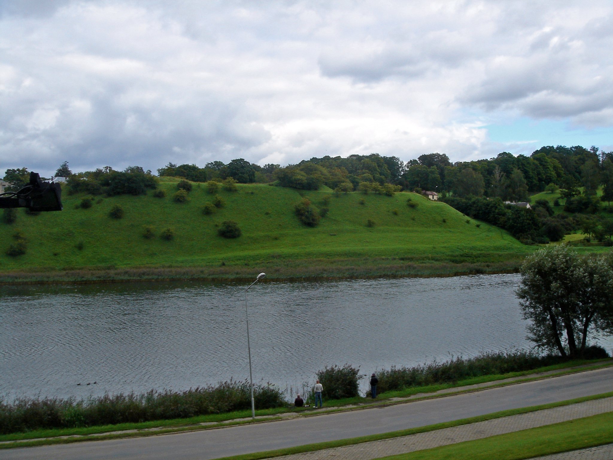
The castle stood on Dzirnavkalns, a hill about 87 metres above sea level between Talsi Lake and Vilkumuiža Lake. Steep slopes descended toward the town on the western, southwestern, and southern sides, while the eastern, northeastern, and northern sides were gentler. A defensive cut-off ditch was dug along the southeastern side, following the line now occupied by Akas and Kalna streets.
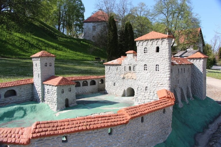
Talsi Castle was a free-standing rectangular road-block and granary castle measuring approximately 98 by 66 metres, with an area of about 6,468 square metres. Its corners faced the cardinal directions. Granite fieldstones formed the castle, whose walls were more than two metres thick. The foundation plan created the same 98-by-66-metre rectangle, while a plan made in 1844 shows four wings, each about 10 metres wide, built against the inner sides of the outer walls.
A well stood near the southwestern wing at the southern corner. The later Heiking residence occupied that corner of the former castle area. Medieval wall remains could still be seen in places until the 1960s, but surveys in 1998-1999 found no masonry standing above ground. Uneven ground and occasional granite foundation stones remain visible, while much of the castle stone was reused in nearby houses and in the construction of the windmill.
Old Talsi Fortress
The earlier wooden fortress known as Old Talsi occupied Klosterkalns about 500 metres southeast of the stone castle. It covered approximately 0.4 hectares and was one of the larger and stronger ancient hillforts in Courland. Excavations showed that it remained in use during the thirteenth and fourteenth centuries, probably alongside the later stone fortress.
Vilkumuiža Lake Finds
Vilkumuiža Lake, beside the castle site, has yielded numerous bronze and iron objects placed there during lake burial rituals. The finds include swords, battle axes, knives, horse fittings, and jewellery, providing material evidence for ritual activity associated with the earlier settlement landscape.