Wallanlage Weilenscheid: An Iron Age Summit Ringwall in Germany
Site at a Glance
- Rating
- 4.5
- Popularity
- Very Low
- Country
- Germany
- Primary era
- Iron Age
- Eras represented
- Iron Age
- Civilizations
- Celtic
- Site type
- Military
- Remains
- Wall
On this page7 sections
History
Wallanlage Weilenscheid is an Iron Age summit fortification in Germany, near Elspe in Lennestadt. Its surviving earthworks are generally associated with the early La Tène period, a later Iron Age cultural phase conventionally dated here to 480–300 BC. The builders are unknown, although they have been variously connected with Celtic or Germanic communities. The site is regarded as an important archaeological landscape monument in the region.
Settlement and regional setting
The hill stood within a landscape crossed by several historical routes. The Heidenstraße, a long-distance road between Cologne and Kassel, followed the Elspetal below the hill. Another route known as the Roman Road joined it above Förde and continued through Elspe toward the Brilon plateau. The Bergstraße began at Trockenbrück and led toward Arnsberg, while the Kriegerweg from Siegen crossed the Gleie valley near Elspe before continuing through Bracht toward the Paderborn region.
The fertile, relatively level slopes around the limestone depressions between Attendorn and Elspe encouraged early settlement. Stone Age finds from the Hespecker and Sporker plateaus show that people were active in the wider area long before the fortification was built, although a continuous settlement sequence into later prehistory has not been established.
Iron Age construction and dating
The fortification was first assigned broadly to the Iron Age from its form and position on a prominent summit. In Central Europe, the Iron Age was the prehistoric period associated with widespread use of iron tools and weapons before the Roman imperial period. Recovered fibulae, or brooches used to fasten clothing, allowed a more precise connection with the early La Tène period.
One fibula belongs to the Münsingen type. Other finds include a ring fragment with raised ribs and a hollow-boss ring fragment. Together, these objects point especially to the end of the third or the second century BC. The dates of the individual fortification phases, and whether they were constructed at the same time, remain uncertain. The scale of the earthworks indicates that a large organized group took part in their construction, perhaps an entire tribe or kin group, but the identity of that community has not been resolved.
Function and regional importance
The fortification’s purpose is not fully established. Its distance from major settlements, the difficult terrain, and the challenge of securing water and supplies make a permanent settlement or long-term refuge difficult to demonstrate. The rocky summit also shaped the site’s use and archaeological interpretation. A religious or cultic function is considered the most plausible possibility, since ritual activity would have required fewer stored provisions than permanent occupation. The walls may have helped protect ritual places from outside interference.
Old settlements close to the hill indicate that the fortification had regional importance. Daniel Bérenger, a German archaeologist who classified prehistoric fortifications by their topography and ground plan, placed Weilenscheid among six Westphalian Iron Age types. His Type A describes a ringwall, an enclosed earthwork arranged around an elevated area, in a summit position.
Remains
Summit earthworks and terraces
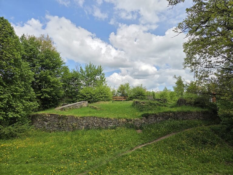
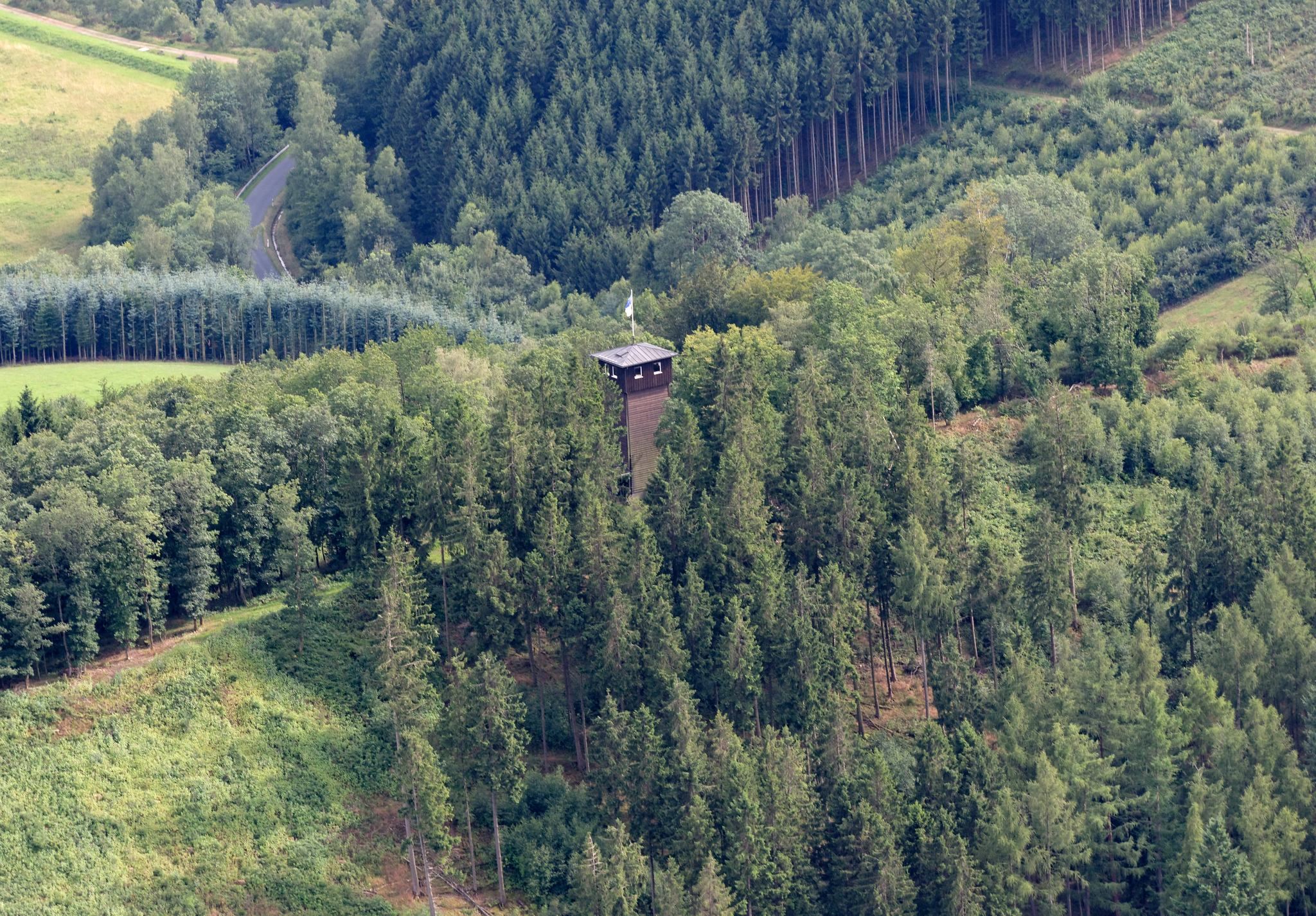
Wallanlage Weilenscheid occupies the Weilenscheid, a high point within a hill chain bordered by the Lennetal to the southwest, the Elspetal to the northeast, and the Hachener valley to the southeast. The summit reaches 481.4 metres above sea level and is surrounded by the lower Wollberg or Wohlberg, Hollberg, and Drüpel, whose elevations are 445, 446.7, and 450 metres respectively.
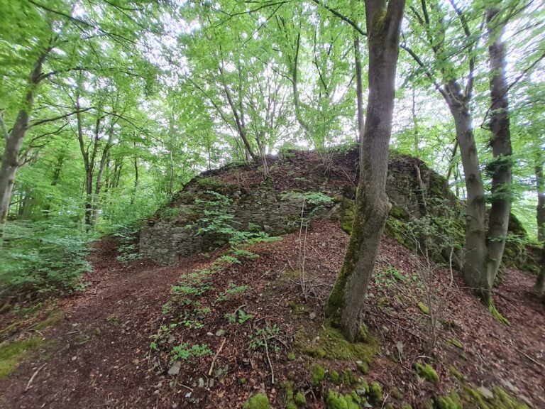
A sharp rocky ridge crosses the summit from southwest to northeast. Two concentric and parallel fortification lines encircle the hilltop, surviving as wall terraces separated by approximately 15 to 30 metres. A third terrace or natural terrain step lies below the track toward the Elspetal and continues as far as the spring known as Vorderster Siepen. The enclosed interior measures about 225 metres from end to end and 75 metres across, while the combined edges of all the terraces form approximately 1,200 metres of fortification lines.
The site is an earthwork created through human labor on rocky ground. Its internal arrangement is known mainly through the terraces and enclosure lines, while buildings within the fortifications have been identified only on a limited basis. The terrain and water conditions are important to understanding why the enclosure has been interpreted as a place whose use may have been seasonal, communal, or ritual rather than a continuously occupied settlement.
Recovered objects
Small finds provide the principal chronological evidence for the earthworks. The fibulae include a Münsingen-type example, while the ring fragments include one decorated with raised ribs and another with a hollow boss. Their forms connect the fortification with the early La Tène period and point particularly toward the end of the third or the second century BC. These objects help place the surviving terraces within the wider Iron Age history of the region.