Samobor Fortress: A Medieval Stronghold in Bosnia and Herzegovina
Site at a Glance
- Rating
- 4.7
- Popularity
- Very Low
- Country
- Bosnia and Herzegovina
- Primary era
- Medieval
- Eras represented
- Medieval
- Civilizations
- Kingdom of Bosnia
- Site type
- Military
- Remains
- Castle
On this page14 sections
History
Samobor Fortress is a medieval fortress in Bosnia and Herzegovina, built in the fourteenth century by Sandalj Hranić of the Kosača dynasty above the confluence of the Janjina and Drina rivers. It was first recorded in 1397 and became one of the principal towns and strongholds of the Kosača family in Upper Podrinje, the region around the upper Drina River.
Kosača rule
Upper Podrinje came under the Kotromanić state in 1373 before passing toward the end of the fourteenth century to the Kosača family, a powerful medieval noble dynasty that controlled extensive territories in Bosnia and Herzegovina. Sandalj Hranić held Samobor during the early fifteenth century. In 1423, Ragusan envoys, diplomats from the medieval city-state centered on Dubrovnik, met him at the fortress.
Samobor and its suburb appear repeatedly in documents from the first half of the fifteenth century. The settlement did not become a major commercial center. By 1435, only three recorded trade caravans had Samobor as their destination. In that year, Sandalj’s nephew and heir, Stjepan Vukčić Kosača, inherited the fortress. Alfonso V confirmed Samobor and its surrounding territory to Stjepan in charters issued in 1444 and 1454, while Frederick III confirmed them in 1448. Stjepan later issued a charter at nearby Međurečje in 1461.
Ottoman administration
Stjepan still held Samobor in April 1465. In the late spring, Ottoman forces commanded by Isa-beg Ishaković entered his territories, and Samobor became the first of his Upper Podrinje fortresses to fall. Kosača control ended with the conquest.
Under Ottoman rule, Samobor belonged to the Herzegovina Vilayet, an Ottoman province, within the Bosnian Sanjak, a subdivision of a province. It became the administrative center of the Samobor or Pribud nahiyah, a smaller district, and belonged to the Drina kadiluk, a district administered by a Muslim judge, whose seat was at Foča. The district continued to be known by its two names until the beginning of the eighteenth century.
The Ottoman authorities maintained a permanent garrison from the conquest until the fortress was abandoned in 1832. Around 1800, the garrison included 20 fortress guards, 18 armorers, and an unspecified number of gunners under a dizdar, the commander of an Ottoman fortress. For several years before the Austro-Hungarian occupation, the southern fortress served as a penal facility, while the main fortress had already been abandoned.
Decline and protection
The site deteriorated after abandonment. By 1892, most wooden elements had disappeared and sections of masonry were collapsing. A survey and archaeological reconnaissance by the Institute for the Protection of Monuments of Bosnia and Herzegovina in 1973 recorded the monument’s condition, but deterioration continued. A further inspection in 2005 found ruinous walls, cracks in the main tower, fallen wall cladding, and a western entrance arch close to collapse. Overgrown paths and the lack of roads for transporting materials hindered major archaeological and conservation work.
Samobor Fortress and its surroundings are protected as a National Monument of Bosnia and Herzegovina. The old Samobor fort and its architectural ensemble received formal national-monument protection as a Category I historical monument in 2006. The name Samobor is traditionally associated with a solitary pine tree that stood on the cliff during the fortress’s construction.
Remains
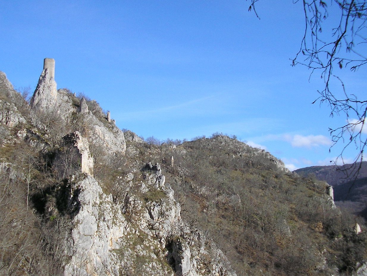
Samobor Fortress occupies more than one hectare on a rocky hilltop on the slope of Borovska Mountain, above the confluence of the Janjina and Drina rivers. Its highest point lies at the northwestern end, where the position controlled roads through the two river valleys. Steep, uneven terrain, narrow passages, and small plateaus shaped the irregular plan, which extends approximately 350 to 400 meters in places. Cliffs protected the southern, northern, and eastern sides, while the practical approach came from the southwest.
Entrance and eastern section
Southwestern entrance
The fortress was divided into interconnected southwestern, eastern, central, upper, and southern sections. The main entrance was protected by a tall three-sided tower with an approximately equilateral-triangular plan. Its walls measured between 1.8 and 2.1 meters thick. The tower survives to the ceiling level of the ground floor, while the outer facing of its upper level has fallen away. A 1.5-meter-thick rampart joined the tower on its eastern side and rose toward the northeast. An arched gate opened through the rampart beside the tower.
Eastern defenses
From the main entrance, a route about 400 meters long crossed narrow and sometimes steep natural cuts toward the eastern section. Steep rocks made this area naturally difficult to reach from three sides, while the entrance tower protected it from the west. A broad natural cut running from west to east probably accommodated wooden houses. Regularly dressed stone blocks may have supported house posts or served as platforms for cannon. Narrow guard walls and benches cut into the bedrock survive at projecting points along the northern side.
The route continued to a second gate leading into the central section and toward the main tower and eastern rampart. At the end of the nineteenth century, two square towers, each up to 8 meters high, protected this entrance, with a doorway between them. A further tower was recorded northeast of the entrance in 1973. The entrance is now represented by the surviving corner of one tower.
Central and upper sections
Former church and mosque
The central section surrounded a mosque positioned 20 meters northeast of the second entrance. The building was probably created by converting an older church from Sandalj Hranić’s period. In 1892, the church’s altar arch could still be seen between the mosque’s eastern wall and the rock, while its western entrance had collapsed into a ravine.
The mosque stood on ground sloping westward and was rebuilt twice. In 1763, during the rule of the Bosnian governor Malovan Ali Pasha, its length was rebuilt across the width of the former church to reduce the danger of collapse. Another repair followed in 1886 and 1887. The mosque and porch together measured 10 meters in length. Stone and tufa walls, coated with lime, were about 1 meter thick and approximately 3 meters high, reaching as much as 8 meters on the western side. A wooden roof covered the structure. It remained intact in a photograph published in 1912; foundations were visible in 1973, and by 2005 the surviving fabric lay below ground level.
Rock-cut seats
Four seats were carved into the bedrock beside the route from the entrance toward the central and upper sections. The first stands about 1.5 meters high and has an irregular trapezoidal form with a rectangular seat. Five meters farther along, the second faces the interior of the fortress and overlooks the donjon, the principal defensive tower.
The third seat, on the opposite side of the route about 15 meters from the first, resembles two steps. One faces Međurečje and the other the donjon tower. It has lost part of its roof and southeastern base. The fourth lies 6 meters beyond it on the left side of the path and retains no central seating section.
Main tower
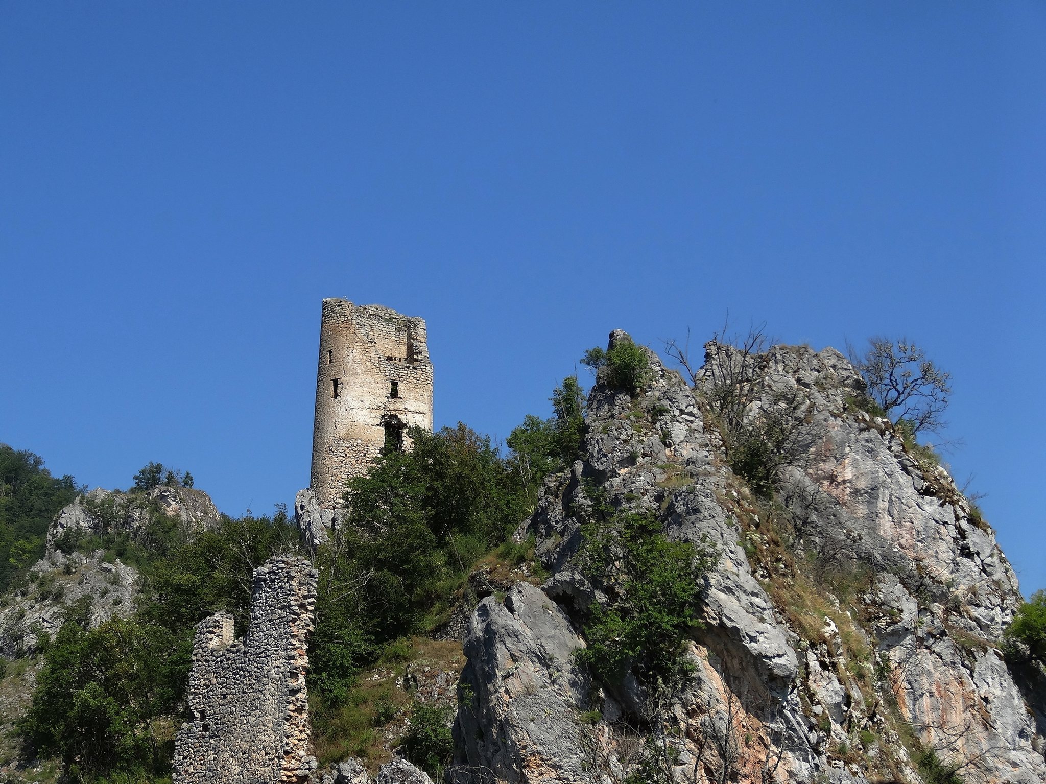
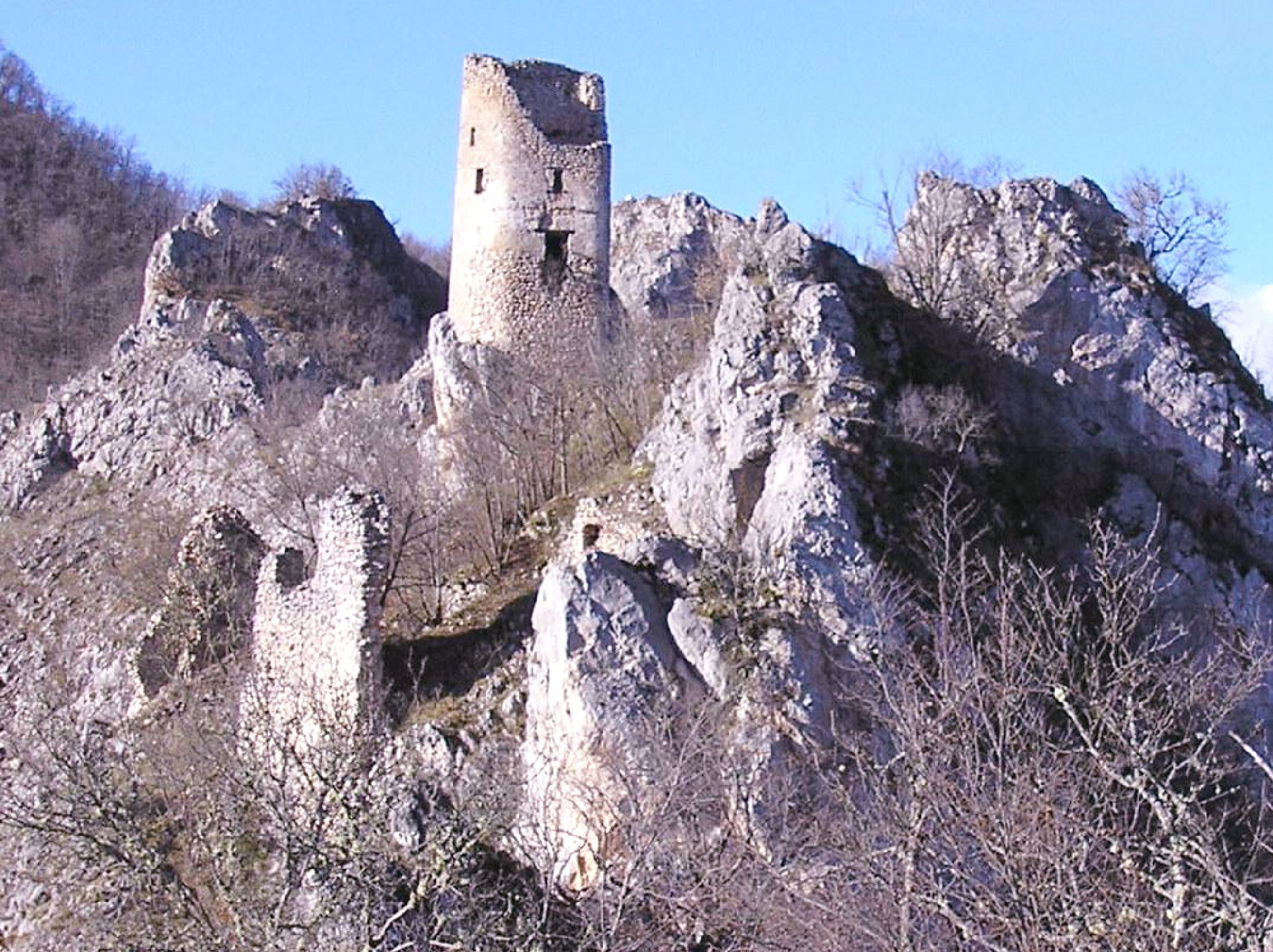
The upper town contains the most completely preserved structure, the main tower on a projecting rock at the extreme northwestern end. It rises above the other sections and was entered by a bridge. Limestone wings on both sides of the approach formed an arch and protected the bridge.
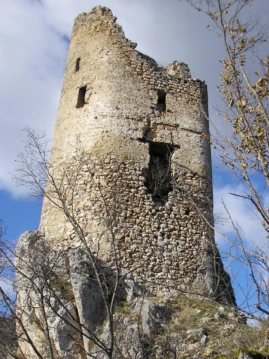
The tower has an irregular elliptical plan, with rounded outer surfaces on its narrower side walls. Three levels survive. Its internal dimensions are 4 by 2 meters, while its external dimensions are 6.9 by 4.55 meters. Wall thickness varies from approximately 1.3 to 1.9 meters in some sections and from 0.9 to 1.05 meters in others. The tower now rises about 11 meters, slightly more than half its original height. Stevan Delić recorded it at 18 meters, and a photograph from 1912 shows one more floor than survived in 1973. The southeastern wall has since collapsed completely.
Regularly dressed stone and tufa blocks form the tower in horizontal courses. Thick oak beams served as architraves, the horizontal structural members above doors and windows. The interior is filled with fallen masonry, while collapsed stones lie in the ravines of the Janjina, which descend more than 200 meters at this point.
Ground east of the main tower is especially steep and contains a dense network of ramparts, walls, and retaining walls. Wooden buildings probably once stood there. A lower and wider plateau northeast of the tower contains remains of additional structures whose original forms and dimensions require archaeological excavation for definition.
Southern fortress
Southern rampart and tower
The southern fortress lies about 150 meters below the central plateau. A rampart with a broken-line course follows the steep terrain and connected the southern area with the central section. At its foot stand the remains of a square tower with a gate on its northern side. All four walls survived at the end of the nineteenth century, but by 1973 the eastern wall had fallen into the ravine. The slope behind the tower descends almost vertically toward the Janjina.
Across the fortress, wooden elements have disappeared, masonry has collapsed, and wall facings have fallen away. The main tower remains the most substantial surviving structure, although its walls are cracked.