Kauttuan linnavuori: An Iron Age Hillfort in Finland
Site at a Glance
- Rating
- 3.3
- Popularity
- Very Low
- Country
- Finland
- Primary era
- Iron Age
- External website
- Open
- Eras represented
- Iron Age
- Civilizations
- Unclassified
- Site type
- Military
- Remains
- Fort
On this page8 sections
History
Kauttuan linnavuori is an Iron Age hillfort in Finland, near Kauttua in Eura, Satakunta. The fortification stood in a settlement landscape that included one of Eura’s old villages, where a large and wealthy Iron Age community developed. It is probably connected with the Luistari cemetery, located about 800 metres away. The hillfort is described as the only one in Lower Satakunta and as one of Finland’s smaller hillforts.
Iron Age occupation
The hillfort was occupied at least around the transition from the seventh to the eighth century. This dating is based on pottery types and a straight-backed fighting knife found at the site. The pottery type was used in the early eighth century, while straight-backed fighting knives were used at the end of the Merovingian period, the later part of Finland’s Iron Age, conventionally dated from about the sixth to the eighth century.
The finds indicate varied activity within the fortification. They include pottery fragments, part of a fighting knife, a lower quern stone used for grinding, a piece of iron, an iron nail, burnt bone, and fragments of clay discs that may have served as game pieces. More than 17 kilograms of iron slag, the waste produced during ironworking, were also recovered. This material can indicate metal production or smithing at the site.
Archaeological investigation and management
Archaeological investigations took place in 1886, 1946, and 1975. Hjalmar Appelgren-Kivalo excavated an eight-metre section of the rampart west of the gate and an area immediately inside it. Jouko Voionmaa examined the point where the rampart reached the cliff, the southeastern corner and inner side of the rampart, and a small part of the courtyard. Pirkko-Liisa Lehtosalo-Hilander also investigated the site in 1975. Excavation has covered approximately 16.5 percent of the summit area.
The hillfort has been included in the Finnish Heritage Agency’s management programme since 1995. Information boards have been installed, vegetation on the summit is cut annually, and scrub is cleared regularly from the stone ramparts so that the underlying rock remains visible. A study of plant species around the hillfort in 1996 identified hazel as the only archaeophyte, a plant introduced to the region in the distant past, often through human activity.
Remains
Setting and enclosed area
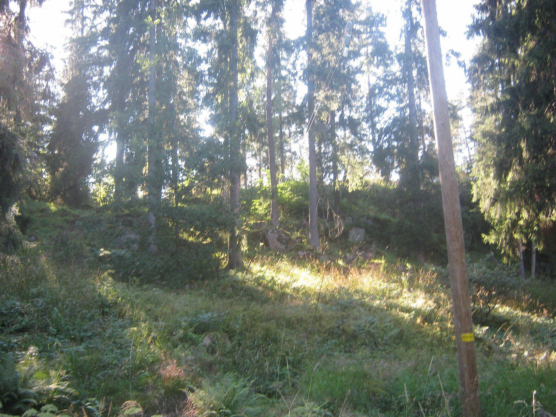
Kauttuan linnavuori occupies a wooded hill at the northern end of Lake Pyhäjärvi. It stands about 700 metres from the modern lakeshore and approximately 500 metres from the headwaters of the Eurajoki River, rising roughly 20 metres above a level agricultural plain. The northeastern and northern sides consist of naturally steep rock, while the other slopes are gentler and were probably strengthened with wooden fortifications.
Natural cliffs and artificial ramparts together enclose a compact area of about 750 square metres. The summit measures no more than approximately 30 by 40 metres. The surviving layout therefore combines a small interior with a defensive boundary that uses the terrain most strongly on the steep northern and northeastern sides.
Ramparts and entrances
Stone rampart foundations
Stone foundations for the wooden ramparts encircle the gentler slopes. They are formed mainly from large fieldstones, supplemented by smaller stones. The stonework is approximately 1.3 to 4.5 metres wide and between 1 and 2 metres high, extending for about 56 to 58 metres. These foundations supported a wooden defensive structure, although no remains of the timber itself survive.
The inner rampart includes angular sections that may have held log joints. The distances between these sections correspond to the lengths of the logs, providing a possible indication of how the wooden structure was assembled. Stones to the southwest have led to the suggestion that an outer rampart may also have existed, but they do not form a rampart-like arrangement, so this feature remains uncertain.
Gate and excavated rampart areas
An opening at the southwestern corner of the stonework may mark the entrance to the fortification. Appelgren’s excavation in the western rampart exposed red gravel up to 45 centimetres thick. Excavations at the southeastern corner revealed pottery fragments bearing wave-line ornament, while part of a straight-backed fighting knife was found in the courtyard.
Other excavated material helps explain the activities carried out within the enclosed area. The quern stone points to grinding, while the iron slag, iron fragment, and nail relate to ironworking or metal use. Burnt bone and the clay-disc fragments add further evidence of activity in the small summit enclosure.