Kashiya Cave Tombs: A Large Ancient Necropolis in Japan


Site at a Glance
- Rating
- 4
- Popularity
- Very Low
- Country
- Japan
- Primary era
- Medieval
- Eras represented
- Medieval
- Civilizations
- Yamato
- Site type
- Burial
- Remains
- Necropolis
On this page6 sections
History
The Kashiya Cave Tombs are a necropolis in Japan, located at Kashiya in Kannami, Shizuoka. Created from the end of the sixth century to the end of the eighth century, they span the final Kofun period, Japan’s ancient mound-building era, and the early Nara period, when a centralized imperial state was developing. The complex is regarded as the largest group of cave tombs in Shizuoka Prefecture and is recognized for illustrating funerary practices in eastern Japan during the seventh and eighth centuries.
Creation and changing burial customs
The tombs formed an extensive cemetery on the eastern side of the Tagata Plain, in the Kano River basin at the northern end of the Izu Peninsula. At least 300 tombs are believed to have existed, although the precise total is unknown and estimates range from approximately 300 to 500. Cremated human bones were found in later tombs, providing evidence of a change from inhumation, in which the body was buried, to cremation.
Investigation and preservation
The site had attracted academic attention by the Meiji period. Its first academic investigation took place in 1947 under a Doctor of Letters teaching at Nippon University’s Mishima Preparatory School. Investigators divided the complex into five areas, labelled A through E, and classified the tombs into five types. Areas A and E were not investigated because many tombs there had already been destroyed or had disappeared.
Land development and large-scale residential construction threatened the complex from the 1960s. Most of area D disappeared or was buried beneath developed land, leading members of the Sunzu Archaeological Society and local residents to create the Kashiya One Hundred Holes Preservation Association. A second investigation in 1973 surveyed areas B, C, and the small surviving part of D. It confirmed 108 tombs and produced both a topographic map and a distribution map. In 1974, a third investigation searched for unopened tombs in B and C and measured some opened examples. Five further tombs were found in B, and the combined number in B and C was estimated at about 200.
A Kannami Town Board of Education survey in 1997 found 17 additional unopened tombs, indicating that further examples may survive inside and outside the protected area. Part of area B and area C were preserved through the work of researchers and local residents. This surviving portion became a National Historic Site of Japan on February 20, 1976, and the protected area was extended in 1998.
As development and natural deterioration made preservation in the original condition increasingly difficult, Kannami established a preservation and improvement committee for the historic site. Conservation work backfilled open tombs while retaining visible indications of their entrances and left surviving blocking stones in place. Waterproof mortar was applied to tombs and exposed wall surfaces as a provisional measure approved by the Agency for Cultural Affairs. Trees and large roots threatening the tombs and rock surfaces were felled individually, and sand from collapsed natural ground was added to the mortar surfaces to retain a natural colour and texture.
Remains
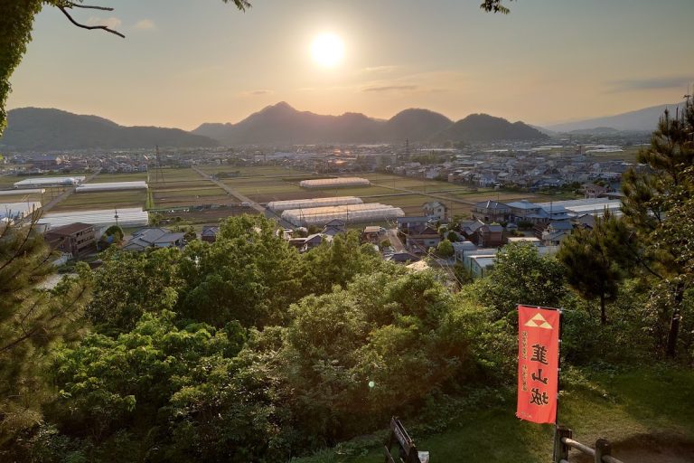
The tombs occupy an area approximately 600 metres from east to west and 250 metres from north to south, at elevations of about 20 to 30 metres on a steep hill. Their openings face south, east, or west toward the Tagata Plain. The hill lies at the southern end of a range extending westward from Mount Hakone, and the tombs were cut into an exposed pumice-flow layer produced by eruptions of that mountain. The Kakizawa River runs to the east, while the loam-formed Mukohara Plateau lies across the river to the west. Mount Shiroyama formerly stood to the south, beyond which the Tagata Plain and its extensive wetland extended.
Burial chambers and hillside layout
The tombs are arranged in four or five levels on the hillside. Their entrances are rectangular and sometimes square, leading to chambers cut horizontally into the rock. The chambers have vaulted ceilings averaging about 1.5 metres high and extend approximately two to three metres into the hillside. The passages are filled with river stones. The five groups, A through E, reflect differences in location and design. Modern housing and property development destroyed most of A, D, and E, while the preserved area consists mainly of B and C and contains approximately 116 tombs. Conservation has retained surviving blocking stones and visible entrance positions where open chambers were backfilled.
Burial objects and ritual evidence
Grave goods from the tombs include fragments of Haji ware, a low-fired earthenware, and Sue ware, a harder high-fired pottery associated with Korean-influenced technology in ancient Japan. Other finds include gold, copper, and stone ornaments, magatama, curved comma-shaped beads used as ornaments and ritual objects, cylindrical beads, weapons, and horse fittings. Investigations beginning in 1947 also uncovered a tortoise plastron interpreted as an oracle bone for divination. It was the first find of this kind in Japan. Replicas of grave goods that were once present at the site have since been removed and transferred elsewhere.