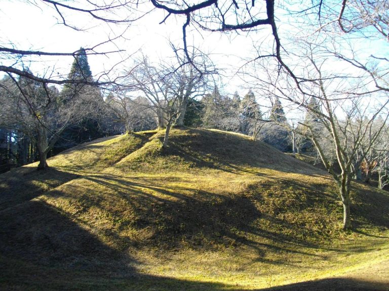
Ryūkakuji Iwaya Kofun: A Seventh-Century Square Burial Mound in Japan


Site at a Glance
- Rating
- 4.1
- Popularity
- Very Low
- Country
- Japan
- Primary era
- Medieval
- External website
- Open
- Eras represented
- Medieval
- Civilizations
- Yamato
- Site type
- Burial
- Remains
- Burial Mound
On this page7 sections
History
Ryūkakuji Iwaya Kofun is a square burial mound in Japan, built during the final phase of the Kofun period, probably in the first half or around the middle of the seventh century. It is Tomb 105 within the Ryūkakuji Kofun Group in Sakae, Chiba Prefecture, a group comprising 115 tombs, of which 114 have been confirmed. The date remains uncertain because its chronology is inferred mainly from the form of its horizontal stone chambers, which are entered from the side of the mound.
Development of the Ryūkakuji Kofun Group
Construction of the group appears to have begun in the sixth century on the Shimosa Plateau, northeast of Lake Inba. Its earlier tombs were comparatively small keyhole-shaped and circular mounds. In the first half of the seventh century, the large Asamayama Kofun was built, followed by Ryūkakuji Iwaya Kofun. The date assigned to Asamayama Kofun remains disputed, adding to the uncertainty surrounding the sequence.
After Asamayama Kofun, burial mounds were increasingly placed on hills at the heads of valleys leading toward the Katori Sea rather than directly beside Lake Inba. Ryūkakuji Iwaya Kofun occupies one of these locations, indicating a change in orientation toward the Katori Sea. Square mounds continued to be built within the group during the latter part of the seventh century, including Miso Iwaya Kofun. Differences in the stone materials used by these tombs support the sequence from Asamayama Kofun to Ryūkakuji Iwaya Kofun and then to the later square mounds.
Later history and preservation
The people buried at Ryūkakuji Iwaya Kofun are unknown. By 1591, the stone chambers were thought to have been open, and their long-standing accessibility gave the tomb a place in local religious belief. The Bowl-Lending Legend held that bowls could be borrowed from the chambers.
Meiji University measured the mound and its stone chambers in 1970. Cleaning and topographic surveys undertaken by the Sakae Town Board of Education in 2007 included Tomb 104, and another survey in 2008 identified a sloping approach on the mound’s southern side. The tomb became a National Historic Site on January 27, 1941. In 2009, the designation was expanded to include the wider Ryūkakuji Kofun Group and surrounding terrain, with the official name changed to “Ryūkakuji Kofun Group and Iwaya Kofun.” Sakae Town manages the site.
Remains
Mound and enclosure
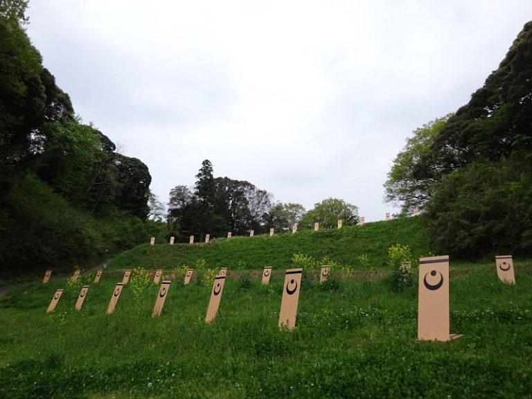
The kofun stands on a plateau about 30 metres above sea level on the northern shore of Lake Inba. Its square mound measures approximately 78 metres on each side and rises 13.2 metres high. Three tiers form the mound, with the first and second tiers lower than the third. A moat roughly 3 metres wide surrounds three sides, while an outer embankment extends beyond it. Together, the mound, moat, and embankment form a complex approximately 110 metres square.
Ryūkakuji Iwaya Kofun is among the largest square kofun of its period in Japan. It is larger than Kasuga Mukoyama Kofun, traditionally identified as the mausoleum of Emperor Yomei, and Yamada Takatsuka Kofun, traditionally identified as the mausoleum of Emperor Suiko. Among square kofun, it is described as second in size only to Masuyama Kofun in Kashihara, Nara Prefecture, which is thought to date from the first half of the fifth century. A first-order triangulation point stands on the mound’s summit.
Horizontal stone chambers
Two horizontal stone burial chambers lie at the centre of the mound’s southern foot, about 10 metres apart. Each has projecting side sections on both sides of the main chamber and lacks an entrance passage. The western chamber is approximately 4.23 metres deep, 1.68 metres wide at the rear wall, and 2.14 metres high. The eastern chamber was slightly larger, measuring about 6.5 metres long and just over 2 metres wide, but it has collapsed. The chambers had been open since at least the sixteenth century, and a full excavation has not yet taken place.
Stonework and approach
The chambers were built with tuffaceous sandstone from the Kinoshita Formation of the Shimosa Group. This stone contains abundant shell fossils from the Kinoshita Shell Bed, which is exposed in a limited area near Lake Inba. Because the sandstone is relatively soft, builders cut it into blocks approximately 60 to 100 centimetres long and about 30 centimetres wide, then laid them in alternating courses resembling brickwork.
Schist quarried near Mount Tsukuba in Ibaraki Prefecture was used in the parts of the chambers thought to have supported coffins. Later square tombs in the Ryūkakuji group, including Miso Iwaya Kofun, used shell-fossil-bearing sandstone without schist. A sloping approach ran from the valley south of the mound toward the burial complex.