Muro Miya-yama Kofun: A Keyhole-Shaped Burial Mound in Japan

Site at a Glance
- Rating
- 4.4
- Popularity
- Very Low
- Country
- Japan
- Primary era
- Classical
- External website
- Open
- Eras represented
- Classical
- Civilizations
- Yamato
- Site type
- Burial
- Remains
- Burial Mound
On this page10 sections
History
Muro Miya-yama Kofun is a large fifth-century burial mound in Gose, Nara, Japan, built during the middle Kofun period, an era from about the third to the sixth centuries when powerful regional chiefs constructed monumental tombs. The mound is the largest in the Katsuragi region and is ranked as the eighteenth largest in Japan. Its sudden appearance in an area without earlier large kofun, together with its exceptional scale, has been interpreted as evidence of changing political power during the transition from the Saki to the Kawachi ruling centers.
Construction and chiefly power
The mound was created at the beginning of the fifth century by cutting the end of a ridge on the southwestern edge of the Nara Basin. Its construction formed part of a wider development in the Gose area. The Nango archaeological complex flourished during the middle to late fifth century, while the Koseyama Kofun group was established from the end of the fifth century. The next major chiefly tomb in the Katsuragi region is generally identified as Wakigami Kanko-zuka Kofun, whose mound measures about 149 meters in length and is substantially smaller than Muro Miya-yama Kofun.
The person buried in the principal tomb is unknown. A current interpretation connects the burial with Katsuragi no Sotsuhiko, a figure associated with the Katsuragi leadership and with activity on the Korean Peninsula. No conclusive evidence establishes that identification, and the Sotsuhiko described in historical texts may represent more than one individual.
Names, traditions, and religious associations
The mound is also called Muro-no-Ohaka. Its traditional association with Hachiman worship gave rise to the name “Miyayama.” Hachiman is a Japanese deity associated with warfare, protection, and the imperial line. A Hachiman Shrine has long stood on the rear circular mound. The ancient place-name Muro appears as Muro-go in the Wamyosho entry for Katsuragi County in Yamato Province.
An older tradition identifies the tomb with Takeuchi no Sukune, a largely legendary figure whose characterization probably developed around the seventh century. A medieval tradition already associated his death and burial with a place called Muro by approximately the Nanboku-cho period. Earlier interpretations also identified the mound as the tomb of Emperor Kōshō or Emperor Kōan. The Kojiki and Nihon Shoki place Emperor Kōan’s Akitsushima Palace of Muro in this area, and a monument identifying the palace site stands within the Hachiman Shrine grounds east of the kofun.
Investigation and protection
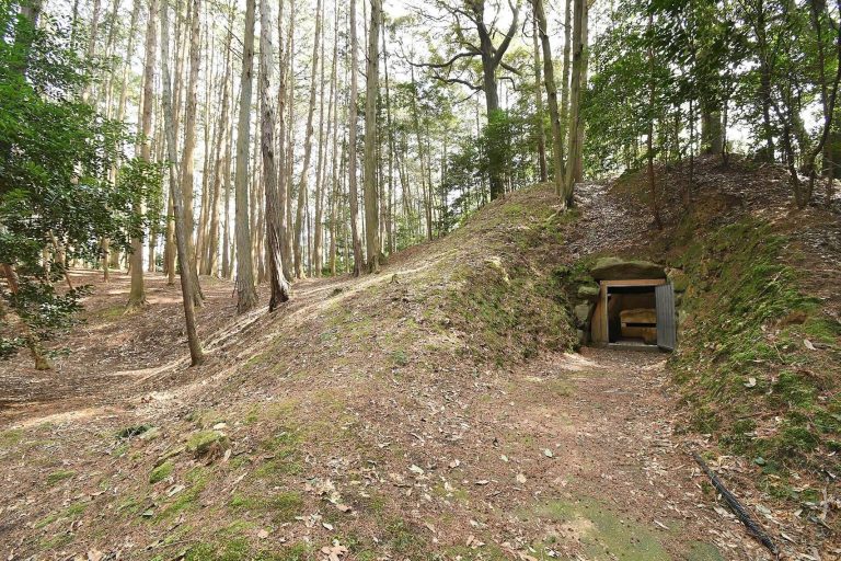
Nekozuka Kofun, a secondary mound beside the principal tomb, was excavated around 1888. The work reportedly revealed a vertical-entry stone chamber, a burial chamber reached from above through the mound, together with iron implements. Numerous armor and weapon fittings from the mound have led to the interpretation that its occupant may have been an early official responsible for managing a weapons storehouse.
Cultivation affected the anterior portion during the wartime period and brought boards of koyamaki wood to light, possibly from a wooden coffin. Further cultivation near the front of the mound in 1908 reportedly exposed a wooden object that may also have been coffin material, along with at least eleven mirrors, beads, and stone objects. Umehara Sueji later described the mound’s exterior, the roof stones of the rear chamber, and these finds in 1922.
A tomb-robbing incident in 1950 led to an emergency investigation of the rear mound. The investigation confirmed two vertical-entry stone chambers and clarified the condition of the southern chamber and its coffin. Later work examined the northern projecting area in 1971, the northern outer bank in 1989, and the wider site in 1995. A typhoon in 1998 toppled trees and exposed many artifacts, allowing further investigation of the northern burial chamber.
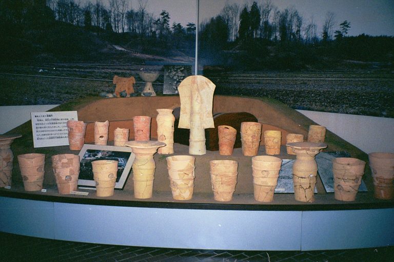
The mound area became a National Historic Site on March 3, 1921. The protected area was enlarged through additional designations in 2022, 2024, and 2025. Parts of the excavated haniwa, clay figures and cylinders placed around or on burial mounds for funerary and symbolic purposes, together with reconstruction models of their arrangement, are held at the Museum of the Archaeological Institute of Kashihara. Finds are also preserved and displayed at the Gose City Cultural Properties Exhibition Room.
Remains
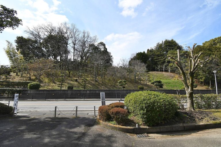
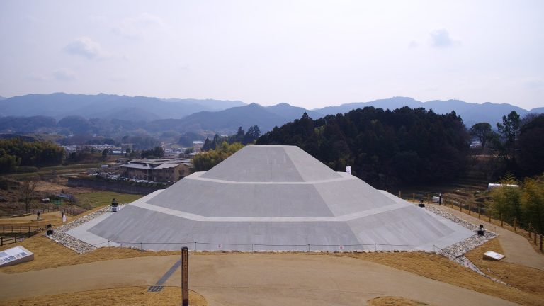
Muro Miya-yama Kofun is a zenpo-koen-fun, the keyhole-shaped form combining a circular rear mound with a rectangular front section. It extends for approximately 238 meters and faces west-southwest. Both the rear and anterior portions were built in three tiers. Granite split-stone fukiishi, stones laid over a mound’s outer slopes, covered the exterior, while cylindrical and morning-glory-shaped haniwa encircled the terraces.
Mound and surrounding earthworks
The circular rear portion measures about 105 meters across and rises approximately 25 meters. Its upper circular platform has a basal diameter of about 38 meters, a top diameter of about 30 meters, and a height of roughly 2.5 to 3 meters. The rectangular anterior portion is about 110 meters wide and 22 meters high. A separate reconstruction estimate proposes a rear portion of about 148 meters and an anterior width of about 152 meters, figures that differ from the directly measured dimensions. Figurative haniwa, including houses and granaries, stood on the upper part of the circular mound. The overall outline has been compared with that of Konabe Kofun.
A shield-shaped moat surrounded the mound. Naka-ike, a pond on the southern side, is regarded as a surviving trace of this water barrier. The outer bank is estimated to have been about 40 meters wide, and traces on the northern side occur in the area now occupied by National Route 309. The northern projecting area was built in two tiers by cutting the natural ground, and its form and associated finds indicate that it was planned and constructed at the same time as the main mound. A southern projecting area is inferred from an unnatural projection on the northern bank of Naka-ike. A possible platform is also indicated by a topographic bulge north of the junction between the circular and anterior portions.
Rear burial chambers
Southern chamber
The burial arrangements are estimated to have included six facilities, with two in the rear circular mound, two probably in the anterior portion, one in the northern projecting area, and one probably in the southern projecting area. The two rear chambers lie parallel to one another on the northern and southern sides of the mound’s east-west central axis.
The southern chamber is a vertical-entry stone chamber built from split blocks of crystalline schist, including green schist and graphite schist brought from the Kinokawa area. It measures about 5.5 meters in length, 1.9 meters across at the eastern end, 1.71 meters across at the western end, and approximately 1.1 meters in height. Its roof used cut blocks of welded rhyolitic tuff from the Himeji Acidic Rocks near Kakogawa in Hyogo Prefecture. Five of the six roof stones survive.
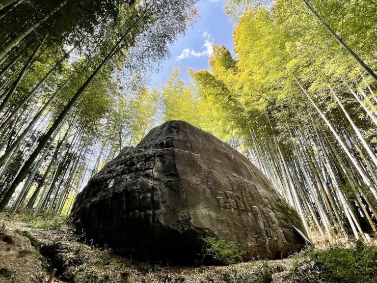
At the chamber’s center is an assembled chest-shaped stone coffin made from layered hyaloclastite, known as Tatsuyama stone, from the Kakogawa River basin. The coffin was coated completely with vermilion and measures about 3.5 meters long, or 3.77 meters when its rope-hanging projections are included. It is about 1.4 meters wide. Its lid has a grid-patterned tortoiseshell design and eight rope-hanging projections, two on each side. The deceased was placed with the head toward the east, and the chamber appears to have been built after the coffin was installed.
Tomb robbing scattered many of the grave goods, but investigations recovered fragments of triangular-rimmed bronze mirrors with divine-beast designs, armor, swords, and other blades. The finds also include magatama and tubular beads, a koto-pillar-shaped stone object, eleven swords, fragments of a leather-laced cuirass, and a divine-beast mirror with a scrolling-band design. The position of some objects in relation to the coffin remains uncertain. Objects in the earth above the chamber may have been deposited in a ritual after the roof stones were closed. They include steatite copies of a knife and an axe head, fragments of Haji ware, a low-fired earthenware tradition, and iron implements such as an iron sword.
Northern chamber
The northern chamber is a second vertical-entry structure built with green schist. Root exposure after the 1998 typhoon indicated that it contained a chest-shaped coffin made of Tatsuyama stone and packed around with diorite. The chamber was heavily disturbed by robbing, and many of the surrounding haniwa had been displaced.
Among its grave goods were at least four pieces of pottery made in Kaya, the ancient polities of southern Korea. One is a finely made boat-shaped vessel. Their unusual color, compared with ordinary Japanese Sue ware, a high-fired ceramic tradition, has led to the interpretation that these vessels were heirlooms brought from the Korean Peninsula.
Funerary figures and secondary mound
Two rectangular rows of haniwa surrounded the southern chamber. The outer row contained roughly forty weapon-shaped figures, about 1.5 meters high, including armor-, quiver-, and shield-shaped forms. The inner row consisted of cylindrical and morning-glory-shaped figures. The weapon-shaped figures faced outward and are interpreted as symbolic protectors of the deceased.
The helmet-shaped figure in this arrangement represents a leather helmet rather than the iron helmet commonly used at the time. This has been interpreted as an image of a bodyguard or personal guard protecting the deceased, rather than as the deceased’s own equipment. At least five large house-shaped haniwa stood farther south. One, about 1.2 meters high, has square posts resembling those of a large raised-floor building excavated at the Gokurakuji Hibiki site, a probable fifth-century chiefly administrative center south of the kofun. The figure slightly predates that building and is therefore not identified as a representation of it.
Nekozuka Kofun is a square secondary mound northeast of the main mound, constructed as if resting on its outer bank. It measures approximately 70 meters on each side and rises about 10 meters. Associated finds include green schist, swords, iron arrowheads, three-pronged iron fittings, triangular-plate leather-laced cuirasses, and neck armor. Cylindrical and morning-glory-shaped haniwa were also recovered from the northern projecting area.