Inari-mori Kofun: A Keyhole-Shaped Burial Mound in Japan
Site at a Glance
- Rating
- 3.9
- Popularity
- Very Low
- Country
- Japan
- Primary era
- Classical
- External website
- Open
- Eras represented
- Classical
- Civilizations
- Unclassified
- Site type
- Burial
- Remains
- Burial Mound
On this page7 sections
History
Inari-mori Kofun is a late-fourth-century keyhole-shaped burial mound in Japan, located at Nagaoka in Nan’yō on the northern edge of the Yonezawa Basin. Built near the beginning of the middle Kofun period, when monumental Japanese burial mounds were constructed for powerful individuals, it is approximately 96 meters long. The mound is the largest kofun in Yamagata Prefecture and ranks seventh in size in the Tōhoku region.
Formation of a regional monument
Earlier burial mounds had already been built in the areas now associated with Yonezawa, Kawanishi, and Nan’yō. These included keyhole-shaped mounds with square rear sections, such as Tenjinmori Kofun and Hōryōzuka Kofun. Inarimori Kofun is interpreted as a monument that brought these three regional areas together symbolically. One hypothesis therefore regards it as a commemorative monument created by the regional ruler of Okitama, a historical area broadly corresponding to the surroundings of modern Nan’yō and Yonezawa. The identity of the person buried within the mound remains unknown.
The political meaning of the mound is also reflected in the later development of the region. No later major burial mound directly following Inarimori Kofun has been identified, while the regional center of Okitama is considered to have shifted toward the Yonezawa area. Some interpretations compare the mound’s shape with burial mounds in Natori, Shikama, and Namie. Another proposes that its occupant was allied with the person buried at Raijinyama Kofun in Natori, the largest kofun in the Tōhoku region.
Interpretations of the unusual front section
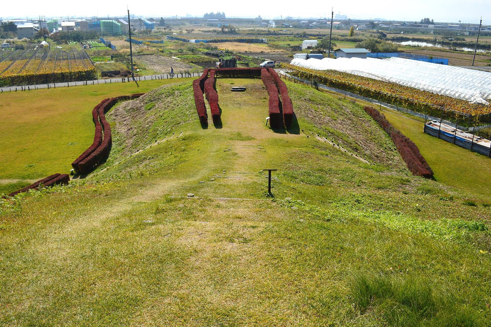
The front part of Inarimori Kofun has an irregular form. One interpretation proposes that approximately half of this section was deliberately left unbuilt, creating what has been described as a half-front-section shape. This theory connects the restriction to the occupant of Raijinyama Kofun, although other interpretations reject the proposal and regard it as requiring further verification. The differing explanations show how the mound’s form has been used to consider relationships between regional ruling groups during the Kofun period.
Discovery and protection
Inarimori Kofun was first proposed as a kofun in 1938. A trench investigation in 1961 recovered only Sue ware, a hard wheel-made stoneware, from the Heian-period phase and did not establish the mound’s identity. Later investigations also identified remains of a settlement dating to around the middle of the Kofun period in the surrounding area.
A 1977 survey established that the mound was keyhole-shaped. Excavations and investigations carried out from 1977 to 1979 clarified its structure and construction methods. The Nan’yō Board of Education conducted further investigations in fiscal years 1987 and 1988, after a detailed survey drawing had been prepared in 1985. Inari-mori Kofun became a National Historic Site of Japan on May 24, 1980, a designation recognizing its archaeological and historical importance. The designated area covers 10,182.7 square meters. Site improvement in fiscal year 1989 substantially retained the mound, and the mound and its surroundings are maintained as an archaeological park.
Remains
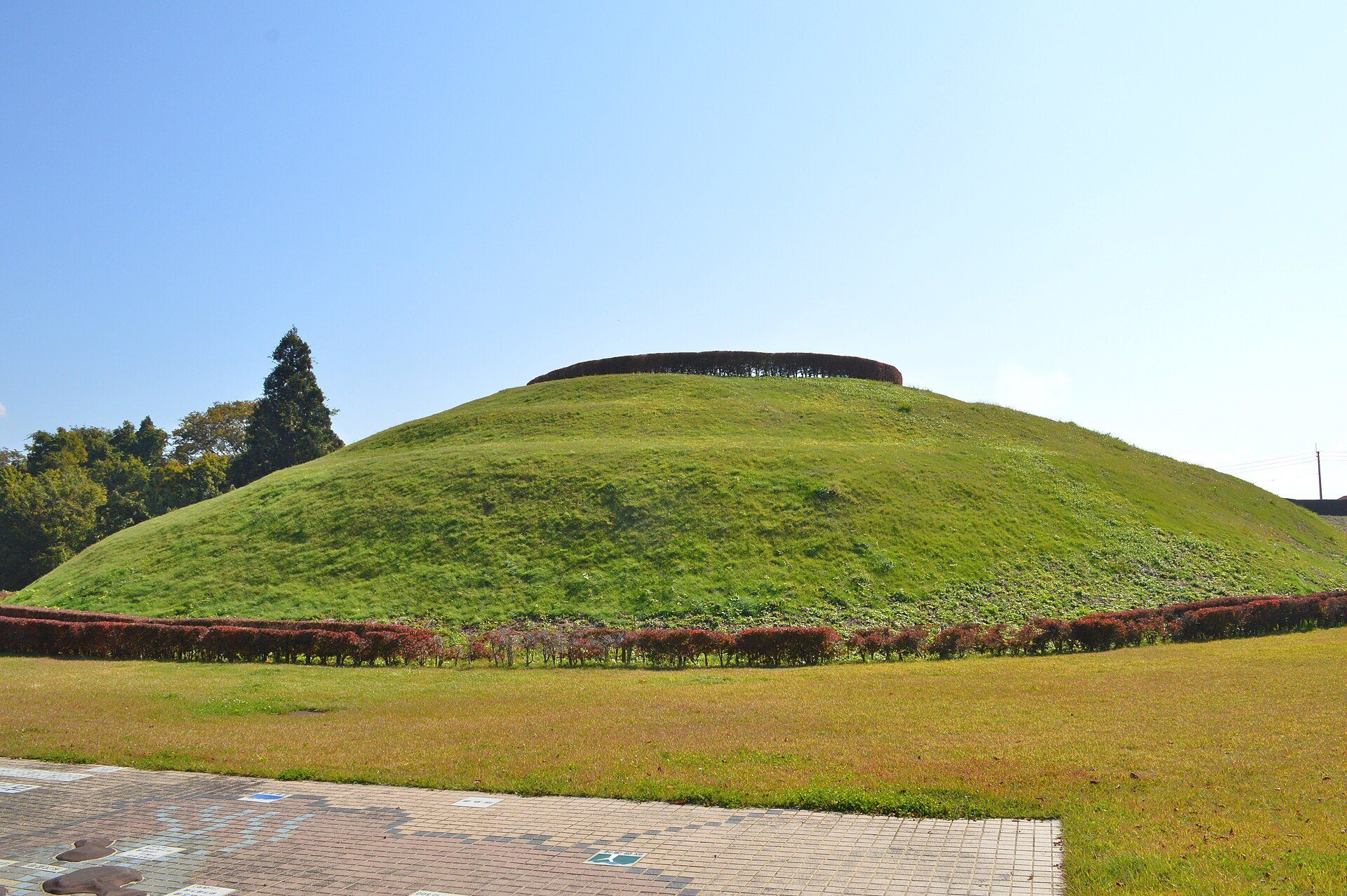
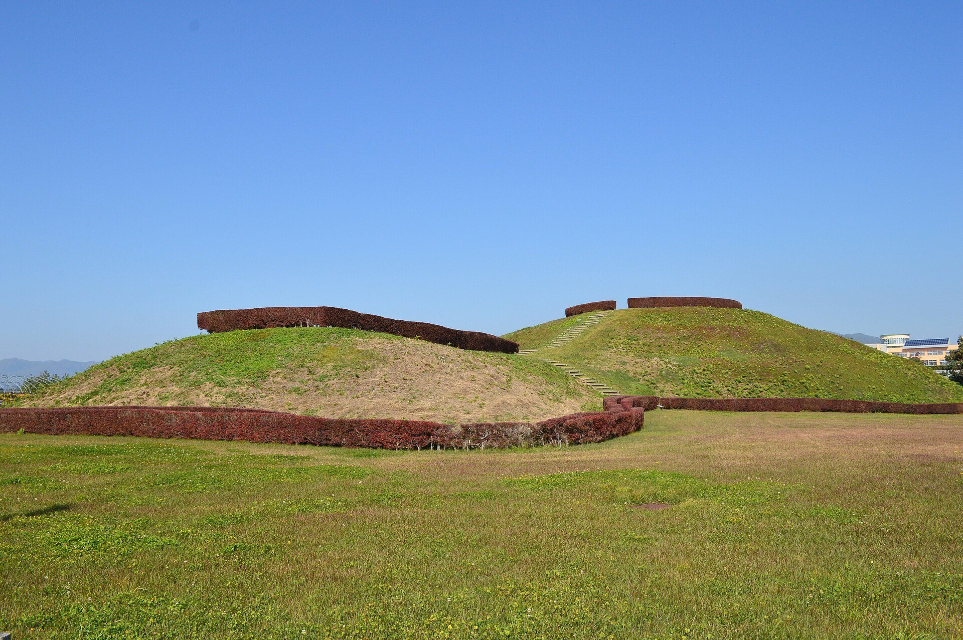
Inari-mori Kofun was formed by cutting across the end of an isolated hill on the right bank of the Yoshino River. Its front section points south-southwest toward the center of the Yonezawa Basin. The mound has the characteristic keyhole plan, combining a circular rear section with a projecting rectangular front section, and preserves its original form comparatively well.
Mound layout and construction
The circular rear section measures about 62 meters across and rises approximately 9.6 meters. It has three construction tiers. The lowest tier is relatively high and was formed largely by cutting into the natural hill, while the second and third tiers were made through compacted-earth construction, in which layers of earth were repeatedly compressed to produce a stable mound. A terrace-like belt extends around a defined area surrounding the mound.
The rectangular front section is about 34 meters long, 30 meters wide at its outer end, and approximately 5 meters high. It has a single tier and is lower and shorter than the rear section. The resulting difference between the two parts contributes to the mound’s distinctive profile and is central to interpretations of its irregular front form.
Burial evidence and later use
The interior of the mound has not been investigated, so the burial facility has not been identified. One theory proposes that the deceased was placed in a wooden coffin set directly in a pit rather than in a stone burial chamber. Excavation recovered Haji ware, a generally unglazed earthenware tradition of ancient Japan, including a high-footed vessel from a pit dwelling directly beneath the rear section. The vessel belongs to an early form of the Shiogama type, a regional style of Haji ware, and dates to the first half or middle of the fourth century. Its position shows that the mound was built after the earlier dwelling had been in use.
A perforated-bottom Haji ware jar was found where the natural ground had been cut away. It appears to date from the time of construction, but its form was not commonly used in the Okitama region and is regarded as an imported heirloom. It therefore does not securely establish when the mound was built. Excavated remains also include reported human bones. From the Heian period through the medieval period, the area was used as a cemetery, leaving later burial pits and fragments of stone pagodas that record the site’s continued use after the Kofun period.