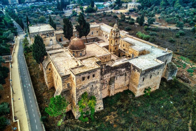
Hurvat Anim: An Ancient Jewish Settlement and Synagogue in Israel


Site at a Glance
- Rating
- 4.5
- Popularity
- Low
- Country
- Israel
- Primary era
- Medieval
- Eras represented
- Iron Age, Classical, Medieval
- Civilizations
- Byzantine, Israelite, Roman
- Site type
- Domestic
- Remains
- House
On this page12 sections
History
Hurvat Anim is a ruined settlement and archaeological site in Israel, identified with biblical Anim and the Late Antique Jewish settlement of Anaia. Its history extends from an Iron Age hilltop fortress to a Roman-Byzantine rural community whose synagogue remained in use into the seventh century or possibly the seventh to eighth centuries.
Iron Age and Biblical Anim
Anim is listed within the territory of Judah in the Book of Joshua. The site’s position and pottery from the settlement support its identification with that biblical place. Iron Age remains at the top of the rocky hill include a fortress, while the wider settlement later developed a rural economy based on crops, cisterns, seasonal cave dwellings, and agro-pastoral activity.
The division between lower and upper settlements called Anim also appears in the Arad ostraca. These Iron Age inscriptions, written on pieces of pottery, preserve administrative and geographic information from the southern Judean region. The two settlements were connected by a road, a relationship that continued to shape the area in Late Antiquity.
Late Antique Anaia
In the Roman-Byzantine period, the southern Levant was ruled first by Rome and later by the Byzantine Empire. Eusebius of Caesarea, a fourth-century Christian bishop and historian, described a Jewish settlement called Anaia in the southern Judean region. He distinguished it from a Christian settlement to the east, identified with Upper Anim, where a Byzantine church was later found.
This arrangement places Lower and Upper Anim within a landscape shared by Jewish and Christian communities. The road between them and the church overlooking the Jewish settlement provide the setting for the relationship described in Late Antique accounts. At Lower Anim, the synagogue’s earliest phase belongs to the third century, while its principal building phase dates from the fourth through the seventh centuries.
Early Islamic period and modern investigation
The synagogue was later converted into a mosque during the early Islamic period. Gold coins and other activity indicate that the settlement continued into the eighth century. The possibility that Jewish inhabitants remained at the site into the early Islamic period and were compelled to convert to Islam has been proposed, but it remains a hypothesis rather than an established fact.
Nineteenth-century and early twentieth-century surveys recorded the place as an Arab hamlet or ruin called Lower Ghuwein. Edward Robinson noted the ruin in 1838, and the Survey of Western Palestine described ruins and caves in the 1870s. Excavation work began in 1987, followed by excavations directed by Z. Ilan and Dan Urman in 1988 and 1989. The site has been within Israel since 1949 and is now incorporated into the Yatir Forest recreational area as a site of national heritage importance.
Remains
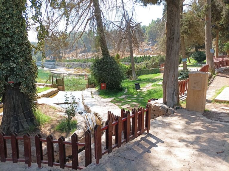
Hurvat Anim occupies the slope of a rocky hill in the Yatir uplands, at about 685 metres above sea level near the northern edge of the Negev. The ruins lie approximately 20 kilometres northwest of Arad and southwest of Livnah. Caves, cisterns, terraces, fences, sheep pens, a cemetery, an Iron Age fortress, and the synagogue complex survive across the uninhabited settlement.
Settlement and agricultural landscape
Cave dwellings and water systems
Approximately 50 rock-cut dwelling cellars or cave dwellings form part of the settlement. Only portions of their walls rise above ground, while some entrances have carefully made stone lintels decorated with rosette reliefs. Underground cisterns were cut into the bedrock, and a stairway south of the synagogue leads toward a cistern and concealed caves protected against unauthorized entry.
Farming installations
The surrounding remains reflect dry farming and seasonal agro-pastoral activity. Terraces, stone fences, sheep pens, and other agricultural installations spread through the landscape. A winepress cut into the bedrock has three descending surfaces. Grapes were crushed on the upper surface, juice ran into a small settling compartment, and the liquid was collected in pottery jars for fermentation and storage in underground spaces.
A rock-cut olive press consists of a fixed lower section, known as the sea, and a movable pressing element operated by a working animal. Together with the winepress, cisterns, and field installations, it illustrates the systems that supported the settlement’s rural economy.
Anim Synagogue
Building and layout
The Anim Synagogue is a rectangular basilical synagogue, meaning a long hall-like building organized along a principal axis. It measures approximately 14.5 by 8.5 metres, is oriented toward Jerusalem, and has entrances on the eastern side. An entrance porch and a courtyard with rooms on both sides formed part of the complex. The eastern entrances retain two characteristic stone lintels, while walls built of hewn stone survive to about 3.5 metres high.
Columns stood on square bases at the front of the building and supported capitals. The hall had a tiled roof, and its walls were plastered. Geometric mosaics once covered the floor, with traces recovered beneath a later floor of stone slabs. A fragment of a Hebrew inscription and portions of a marble basin used for ritual handwashing were also found.
Interior ritual space
A section of the original bedrock was deliberately left exposed inside the synagogue, a practice also known at the ancient synagogue of Maon in the southern Judean hills. Z. Ilan identified an unusual sacred space occupying about one-quarter of the hall’s width. Screen slabs separated it from the rest of the room, and several fragments of those screens survive.
Relationship with Upper Anim
The synagogue complex forms part of the physical and historical landscape shared with Upper Anim. The Byzantine church at Upper Anim stood on the hill east of the upper settlement, and the two communities were connected by a road. This surviving landscape preserves the relationship between the Jewish settlement at Lower Anim and the associated Christian community in the Late Antique period.