Moulin de Rouvres: A Historic Watermill and First-Aid Post in France


Site at a Glance
- Rating
- 4.5
- Popularity
- Very Low
- Country
- France
- Primary era
- Medieval
- Eras represented
- Medieval, Early Modern, Modern
- Civilizations
- German, Holy Roman Empire
- Site type
- Economic
- Remains
- Watermill
On this page13 sections
History
Moulin de Rouvres is a historic watermill in France, at Rouvres-en-Woëvre, whose documented history begins in the thirteenth century. Its development was linked to the Benedictines, members of the Order of Saint Benedict, whose religious estates often included mills and fishponds. The mill stood beside an artificial pond and became an important source of income for the seigneury, or territorial lordship, of Rouvres-en-Woëvre from the thirteenth to the eighteenth century.
Benedictine origins and medieval lordship
The site was originally attached to a farm occupied since the Gallo-Roman period. Benedictine activity at Rouvres is recorded from 962, when Wigfrid, Bishop of Verdun, replaced the community of Saint-Saturnin with one belonging to Saint-Paul. A document from 972 lists the congregation’s revenues from the church and two manses, or rural agricultural holdings, at Rouvres. The Benedictine Abbey of Rosa, occupied by monks of Saint-Paul, appears in records from 1144, and the earlier farm was transformed into an abbey during the twelfth century.
The mill and pond were probably created in connection with the Benedictine presence at Rosa. In 1230, Gobert d’Aspremont recognized the monks’ ownership of the pond below the abbey and above the mill. The same arrangement divided economic rights between the church estate and the lords of Rouvres. The pond belonged to the Rosa estate, while Gobert VI d’Aspremont retained fishing rights and the mill’s revenues. The monks used dikes and canals to create the pond in the thirteenth century, adapting the water system to local geological conditions.
The seigneury itself had developed from a usufruct over Rouvres granted by Bishop Richer of Verdun between 1098 and 1107 to his brother Albert, lord of Briey, on behalf of Matilda of Tuscany, an eleventh-century Italian ruler whose territories extended across much of central and northern Italy. In 1144, Albert de Romont ceded part of the Rouvres estate to Bishop Albéron de Chiny, on the condition that the Abbey of Saint Paul administer it. Gobert V d’Aspremont challenged the donation in 1166, later accepted it, and added agricultural land to the bequest.
Around 1339, Jean I d’Apremont transferred part of his Rouvres property, including the mill and its land, to Mathieu de Noviant-aux-prés, lord of Mandres-aux-Quatre-Tours. The exchange involved the fortified house of Mandre and the exercise of high and low justice there. Mathieu’s descendants then received the mill’s revenues as a fief of the Bishopric of Verdun until Lorraine and Bar were annexed by the Kingdom of France in 1766.
The Cour de Rouvres and divided revenues
Mathieu de Noviant-aux-prés established the Cour de Rouvres, also called the Grande Cour de Rouvres. A 1377 vidimus, an authenticated copy of an earlier document, describes the fief as including a house and dependencies, communal ovens at Rouvres and Lanhères, and various rents from the mill, meadows, land, and the bourgeois inhabitants of Rouvres.
The mill’s income was divided among successive rights-holders. The agreement of 1339 specified five reds of mill production and six reds of oats from the land. In 1456 and 1457, Louis de Haraucourt, lord of Gondrecourt-en-Woëvre, received four livres from the land and mill. Later records, from 1571, 1612, 1664, and 1699, list rents of eight rases of oats from the land and four rases of wheat from the mill. A rase or red was a historical regional measure of grain or mill production.
The Cour de Rouvres fief was divided among several co-owners between 1450 and 1778. The Thirty Years’ War, a seventeenth-century European conflict that brought widespread military destruction, and the French occupation devastated the estate. Its courtyard house was destroyed, leaving surviving sections of its north, south, and west walls. The eighteenth century also brought the destruction of the dovecote and the communal ovens of Rouvres and Lanhère.
Transfer to the French state and agricultural conversion
Following the annexation of the Duchy of Lorraine and Bar in 1766, the Kingdom of France purchased the mill and its lands. After the French Revolution, the Abbey of Rosa was dismantled, and the mill and pond were sold as national property. During the nineteenth century, industrial gristmills competed with the traditional watermill, while fish brought from the French coasts challenged its fish-farming activity. The pond was drained in 1889, and the mill was converted into a farm.
The property passed to a private owner in the early twentieth century. Its agricultural uses included sheep and cattle breeding and polyculture. The buildings remained in agricultural use after the First World War, and farming continued until the 1990s, when production declined to a small cattle herd. The buildings subsequently deteriorated, with severely damaged roofs, endangered roof structures, and partly blocked channels in the dikes.
First World War military base
During the Battle of Étain-Rouvres on 24 and 25 August 1914, Moulin de Rouvres served as a Verbandplatz, a German military first-aid and casualty-collection post, for the 45th Landwehr Brigade. A Landwehr brigade was a German reserve formation composed chiefly of older or previously trained soldiers. Wounded men from the Ldw.I.R. 100 and Ldw.I.R. 102 regiments were brought to the mill from the front between Boinville-en-Woëvre and Warcq.
Rouvres-en-Woëvre was completely destroyed during the fighting, and the German army shot its inhabitants, while the mill itself suffered no damage. After the front stabilized, the German army converted the site into a permanent first-aid post, supply centre, and troop billet during the Battle of Verdun. Its position near the front and its protection by wooded terrain made it a strategic rear base. The complex could shelter up to 3,000 soldiers, including troops moving to or from the front and wounded men from the fighting around Forts Douaumont and Vaux. Some wounded were treated at the mill, while others were sent to Metz.
The base also provided a place of rest and social interaction. Soldiers returning from the front were undressed, washed, shaved, and deloused before going to their quarters. The military installation therefore combined medical, logistical, residential, and communal functions. Its later interpretation is also linked to a tablet engraved by a German soldier during the occupation and to objects recovered from the site.
Restoration and present use
After the First World War, the wooden German installations were dismantled, and the mill returned to agricultural use. The property was purchased in the early 2000s. Restoration first stabilized the principal buildings through roof renovation and later gave greater attention to the medieval and German remains. In 2011, a local collective began restoring the German facilities and rebuilding part of a demolished barracks. A museum opened in 2012 with relics recovered at Moulin de Rouvres. The privately owned complex now combines museum and residential functions.
Remains
Geological setting and water system
Moulin de Rouvres lies at the southern end of the Dalle d’Étain, a localized Upper Bathonian geological formation made chiefly of resistant oolitic limestone and associated marl. Oolitic limestone contains small rounded grains formed in shallow, moving water. The site occupies a transition between the clayey depression of the Woëvre plain to the west and the limestone plateau of the Pays Haut des Côtes de Moselle to the east. Surface marls, lateral marly bands, and silt deposits formed a depression where stagnant water created marshland before it was adapted into a mill pond.
The main pond and dikes
The pond probably preceded the mill and supplied both milling water and a fish-farming resource. Its formation was unusual on the Dalle d’Étain, where the porous surface and deep limestone generally discouraged pond formation. At Moulin de Rouvres, a localized clay elevation and impermeable soils retained water. In the early nineteenth century, the principal pond covered nearly 43 hectares. It collected water from the Rosa stream and part of the watershed of the Darmont mill stream, while overflow passed into the Darmont stream, then the Orne, a tributary of the Moselle and a sub-tributary of the Rhine.
Between 1429 and 1430, a 300-metre dike enlarged the pond to approximately 43 hectares. Three canals regulated its water level, and an aqueduct, a structure that carries water between levels, directed water through the dike toward the wheel. A smaller second pond was formed by diverting water from the Rosa stream. The pond appears with the mill on the 1827 Napoleonic cadastral map. After drainage in 1889, the two adjoining ponds became marshes, and agricultural drains channelled water toward the Darmont stream so that the former depression could be cultivated.
The mill and hydraulic machinery
The water wheel was mounted against an exterior wall below the dike. Its transmission mechanism connected with a millstone inside the building. Grain was stored on the three floors above the millstone, then ground into flour for distribution to surrounding villages. Traces of the former wheel remain on the mill’s west wall, while the hydraulic installations survived after the pond was drained.
The causeway leading to the mill was widened in 1466 to improve access to nearby villages. In 1556, the buildings were improved and their capacity for storing grain and flour increased. Materials from the ruined Orfontaine mill near Moulainville were used to repair and enlarge Moulin de Rouvres in 1660. The later farm conversion added two barns, a sheepfold, and a washhouse. During the German occupation, the washhouse became a stable, and a lean-to was built against the mill before being demolished after the war.
First World War installations
Military waterworks and infrastructure
During the First World War, the German army redeveloped the pond beside the mill and built a third reservoir upstream. The water supplied soldiers’ daily needs and operated steam engines. A gravel road, a 0.60-metre railway, pressurized water, electricity, and a telephone line served the military base. These installations connected the agricultural mill complex to the wider logistical system supporting German forces near the front.
Barracks and medical facilities
The German installations extended for approximately 700 metres and included wooden barracks, wooden chalets, sanitary facilities, showers, and a bandstand. Construction used wood, cob, brick, and prefabricated materials. An officers’ building stood directly on the dike. The main mill was refitted with an internal medical circuit, while its basements held a warehouse, kitchen, and infirmary. Dormitories for soldiers and wounded men occupied the upper floors.
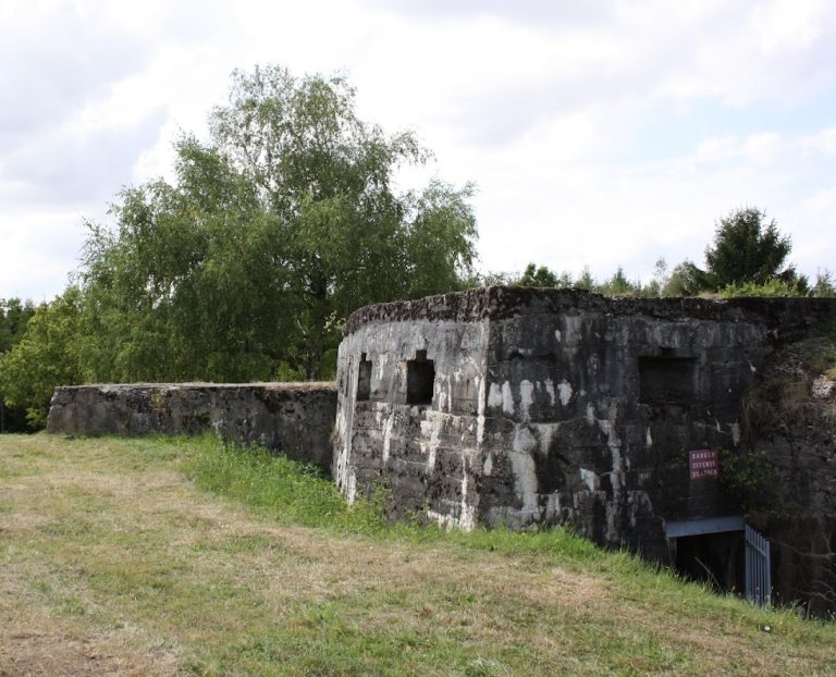
Three barracks, several bunkers, a brick command post, the railway station, and the hairdresser’s shop remained after the war. Restoration has enhanced these surviving military structures and rebuilt part of a demolished barracks. A museum display includes furniture, weapons, and objects associated with the garrison’s domestic life, together with the engraved tablet and other relics found at Moulin de Rouvres. They provide physical evidence of the base’s medical, logistical, and residential uses during the wartime occupation.