Solomon’s Pools: An Ancient Water System near Bethlehem


Site at a Glance
- Rating
- 4
- Popularity
- Low
- Country
- Israel
- Primary era
- Classical
- Eras represented
- Classical, Medieval, Modern
- Civilizations
- British, Mamluk, Roman
- Site type
- Infrastructure
- Remains
- Cistern
On this page16 sections
History
Solomon’s Pools are three ancient reservoirs in Israel, about 3.5 to 4 kilometres south of Bethlehem, that formed the centre of a long-distance water system serving Jerusalem and the Herodium. The complex belongs to the history of the Second Temple period, the era from the rebuilding of the Jewish Temple in the late sixth century BCE until its destruction by the Romans in AD 70. Its traditional connection with Solomon is not accepted as the date of its construction.
Hasmonean and Herodian water supply
The upper two pools were probably begun during the Hasmonean period, the era of the Jewish dynasty that ruled Judea from the second century BCE into the first century BCE. Their construction may have started between the mid-second and mid-first centuries BCE and was probably completed under Herod the Great, the Roman client king of Judea whose reign included the rebuilding of the Second Temple and extensive water-management works. Another archaeological interpretation places the construction of the pools in the late second century CE, while a further possibility is that Herod or an earlier Hasmonean ruler created the reservoir complex.
The system was developed to meet Jerusalem’s increased water needs during the Second Temple period, when the city’s existing sources were considered insufficient for the Temple and its pilgrims. Two aqueducts carried water into the pools, while three conveyed it onward. Two ran north toward Jerusalem and another went east toward the Herodium, Herod’s fortified palace complex and settlement. Together, the five aqueducts extended for approximately 80 kilometres.
The Low-Level Aqueduct probably dates to the first century BCE, near the end of the Hasmonean period. It took water from the lower pool to underground cisterns beneath the Temple Mount, where the supply was primarily used by the Second Temple. The High-Level Aqueduct began at the upper pool and followed a broadly similar route, although its final destination in Jerusalem remains uncertain. It may have supplied Herod’s Palace, which ancient descriptions associated with fountains.
Herod created the Wadi al-Byiar Aqueduct to feed the upper pool. Its route, approximately 4.7 kilometres long, gathered spring water, surface runoff, and groundwater through a qanat-like tunnel. A qanat is a gently sloping underground passage that collects groundwater and carries it toward the surface or a reservoir. The route passed through the hills by means of long tunnels and 23 vertical or inclined shafts, some reaching 33 metres deep.
Roman intervention and later repairs
During a later Roman phase, Pontius Pilate, the Roman prefect of Judaea, built a 39-kilometre aqueduct bringing additional water from the collection pools at Arrub. The project was paid for from the Temple treasury and provoked local opposition. It was destroyed during the First Jewish-Roman War, the conflict that ended with the Roman destruction of Jerusalem and the Second Temple in AD 70.
The water system was repaired repeatedly. Soldiers of Legio X Fretensis, a Roman legion stationed in the eastern Mediterranean that also carried out engineering works, repaired parts of it during the second century CE. Later interventions were made under the Mamluks, the Muslim dynasty that ruled Egypt, Syria, and Palestine during the medieval period, and under the Ottomans, who ruled much of the region from the early sixteenth century until the twentieth century.
The lower pool was probably added during the Mamluk period, possibly in the late fifteenth century. Two pools were mentioned in the tenth century, while Felix Fabri described three in the fifteenth century. In 1902, during the reign of Sultan Abdul Hamid II, a new 16-kilometre pipeline to Jerusalem was inaugurated. The wider system supplied Jerusalem intermittently for approximately two millennia, until 1967.
Modern restoration and changing use
In 1924, the British Mandate authorities began restoring the pools and their springs. The Wadi al-Byiar tunnel was cleaned, a dam was constructed at its end to collect rainwater, and a regulating installation directed water into the reservoirs. Jerusalem also began receiving water from other sources in 1924 and 1934, but the springs and pools remained important supplies. East Jerusalem continued to receive water from them until the Six-Day War in 1967.
The restoration work in 1924 was directed by Rabbi Isaiah Shapira, a religious Zionist rabbi who led a religious labour group associated with the Mizrachi movement. The group was a religious Zionist movement founded in the early twentieth century, and Shapira lived in the nearby fort during the project.
The aqueduct beyond Bethlehem was taken out of use and destroyed in 1967. Since then, the pools have supplied water only as far as Bethlehem, while farmers from Artas have also used the water for irrigation. The complex suffered neglect after 1967, and nearby industrial and quarrying enterprises extracted water from the pools between 1967 and the 1990s. Six people drowned there from 1993 onward. A wall of one reservoir collapsed in 2016, followed by a restoration project in 2017.
The Convention Palace Company has managed the pools since 2009. In 2026, Israel’s Finance Minister Bezalel Smotrich advocated taking control of the site, a proposal criticized by the archaeological organization Emek Shaveh as a threat to the Oslo arrangements. The pools were subsequently included in Palestine’s tentative World Heritage listing for the Jerusalem water system, known as Qanat es-Sabeel.
Traditions of Solomon and Etam
The traditional association with Solomon is reinforced by the site’s proximity to the ancient settlement identified as biblical Etam and to the spring of Ein Eitam. Josephus, a first-century Jewish historian who wrote about Judaea and the Jewish-Roman wars, described Etam as a water-rich place where Solomon spent time. He also mentioned the spring and the aqueduct leading toward Jerusalem. A later legend says that Solomon built the pools so that his wives could bathe in them.
Remains
Solomon’s Pools comprise three large rectangular or trapezoidal reservoirs arranged downslope rather than in a straight line. Each lies approximately 6 metres below the preceding pool, and the reservoirs are separated by roughly 45 to 49 metres. Their positions allowed water to pass from a higher pool into the next lower one when pumped. The structures are partly cut into bedrock and partly built from large stones set in mortar. Their lengths range from approximately 118 to 179 metres, their depths from about 8 to 23 metres, and their combined capacity from approximately 288,000 to 290,000 cubic metres.
Reservoirs and water sources
Upper pool
The upper pool is approximately 116 metres long, 70 to 72 metres wide, and about 8 metres deep. Its sides combine rock-cut sections with masonry construction. A stairway on the southwest side descends toward the bottom. Water reached this reservoir from springs, runoff from the surrounding hills, and aqueducts from the southern hills. Ain Saleh, at the head of Wadi Urtas about 200 metres northwest of the pool, supplied water through a substantial underground passage. Ain Burak also lay in the same direction.
Middle pool
The middle pool measures approximately 120 to 129 metres in length, 76 to 80 metres in width, and about 12 metres in depth. It was hewn entirely from rock and has stairways at both ends. A channel on its northeastern side carried spring water into the reservoir. Beneath the pool are the remains of a British pumping station that sent water by pipe to Jerusalem’s Old City.
Lower pool
The lower pool is approximately 177 metres long and reaches about 15 metres in depth. It combines rock-cut and masonry-built sections, with stairways at both ends. An opening at the southern end admitted rainwater. Its large eastern wall consists of ashlar, regularly shaped dressed stone blocks, arranged in stepped courses. A small chamber in the wall formed the outlet for water flowing toward Jerusalem. Ain Attan, also called Ein Eitam, lay southeast of the pool, while Ain Farujeh was beneath it. A later pumping station below the lower pool continues to supply Bethlehem.
Aqueducts and hydraulic works
The reservoirs were linked to springs, collection reservoirs, and channels and conduits that ran both above and below ground. Water came from the surrounding springs and from additional reservoirs, including the Arrub pools near Hebron and another reservoir identified as Bint al-Sultan. Traces of all five aqueducts have been identified. The surviving aqueduct from the pools toward Bethlehem and Jerusalem is approximately 2,350 metres long, with a total gradient of about 11 metres. Its fall was very gradual, at approximately 35 centimetres per 270 metres between the pools and Bethlehem and 35 centimetres per 1,700 metres between Bethlehem and Jerusalem.
Low-Level Aqueduct
The former Low-Level Aqueduct crossed the Valley of Hinnom above the Sultan’s Pool on pointed arches. It continued along the southern slope of Mount Zion and entered Jerusalem near the present Jewish Quarter of the Old City. From there, it ran along the eastern side of the hill, partly on masonry and partly through channels cut into rock. It crossed the embankment near Wilson’s Arch and entered the Temple Mount courtyard at the Chain Gate.
Two prutah coins were found in the Low-Level Aqueduct, one minted under Alexander Jannaeus and one under Herod. A prutah was a small-value bronze coin used in Judea during the Second Temple period. Part of a roof tile stamped with the mark of Legio X Fretensis was also found. Latin inscriptions on sections near Bethlehem, near the Government House, and along the route known as the Pope’s Road preserve the names of commanders of the legion and support its involvement in constructing parts of the system.
Wadi al-Byiar Aqueduct
The Wadi al-Byiar Aqueduct brought water into the upper pool through a route that combined a qanat-like groundwater tunnel with passages for spring water and surface runoff. The system was cut through the hills using long tunnels and 23 vertical or inclined shafts, some approximately 33 metres deep. Its hydraulic design enabled groundwater to be gathered along the route before being directed toward the reservoir.
High-Level Aqueduct and siphon
The High-Level Aqueduct began at the upper pool and followed a route similar to the Low-Level Aqueduct. Its connection with Jerusalem’s buildings remains uncertain, although it may have served Herod’s Palace. The system also incorporated a siphon, a hydraulic arrangement that carries water through a lowered conduit and back upward while maintaining its flow. Surviving remains of this feature are found in Bethlehem.
Ottoman fort and associated complex
Qal’at al-Burak
Near the upper pool stands the Ottoman fort known as Qal’at al-Burak, or Murad Castle. Built in the early seventeenth century, it is a rectangular structure with four square corner towers. The fort contained rooms for soldiers and a mosque, and it guarded the reservoirs, aqueducts, water supplies, and the route between Jerusalem and Hebron.
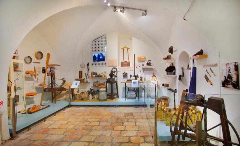
The fort also served as a staging post on the local pilgrimage route to Mecca and, for a period, as a caravanserai, or roadside lodging place for travellers and caravans. It fell into disuse and decay from the mid-nineteenth century and became a ruin. Much of the structure has since been rebuilt as part of a larger complex. The Castle Museum occupies the fort and contains a major ethnographic collection relating to Palestinian history and culture. The surrounding development includes a history museum, a restaurant, and a garden area, with proposed additions including a conference centre, recreational spaces, and a mosque.