Winterstein: A Medieval Rock Castle in Saxon Switzerland
Site at a Glance
- Popularity
- Medium
- Country
- Germany
- Primary era
- Medieval
- Eras represented
- Medieval, Modern
- Civilizations
- Holy Roman Empire, Kingdom of Bohemia
- Site type
- Military
- Remains
- Castle
On this page21 sections
History
Origins and early development
Winterstein is a medieval rock-castle complex on a sandstone massif near Bad Schandau, Germany. It is regarded as the largest and oldest castle complex of its kind in Rear Saxon Switzerland. The castle was probably established in the thirteenth century as the Berken von der Duba, a noble family of the medieval Central European kingdom of Bohemia, expanded their lands. Pottery from the middle of that century provides the earliest evidence of activity at the site. The Markwartitze, another Bohemian family, have also been proposed as its builders, partly because of similarities to the rock castle at Neurathen. The castle’s relatively elaborate development may have been associated with Thimo von Colditz, a senior official in the service of King Wenceslaus IV.
One theory holds that the castle was strengthened as a refuge for Bohemian King Wenceslaus I after Duke Henry II of Silesia’s defeat at the Battle of Liegnitz on 7 April 1241. That proposal is considered implausible. Wenceslaus feared Mongol incursions into Moravia and Upper Lusatia and sought allies; on 7 May 1241, he ratified the Upper Lusatian border charter in the presence of Bishop Conrad of Meissen.
Royal pledges and Meissen control
The first written record of Winterstein dates to 1379, when Wenceslaus IV assigned it under a pledge, a medieval arrangement securing property or its revenues, to his chamberlain Thimo von Colditz, lord of Graupen. The holding was independent but attached to the castle district of Pirna. The pledge was confirmed in 1381 and redeemed by the king in 1391.
In 1396, Winterstein was pledged again, this time to the royal chamberlain Burkhard Strnad von Janowitz. The following year, Wenceslaus ordered residents of the pledged territories to pay taxes to Strnad, indicating that the holding included villages that produced revenue. These may have included Bad Schandau, Altendorf and Lichtenhain, and perhaps Saupsdorf and Hinterhermsdorf. Strnad was murdered in 1397 on the orders of Duke Johann II of Troppau-Ratibor. Johann von Wartenberg, lord of Blankenstein near Tetschen, may have succeeded him as holder of the pledge, but the transfer is uncertain.
In 1404, Winterstein and the Pirna district passed from the Bohemian Crown to Meissen’s Margrave Wilhelm I. The transfer was connected with the Dohna Feud, a conflict in which Wilhelm sought control of the region. A garrison from Meissen, led by Captain von Techerwitz, occupied Winterstein from 1406 to 1408.
Disputed ownership and abandonment
One reconstruction places Winterstein back in Bohemian hands around 1440. A record from 1441 names a knight called Recke of Winterstein, fighting alongside the Wartenbergs in the Wartenberg Feud. That year, Saxon Elector Frederick the Mild, a prince entitled to help choose the Holy Roman emperor, urged the Berken von der Duba and Johann von Wartenberg to stop supporting Recke and other Bohemian castle knights, and to join him and the Bishop of Meissen against them. Recke’s castle may then have been captured and sold by Johann von Wartenberg to the lands and towns of Upper Lusatia on 24 July 1441.
It remains disputed whether this episode concerned the castle near Bad Schandau. Some nineteenth-century researchers placed Recke’s castle at another Winterstein near Lückendorf in the Zittau Mountains, possibly paired with Neuhaus, later called Karlsfried. More recent research considers that location more likely. The purchase document probably perished in a Zittau fire in 1757, while surviving demolition entries concern Neuhaus. Older interpretations instead connected the sale with the Bad Schandau castle and proposed that it was demolished after its purchase, often assigning the demolition to 1442.
Ideas about a trade route near Winterstein also shaped the debate. A proposed route from the Elbe landing place at Postelwitz, past Falkenstein and the Affensteine, and north of Winterstein toward Sebnitz was introduced in local histories in the nineteenth century and challenged by later researchers from about 1950. Postelwitz’s transshipment trade was secondary to the Elbe harbor at Schandau. The Reitsteig, or Riding Path, ran from Sebnitz through the Großer Zschand and south of the Großer Winterberg to the Elbe at Herrnskretschen; it is known only from around 1450, after Winterstein’s period of use.
A newer reconstruction proposes that Winterstein ceased to be permanently occupied after the Meissen garrison left and then fell into disrepair. The Berken von der Duba regained the surrounding territory near their centre at Neuer Wildenstein but did not return to the castle. When they sold the lordship of Wildenstein, Winterstein passed definitively to Saxony in 1451. It became part of the Hohnstein administrative district in 1452, and a castle register of 1456 listed it among castles that had once been built. The site was already described as ruined around 1450.
Rediscovery and changing access
Winterstein appears on Matthias Oeder’s 1592 map of the Electorate of Saxony, but its name then dropped out of written historical accounts for more than three centuries. Local people, recalling the supposed robber knights, called the rock the Rear Robber Castle or Great Robber Castle. In 1804, regional writer Wilhelm Leberecht Götzinger referred to it as Robber Rock, unaware of the name Winterstein. Researchers had suggested several possible locations for the historical castle. Publication of Oeder’s map in 1889 secured the identification of Winterstein with the rock then known as the Rear Robber Castle.
A stairway for reaching the summit existed by the late eighteenth century; artist Adrian Zingg depicted it in a print made around 1790. Its construction date is unknown. Götzinger described it in writing in 1804, and a repair is recorded in 1812. Photographer Hermann Krone made the earliest known photographs of Winterstein around 1855 and returned to photograph it in later years.
After the Second World War, the stairway had deteriorated. On 23 May 1948, members of the Wanderlust 1896 climbing club dismantled it, citing accident risks and harm to the rock. Winterstein then became a climbing peak, a summit used for climbing rather than hiking access. Club members made many first ascents, and the rock had 19 climbing routes and several variants. The Naturfreunde Bad Schandau group built a new stairway on the old line in 1952, restoring hiking access and ending that brief phase. The access installation was renewed and repaired in the late 1990s. The separate Wintersteinwächter remains a climbing peak; its first climbing ascent took place in 1921. Winterstein lies within Saxon Switzerland National Park, just outside the eastern sector’s core zone.
Remains
Massif and castle arrangement
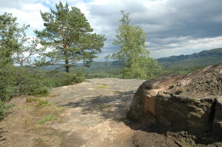
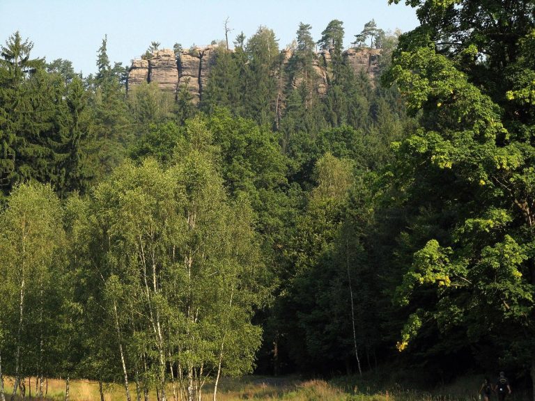
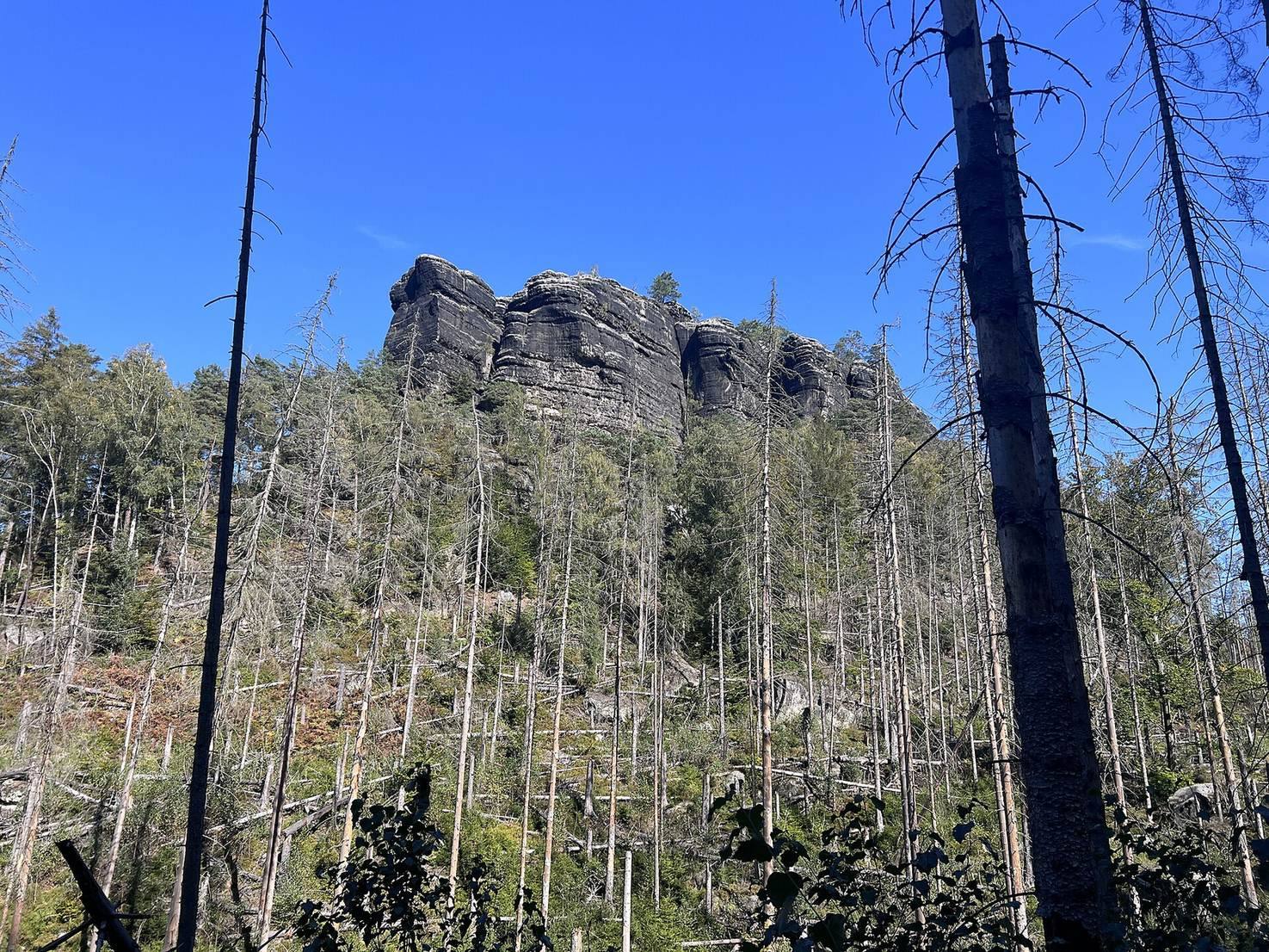
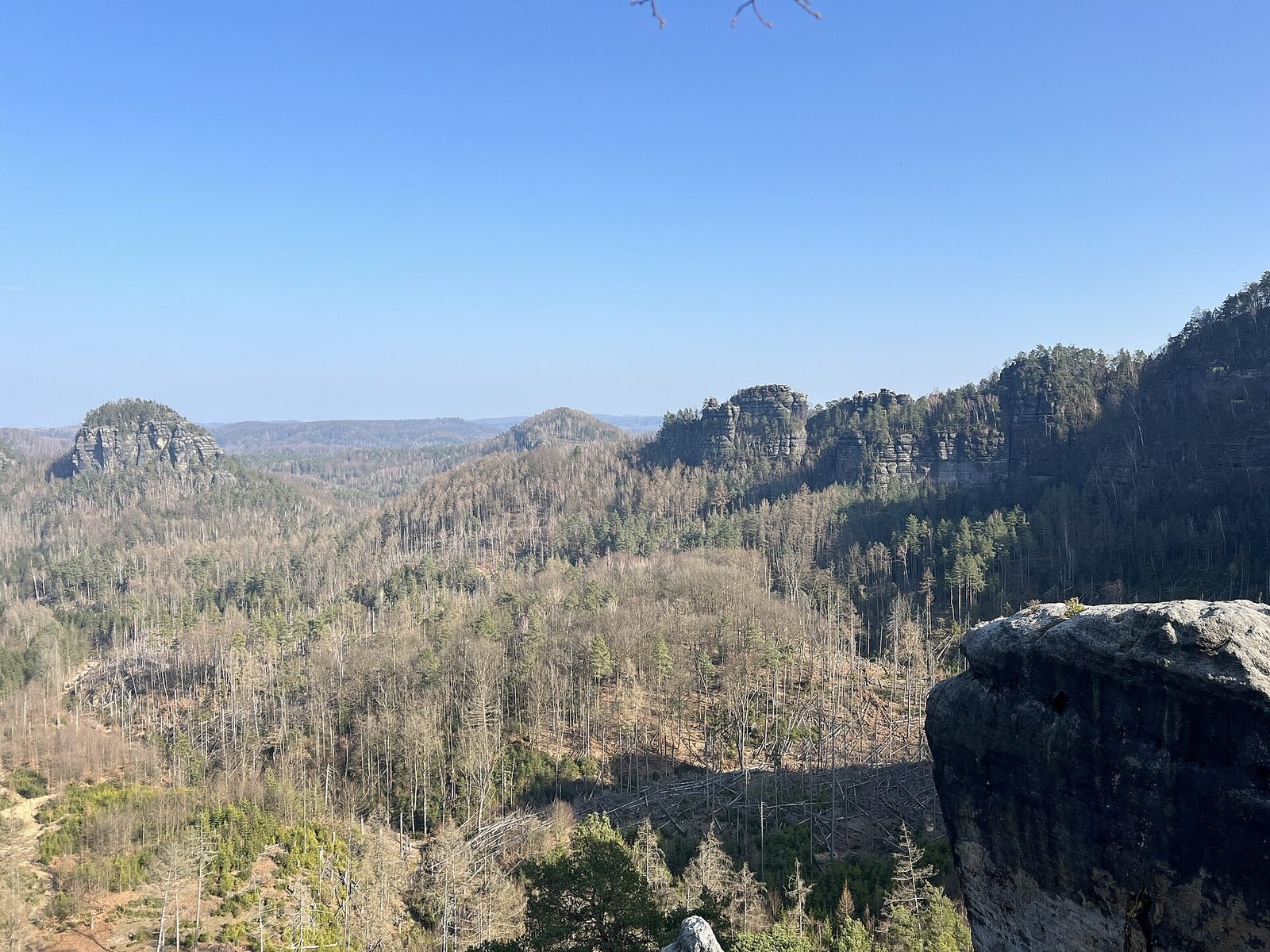
The castle occupies an elongated sandstone massif about 120 by 50 metres in extent, at 389 metres above sea level and roughly 90 to 100 metres above its surroundings. It rises over the forested Großer Zschand in a sparsely settled part of Saxon Switzerland. The Bärfangwände lie to the south, about 30 metres higher and 150 metres beyond Winterstein. The Wintersteinwächter, a climbing pinnacle, belongs to the same rock complex south of the main massif, with a narrow cleft between them.
The rock formed from deposits laid down in a Cretaceous sea. During the Turonian and Coniacian, two stages of the Cretaceous period, the sea deposited sediment up to 400 metres thick. At Winterstein, one sandstone layer forms slopes while a harder, wall-forming layer above it reaches a thickness of 50 to 80 metres. The exposed walls of these layers rise to about 40 metres at the castle; to the north, the rock stands more than 100 metres above the forest. Between the layers, the Lower Cave Horizon, a geological band that forms terraces and overhangs, creates a terrace several metres wide in places on the south and east sides. On the north and west it narrows to an inaccessible strip. A lower, sloping layer forms a narrow band around the massif.
The castle had lower and upper sections built on and against the rock, as well as buildings positioned to control the approach. Most structures were timber or half-timbered, using a timber frame with infill between its structural members. Evidence survives in foundation traces, rock-cut steps and niches, and beam slots, cuttings in the rock that held wooden beams, alongside anchor points for planks and braces. Features in the lower castle indicate at least two building phases, though they cannot be dated more precisely.
Approach and entrances
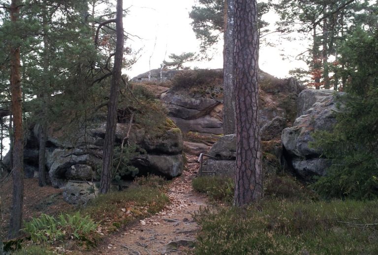
The present approach enters at the southwest corner and follows the route used during the castle’s second phase. Near the first modern steel ladder, beam sockets mark the position of a wooden gate across a narrow cleft. Sandstone steps then pass beneath a sloping rock to a second gate, identified by its beam slots, and the terrace at the beginning of the lower castle. The first-phase entrance lay about 70 metres farther east, near the middle of the later defensive walkway. Rock-cut steps there led to the walkway terrace. Beam slots at a guard position suggest a barrier marking the lower castle’s boundary; the area around the present entrance was incorporated into it only later.
Lower castle and defences
Beam slots and rock-cut niches mark the lower castle’s service buildings. Some slots reach seven metres above the ground, suggesting that these buildings had two storeys. A covered defensive walkway extended for more than 100 metres along the south terrace. Supports for its beams and cuttings for roof rafters survive in the rock face and ground. A guard position cut into the southern wall is roughly person-height and about 90 centimetres deep. At the turn from the south wall to the east, traces remain of a watchtower on the outer rock platform. The walkway continued beside the east wall formed by the Wintersteinwächter and ended at a small guard post in the northeast corner, reached by surviving sandstone steps.
The north and west sides meet a narrow, inaccessible boundary between sandstone layers. On the east, further installations occupied a terrace and a slightly set-back platform above it; a defensive platform is proposed there to protect the more accessible side. In the second building phase, palisades, shelters and narrow buildings were added at the northeast corner. A steep slope about seven metres wide between the base rocks offered a possible approach.
Fissure cave
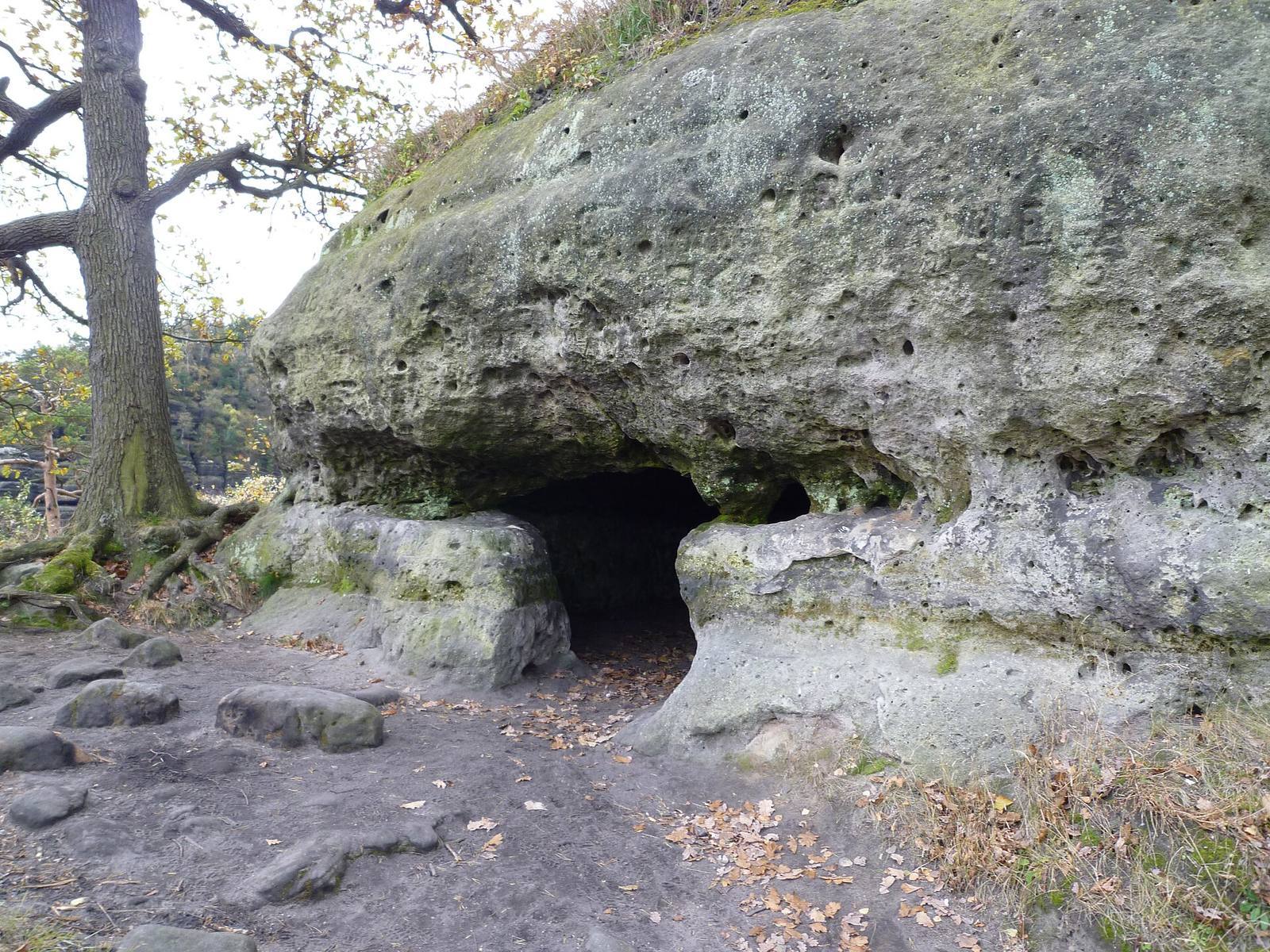
A cave formed along a rock crack lies at the centre of the lower castle. It is about 15 metres deep and nearly five metres wide, and was partly enlarged by cutting into the sandstone. From the defensive-walkway terrace, a narrow fissure with 24 stone steps leads inside. Beam slots indicate that the stairway was probably covered and secured by wooden gates at both ends. Rows of slots in the walls and ceiling divide the cave into three parts. In the front section, beam sockets mark a wooden defensive platform above the entrance, positioned to help protect the lower-castle gate and courtyard. Rock-cut benches in the middle section suggest residential and sleeping use; wall slots may indicate a multi-storey structure connecting with the upper castle. At the rear, a rock-cut cistern, a basin for storing water, was probably separated from the middle area by boards or a stone wall. Slots indicate wooden channels that brought water from above and along the cave walls.
Summit structures
Residential tower and cellar
Residential and defensive buildings occupied the summit plateau. On a raised rock base in its eastern part, sandstone-block foundations measure about 6.1 by 7.4 metres, with walls up to 1.1 metres thick. The building’s precise purpose and upper-storey construction are uncertain. It was once interpreted as a watchroom; the prevailing interpretation identifies it as the central residential tower used by the castle’s lord. Its upper storeys may have been stone or half-timbered. A cellar cut into the rock base survives and remains accessible. Its function is uncertain, but the entrance arrangement has led researchers to question an earlier interpretation of it as a dungeon. The tower also does not appear to have been a keep, the castle’s main fortified tower: the cellar entrance and opening into the base level would have prevented the upper floors from being permanently sealed off. A later cutting of the cellar entrance is considered unlikely because the cellar is slightly offset from the tower and aligned with its outer wall.
Eastern buildings and water supply
Further buildings stood east of the tower and on the Wintersteinwächter. Planks bridged the clefts between the two rocks. Cut channels at the tower base and on the Wintersteinwächter collected rainwater and directed it toward barrels and the cave cistern. Rock-cut niches and holes mark places where barrels stood. A crossbow is scratched into the rock floor in front of a barrel niche at the tower base. A watchtower occupied the easternmost rock head of the Wintersteinwächter.
Western watch positions
The massif’s western end held another watch position and several buildings whose uses remain uncertain. Their distance from the residential tower and isolated position have prompted the suggestion that the castle dungeon was located here. Beam slots may have supported a barrier across the rock ledges below the summit plateau. A guard post with a signal-fire site had a line of sight to the outlying station at Wartburg. A board game carved into the floor of a watchtower at this end, whose postholes survive, was damaged by unknown people in 2000–01.
Goods hoists
Rock-cut supports and beam slots on the summit plateau mark several hoists used to raise goods to both the lower and upper castle. A ground structure shaped like an A, formed by long channels and post slots on the north side of the upper castle, was identified through aerial measurement. Its purpose is uncertain. It may have supported another hoist, perhaps for bringing in building timber, or a projectile-throwing siege engine.
Outlying features
Wartburg outpost
About 200 metres west of Winterstein, the rock called Wartburg rises about 15 metres and is now used as a climbing pinnacle. Sandstone steps and beam slots remain. The outpost’s principal building stood on Wartburg’s eastern plateau; its half-timbered structure is marked by surviving beam slots. A narrow stair cut into a northern rock ridge provided access, and a hoist beside the building supplied goods.
Bärenfang
About 400 metres northwest of Winterstein, downslope toward the Kleiner Zschand, the feature called Bärenfang, or Bear Trap, is a rectangular pit cut into sandstone. It is about two metres deep and covers more than 35 square metres. Cut steps lead out toward the site of a wooden watchtower, indicated by surviving postholes. The feature may have served as a watch and control post on the castle approach and on an older route into the Großer Zschand, roughly along the line of today’s Zeughausstraße. It may also have stored water: the ground slopes toward it, and a cut in the rim could have acted as an overflow. Its precise function remains uncertain.
Finds and present access
Archaeological finds
Finds have come from the summit plateau, the fissure cave and especially the sandy southern slope. The local-history museum in Bad Schandau holds tile fragments, pottery sherds, iron nails, spurs, arrowheads and a short blade from Winterstein. Pottery and ceramic fragments continue to turn up occasionally.
Natural shelters and summit route
Narrow ledges at the base of the massif wind past caves and overhangs. Climbers use these natural shelters for overnight stays. The current summit route includes steel ladders, including a freestanding ladder about ten metres high in the fissure cave, and narrow rock clefts fitted with steps.