Wegelnburg: A Medieval Castle Ruin on the German-French Border


Site at a Glance
- Rating
- 4.7
- Popularity
- Low
- Country
- Germany
- Primary era
- Medieval
- External website
- Open
- Eras represented
- Medieval, Early Modern
- Civilizations
- Holy Roman Empire
- Site type
- Military
- Remains
- Castle
On this page14 sections
History
Wegelnburg is a medieval castle ruin in Germany, built around 1100–1200 on the Schlossberg in the southern Palatinate Forest. It is the highest-situated castle in the Palatinate and stands in the German part of the Wasgau near the French border. Its position and later history connected it with the territorial administration of the medieval German realm.
Medieval name and imperial ownership
The name Wegelnburg appears securely in 1247, when Konrad IV, a Hohenstaufen king of Germany and Sicily, granted Friedrich III of Leiningen a fief formerly held by B. de Waeglenburc. The form Wegelenburg appears in a charter issued in 1402 by Ruprecht I, Count Palatine. Two possible explanations for the name have been preserved. It may refer to a Frankish nobleman called Wegilo or Wagilo, or it may derive from a Palatinate expression meaning “to move back and forth,” perhaps connected with ore extraction at the nearby St. Anna mine passage.
In 1282, troops of the Bishopric of Strasbourg seized the castle under the command of the Alsatian bailiff Otto IV, a high-ranking official responsible for governing a territorial district. The action followed an accusation that the imperial bailiff had breached the peace. Whether the seizure itself resulted in destruction remains uncertain. Later references from the fourteenth, sixteenth, and eighteenth centuries describe destruction, but they do not establish when it occurred. The seizure may have been related to Rudolf of Habsburg’s efforts to recover imperial territories. During the same policy, the lords of Fleckenstein surrendered Löwenstein in 1282 and Guttenburg in 1283.
Wegelnburg remained imperial property and was administered by imperial ministeriales, dependent officials who served territorial lords in administrative and military roles. The castle was expanded during this period. In 1322, Ludwig of Bavaria placed it under the administrative care of Hagenau. In 1330, it was pawned to the Electoral Palatinate, a major state of the Holy Roman Empire ruled by the counts palatine of the Rhine, and the pledge was never redeemed.
Wittelsbach rule and wartime destruction
In 1417, Wegelnburg and its associated administrative district passed by exchange to the Wittelsbach dukes of Palatinate-Zweibrücken, a duchy formed from Palatine territories. Final repairs and extensions took place during the sixteenth and seventeenth centuries. During the Thirty Years’ War, imperial mercenaries captured and damaged the castle, which was occupied by an enlarged garrison during the conflict.
The complex was probably already ruinous when French troops destroyed and slighted it in 1679 under the Treaty of Nijmegen. This series of peace agreements, concluded in 1678–1679, ended the Franco-Dutch War and related conflicts. The troops were commanded by General Monclar. The destruction left Wegelnburg as a ruin rather than an active fortified residence.
Preservation and modern administration
A society devoted to the beautification of Wegelnburg was founded in the 1860s and carried out the first measures to secure and preserve the remains. In 1977, a proposal to incorporate the ruin into the renovation of the Dahn castle group was abandoned after protests from communities that had formerly belonged to the Wegelnburg administrative district.
Stabilization and restoration work between 1979 and 1982 removed large quantities of rubble and attempted to secure the surviving structure. Some additions were historically inaccurate and changed the appearance of the ruin. Since 1963, Wegelnburg has been administered by the Castles Administration of Rhineland-Palatinate.
Remains
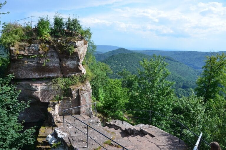
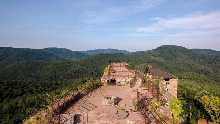
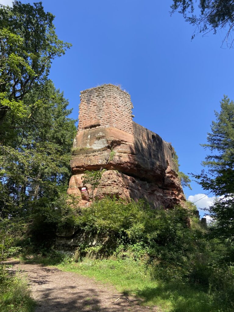
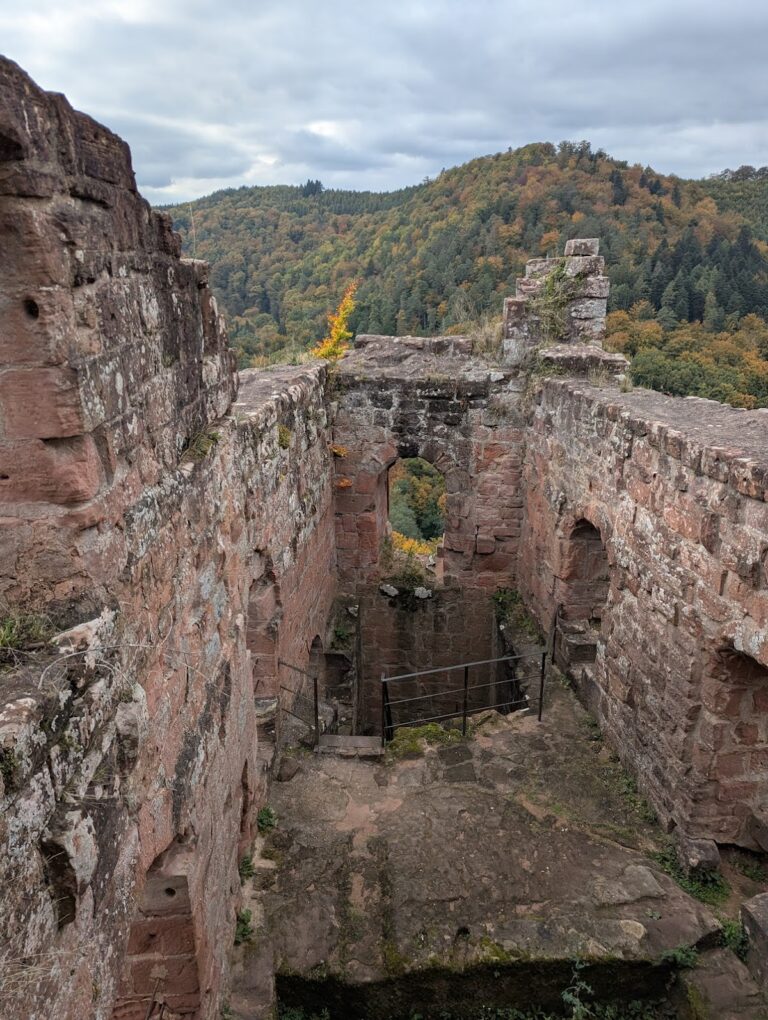
Wegelnburg occupies a narrow sandstone ridge running approximately northeast to southwest on the northern summit of Schlossberg, at 570.9 metres above sea level. The ridge is about 90 metres long and between 5 and 19 metres wide. The upper castle measures approximately 90 by 8 metres, and the restricted rock platform limited the area available for construction. A broader section between Wachtfelsen, Krötenstuhl, and the main castle provided additional building space. Recent investigations indicate that these areas may have formed one continuous development rather than separate installations.
Ridge layout and castle divisions
Baileys and entrances
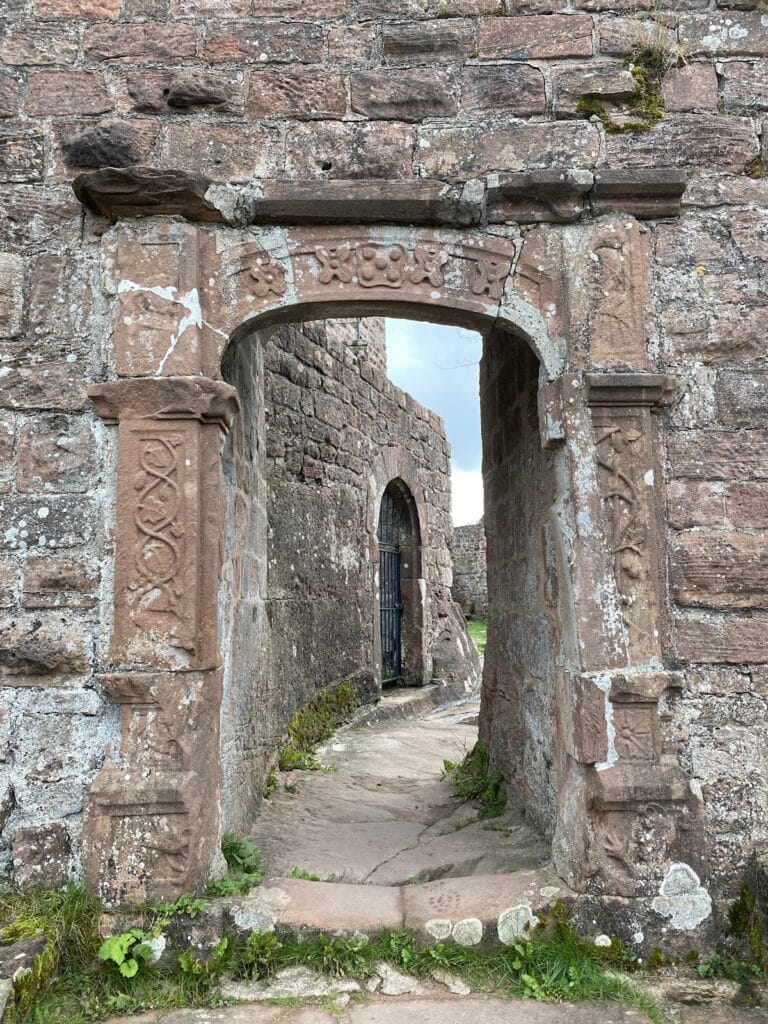
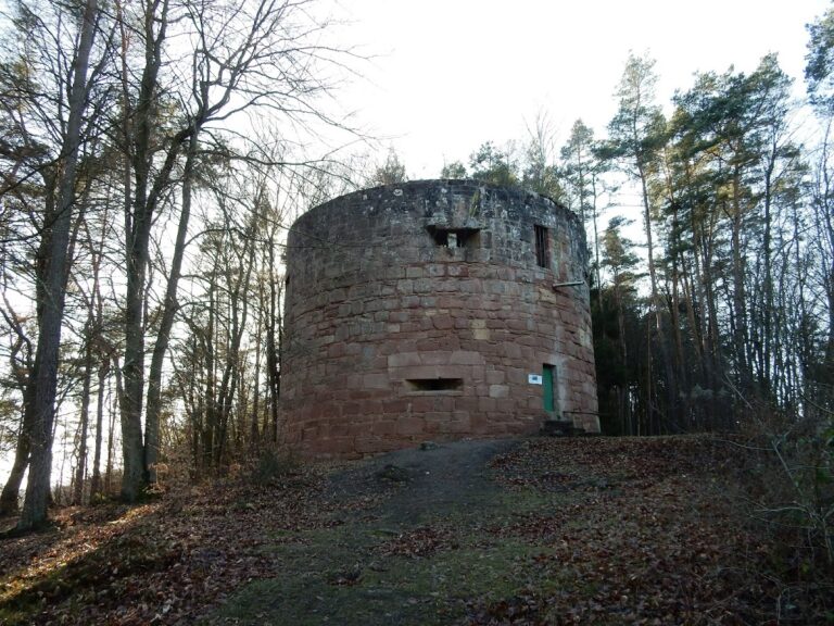
The castle was arranged in lower, middle, and upper baileys, enclosed sections that served distinct defensive or functional roles. The lower bailey occupied the western side of the complex. The preserved and restored inner gatehouse forms part of the main castle. Rock-cut stairs lead to the upper bailey, while rock-hewn passages, a rock cellar, niches, timber sockets, another stairway, and renewed arches survive in the lower and middle baileys.
Rock platform and approaches
A level surface cut into the sandstone contained the main entrance and creates a visual division between the principal rock ridge and the remaining ridge with its further buildings. A track reaches the site from the southwest, while a narrow footpath leads toward it from the northwest. The foundations and walls follow the sandstone outcrop, producing a smooth transition between built masonry and natural rock. Rock caves are incorporated into the upper and middle baileys.
Water installations
Larger rock-cut shaft
One water installation lies in the forward central part of the rock massif. Its function remains uncertain, since it may have been either a well or a cistern, a built or excavated reservoir for storing water. The opening is approximately 2.15 metres wide. The shaft is clear to about 8.50 metres before building rubble fills it. Its masonry lining is 60 centimetres thick, after which the opening continues through the bedrock at a width of about 2.15 metres.
Rock-carved shaft near the chamber
A second water installation lies at roughly the same elevation near a rock chamber. Its circular shaft is about 90 centimetres in diameter and is blocked by rubble at a depth of approximately 4 metres. Where it can be followed, the shaft retains the same narrow width and is carved directly into the natural rock.
Residential remains and wider landscape
Residential buildings
The residential buildings survive as fragmentary stone remains, making their original appearance difficult to reconstruct. Later masonry additions have altered the ruin, and some of these additions are historically inaccurate. The surviving walls nevertheless retain the close relationship between the castle’s construction and the sandstone ridge.
Lines of sight
From the castle, lines of sight extend to Hohenburg and Löwenstein on the neighboring elevation, as well as to the Dahn castle group, Lindelbrunn, Berwartstein, and Trifels. These visual connections place Wegelnburg within the wider network of fortified sites in the Wasgau landscape.