Wadi Hammamat: An Ancient Egyptian Quarry and Desert Route
Site at a Glance
- Popularity
- High
- Country
- Egypt
- Primary era
- Bronze Age
- Eras represented
- Stone Age, Bronze Age, Iron Age, Classical, Medieval, Modern
- Civilizations
- Achaemenid, Egyptian, Ptolemaic, Roman
- Site type
- Economic
- Remains
- Quarry
On this page14 sections
History
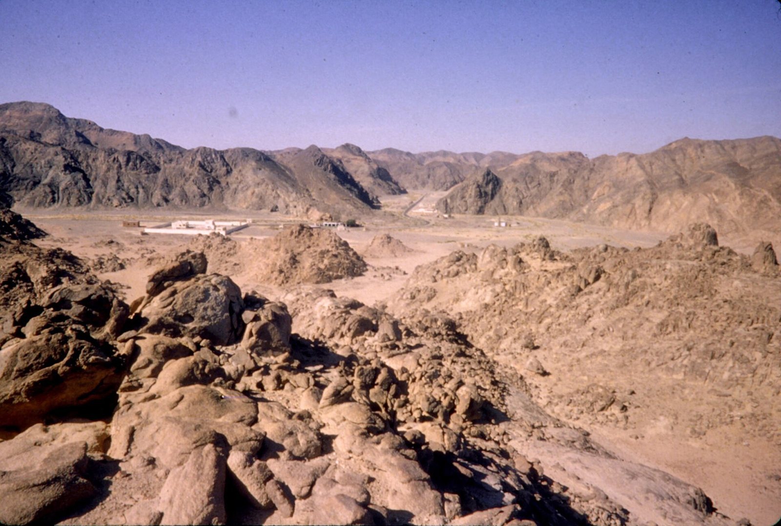
Wadi Hammamat is a six-kilometre-long dry gorge in Egypt’s Eastern Desert, on an ancient corridor between the Nile Valley and the Red Sea. It lies along the boundary between Qena and Red Sea governorates. Quarrying began in the Predynastic Period, before Egypt’s dynastic state, about 6,000 years ago, and continued through almost all of ancient Egyptian history. The valley also provided a route from Coptos, at modern Qift, to desert mines and Red Sea ports.
Early quarrying and political contest
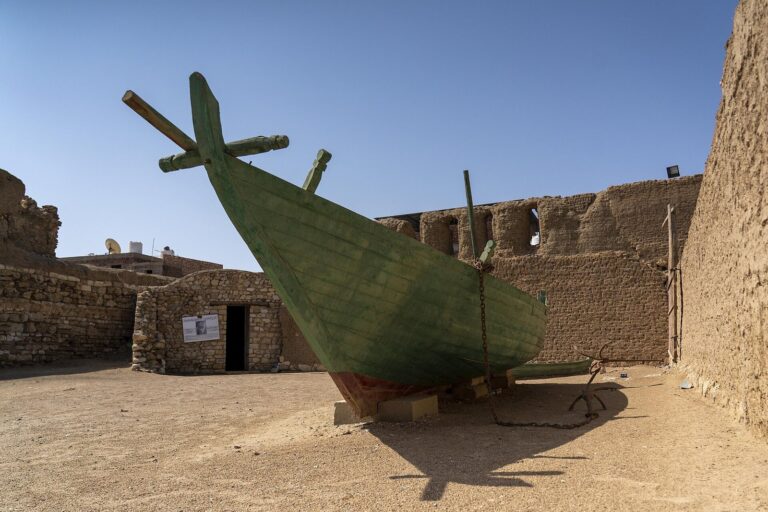
In the Old Kingdom, one of the major phases of ancient Egyptian rule, Wadi Hammamat’s stone was used for increasingly ambitious royal commissions. The quarries’ output and the valley’s position made it an important resource and passage through the Eastern Desert. Coptos served as a starting point for journeys east. Its shipyards produced boat components that were carried across the desert and assembled on the coast.
During the First Intermediate Period, an era of political fragmentation, Thebes and Coptos struggled for control of the valley. The contest ended in Thebes’s favor under Intef the Elder, a Theban ruler. The route continued to serve expeditions and travel between the Nile and the Red Sea.
Middle Kingdom expeditions
In the Middle Kingdom, Wadi Hammamat was called Rô-hanou, meaning either outlet of the waters or road to the sea. Under Mentuhotep III, the chancellor Henenu led an expedition preparing for a voyage to Punt, an ancient trading region whose location remains uncertain. An expedition of about 3,000 men is associated with this period; it also obtained Bekhen stone, the local name for greywacke, a variety of sandstone, for royal statues. Local hunters and inhabitants helped protect the party as it crossed the desert.
Inscriptions from Mentuhotep IV’s reign describe a much larger expedition of 10,000 men sent to retrieve a stone coffin and its lid. Stories attached to the venture tell of a gazelle giving birth on the chosen block and sudden rain revealing a well. The expedition was led by the vizier Amenemhet, who probably later became Amenemhet I, founder of the Twelfth Dynasty.
Quarrying and mining reached an especially active phase from the late Eleventh Dynasty through the Twelfth. An expedition under Senusret I obtained stone for 60 sphinxes and 150 statues, using a workforce of 19,000. During the Second Intermediate Period, another expedition of 130 men sought stone that may have been intended for two obelisks made of schistose sandstone for Sobekemsaf I. One of those obelisks was later found in the Karnak cache.
New Kingdom and Persian rule
During the New Kingdom, gold mining continued in the surrounding valleys, while quarrying at Wadi Hammamat may have become less active. Inscriptions naming New Kingdom kings are relatively scarce before the Ramesside period, the later part of the New Kingdom when rulers named Ramesses were prominent. A map on the Turin mining papyrus, made in the twelfth century BC, shows the route to the Bekhen quarries and to gold and silver mines farther east. It was probably prepared for an expedition under Ramesses IV. A sanctuary of Amun stood near the junction of Wadi Hammamat and Wadi Fawakhir, probably at the site later occupied by the Ptolemaic sanctuary of Min.
The quarries remained important under Achaemenid Persian rule, the period of an ancient Iranian empire. Stone from Wadi Hammamat was used for a statue of Darius I at his royal palace in Susa, in what is now southwestern Iran. Some quarry blocks may have been carried to Persia by sea.
Ptolemaic routes and trade
Under the Ptolemies, the Greek-speaking dynasty that ruled Egypt after Alexander the Great’s conquest, work on desert roads and growing Red Sea traffic accompanied renewed mining in the Eastern Desert. Ptolemy II developed coastal routes and ports, while Ptolemy III built a sanctuary to Min at Bir el-Fawakhir, then called Persou. Quarrying at Wadi Hammamat diminished but continued, and the monarchy and clergy still used its greywacke. In the first millennium BC, the Red Sea was known as the Sea of Coptos.
The route to Saww, the permanent port at modern Mersa Gawasis, was used, but was probably not the usual approach because Wadi Qena offered a shorter way. The Hammamat road more likely served intermittent ports near modern El Qoseir, where Myos Hormos was later established. By the second century BC, the Coptos–Myos Hormos road had become an important channel for trade with Arabia and India. Myos Hormos may have been founded to reduce reliance on the more southerly Edfu–Berenice route, which was vulnerable during the Great Theban Revolt, an uprising against Ptolemaic rule in Upper Egypt. The Coptos road later carried luxury goods, although it received less extensive improvement than the Edfu–Berenice route.
In Hellenistic and Roman times, the journey from Coptos to Myos Hormos covered about 183 kilometres. It took roughly six days, or about 33 hours of walking. The road crossed lower valleys, passed through Wadi Hammamat and Wadi Fawakhir, then climbed over the 534-metre El Rieh Pass, the divide between the Nile and Red Sea drainage basins, before continuing east. Travelers used wells and stopping places at Bir el-Fawakhir and Phoinikôn, and probably at Bi’r Sayyâla, as well as simple rock shelters. Strabo described merchants carrying their own water, but wells and places to stop were available along the route.
Roman quarrying and route security
Under Roman rule, activity in the Eastern Desert shifted from intensive gold extraction toward quarrying stone and gemstones. Around Wadi Hammamat, work in greywacke appears to have declined in favor of green breccia. Under Emperor Tiberius, quarry workers lived at Persou-et-Tamostymis, an unfortified military post that served both the quarries and control of the road. The mining village at Bir el-Fawakhir remained active, and a fort was built there in the first half of the first century AD.
Roman investment in the Coptos–Myos Hormos route expanded during the first two centuries AD, bringing new stopping stations, wells, cisterns, watchtowers and forts. Around the middle of the first century, Myos Hormos lost its leading position in trade with India to Berenice. Activity along the road declined, although Roman construction continued, perhaps for military purposes. In 76 or 77, Egypt’s prefect, its Roman provincial governor, Lucius Julius Ursus received merchants’ complaints about unreliable water and inadequate security. He ordered the construction of forts and fortified water stations. Water points stood no more than 40 kilometres apart, and travelers remained within 20 kilometres of water and a garrison.
The fort of Krokodilô may have replaced the earlier Tiberian post in Wadi Hammamat, and a second-century fort at Bir el-Hammamat may later have taken the place of Krokodilô. Across the full route, more than 70 watchtowers and about a dozen forts were built during the High Roman Empire, although they were not all in use at the same time. Quarrying at Wadi Hammamat ceased toward the end of the second century AD as Roman authority and activity in the Eastern Desert weakened. Most road installations and Myos Hormos were abandoned in the early third century. The port silted up and soldiers left the forts. The connection between declining sea trade and the abandonment of the road installations is uncertain; Roman administrators later gave priority to Berenice.
Later mining, pilgrimage and modern study
From the fifth century, Byzantine authorities, representing the eastern continuation of the Roman Empire, renewed gold mining in the surrounding valleys, especially Wadi Fawakhir. Expeditions again travelled from Coptos through Wadi Hammamat, and some Roman forts on the route were reoccupied. Mining at Fawakhir continued intermittently for about 150 to 170 years. Bir el-Fawakhir probably grew to around 1,000 inhabitants before the mines were abandoned toward the end of the sixth century, probably because of depleted resources and political difficulties.
After the Arab conquest of Egypt, Muslim pilgrims used the road from the Nile Valley to El Qoseir, then crossed the Red Sea to Jeddah on their way to Mecca. In 1890, engineer Charles Nicour surveyed a possible railway between Qena and El Qoseir, but a road for wheeled vehicles was built instead. Known as Route 256 or the Qift–El Qoseir road, it follows the ancient route closely except at the difficult Bir el-Sid gorge. The ancient road avoided that gorge by running through Wadi Fawakhir, and the alignments meet again in Wadi Abu Ziran. Road construction destroyed the remains of the Ptolemaic sanctuary of Min at Bir el-Fawakhir.
James Bruce gave an early European description of Wadi Hammamat in 1769. Vladimir Golenishchev led a study of its inscriptions in 1884–85. Geographer G. W. Murray first identified the mines shown on the Turin mining papyrus with Wadi Hammamat and neighboring valleys; Egyptologist Georges Goyon later confirmed the identification. In the late 1980s, the Institut Français d’Archéologie Orientale surveyed the valley, checked known inscriptions, sought further rock carvings and prepared a topographic plan. The team recorded 250 previously unrecorded inscriptions, including a long text from Merenre’s reign, a Middle Kingdom inscription and several New Kingdom graffiti. Gold extraction continues in the area, particularly at Wadi el-Sid.
Remains
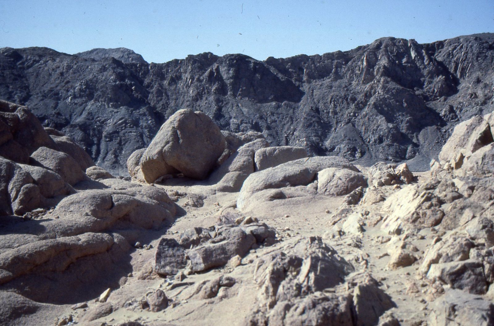
The site is a natural gorge about 100 metres wide, descending from east to west. Its eastern end at Bir el-Fawakhir lies about 400 metres above sea level, while the western end at Bir el-Hammamat is about 320 metres high. Jabal el-Hammamat rises to the west, Jabal Rasfah to the north, Jabal Shahimiyyah to the south and Jabal el-Sid to the east. Wadi Um Had meets the gorge at Bir el-Hammamat; Wadi Fawakhir joins from the northeast and Wadi el-Sid from the southeast at Bir el-Fawakhir. Wadi Attala and Wadi Masaq el-Baqr enter from the north, and Wadi el-Chagg from the south.
Rock formations and quarry resources
The valley’s central core consists mainly of Late Precambrian rocks formed from fragments of older stone. These include greywacke, a greenish-grey sandstone that can also appear dark grey or purplish-grey; slate-like mudstone in purple, green and grey; and green breccia, a rock made of pebbles and stones, mainly igneous fragments, set in a greenish-grey matrix. The rocks have been altered slightly by heat and pressure and appear dark brownish-grey from a distance. Near the valley’s ends are younger Nubian sandstone, light brown and darkened by desert varnish, and other ancient formations. Fawakhir granite ranges from light grey to pinkish grey and contains quartz veins that can carry gold and silver-bearing minerals. Atalla serpentinite and gabbro are dark green to grey, while Dokhan volcanic rocks include light-brown volcanic ash rock, with smaller amounts of andesite and basalt. Weathering gives several of these formations a pinkish-brown appearance.
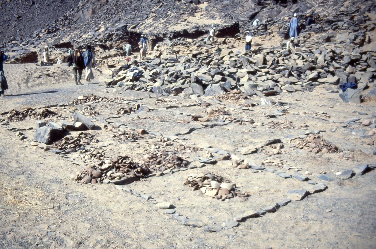
Gold-bearing rock occurs at the valley’s eastern end and farther east in Wadi Fawakhir and Wadi el-Sid. Estimated gold content ranges from 1.7 to 9 grams per tonne at Wadi Fawakhir and from 4 to 28 grams per tonne at Wadi el-Sid. Ore from Wadi el-Sid contains precious metals reported as 80 percent gold and 20 percent silver. The valley’s stone was made into cosmetic palettes, beads, bracelets, vessels, statues, upright inscribed slabs called stelae and stone coffins known as sarcophagi. The Narmer Palette, dated to about 3100 BC, was carved from distinctive stone brought from Wadi Hammamat.
Inscriptions and rock images
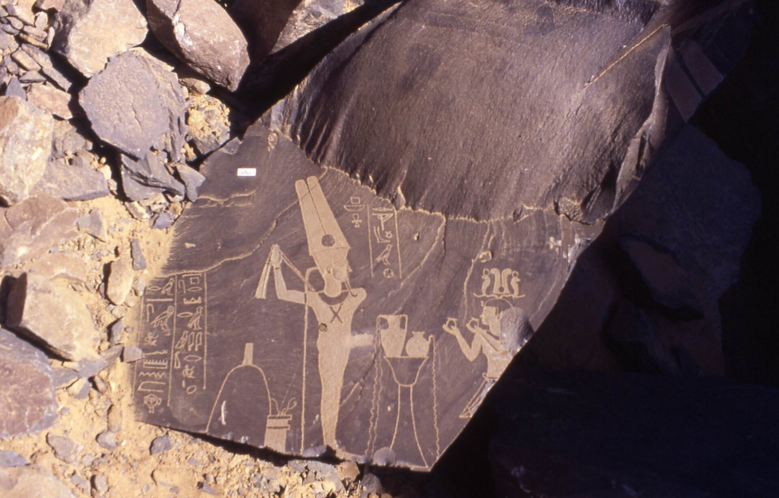
About 750 inscriptions, texts and images have been recorded across the valley. Official and religious writing and informal graffiti were carved or painted in hieroglyphic writing, hieratic, a cursive Egyptian script, Demotic, a later Egyptian script, and Ancient Greek. Many cluster around the main greywacke quarry on the mountain called Bekhen, or pure mountain, and appear on smooth rock faces to the southeast. Their subjects include kings, expedition leaders and the organization of expeditions, as well as prayers, offerings and divine figures. A stela from year 38 of Senusret I describes an expedition’s leader, participants, workforce, duration, outcome and provisions. Georges Goyon found it during surveys in 1947.
Carved rock images northeast of the Bekhen quarries date to the fourth millennium BC. They show hunters, animal traps, ostriches, gazelles and other wildlife, along with reed boats dated to about 4000 BC. The range of plants and animals depicted points to an Eastern Desert that was once wetter and more biologically diverse than it is today. A painted rock inscription is also known from the valley.
Buildings and water features
Quarry chapel
A small chapel near the Bekhen quarries has side rooms and an inscribed naos, the innermost shrine or sacred chamber of a temple. A graffito on the shrine, dated 2 October in year 18, places the chapel in the reign of Tiberius.
Fort and wells at Bir el-Hammamat
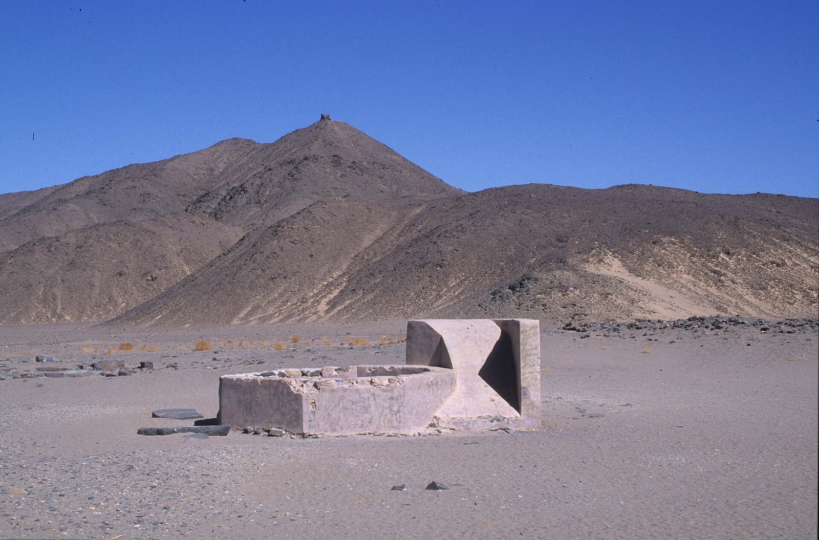
The Roman fort at Bir el-Hammamat retains a courtyard. A circular well associated with the Roman road system is well preserved and partly rebuilt. A modern well built in 1830 occupies the site of the ancient well in the courtyard. It remained in good condition into the following century, although its brackish water meant it was little used.
Courtyard mosque
A mosque was built in the fort courtyard during the Middle Ages, when the route served Muslim pilgrims travelling toward the Red Sea and Mecca.