Galle Fort: A Portuguese, Dutch, and British Colonial Fortress in Sri Lanka
Site at a Glance
- Rating
- 4.6
- Popularity
- Low
- Country
- Sri Lanka
- Primary era
- Early Modern
- Eras represented
- Early Modern, Modern
- Civilizations
- British, Dutch, Portuguese
- Site type
- Military
- Remains
- Fortified Town
On this page12 sections
History
Galle Fort is a fortified colonial town in Sri Lanka, built and expanded by Portuguese, Dutch, and British authorities on the site of an established Indian Ocean port. Galle was visited by merchants and ships from China, India, Arab countries, and other regions long before European fortification. Its early history is associated with Ptolemy, the Greco-Roman geographer and cartographer, a sixth-century account by Cosmas Indicopleustes, the travels of Ibn Battuta, fourteenth-century records and illustrations, and a trilingual inscription from the early fifteenth century.
Portuguese foundation
Portuguese ships began calling at Galle after the fleet of Lourenço de Almeida stopped there in 1505. Before substantial fortifications were built, the Portuguese established a Franciscan chapel in 1541 or 1543. Their first fortified settlement, Santa Cruz de Gale, was founded in 1588. In the same year, an attack by Raja Singha I, the Sinhalese ruler of Sitawaka, forced the Portuguese to reoccupy Galle after moving their main settlement to Colombo.
The early Portuguese defenses were intended to protect the town from local Sinhalese rulers. An earthen rampart, three bastions, and a military garrison guarded the inland side, while a wooden palisade provided much of the protection toward the sea. These works formed the first defensive framework of the settlement.
Dutch conquest and expansion
Dutch forces captured Galle from the Portuguese on 13 March 1640 after a siege involving about 2,500 men under Willem Coster, a commander of the Dutch East India Company. The Dutch acted in cooperation with Raja Singha II, the king of Kandy, but Galle was not handed over to him after the conquest.
From 1649, the Dutch greatly enlarged and strengthened the fort, creating the form that largely survives today. The Dutch controlled Sri Lanka’s maritime provinces from 1640 to 1796, and Galle became one of their principal fortified centers. It served as the headquarters of the Dutch East India Company in Ceylon until 1658. Although the administrative center and governor’s residence later moved to Colombo, Galle retained a sheltered natural harbor where ships could load, unload, and undergo repairs.
During the later seventeenth century, Galle developed into a major Dutch trading port. From about 1665, it served as the Dutch East India Company’s central gathering and transshipment point for trade with southern India and Bengal. Textiles, pepper, saltpetre, cinnamon, and other goods passed through its commercial network. The fort became a colonial town with offices, warehouses, businesses, residences, military facilities, churches, and a hospital. About 83 percent of its area was occupied by residential buildings, many used by company employees and Dutch citizens of varied European origins.
British rule and changing functions
Britain took control of Galle on 23 February 1796, after the Netherlands had been occupied by France. Galle remained the British administrative headquarters in southern Ceylon, the principal colonial-era name for Sri Lanka. Its commercial importance declined as Colombo developed into the island’s main capital and port, but the fort continued to serve administrative and military purposes.
During the nineteenth and early twentieth centuries, Galle lost much of its military importance. The British generally retained usable Dutch buildings and replaced structures that no longer met their needs. They also altered the fort’s defenses, closed the moat, built new houses and gates, added further defenses during the Second World War, and erected a lighthouse. These interventions helped create the combination of Dutch and British colonial architecture visible today.
Sri Lanka became independent in 1948, ending more than four centuries of colonial rule. Galle Fort continued to accommodate residents and administrative functions after its original military role had declined. Its historic buildings and urban plan remained part of a living, multi-ethnic and multi-religious community.
Heritage protection and recent change
The Archaeology Ordinance, following a legislative initiative in 1940, made protection of the fort a responsibility of Sri Lanka’s Archaeological Department. Galle Fort was inscribed in 1988 within the UNESCO World Heritage property Old Town of Galle and its Fortifications under criterion IV, which recognizes architectural ensembles illustrating important stages in human history. UNESCO identified the fort as an urban ensemble showing the interaction of European architecture and South Asian traditions from the sixteenth to the nineteenth centuries.
Conservation planning included a development plan prepared by the Archaeological Department in 1992, an ICOMOS monitoring mission in 1998, cooperation among ICOMOS Sri Lanka, the Archaeological Department, and the Urban Development Authority in the late 1990s, and a revised plan approved in 2002. Special planning and building regulations introduced in 2009 sought to protect the colonial fabric. A Galle Heritage Foundation was established in 1994 to coordinate conservation and management with public authorities, residents, and other stakeholders.
The 2004 Indian Ocean tsunami severely damaged areas outside the fort, while the fort itself suffered comparatively limited damage because of its walls and underground drainage system. Sections of the ramparts were damaged, two parts of the sewer line collapsed, and the Marine Archaeology Laboratory lost some exhibits to the sea. No deaths were recorded inside the fort. Restoration and reconstruction followed through the Ministry of Cultural Affairs, the Galle Heritage Foundation, and the Archaeological Department, with Dutch financial support and technical guidance from the University of Moratuwa.
Since the World Heritage inscription, tourism, foreign investment, and the conversion of properties have altered the fort’s social and economic character. The resident population fell from 2,703 in 1981 to 1,987 in 2001 and 1,068 in 2012. Private houses declined from 72 percent of buildings in 1988 to 32 percent in 2016, while commercial buildings increased from 17 percent of the building stock at inscription to 35 percent in 2016. Hotels, restaurants, galleries, jewelry shops, and other businesses contributed to the loss of local shops, mixed residential-commercial uses, and some hybrid local-colonial architecture. The fort remains a living community as well as a heritage site, creating an ongoing challenge of balancing residents’ needs and tourism with the preservation of its historic fabric and cultural values.
Remains
Peninsula and fortifications
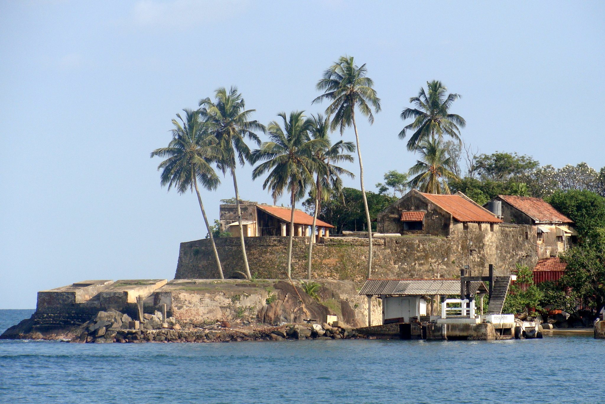
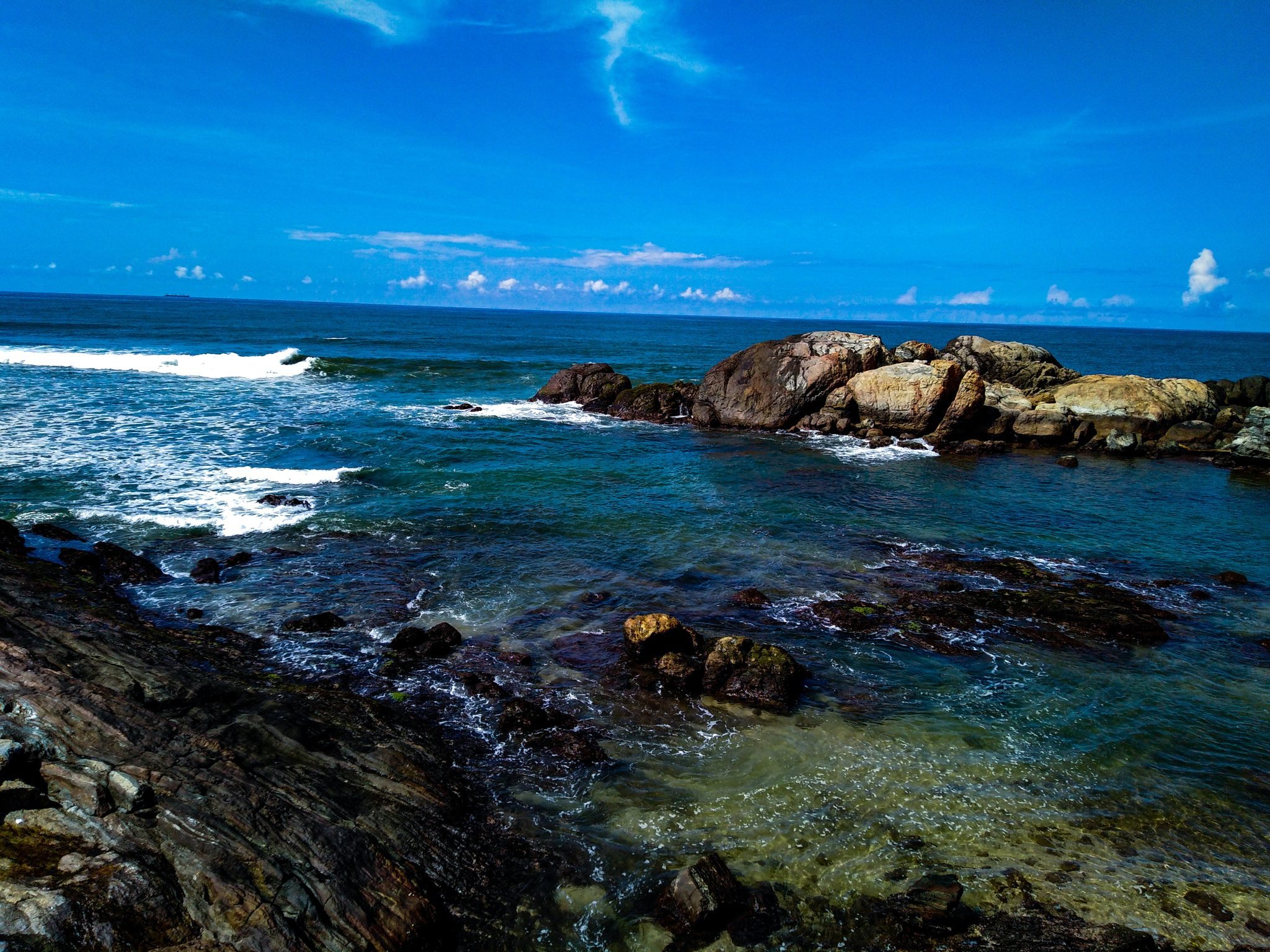
Galle Fort occupies a rocky peninsula on Sri Lanka’s southwestern coast, at the Bay of Galle where the shoreline turns east toward Matara and Tangalle. A narrow strip of land connects it with the rest of the island, and the fortified area covers about 52 hectares. The walls and bastions follow the peninsula’s rocks, cliffs, surrounding sea, and coastal contours rather than forming a regular geometric outline.
The colonial walls form an approximately 2.4-kilometre circuit built of granite and coral masonry. The earliest Portuguese defenses relied mainly on earthworks and timber, while the Dutch progressively enclosed the peninsula with heavier walls and additional projecting fortifications. Many sections were built in 1663, and the seaward wall was completed in 1729. Fourteen named bastions are associated with the fort: Sun, Moon, Star, Zwart, Akersloot, Aurora, Point Utrecht, Triton, Neptune, Clippenburg, Flagrock, Aeolus, Fishmark, and Commandment.
Portuguese and Dutch bastions
Zwart Bastion, whose name means Black Bastion, is the oldest of the bastions and was built by the Portuguese. The Dutch renamed the Portuguese bastions St. Jago, St. Antonio, and Conceycao as Sun, Star, and Moon, while the original Portuguese fortress became Zwart Bastion. At Akersloot Bastion stands a breadfruit tree introduced by the Dutch and reputed to be the oldest of its kind in Sri Lanka. A local tradition says that breadfruit was combined with coconut to counteract its supposedly heat-producing nature.
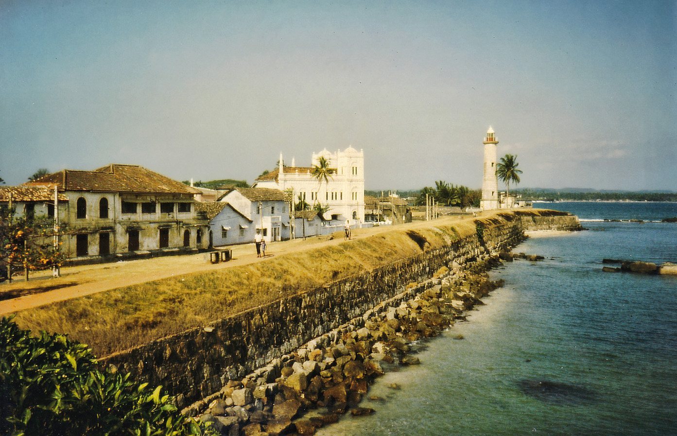
Point Utrecht Bastion terminates the eastern section of the fort and contains a powder house. An 18-metre lighthouse was erected there in 1938. Flagrock Bastion served as a signaling station for ships approaching the hazardous rocky stretches of the bay, with warnings given by musket fire from nearby Pigeon Island. At Triton Bastion, a windmill once pumped seawater for sprinkling the town’s dusty streets, and the bastion also served as a viewpoint.
Gates and later defenses
The older of the fort’s two principal gates stands at the southern end of Baladaksha Mawatha. The Dutch completed it in 1669, originally protecting the entrance with a drawbridge and ditch. Its former Dutch East India Company emblem shows a rooster on a rock above a shield marked VOC, flanked by two lions, with the date inscription ANNO MDCLXIX. After 1796, the British moved the VOC emblem to the inner side and placed the arms of King George III on the exterior. They retained a stone dated 1668 and a small VOC emblem. The British royal arms show an English lion and Scottish unicorn supporting a shield beneath the royal crown and the arms of Hanover, with the mottos Honi soit qui mal y pense and Dieu et mon droit.
The present Main Gate lies between Moon Bastion and Sun Bastion on the northern side. It opened in 1873 after Galle became the administrative center of southern Ceylon, and the British altered the landward approach. Further British changes included closing the moat, constructing new houses, building the lighthouse at Point Utrecht, and adding defenses during the Second World War.
Urban plan and colonial buildings
Inside the walls, the town follows a rectangular Dutch colonial street grid. Narrow streets run parallel to the ramparts, while buildings generally have narrow street-facing facades, gables, verandahs supported by slender columns, high ceilings, substantial pillars, carved wooden doors and windows, and rear courtyards. European building models are combined with South Asian materials, construction methods, climate adaptations, and local scales. The historic building stock includes churches, mosques, residences, warehouses, workshops, government offices, military buildings, commercial premises, and a hospital. Dutch-period street names such as Pedlar Street, Lighthouse Street, Hospital Street, Leyn Baan Street, Church Street, Parawa Street, and Chando Street preserve associations with earlier activities and institutions.
The Groote Kerk, or Dutch Reformed Church, belongs to the Dutch period. Its construction is dated variously to 1640 or 1775, while remodeling is recorded between 1752 and 1755. The church contains gravestones from the former Dutch cemetery, an organ dating from 1760, a calamander-wood pulpit from Malaysia, and a belfry dated 1707 and cast in 1709. A Protestant church in the Baroque style, an ornate European style influential during the seventeenth and eighteenth centuries, was built during the Dutch period for colonists and local converts.
The building now called Amangalla was erected in 1694 as accommodation for the Dutch governor and his staff. In 1865 it became the New Orient Hotel for European passengers traveling through Galle Port, and it was modernized as an Aman Resorts property in 2005. The old Dutch government house, the Commandant’s residence, and other colonial administrative buildings also remain within the fort.
Other historic buildings include the Old Dutch Hospital, the Meeran Jumma Mosque built in 1904, a Buddhist temple established on the site of a Portuguese Roman Catholic church, All Saints Anglican Church built in 1871, an 1882 clock tower, Clan House, and the Galle Lighthouse, built in 1939. The Old Dutch Hospital later underwent extensive restoration and reopened as a dining and shopping complex in 2014.
Drainage and maritime archaeology
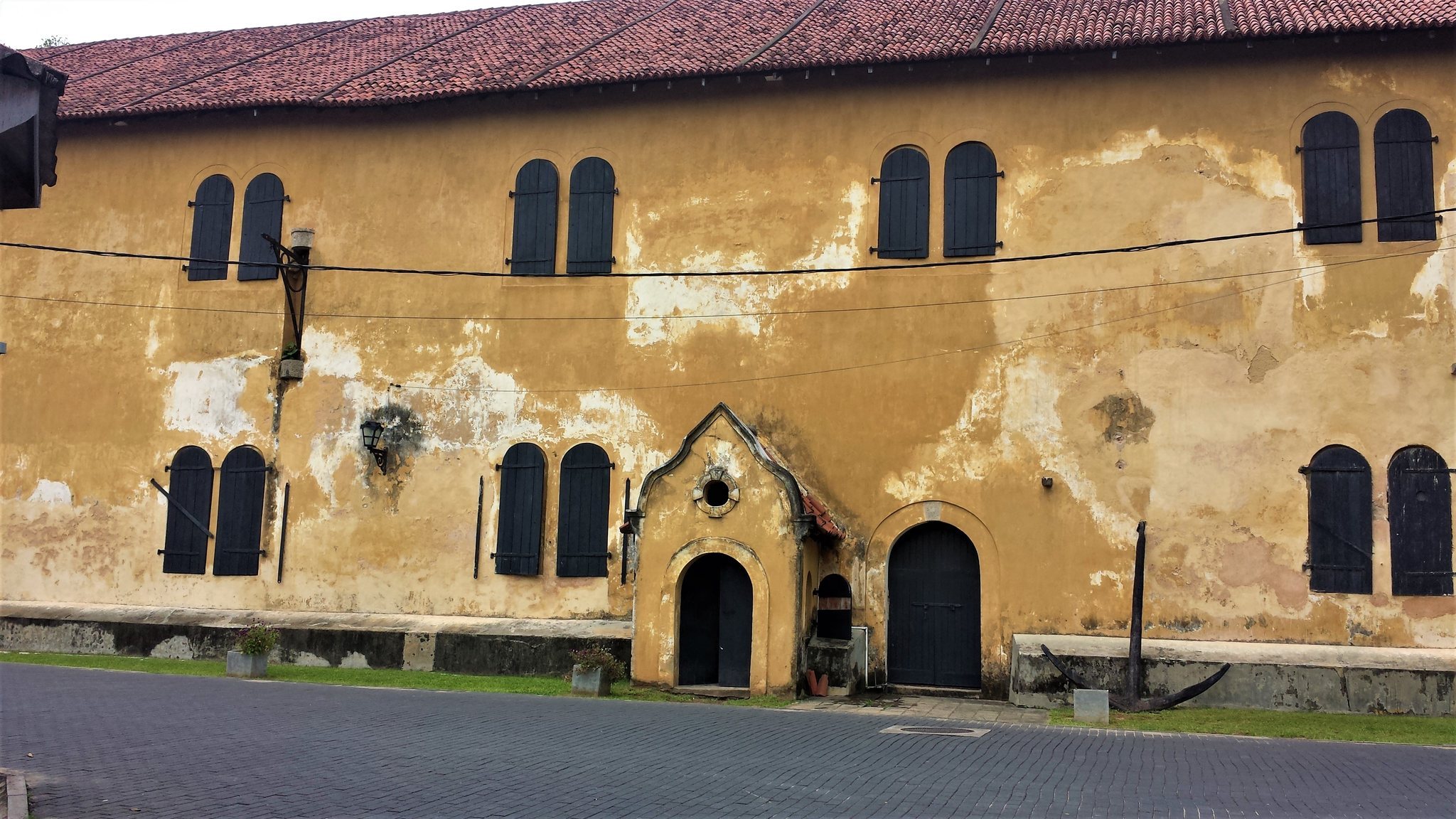
A large warehouse near the older gate was built around 1669 to store spices and ship equipment. It now houses the National Maritime Archaeology Museum. The associated maritime archaeology center was established in 1997 after more than 21 historical shipwreck sites and associated artifacts were identified in Galle Harbour.
The original seventeenth-century drainage system lies about 3 to 4 metres below ground. It used the tidal cycle to flush sewage toward the sea and remains partly functional. Together with the walls, bastions, street plan, buildings, materials, and construction techniques, the drainage network forms part of the fort’s surviving colonial infrastructure.
Integrity and surviving fabric
The fort’s walls, bastions, street plan, architectural forms, materials, and construction techniques retain a high degree of integrity and authenticity, although many buildings have been altered. By 2016, 34 percent of facades had changed and more than 75 percent of buildings had undergone some form of modification. The present fabric therefore brings together Portuguese foundations, Dutch fortification and urban planning, British alterations, and later conservation work.