Threave Castle: A Black Douglas Stronghold in Scotland


Site at a Glance
- Rating
- 4.6
- Popularity
- Low
- Country
- United Kingdom
- Primary era
- Medieval
- External website
- Open
- Eras represented
- Medieval, Early Modern
- Civilizations
- Kingdom of Scotland
- Site type
- Military
- Remains
- Castle
On this page10 sections
History
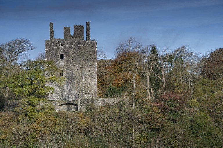
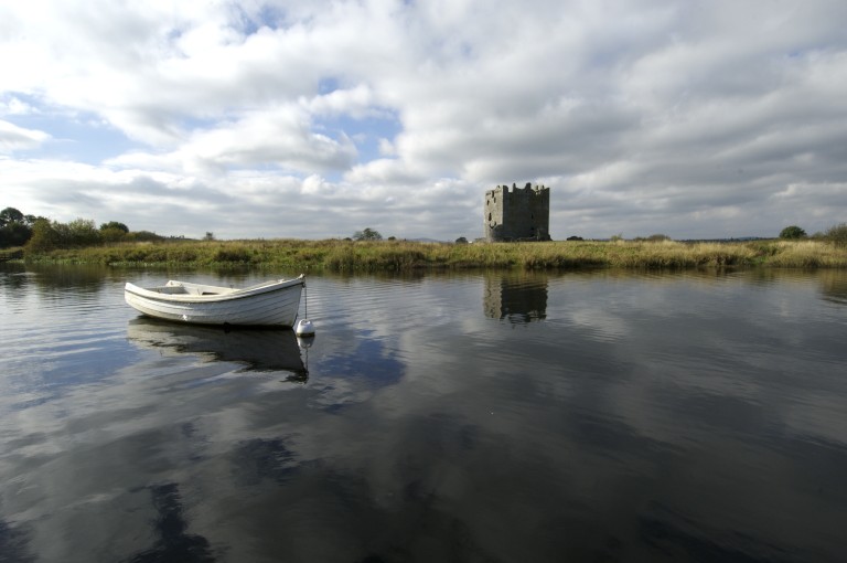
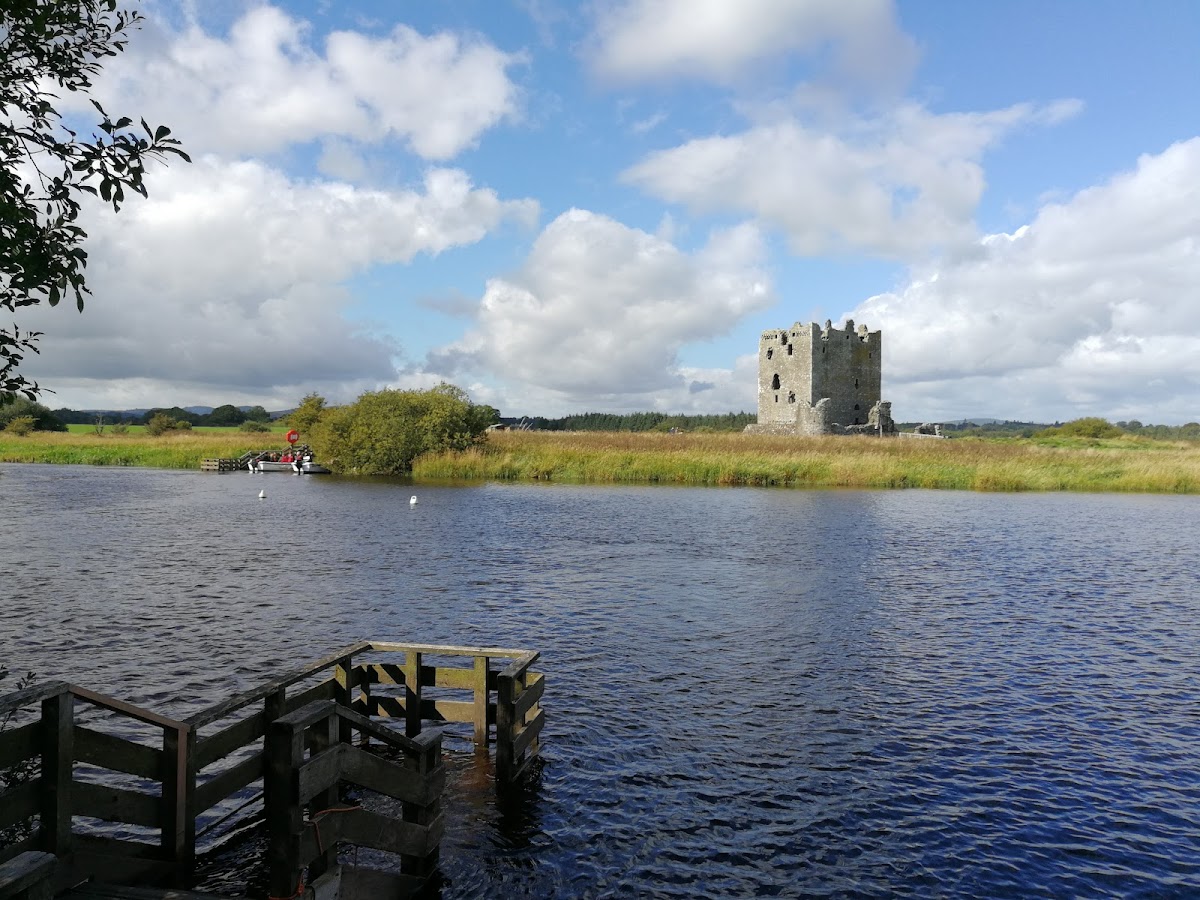
Threave Castle is a fourteenth-century Scottish tower house on an island in the River Dee in the United Kingdom, about 2.5 kilometres west of Castle Douglas. Built probably in the 1370s for Archibald the Grim, it became a stronghold of the Black Douglases, the powerful Douglas branch that held the earldom of Douglas and lordship of Galloway.
Early settlement and the first stronghold
The name Threave probably comes from the Cumbric word tref, meaning “homestead.” This may point to settlement before Gaelic-speaking communities arrived in the area during the seventh century. The island has also been linked by tradition with Fergus of Galloway, although no evidence shows that he occupied it.
A fourteenth-century record describes Edward Bruce burning an island on the River Dee in 1308. A penny dating from around 1300 was found among the remains of burned buildings at Threave, and may connect the destruction with that event. Excavations in the 1970s uncovered buildings that could belong to this period and may have formed an early stronghold of the Lords of Galloway.
The Black Douglas stronghold
Archibald the Grim became Lord of Galloway in 1369 and strengthened his authority across the region during the following years. Threave Castle was probably built in the 1370s to secure his newly acquired territories. Although Archibald controlled several other castles and may have spent limited time there, he died at Threave in 1400. This is the first recorded historical reference to the castle.
Archibald’s son, Archibald Douglas, 4th Earl of Douglas, married Princess Margaret, the daughter of Robert III. After his death in France in 1424, Margaret governed Galloway from Threave for about 23 years as Countess of Douglas and Duchess of Touraine. She was compelled to cede Galloway to William Douglas, 8th Earl of Douglas, in 1449 and died at Threave soon afterward.
Margaret’s granddaughter, Margaret Douglas, known as the Fair Maid of Galloway, married her cousin William Douglas in 1444. The marriage reunited two branches of the Black Douglas estates and helped William consolidate his control of Galloway. In 1447 he began major improvements to Threave’s defences.
William Douglas seized and killed Patrick Maclellan of Bombie, the Sheriff of Galloway, in 1452, despite James II’s demand that Maclellan be released. James II, the fifteenth-century king of Scotland who sought to destroy Black Douglas power, later killed William at Stirling Castle. William’s brother, James Douglas, 9th Earl of Douglas, continued the fortification of Threave and rebelled against the Crown.
The siege of 1455
After James Douglas was defeated at the Battle of Arkinholm on 1 May 1455, royal forces attacked the remaining Douglas strongholds. Threave was the last to resist. The siege began in June and continued for more than two months, while James II based himself at Tongland Abbey.
A large cannon was brought from Linlithgow Palace, but Threave’s new artillery defences prevented a direct capture. The garrison eventually surrendered after Douglas supporters received payments and grants of land. The agreement was probably secured through bribes and promises of safe conduct rather than by an assault that breached the castle.
Royal fortress and Maxwell control
After the fall of the Black Douglases, Threave and the lordship of Galloway were annexed to the Crown. The castle became a royal fortress with appointed keepers and was granted to Margaret of Denmark, the wife of James III. James IV visited Threave in 1502.
Hereditary responsibility for the castle passed to the Maxwell family in 1526. Robert Maxwell surrendered it to the English after his capture at the Battle of Solway Moss in 1542. James Hamilton, Earl of Arran, recovered Threave for Scotland in 1545.
The Crown later demanded the castle’s surrender several times because of suspicions about the Catholic Maxwells’ loyalty. One such period of concern came in 1588, as the Spanish Armada approached England. During the Bishops’ Wars of 1638 to 1640, conflicts between Charles I and Scottish Covenanters over royal authority and the governance of the Church of Scotland, the Maxwells supported the king and stationed a garrison of up to 100 men at Threave.
Abandonment and preservation
Covenanter forces besieged Threave in 1640. The garrison surrendered after 13 weeks on the king’s orders. The Covenanters then ordered the buildings to be dismantled, and the castle was largely abandoned. It was never again permanently inhabited.
Around 1800, during the Napoleonic Wars, alterations were made to allow for the possible accommodation of French prisoners of war, although firm evidence does not show that the castle was used for this purpose. The ruins were placed in state care in 1913. Repairs and archaeological investigations followed, including extensive excavations in the 1970s that revealed more about the earlier buildings and the castle’s development. Threave has been a scheduled monument since 1921 because of its national significance and is maintained by Historic Environment Scotland.
Remains
Threave Castle occupies the western edge of an island in the River Dee. The island covers about 8 hectares today, although it may have been only about one-third that size in the fifteenth century. The surviving complex includes a largely complete rectangular keep, a curtain wall, one remaining artillery tower, the foundations of a gatehouse, a former moat, earthworks, and traces of subsidiary buildings, a harbour, and earlier occupation.
The tower house
The five-storey keep measures approximately 18.4 by 12.1 metres and survives to about 21 metres high. It was probably built in the 1370s as a tower house, a fortified residence centred on a tall, self-contained stone tower. When first constructed, it stood independently without an outer defensive enclosure.
The original entrance was on the east side at first-floor level. A wooden stair tower and a movable bridge provided the approach. Inside, the entrance opened into a reception hall, while part of the same level contained a kitchen. Vaulted storage cellars below included a well and a prison, reached by a ladder.
An internal spiral stair set within walls about 2 metres thick led upward to the great hall, the lord’s outer chamber, and the bedchamber. Larger windows were concentrated mainly on the less vulnerable west and north sides. The upper rooms had wooden floors, fireplaces, and a latrine. The top storey contained nine windows and an external door but no fireplace or latrine. In peacetime it accommodated servants, while during a siege it provided space for the garrison. The outside door also allowed equipment to be hauled up from ground level and opened onto a wooden defensive gallery.
Holes in the outer walls supported a timber bretèche, a projecting defensive gallery from which attackers below could be targeted, on three sides of the keep. A more permanent machicolation above the entrance served a similar purpose through openings in the masonry. The timber galleries, roof, upper floors, and other wooden elements have disappeared.
The curtain wall and artillery house
The keep was later enclosed on its east, south, and west sides by a curtain wall. The east and south sections formed an artillery house, a defensive structure designed to mount guns. William Douglas began this work in 1447, and it was completed during the subsequent Douglas resistance. Earlier buildings were demolished both to provide stone and to clear fields of fire.
The artillery house stood only about 4.4 metres from the keep. Its curtain wall was approximately 1.5 metres thick and formerly reached up to 6 metres high. The wall was battered, or inclined slightly outward, to resist artillery fire and also contained openings for longbows or crossbows.
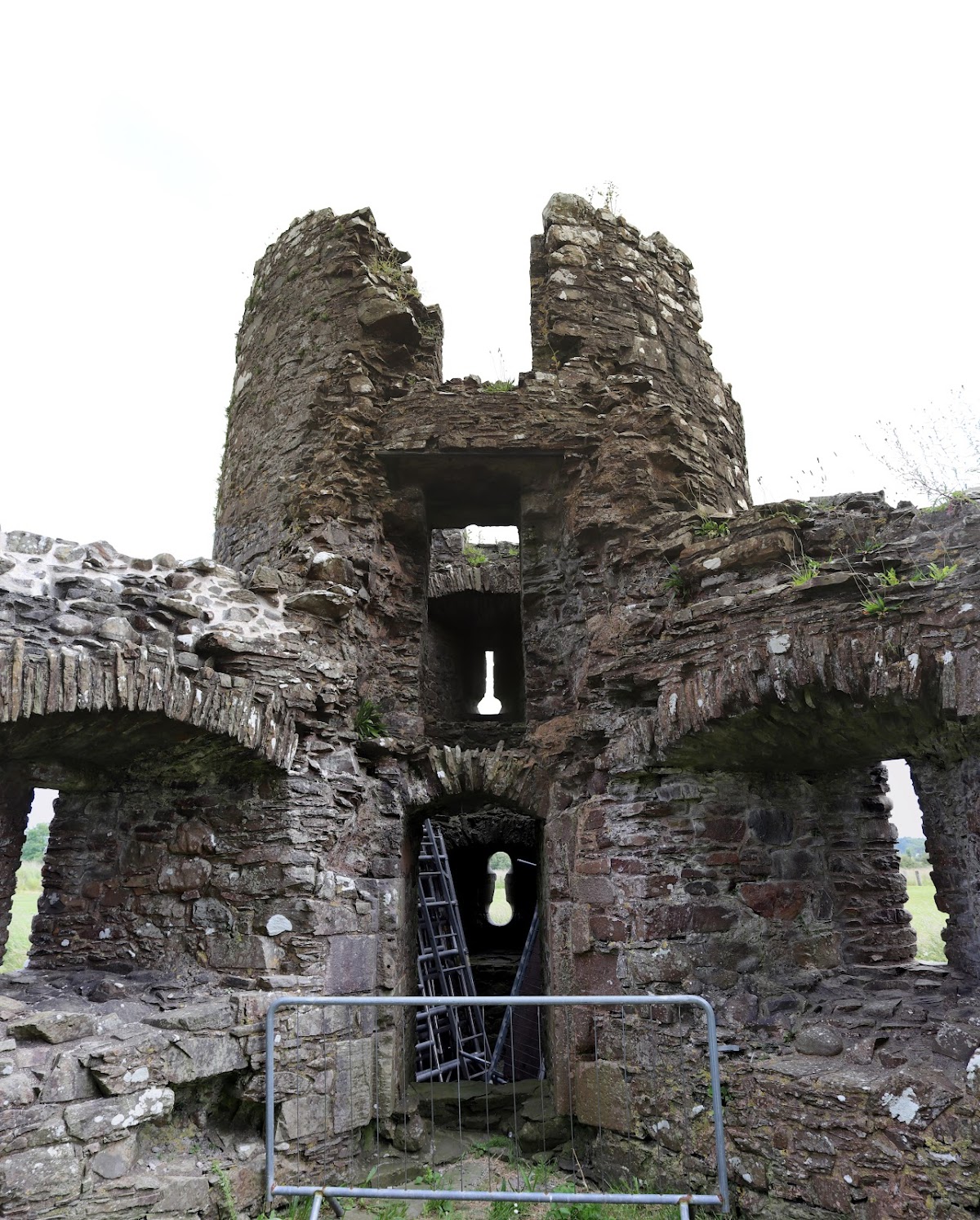
Three round corner towers projected from the artillery house. Each had gun ports on two levels and a crenellated parapet above. The lower openings were dumb-bell-shaped, while the upper ones were inverted-keyhole-shaped. They may have accommodated breech-loading guns of about 80 millimetres calibre mounted on wooden stocks.
Only the south-eastern artillery tower survives. The other two were badly damaged during the 1640 siege and later collapsed. The east wall contained a gatehouse nearly 8 metres high, with a drawbridge, two inner doors, and a firing platform above. A rock-cut ditch surrounded the curtain wall and was formerly flooded to create a moat. The precise relationship between the curtain wall and the keep remains uncertain, although the two structures stand very close together.
Island defences and archaeological remains
The River Dee runs close to the keep on the west. A surviving riverside wall curves toward the keep’s north-west corner, where a gated harbour provided a secure alternative entrance. Access was also possible across a ford or partly submerged causeway at the southern end of the island. The river level was higher during the medieval period.
The north side was protected mainly by an earth bank and marshy ground that made an attack difficult. Beyond the artillery house and its ditch lie foundations of earlier buildings. The outermost defence is an earthwork hastily constructed by Lord Maxwell’s garrison before the 1640 siege.
Excavations recovered a lead seal matrix associated with Princess Margaret. It bears the combined arms of her husband and her father, Robert III. Its poor workmanship suggests that it may have been a trial piece or a forgery. Together, the surviving keep, south-eastern artillery tower, curtain-wall sections, gatehouse foundations, moat, earthworks, harbour traces, and earlier building remains present the ruined form of a castle repeatedly adapted to changing political and military circumstances.