Tel Megiddo: An Ancient Canaanite City and Archaeological Mound
Site at a Glance
- Rating
- 5
- Popularity
- Very Low
- Country
- Israel
- Primary era
- Iron Age
- Eras represented
- Stone Age, Bronze Age, Iron Age
- Civilizations
- Assyrian, Canaanite, Egyptian, Israelite
- Site type
- City
On this page26 sections
History
Tel Megiddo is the archaeological mound of the ancient city of Megiddo in Israel. At the western edge of the Jezreel Valley, near the Wadi Ara pass through the Carmel ridge, the city controlled routes connecting Egypt with Syria, Mesopotamia, Anatolia, and the Phoenician coast. Canaanites, the peoples of the ancient Levant, developed it into a major Bronze Age city-state, a city and its surrounding territory governed as a small political unit. In the Iron Age, Megiddo became a royal and administrative center of the Kingdom of Israel. The Bronze Age and Iron Age are successive archaeological periods named for the metals commonly used in tools and weapons.
Early settlement and Canaanite city
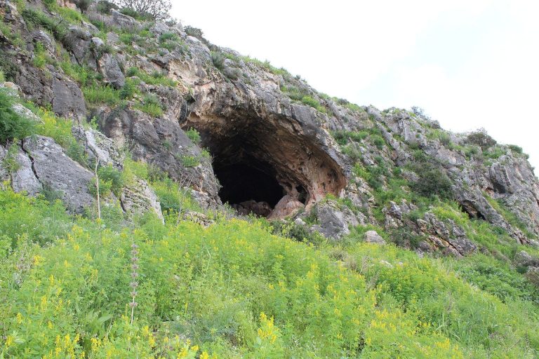
People lived at Megiddo from the Neolithic period. The earliest occupation may date to about 7000 BCE, though evidence from a cave on the eastern slope is sparse. One of the mound’s numbered settlement layers, or strata, is dated to about 5000 BCE; at Megiddo, higher stratum numbers generally indicate earlier occupation. More than twenty layers have been identified, and settlement continued into the Persian period.
Megiddo became a fortified town in the Early Bronze Age. Its urban life contracted after political systems of that period collapsed in the later third millennium BCE, then revived in the Middle Bronze Age, when the city emerged as a leading regional center. It acquired new defenses, a palace, and a gate. A royal burial dated to about 1700–1600 BCE reflects the city’s power. Megiddo remained important in the Late Bronze Age, when local rulers governed under Egyptian authority.
Egyptian rule and Late Bronze Age
In 1458 BCE, a coalition of Canaanite rulers gathered at Megiddo to resist the Egyptian pharaoh Thutmose III. He took his army through the difficult Wadi Ara pass and surprised the coalition near the city. After defeating it and capturing many chariots, the Egyptians faced a seven-month siege of Megiddo. The city eventually surrendered and returned to Egyptian rule, becoming an Egyptian stronghold. Inscriptions at Karnak, a major temple complex in ancient Thebes, describe the campaign.
Diplomatic letters from Megiddo preserve the local ruler Biridiya’s disputes with Labaya, ruler of Shechem, and his requests for Egyptian assistance after an Egyptian auxiliary force departed. The correspondence also links Megiddo with nearby Taanach and Kumidu. The city was damaged at the end of the Late Bronze Age, then rebuilt and prospered again. A Canaanite dynasty continued to rule after Egyptian authority in the region ended.
Iron Age I and the Israelite monarchy
A major fire destroyed Megiddo near the transition from Iron Age I to Iron Age II. Its date and cause are debated. Estimates range from the later 11th to the early 10th century BCE, while recent radiocarbon interpretations favor the early 10th century and connect the destruction with the expansion of highland powers rather than the campaign of the Egyptian pharaoh Shoshenq I.
Biblical accounts associate Megiddo with the territories of Manasseh and, in another passage, Issachar. They also say that the Israelites initially failed to capture the Canaanite city. The biblical narrative links Megiddo with building works attributed to Solomon and places it in an administrative district, but the dating and attribution of early Iron Age construction to Solomon remain disputed.
Megiddo regained importance under the Israelite monarchy. Its early Iron Age II defenses, palaces, and water installations are associated with the Omrides, a ruling dynasty of the northern Kingdom of Israel in the ninth century BCE. The gate traditionally called the Solomonic gate is now generally dated to this period, although the chronology of some buildings has been debated. A later phase, probably under Joash and his son Jeroboam II, made the city a military center for Israelite cavalry and chariots. Biblical references also associate Ahab with Megiddo’s military role.
One Iron Age destruction has been attributed to Hazael, king of Aram-Damascus, an Aramaean kingdom centered on Damascus. A different proposal connected the destruction of Stratum V with Shoshenq I’s campaign around 926 BCE. That argument drew partly on a fragment bearing the pharaoh’s royal name, found in excavation spoil, and a damaged list of place-names at Karnak. Radiocarbon recalibration instead favors destruction during Hazael’s campaign, around 835 BCE.
Assyrian rule, decline, and later memory
Tiglath-Pileser III, king of the Neo-Assyrian Empire, conquered Megiddo in 732 BCE and made it the capital of the province of Magiddu. The city was rebuilt as an administrative center. In 609 BCE, the Egyptian pharaoh Necho II captured Megiddo during a battle with the Kingdom of Judah. The biblical account says that Judah’s King Josiah died there.
After the Egyptian conquest, Megiddo declined. In the Persian period it was a small settlement, protected by a fortress and used by Persian troops travelling along the main route. Accounts place its final abandonment at different dates, around 586 BCE or around 350 BCE. The later settlement of al-Lajjun grew nearby without disturbing the ancient remains.
Megiddo’s association with Armageddon arose from the New Testament Book of Revelation, which names a place rendered in Greek as the site of a final battle between opposing forces. Some interpret the name as a reference to Mount Megiddo, while others understand it as symbolic. The area also saw fighting in 1918 between Allied forces led by General Edmund Allenby and the Ottoman army.
Excavation and conservation
Megiddo was once identified with Lajjun. Excavations directed by Gottlieb Schumacher in 1903–1905 established that the mound then called Tell el-Mutesellim was the ancient city. His work included a main north–south trench and test trenches, and identified six occupation layers. His field records were later destroyed during the First World War; Carl Watzinger published the excavation data that survived.
The Oriental Institute of the University of Chicago excavated the mound from 1925 to 1939. The expedition shifted from plans to excavate the whole mound layer by layer to work in four deep sections. It exposed four layers fully, identified about eight occupation levels, and introduced aerial photography to its work at Megiddo. Excavation ended with the outbreak of the Second World War. Soil from the dig was dumped on the eastern slope, changing the mound’s original profile.
Yigael Yadin led excavations in 1960, 1966, 1967, and 1971, examining the northern defenses, temple area, lower city, gates, stables, and ground west of the water system. Abraham Eitan led another excavation in 1974. Tel Aviv University excavations began in 1992 and expanded in 1994, investigating multiple areas and settlement periods from the Early Bronze Age through Iron Age II.
UNESCO added Tel Megiddo in 2005 to the World Heritage property Biblical Tells—Megiddo, Hazor, Beer Sheba; the site is also protected as a national park. Before 2006, conservation largely consisted of maintenance and repairs as needed. A broader plan followed, with work on the water system in 2007, partial conservation of the granary in 2009, and repairs to the northern stable floor and steps near the spring. Conservators reset marked stones using mortar made with local soil and lime. Earlier concrete reinforcement was recognized as harmful because it released salts into ancient stone.
Remains
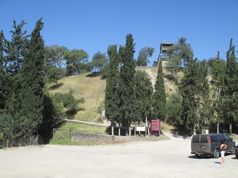
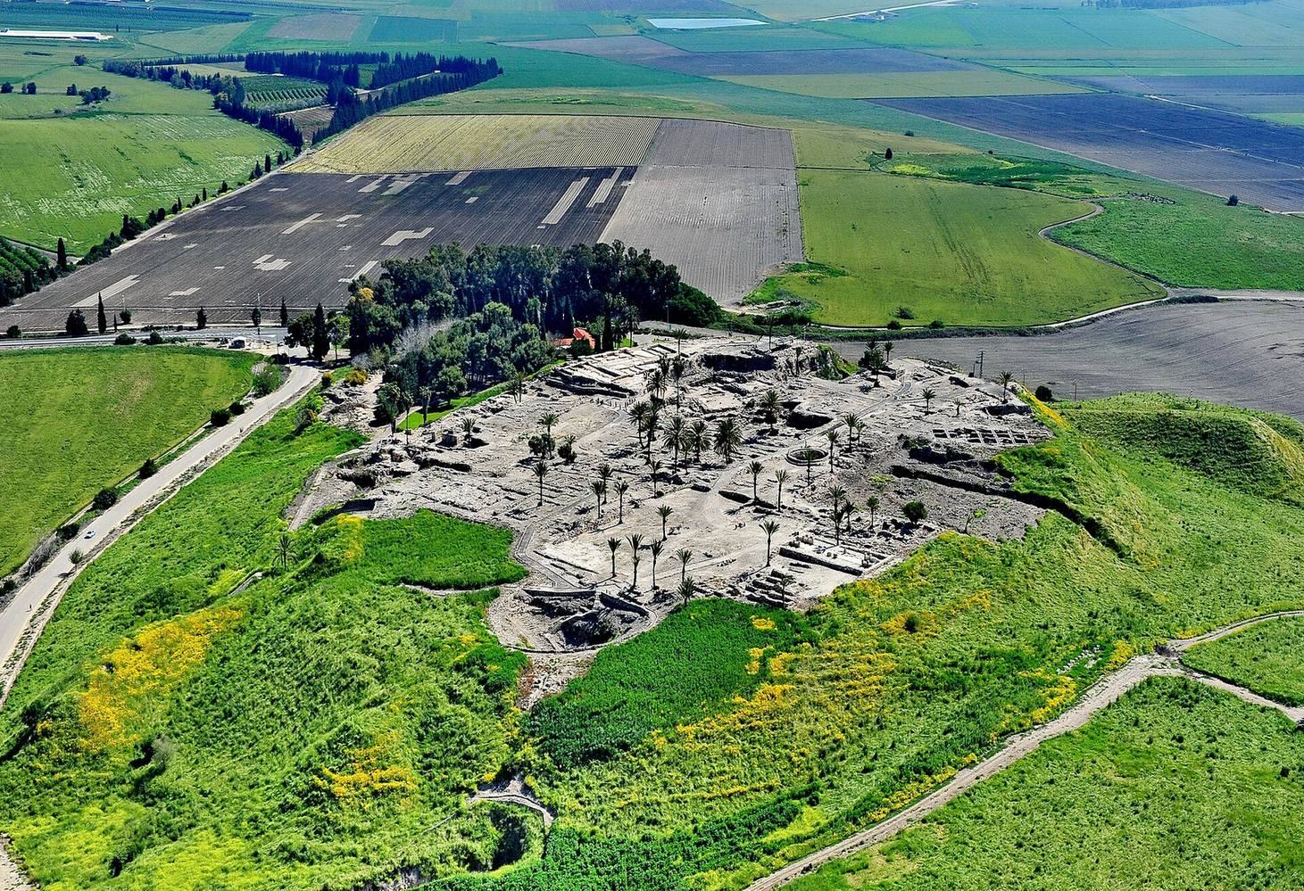
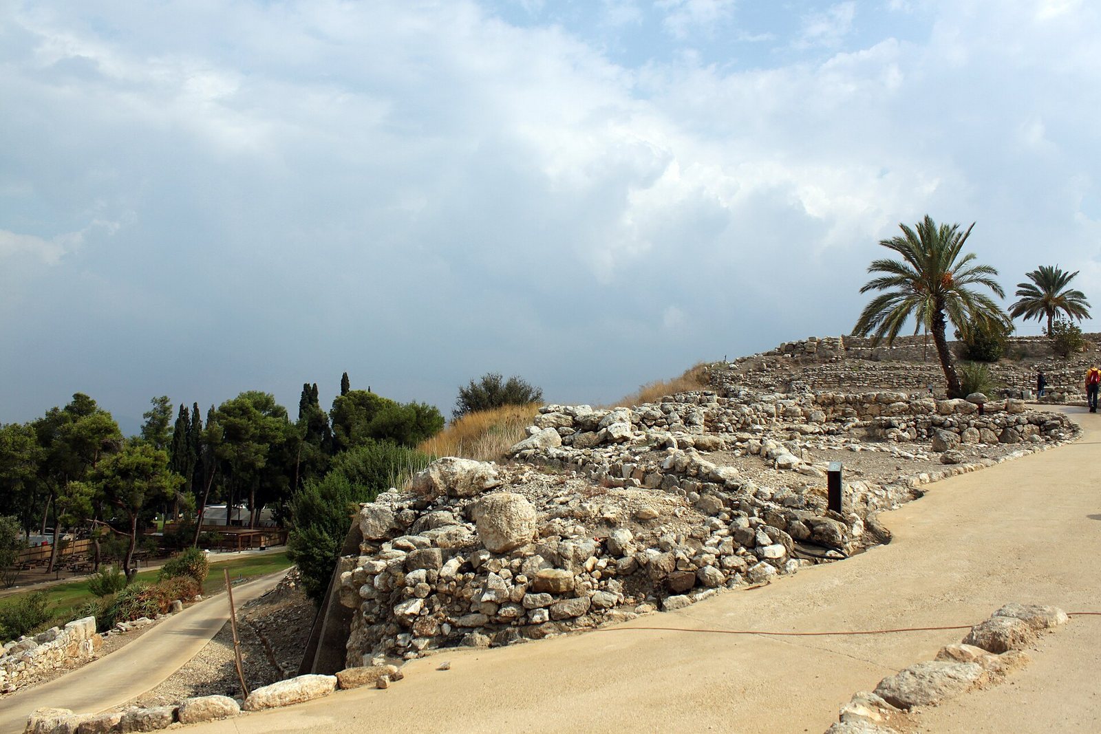
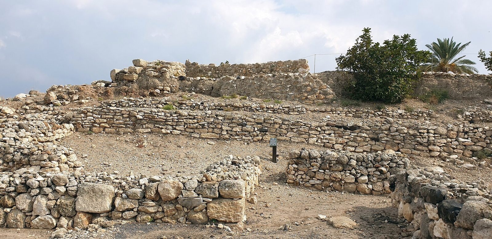
Tel Megiddo is a tell, a mound created by successive settlement and rebuilding. It occupies about 60 dunams, a unit of area equal to 1,000 square metres, and rises approximately 40–60 metres above the surrounding plain. Set between water sources at the western margin of the Jezreel Valley, it overlooks the valley near the northern entrance to Wadi Ara. Its remains include settlement layers, defensive walls, gates, public and religious buildings, palaces, and a water system.
Mound and earliest settlement
Sparse Neolithic remains came from a cave on the eastern slope near ‘Ain el-Qubbi. Chalcolithic remains include buildings with rounded ends and a temple. An early settlement extended beyond the present archaeological park. In the Early Bronze Age, a massive wall enclosed the settlement. During Early Bronze Age IIb, defenses protected a core of about 20 dunams, while much of the population lived on the eastern slope and could take refuge inside the fortified area. Estimates of the Early Bronze Age settlement’s extent vary: one geophysical estimate is about 50 hectares, while another places the Early Bronze Age IA and IB settlement at about 25 hectares and describes its buildings as sparse and irregularly distributed.
Bronze Age architecture
Early Bronze Age temple
A monumental temple of Early Bronze Age IB, dated to about 3000 BCE, measures 47.5 by 22 metres. Its scale was more than ten times that of a typical temple of its period. Corridors within the building held objects connected with worship and animal bones from ritual sacrifices. More than 80 percent of the animal remains were young sheep and goats; the others were cattle.
Southern compound and later sanctuaries
South of the temple, a separate Early Bronze Age IB compound has long parallel stone walls about four metres wide, with narrow corridors between them. Animal-sacrifice remains came from the corridors. The compound lies below large Early Bronze Age III temples of megaron form, meaning halls with long rectangular plans, which remained in use into the Middle Bronze Age. A large circular altar and a megaron-style temple were also built in Early Bronze Age III. The sanctuary complex included structures among the largest known for its period in the ancient Near East.
Middle and Late Bronze Age buildings
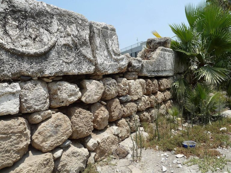
In Middle Bronze Age Stratum XI, the city had an earthen rampart topped by a wall, a new palace known as Building 5059, and a new gate in Area A-A. During Late Bronze Age Stratum IX, the existing urban layout continued with limited architectural change, and a palace wing was added east of the gate in Area D-D. Royal compounds stood on both sides of the gate through the end of Stratum VII. Other Late Bronze Age remains include the gate known as the Canaanite gate, palace structures, and a large granary. A timber beam at the gate was later reconstructed and marked as a reconstruction; two courses of stone were added above it to raise the gate.
Iron Age architecture
Palaces and public buildings
The palace complex continued into Iron Age I. A building excavated as a treasury in Stratum VIIA stood over the remains of a Stratum VIIB palace. Iron Age I rebuilding reused earlier parts of the city: the gate stayed in the same location, the northern palace was restored, and new public buildings were set around Late Bronze Age structures. The Middle Bronze Age monumental temple also remained in use. Fire-destroyed buildings preserve mud bricks turned red by heat.
In Iron Age II, three palaces had large front courtyards bounded by rough-stone walls incorporating ashlar piers, carefully cut and squared blocks. The gates of the palaces had proto-Aeolic capitals, carved architectural tops with distinctive curling forms. The northern palace, Building 6000, covered 440 square metres. The eastern palace had standing stones 2.5 metres high, with offering tables beside them.
Gate and city defenses
A broad approach road, bordered by two stone walls, led to the Iron Age gate conventionally called the Solomonic gate. The six-chambered gate belongs to Strata VA–IVB and is generally assigned to the Omride period, though its date has been debated. Two towers at its front joined the gate to the city wall. The wider defenses included a thick wall with alternating projecting and recessed sections. House walls at the city’s edge connected with palace walls to form a continuous defensive line.
Sanctuary and grain silo
A sanctuary north of the city and west of the gate contained standing stones and a large altar with projecting horns. In the southern part of the city, a substantial grain silo reached about seven metres deep and eleven metres across. Its stated capacity was 450 cubic metres of fodder.
Stable complexes
Large building complexes were excavated both north and south of the city. They are usually assigned to Stratum IVA, though dates in Strata VA–IVB have also been proposed. The southern complex comprised five buildings around a courtyard paved with lime. Each building measured about 21 by 11 metres and was divided into three sections. Stone-paved aisles flanked a central corridor; holes in the pillars could tether horses, and stone mangers stood between them. Each building may have held about 30 horses. The northern buildings had a similar form but no central courtyard and may together have accommodated about 300 horses. Estimates for the capacity of both complexes range from 450 to 480 horses.
The buildings’ function remains disputed: they have also been interpreted as storehouses, marketplaces, or barracks. Building 1576 in the southern complex was partially reconstructed in 2006 according to the stable interpretation. White soil covered its courtyard, obscuring much of the excavated remains, and horse sculptures were placed in the stable area and nearby space in 2009.
Water system
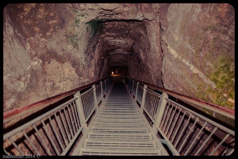
The water system provided access to a spring without requiring people to leave the city’s defenses. An earlier approach road, probably dating to the 10th century BCE, ran between parallel walls to a spring outside the western wall. A more elaborate system, probably constructed in the ninth century BCE, concealed the spring and allowed water to be drawn from within the city. It consists of a shaft about 30 metres deep and a rock-cut tunnel about 80 metres long leading to the water source. Because the tunnel floor lies below the spring, water flows into the shaft and can be raised with a rope and bucket. A wall concealed the spring’s outlet. The system was excavated by the Chicago expedition, adapted for visitors in the 1950s, and restored in 2007.
Assyrian and Persian remains
Assyrian gate and buildings
In Stratum III, a city gate was added to the surviving Wall 325. A chamber stood on each side of its passage. Three large buildings lay near it: Buildings 1052 and 1369 to the west and Building 490 to the east. Parts of their plans display Assyrian architectural features.
Fortress
In Stratum II, Wall 325 ceased to serve as a defense and the settlement became unwalled. A fortress was built in the eastern part of the city. Its construction has been attributed either to Josiah of Judah or to an Egyptian garrison. The fortress also protected the small Persian-period town.
Objects and burials
Ivories and written remains
The Iron Age treasury building yielded the Megiddo ivories, about 380 objects and fragments. The collection includes long plaques carved with images and a square box decorated with finely carved lions and sphinxes. The ivory work shows Egyptian stylistic influence; an ivory pen case bears the royal name of Ramesses III. The objects are now held at the Institute for the Study of Ancient Cultures in Chicago and the Rockefeller Museum in Jerusalem. An eighth-tablet fragment from the Epic of Gilgamesh was recovered from excavation spoil associated with the Chicago expedition. It may point to an archive in an unexcavated part of the palace.
Metal and weight hoards
Hoard 5213, found in a wall on the northern mound, dates from the end of the Late Bronze Age to Iron Age I. It contained a flint knife, a stone mortar, 81 bronze and carnelian objects, gold and bronze beads, and silver items. Textile traces show that objects were wrapped together. Erin Hall interpreted this mixed-metal assemblage as economic rather than ritual, perhaps portable wealth for trade or safekeeping during instability.
Yigael Yadin found Hoard 6206 in 1970 beneath the Stratum VIA destruction layer, under a floor near a room threshold. Pottery sherds protected the textile-wrapped bundle, which measured about 15 by 10 centimetres. Its contents included eight bone or ivory wheel-shaped objects, a spindle, two animal-shaped bronze weights, two bronze pomegranate pendants, five other weights, six iron bracelets, a ring, hundreds of tiny beads, and semiprecious stones. The two bronze weights depict a seated monkey and a reclining horned animal, probably an ibex. The monkey weighs 31.17 grams and holds a round object near its mouth; the hollow animal weighs 25.34 grams. The other weights include a bronze object whose use as a weight is uncertain and four stone weights of different shapes and materials.
Yadin initially interpreted Hoard 6206 as a woman’s jewelry cache. Anabel Zarzecki-Peleg later proposed that its weights and metal objects point to trade in metal valued by weight. The hoard combines Late Bronze Age Canaanite craft traditions with Iron Age objects, including an unusually large group of iron bracelets. A separate jewelry cache, recovered from a ceramic vessel excavated in 2010, was identified after packed earth inside the vessel was analyzed. Dating to about 1100 BCE, it contains gold and silver jewelry, carnelian beads, a ring, and earrings. It was probably associated with a wealthy Canaanite family, perhaps the ruling elite.
Burials and medical evidence
A Bronze Age tomb discovered in 2023 held two elite brothers with Cypriot pottery, food, and other valuable possessions. One brother had undergone trepanation, a procedure that makes an opening in the skull. A square opening about 30 millimetres across had been cut into his frontal bone after an incision in the scalp with a sharp, bevel-edged tool. He died immediately after the operation, at an estimated age of 20–40. The younger brother died in his teens or early twenties, probably from an infectious disease such as leprosy or tuberculosis.
Condition and conservation
Excavation spoil altered the eastern slope, and rain erosion cut deep channels into section B-B, threatening its collapse. Heavy winter rains in 2005–2006 damaged a path in the area. Other conservation concerns include unstable walls, crumbling stone, vegetation that conceals or damages remains, and leaks, mold, and rust in the water installation. Concrete reinforcement on some walls releases salts harmful to ancient stone; later repairs used local soil and lime instead. A channel near the water-system entrance diverts rainwater after runoff entered the installation, and deteriorating stonework in the granary received partial conservation in 2009.