Tal Afar Citadel: An Ottoman Fortress on Earlier Assyrian Remains
Site at a Glance
- Rating
- 4.4
- Popularity
- Very Low
- Country
- Iraq
- Primary era
- Early Modern
- Eras represented
- Iron Age, Medieval, Early Modern, Modern
- Civilizations
- Assyrian, British, Ottoman, Umayyad
- Site type
- Military
- Remains
- Citadel
On this page7 sections
History
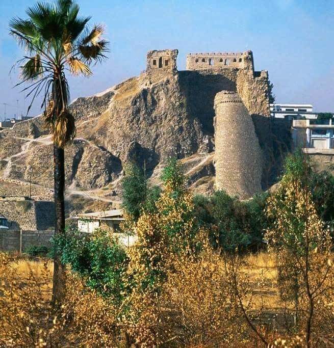
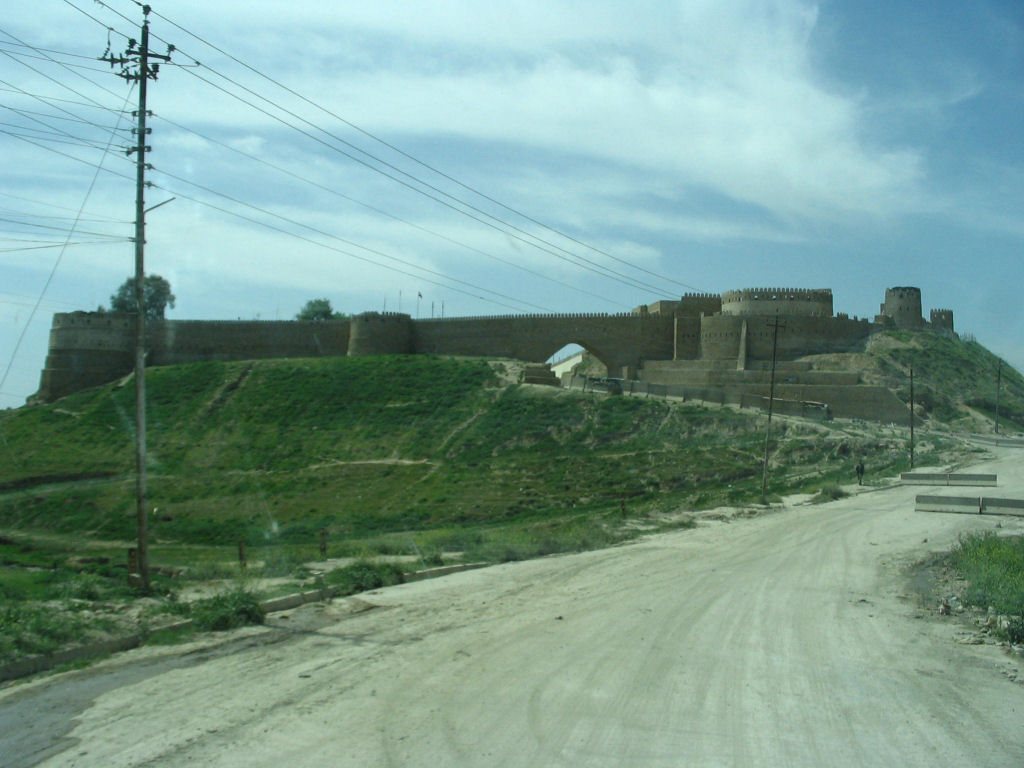
Tal Afar Citadel is a fortified site in Tal Afar, Iraq, built under Ottoman rule in the sixteenth century and incorporating remains attributed to the Assyrian period. Its long history reflects the strategic importance of Tal Afar in Nineveh Governorate, where earlier religious traditions, Islamic rule, imperial administration, and modern warfare all shaped the fortress.
Assyrian and Roman associations
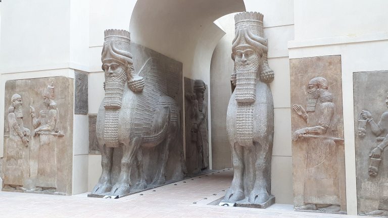
Tal Afar was associated with the Assyrian period, when it served as a center of worship for Ishtar, a major Mesopotamian goddess linked with love, war, and political power. Orchards belonging to the city were endowed to her temple. The citadel also contains remains attributed to this earlier civilization. Roman authorities later renovated the fortress and controlled its walls, although the surviving account does not establish the precise extent of those works.
Umayyad and Ottoman phases
Another tradition connects the fortress with Marwan ibn Muhammad, governor of the Jazira region in 720. He is said to have rebuilt it during the Umayyad period, when the dynasty ruled the Islamic caliphate from 661 to 750. The fortress was then known as Marwan Castle, leading some interpretations to place its original construction in the Umayyad period rather than the Assyrian or Ottoman eras.
The citadel was commonly dated to the sixteenth century under the Ottoman Empire, whose administration controlled northern Iraq. This phase gave the fortress much of the form associated with its later history, including substantial enclosing walls, corner towers, gates, and a concealed connection to the spring beneath it.
Destruction and modern military use
The fortress suffered major damage in several periods. In 1841, during an uprising against the governor of Baghdad, Muhammad Pasha Ince Bayraktar occupied the citadel and ordered the surrounding walls and fortifications demolished. The citadel itself apparently avoided major damage because of its strength. During the British occupation of Tal Afar in 1920, the walls were demolished again and the main gate was dismantled. Its surviving timbers were placed across the stream supplied by the spring and continued to serve as a small crossing until 1955.
After the 2003 invasion of Iraq, the citadel housed Tal Afar’s mayoral, municipal, and police headquarters. American forces used it as a base during the Battle of Tal Afar in 2005. Islamic State forces seized the town in June 2014 and used the citadel as a prison for women and girls who were to be forcibly married to members of the organization. In December that year, militants destroyed the northern and western walls and excavated parts of the ruins, probably seeking antiquities for sale. UNESCO Director-General Irina Bokova condemned the destruction.
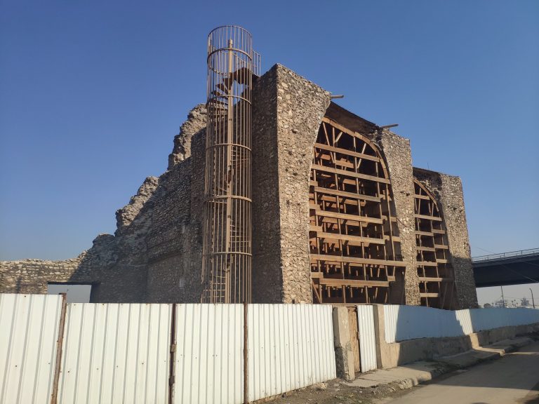
Iraqi forces recaptured Tal Afar during the 2017 operation against Islamic State control. By then, the citadel had suffered extensive damage. Large sections were destroyed in 2015, including much of the historic outer wall, leaving the fortress in ruins.
Remains
The citadel occupied approximately 28,000 square metres in the center of Tal Afar, on top of the town’s spring. Primary and secondary walls enclosed the stronghold. The principal wall measured about 3.30 metres in thickness and rose approximately 6 metres high, while the citadel as a whole stood about 25 metres above the surrounding ground. Stone bound with pure gypsum plaster formed the fortifications.
Walls and towers
Four substantial corner towers stood at the angles of the main enclosure, with smaller towers positioned between them. The large towers were three storeys high and were described as capable of accommodating at least 300 warriors each. Openings and loopholes, narrow apertures used for observation and weapon fire, allowed defenders to watch and control approaches to the fortress. Firing openings, balconies, and apertures for pouring hot water and naphtha, a flammable petroleum distillate used in incendiary warfare, formed part of the defensive arrangement. The gaps between successive balconies measured approximately 40.25 centimetres and served for firing. The northern and western walls were destroyed in 2014, while extensive parts of the wider fortification were demolished in 2015.
Gates and spring
Four entrances served the citadel. The eastern Water Gate, also called the Secret Gate, connected with the spring through a concealed tunnel. The southern Sinjar Gate was the principal entrance, while the western Nisibin Gate and northern Mosul Gate completed the circuit. The dismantling of the Main Gate in 1920 changed the entrance structure, and its remaining wooden elements were later used as a crossing over the spring-fed stream.
Before the British cleared it in 1920, the tunnel to the spring had become blocked with dirt and rubble. A room was built above the spring, and a pump was installed to send water up to the citadel. Remains of this pumping room were still visible. The water connection and the surviving entrance names preserve the relationship between the fortress and the spring on which it was built.