Ciudad Perdida: A Tairona Settlement in Colombia
Site at a Glance
- Rating
- 4.9
- Popularity
- Low
- Country
- Colombia
- Primary era
- Medieval
- External website
- Open
- Eras represented
- Medieval, Early Modern
- Civilizations
- Tairona
- Site type
- City
On this page12 sections
History
Ciudad Perdida is a pre-Columbian Tairona settlement near Santa Marta in Colombia’s Magdalena region, built in the Sierra Nevada de Santa Marta between an earliest development around AD 700–900 and the sixteenth century. Also known as Teyuna and Buritaca-200, it became the probable political, religious, economic, and manufacturing center of the Buritaca region.
Development of the Tairona center
Most of the city was constructed between the eleventh and sixteenth centuries. It probably supported between 2,000 and 8,000 inhabitants and stood at the center of a wider network of Tairona villages. The settlement’s terraces, plazas, paths, and buildings formed an organized urban and ceremonial landscape in the mountain region.
The Tairona remained at Ciudad Perdida until the sixteenth century. They probably left after prolonged trade and conflict, the spread of disease, and the wider effects of Spanish conquest. Although the Spanish traded with the Tairona, they did not enter the city itself.
Indigenous memory and rediscovery
Kogi, Wiwa, Arhuaco, and Kankuamo communities identify themselves as descendants of Tairona populations. Members of these communities state that they visited the site before its public rediscovery and call it Teyuna. They regard it as the heart of a network of settlements inhabited by their Tairona ancestors.
Local treasure looters, known as guaqueros, rediscovered the abandoned settlement in 1972 after following a stone staircase through the forest. Gold figures and ceramic urns from the site soon appeared on the local black market, bringing wider attention to the ruins.
Archaeology and conservation
The Instituto Colombiano de Antropología became aware of Ciudad Perdida during investigations in the Sierra Nevada in 1973. A government archaeological expedition led by Gilberto Cadavid and Luisa Fernanda Herrera surveyed the site in 1976, recording both its remains and the damage caused by illegal excavations. Archaeological reconstruction began that year and continued until 1982.
Steep terrain, difficult climate, and looting made the early work particularly challenging. Excavation damage had obscured the original arrangement of some structures. Former guaqueros assisted the restoration team because they knew the terrain and remembered the forms of terraces, stone rings, paths, and stairs.
Further conservation led by Gilberto Cadavid between 1986 and 1993 cleared mud, soil, and harmful vegetation from stairs and paths and rebuilt collapsed walls using their original dry-stone technique. Dry-stone masonry uses carefully arranged stones without mortar, supported here by layers of earth, bonding stones, and protective capstones. Additional conservation projects followed in the 2000s, and a permanent archaeological base is maintained at the site.
Conflict, protection, and cultural management
The surrounding region was affected by Colombia’s armed conflict, which involved the national army, right-wing paramilitary groups, and left-wing guerrillas including the ELN and FARC. On 15 September 2003, the ELN kidnapped eight foreign tourists in the area and released the final hostage three months later. The AUC also attacked Indigenous and other inhabitants of the region.
Access resumed in 2005, while army patrols and cooperation between national institutions and Indigenous communities became part of the site’s protection. Since 2009, the Global Heritage Fund has supported documentation, conservation, regional management planning, and measures addressing climate, vegetation, neglect, looting, and unsustainable tourism.
Ciudad Perdida is administered as a national archaeological park by the Colombian Institute of Anthropology and History, or ICANH, Colombia’s national institution for archaeological research, protection, and cultural-heritage management. The site lies within the Sierra Nevada de Santa Marta Biosphere Reserve, recognized by UNESCO in 1979. It has also appeared under changing UNESCO World Heritage tentative-list designations, which identify places a state may propose for future inscription.
Indigenous communities continue to play an active role in preservation and management decisions because of their historical and ancestral relationship with the territory. Their cultural protection of the site forms part of the continuing interpretation of Ciudad Perdida as Teyuna, the center of an ancestral settlement network.
Remains
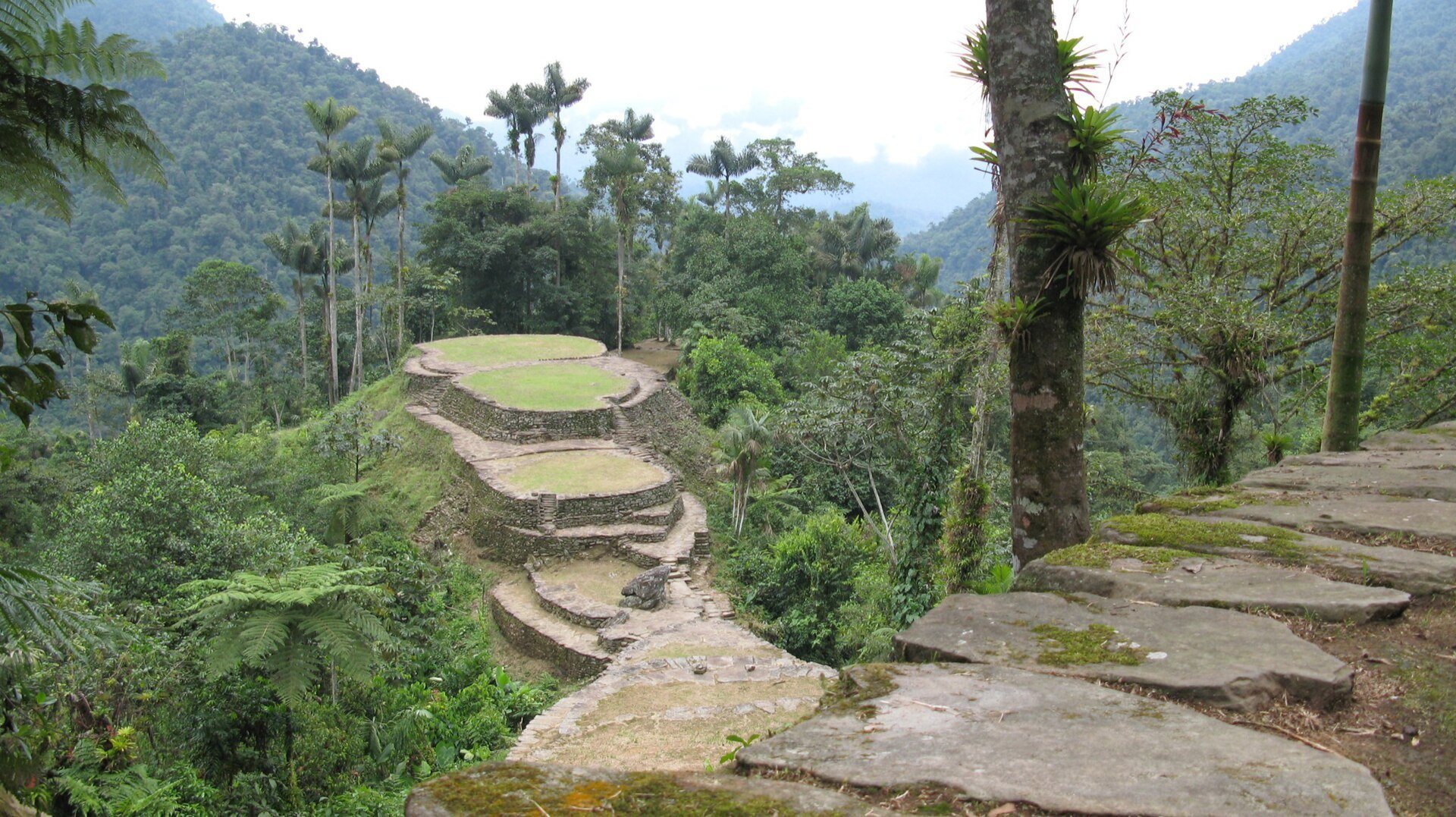
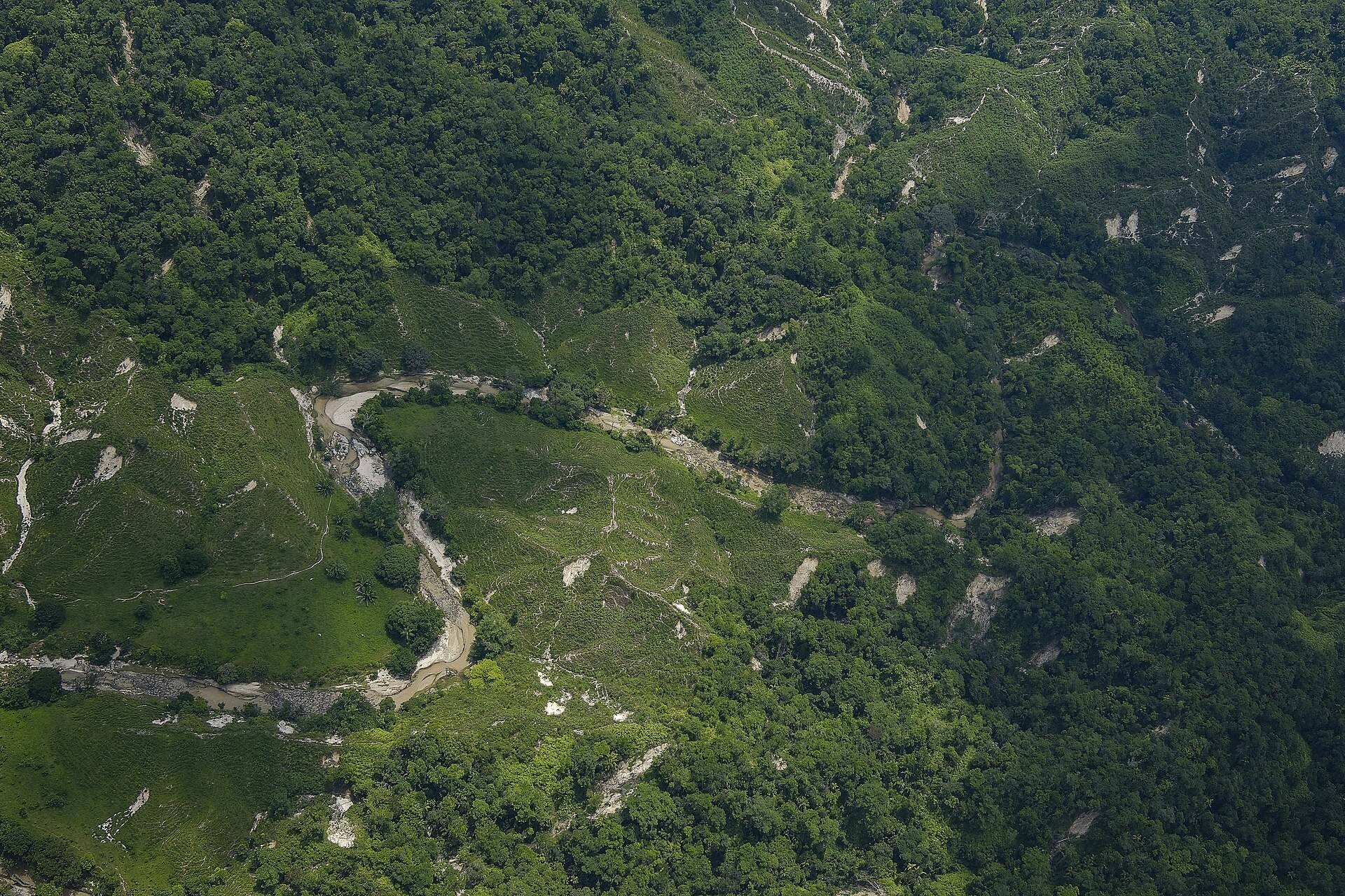
Ciudad Perdida occupies the northern side of the Sierra Nevada de Santa Marta, at the foot of Cerro Correa and on the right bank of the Buritaca River. The exposed settlement lies roughly between 900 and 1,200 meters above sea level, while the wider site extends to about 1,300 meters. Its built landscape consists of stone terraces, platforms, paved paths, stairs, walls, drainage channels, bridges, and circular or oval plazas.
Terraces and urban sectors
Terrace construction
At least 169 terraces have been identified, while the broader ruin complex has also been described as containing about 200. The structures cover approximately 35 hectares, with a central urban area of about 48,000 square meters and a city extending across roughly 2 square kilometers. The exposed settlement is divided into four principal sectors: Eje Central, with 46 terraces; Piedras, with 38; El Canal, with 22; and La Gallera, with 19.
Terraces supported residences, agriculture, gardens, ceremonial centers, and food storage. Wooden buildings once stood on some of the stone platforms, while their surviving evidence consists chiefly of stone foundations. Terrace walls were made by cutting a roughly rectangular slope into the earth, using stones taken from the excavation, and packing soil and rubble behind the masonry. Flat stones measuring about 1–2 meters were set into this fill as bonding elements. Additional courses were placed progressively farther back to create a sloping wall face, and flat slabs capped the walls to limit erosion.
Paths and water infrastructure
Paved roads and stairways connect the terraces. One approach rises through dense forest by approximately 1,200 stone steps, and some differences in elevation between terraces reach about 12 meters. Drainage channels and bridges formed part of the settlement’s infrastructure. Erosion gullies created by illegal excavations undermined some walls and threatened the stability of surviving structures.
Plazas and cultural features
La Capilla
The central plaza, known as La Capilla, is regarded as sacred by present-day Kogi and Arhuaco communities. It has also been used as a helicopter landing area. Tourist helicopter landings were prohibited in 2010 after studies found that they damaged the archaeological fabric, although military helicopters remained exempt.
Carved stone and recovered objects
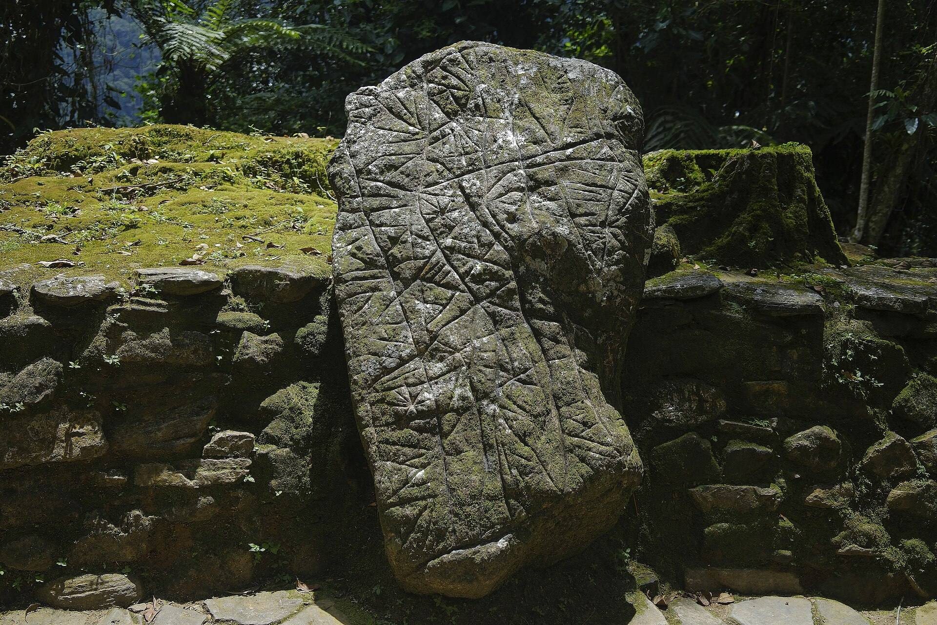
A carved stone bearing markings is believed to represent a map of Ciudad Perdida and the paths linking it with the wider region. Gold figures and ceramic urns appeared on the local black market after the settlement’s rediscovery. Some surviving finds associated with Ciudad Perdida are exhibited in gold museums in Cartagena and Santa Marta.
Ciudad Perdida forms part of a wider archaeological landscape that remains only partly investigated. An estimated 30–40 percent of archaeological sites in the Sierra Nevada region have been studied, while expanded use of lidar, a laser-based method for mapping ground surfaces, has revealed additional settlements and archaeological features beneath dense vegetation.