Son Fornés: A Multi-Period Settlement in Mallorca
Site at a Glance
- Popularity
- Medium
- Country
- Spain
- Primary era
- Iron Age
- Eras represented
- Iron Age, Classical
- Civilizations
- Roman
- Site type
- City
On this page18 sections
History
Son Fornés is a multi-period settlement about 2.5 km northwest of Montuïri on the island of Mallorca, Spain. Its earliest organized occupation dates to the Talayotic period, about 900–550 BCE, when communities built large communal stone towers called talayots. The settlement continued through the post-Talayotic, or Balearic, period (550–250 BCE) and the Roman period (250 BCE to about 100 CE).
The Talayotic settlement
Communal life at Son Fornés centered on its talayots. The settlement’s economy relied heavily on livestock, alongside cereal and legume cultivation and probably seasonal gathering of wild plants. Except for metals, many everyday tools could be made from materials available locally. Household goods and patterns of consumption suggest substantial self-sufficiency and relatively limited differences in wealth between households.
The settlement suffered major destruction near the end of the Talayotic period. In the following centuries, new buildings were constructed among or over earlier remains, changing the organization and use of the site.
The post-Talayotic settlement
During the post-Talayotic period, Talayot 3 was adapted for communal sanctuary use. The central district between Talayots 1 and 2 was reorganized around two sanctuaries, streets, and workshops, becoming an economic center. Son Fornés appears to have served as a rural settlement rather than a leading political center.
These changes took place amid the westward expansion of Punic influence. Punic settlers founded Ebusus, the ancient name for Ibiza, in 654 BCE. Balearic slingers later fought for Carthage in conflicts with Greek powers and Rome. At Son Fornés, large quantities of goods from the Punic-Ebusitan world reached the settlement during the third century and the first half of the second century BCE.
Roman rule and later activity
After Rome defeated Carthage in the Third Punic War in the mid-second century BCE, Roman trade expanded across the region. Around the end of that war, the central district and sanctuaries at Son Fornés underwent extensive remodeling, and goods associated with Roman influence appeared. In 123 BCE, the Roman commander Quintus Caecilius Metellus led the conquest of the Balearic Islands, bringing them under Roman rule.
Son Fornés continued to develop during the Roman period. As Roman urban centers grew at Pollentia and Palma, the settlement was gradually abandoned. Its final abandonment is placed toward the end of the first century CE. From about the second century CE, people visited the site intermittently during the Byzantine and Islamic periods. A serving dish from the Almoravid period, made in southeastern Iberia, belongs to this later evidence.
The estate and archaeological study
The name Son Fornés comes from a historic agricultural estate that may have begun as a rural farmstead during the Islamic period. The Fornés family, associated with trade, appears in records from 1512. The estate was valued at 6,000 Mallorcan lliures, a historical currency, in 1656, and belonged to Joan Antich de Llorac in 1669. In 1718, Joan Miquel Antich de Llorac left it to his wife, Coloma Barceló. By 1839, it was owned by the Pont and Vich family.
Archaeological excavation began in 1975 under Catalan archaeologist Vicenç Llull. Fieldwork in the 1970s and 1980s stopped in 1988 during a pause connected with preparation of an archaeological survey of Mallorca, then resumed in 2002. Fourteen excavation campaigns and three interventions to consolidate and restore structures have taken place. The municipality acquired the site, and the Son Fornés Archaeological Museum opened in 2001 to manage it. The archaeological complex was declared a Historic-Artistic Monument in 1966 and has cultural-interest status.
Remains
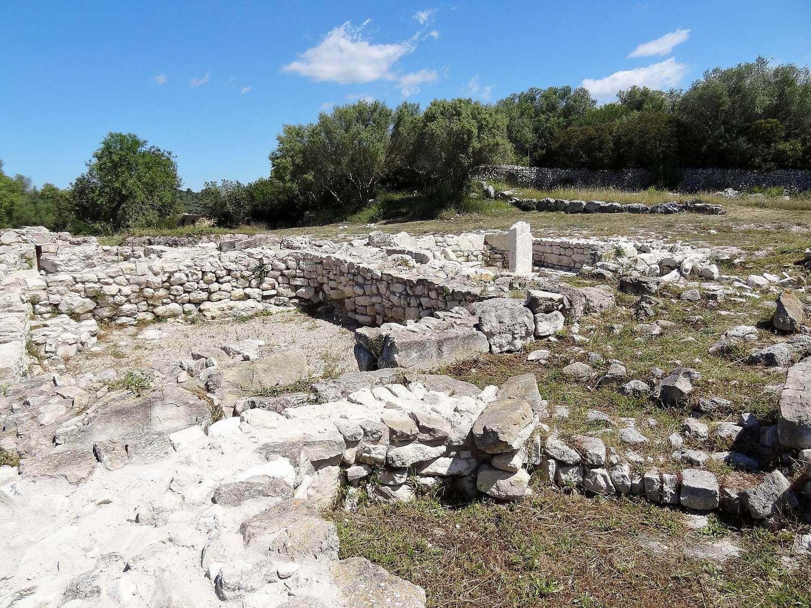
The settlement covers about three hectares on a rise in Mallorca’s Pla de Mallorca, at roughly 130 m elevation. Wetlands once surrounded the rise; they were drained for intensive cereal cultivation, probably beginning during the island’s Islamic occupation. The exposed remains include three circular towers, houses, walls, later sanctuaries, streets, workshops, and foundations of Roman-period rooms.
Talayotic towers
Talayot 1
Talayot 1 is circular, about 17 m across, and survives to a maximum height of 3.5 m. Its cyclopean masonry, built from large stone blocks, forms two walls with rubble packed between them. Large, roughly squared blocks make up the exterior face, while smaller polygonal stones form the inner face. The walls are about 5 m thick; some blocks may weigh up to nine tonnes, and the total stone used is estimated at about 2,000 tonnes.
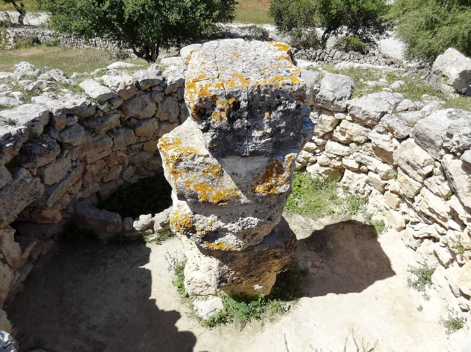
A low passage about 5 m long on the southeast side leads into a central chamber about 6.6 m across. A column of five large blocks, roughly 4 m high, supported the roof. The chamber also contains a built-in storage space, two hearths, and a low semicircular wall. Hinge remains suggest that the entrance may have had a wooden door; the roof is thought to have used radial beams covered with branches, clay, and small stone slabs. Cattle, goat, and pig remains show that large animals were butchered there, with portions distributed among households.
Talayot 2
Talayot 2 stands about 28 m east of Talayot 1 and measures roughly 12 m across. Its surviving walls average about 1.8 m high. The chamber, about 4.2 m in diameter, was entered from the roof through an opening and a descending spiral staircase. Unusual ceramic vessels found inside differ markedly from ordinary pottery of the period, prompting the interpretation that the chamber hosted restricted political or ritual gatherings.
Talayot 3
In the eastern part of the settlement, Talayot 3 measures about 12.5 m across. Its outer wall is thinner than that of Talayot 1, and its eastern entrance is wider. Its original form is difficult to establish because the structure was remodeled and used in later periods. In the post-Talayotic phase it was reshaped into a horseshoe-form building, with a small central altar and installations associated with handling liquids. Large-mammal remains have been linked to ceremonies involving wine and bull sacrifice.
Settlement walls and houses
Walls and enclosure
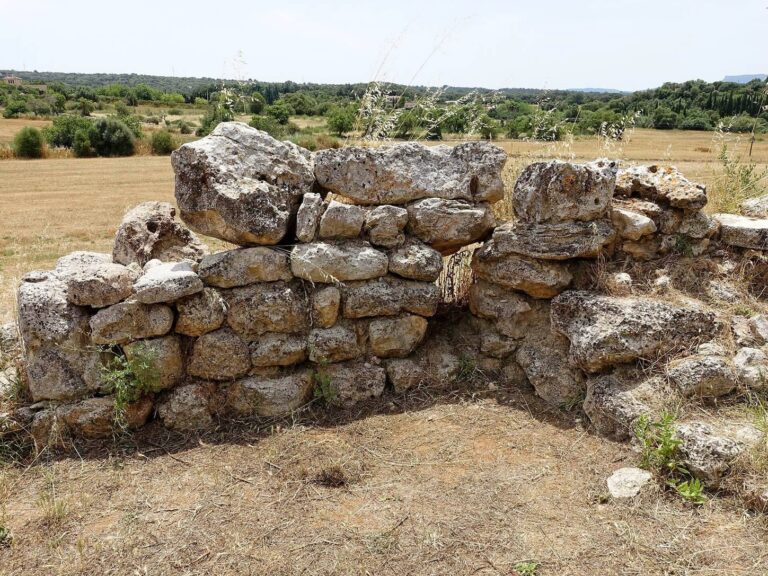
A wall between Talayots 1 and 2 formed a central axis of the settlement, with houses built against it. Another wall, about 2 m wide, linked the three towers and enclosed the settlement. A separate fragment marks the western edge of the excavated area. This poorly preserved section of cyclopean stonework is about 18 m long, 0.6 m wide, and up to 1.2 m high.
Domestic buildings
The remains represent six Talayotic houses or house units, with seven recorded room areas. Some houses were roughly rectangular and attached to the wall between Talayots 1 and 2; others had kidney-shaped plans and were attached to the towers, including one that provided access to Talayot 1. Usable house areas were generally about 35–45 m². The stone walls survive unevenly, and some rooms retain only fragments. One unit includes a central column, stair access, a cistern, and a hearth; an adjoining room has two columns and paving around one of them. The largest house was divided into three rooms and had stair access, a large stone food-preparation slab, and a range of vessels, bowls, and pots.
Houses had internal columns to support their roofs and hearths for domestic work. Activities included butchering sheep and goats, making flour, producing pottery, and working hides. Awls used for sewing hides were found, and water was kept in installations cut into the ground or in large ceramic vessels.
Post-Talayotic central district
Sanctuary 1
Sanctuary 1 has a rounded end and a front wall that curves slightly inward. It measures 7.8 m from end to front and 8.8 m across the façade. Its double walls average 1.2 m thick, and its interior covers about 30.7 m². The only entrance is centered in the façade. The base of a central column remains, while benches about 0.4 m wide run along the inner front and parts of the side walls. Two hearths made from fired-clay slabs were identified from the ash they contained.
Sanctuary 2
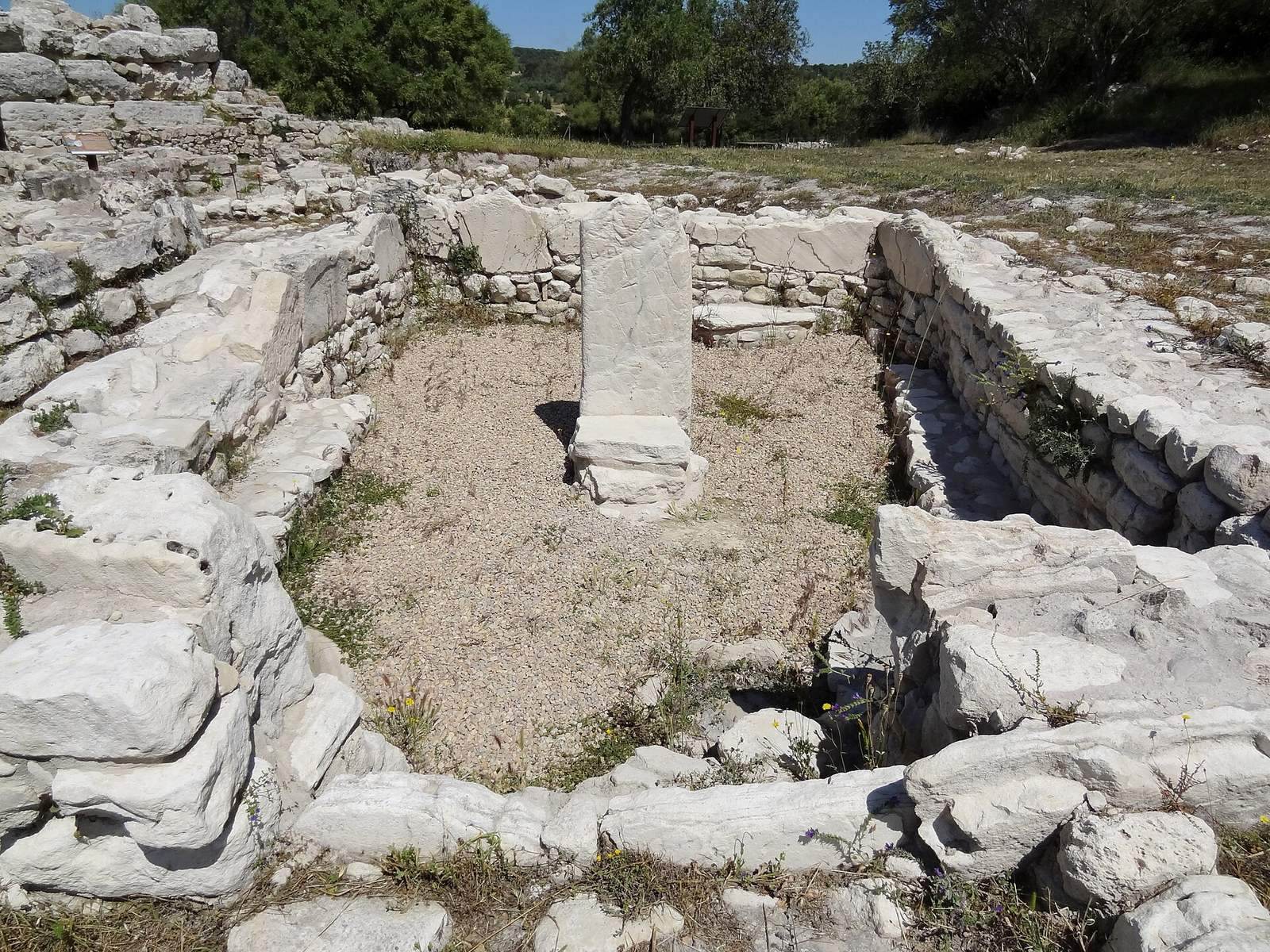
Directly northeast of Sanctuary 1, Sanctuary 2 is a rectangular building with rounded corners and double walls. It measures 7.8 by 7.1 m, with an interior area of about 19 m². A single upright stone, 1.7 m high, stands at its center; with a flat slab, it forms a large seat facing the entrance. A water basin about 0.92 m across and a hearth occupy the two corners of the façade.
Streets, workshops, and Zone G
A network of streets ran among the central buildings, forming the earliest known street system in prehistoric Mallorca. The streets incorporated a means of collecting rainwater, and nearby workshops were used for metalworking and pottery production. A separate settlement area, Zone G, occupied the highest ground. A tower was built there, followed by a dwelling and an enclosing wall; this area remains little excavated.
Roman-period remains
Foundations of about twenty rooms from the Roman period are interpreted as storerooms and workshops. Finds include Punic-Ebusitan wine amphorae, transport vessels used for liquids, and associated tableware from the third century and the first half of the second century BCE. Materials associated with later remodeling of the central district include Greco-Italic and Dressel 1 amphorae, a Roman transport-jar type, and black-gloss pottery from Campania.